King’s Head – High Street

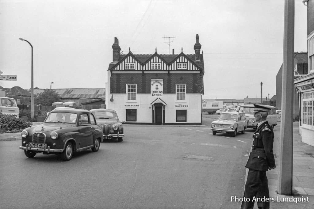
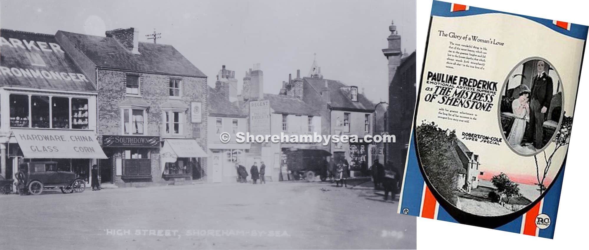
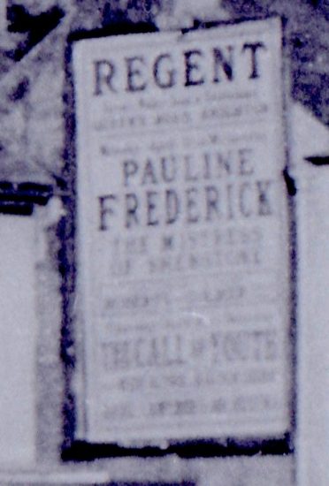
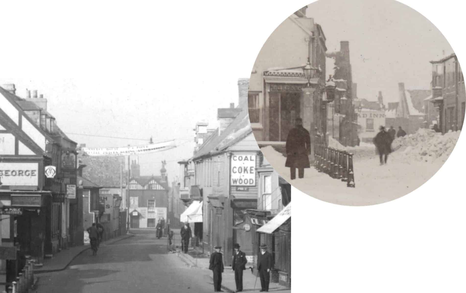
Still finding previously unnoticed discoveries in photos we’ve known for years. We’re told that the King’s Head was Georgian in the main and even mediaeval at heart – you had to step down from the street into the main bar, often a sign of a building’s antiquity. It had it’s three gables added in the 1890’s and this is the first time I’ve noticed a photo (taken after the snow storm of 1881) providing a hint of how it looked before. Perhaps a photo of the complete building will turn up one day.
Kings Head 1967 ©`Anders Lundquist
The West End and what replaced the Kings Head. Montage by ©Roger Bateman

White Lion Street

Often missed on the 1872 map is the name ‘White Lion Street’ in the place of West Street. It was renamed as such, for a short while at least, due to the influence of the landlord of the White Lion Inn. We only have a vague aerial shot and an acute angle view of the Inn but this computerised reproduction gives more of an idea of how it looked.

Dilkusha bungalow and storm damage 1913

Continual searches through our collections over the years do lead to some images sticking in the memory and these are three of them. At the top is the well known postcard of Dilkusha bungalow and below it a view from the beach-side of the storm damage (1913 I think) to it and its neighbours, then another from the Widewater side.

History under a car park

A little known story is  about the demolition of the lovely old cottages in Middle Street that were replaced by today’s car park. Why just those in between other similar cottages in the street? It seems the whole row  were considered then to be unfit for human habitation and, true or not, one of the criteria was said to be a lack of natural light (which of course many old buildings do suffer from). During the inspection of those in Middle Street the  council official responsible for approving the demolishing had reached the cottages beyond today’s car park and, when asked if she needed the light on to be able to see, replied she could see perfectly well. In doing so she could not then condemn it and that, I am told, is why the rest survived.

Map from 1360

I’m fascinated by mediaeval history particularly concerning our area. Don’t know how long this resource has been on line but it provides a revealing glimpse of the places in c.1360 considered then to be more important. I’ve added the present day names and surprisingly (for me) it includes places like Stopham and Chiddingfold – Selsey at that time was an island! Shoreham is portrayed as quite a dominant town which of course it was then due to its shipbuilding industry but strangely the River Adur is not included. What it lacks in detail and proportion it makes up for by magically taking us back to a Tolkein-like middle earth seven hundred years ago (see the complete map shape of the British Isles) – an amazing feat for those times.
Well worth a visit – http://www.goughmap.org/map/

Details hidden in photographs

Dating photos can often be difficult but sometimes there’s a clue that makes it easy. This photo of the High Street has a poster for a film on the side of one of the buildings that was released in 1921.
(enlargement and increased contrast of the poster since added to make it all readable)

Dating photos

The two photos of Stow & Sons yacht-building sheds were almost certainly taken within a short time and distance of each other. There are a number of clues including the same yachts moored in front of the sheds but most significantly of all is the man working on one of the masts.
The large yacht below has been identified as the Rosalind built in 1904 by Stow but there is a date 26th August 1906 written in ink on the reverse. Built for owner Charles Hellyer and registered at Hull it voyaged widely but, significantly, Lloyds Yacht Registers record it returning to Shoreham for the vessel’s annual survey in 1906 and is likely to be the date of that photo.
Of all the photos we have of Stow yachts it is only the Rosalind that has a cranked, forward leaning mizzen mast so close to the stern. Amongst the vessels in the other photos the fourth yacht from the left also has a cranked mizzen mast (marked X) in a similar position and therefore more likely to be the Rosalind and of  a similar date.

Old slipways

Until recently as you walked back to the town over the footbridge you could see the rails of a slipway in the grounds of the Sussex Yacht Club. Were these the remains of the 19th century rails in the last of Shoreham’s shipyards? It doesn’t seem so.  Maps show the original rails in Dyer’s Yard to have been at more of an acute angle to the riverside than the ones In the modern photo. The others to the right, also 19th century, were installed nearer to the time when the yachtbuilder Stow & Son ran the yard.

Shoreham built ships

Having researched and recorded Shoreham built/registered ships I still pick up photos/postcards of them that turn up from time to time. These two recent, poor quality, acquisitions are of the Carbonaria (left) built in 1866 by William May and the other Commerce (right) 1862 by James Britton Balley, both at the old shipyard where Suters Yard was subsequently located. Some time ago I was told that the Commerce ended up as a mooring hulk on the Mersey at Liverpool and was given a photo of it that I’m also including here. The lack of detail makes it difficult to be sure that they are one and the same but if they are then the hulk must have had its gunwales removed.

Bringing Shoreham’s old houses to life

With a bit of patience (and a lot of time) you can rebuild Shoreham’s old houses even when they were photographed in a ruinous state. Using a Pixelmator programme for Mac and a photo of Kingston Cottage (it once stood next to the Kingston Inn) you can create a close impression of what it looked like when it was once cared for.