A Tale of 5 Bridges
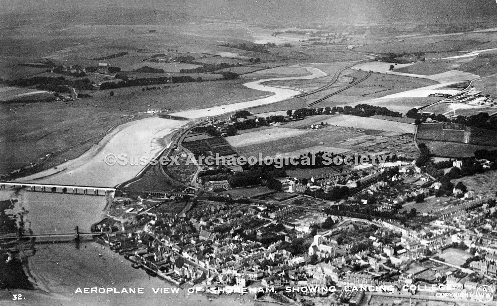
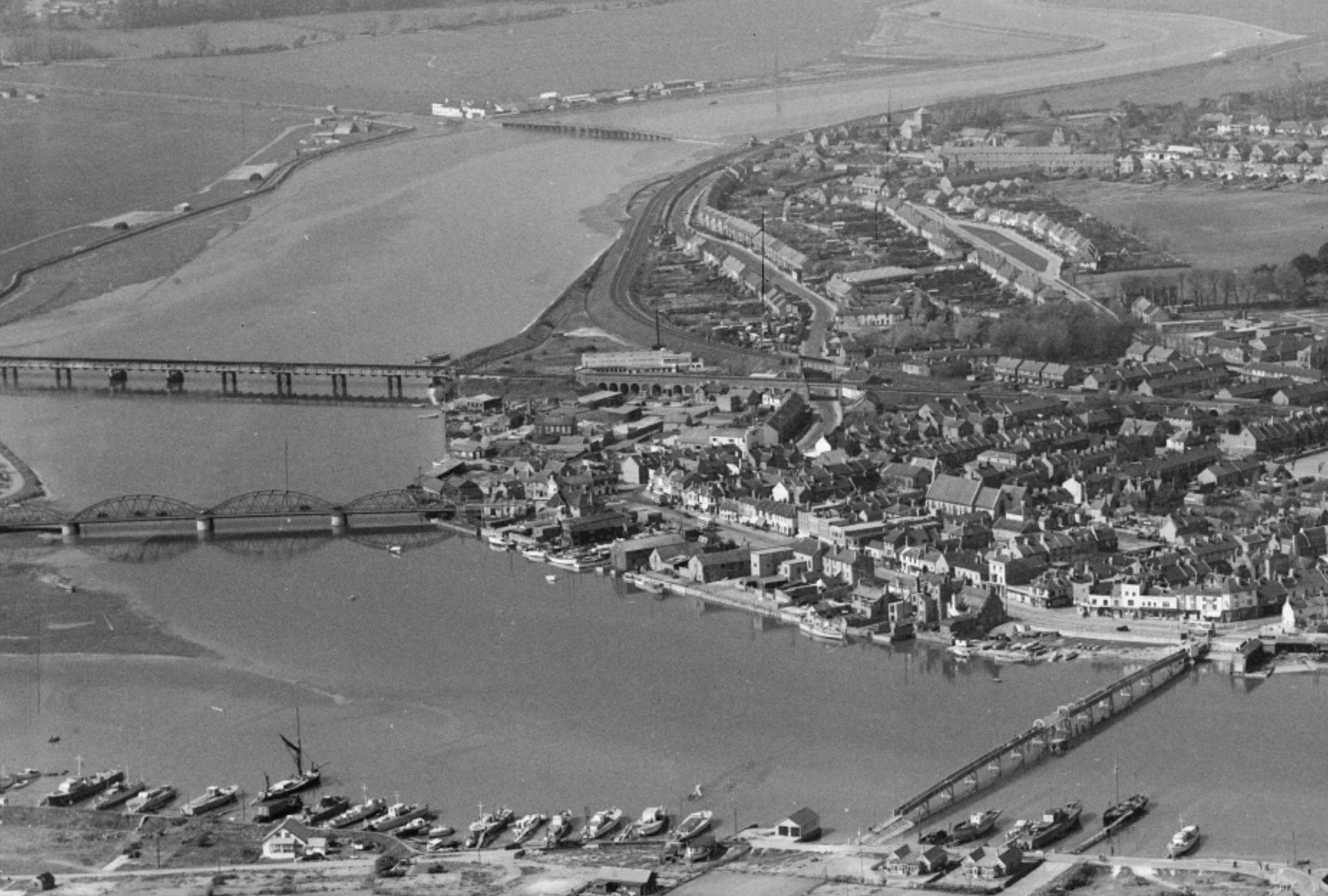
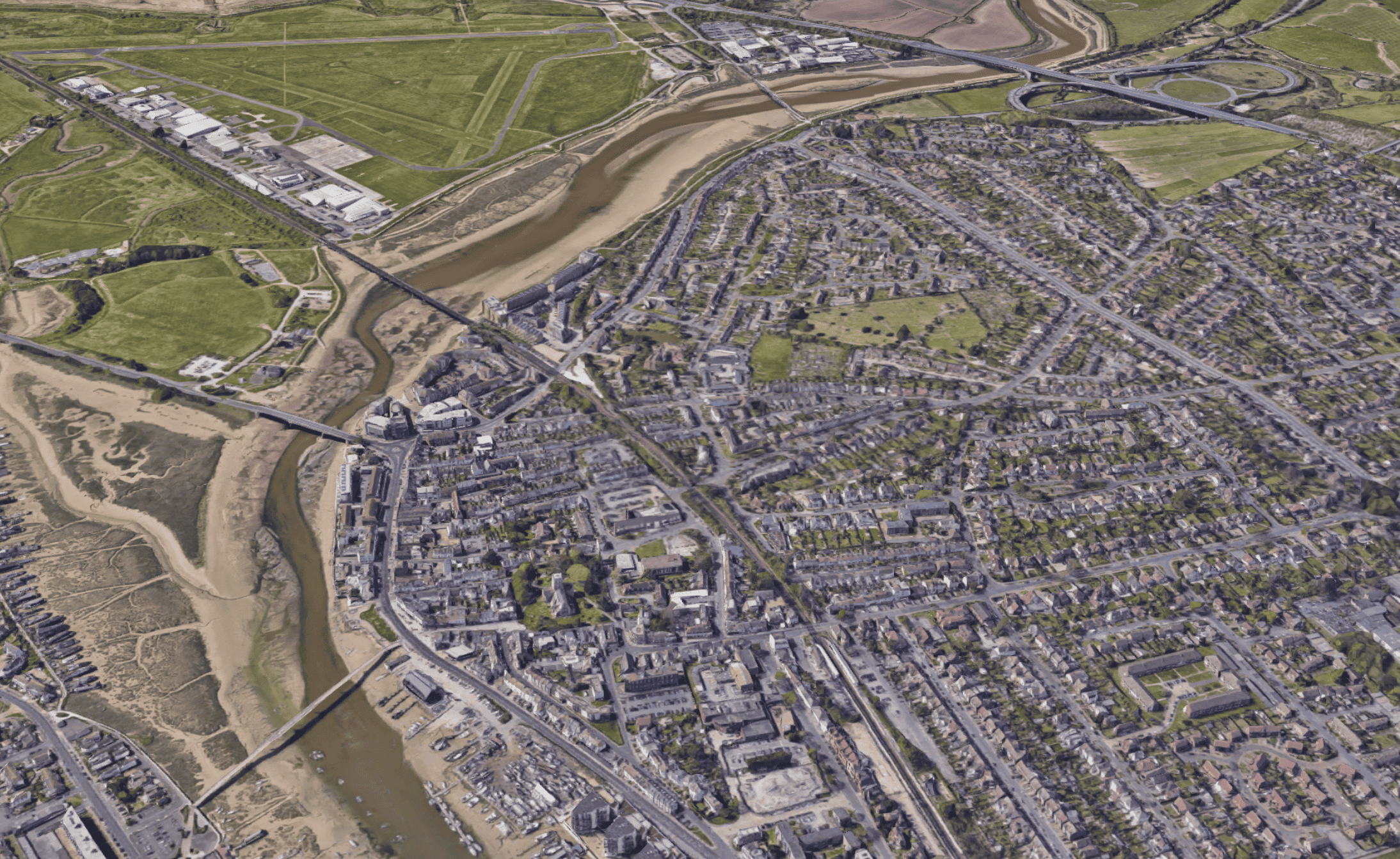
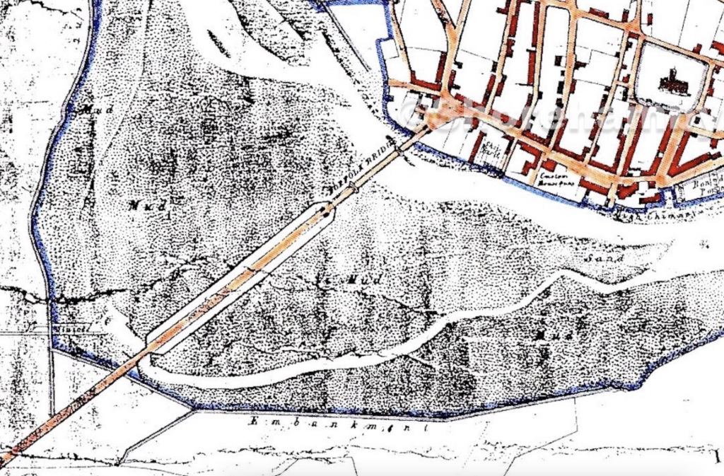
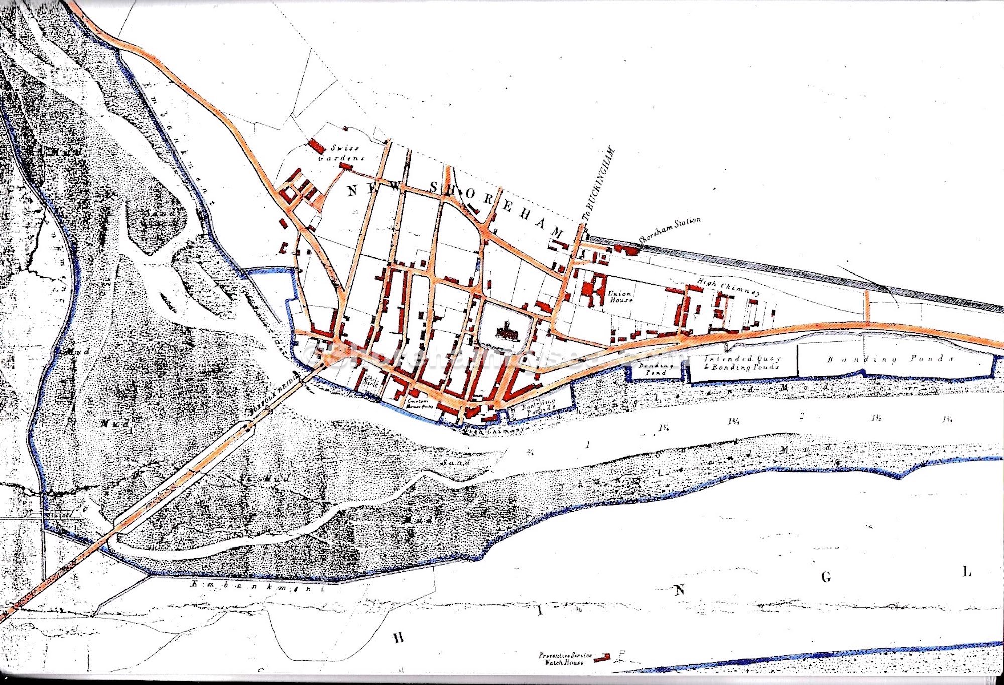
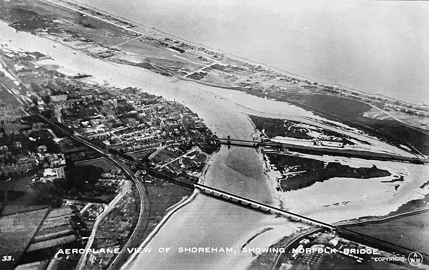
Shoreham has 5 bridges over the Adur. Before 1781 the only way to cross was by ferry boat or detour upriver to cross at Bramber bridge. The ‘old’ Toll Bridge changed this in 1781, followed 50 years later by the suspension Bridge and causeway to Lancing. Within 12 years the railway was extended westwards from the Shoreham terminus with the building of an impressive viaduct / wooden trestle rail bridge (1845). This was replaced 50 years later. By 1921 Shoreham had a new footbridge to the beach and 2 years later the original Norfolk Bridge was replaced. 46 years later a brand new road bridge was constructed as part of the new A27 trunk road, bringing the tally of river bridges to five.
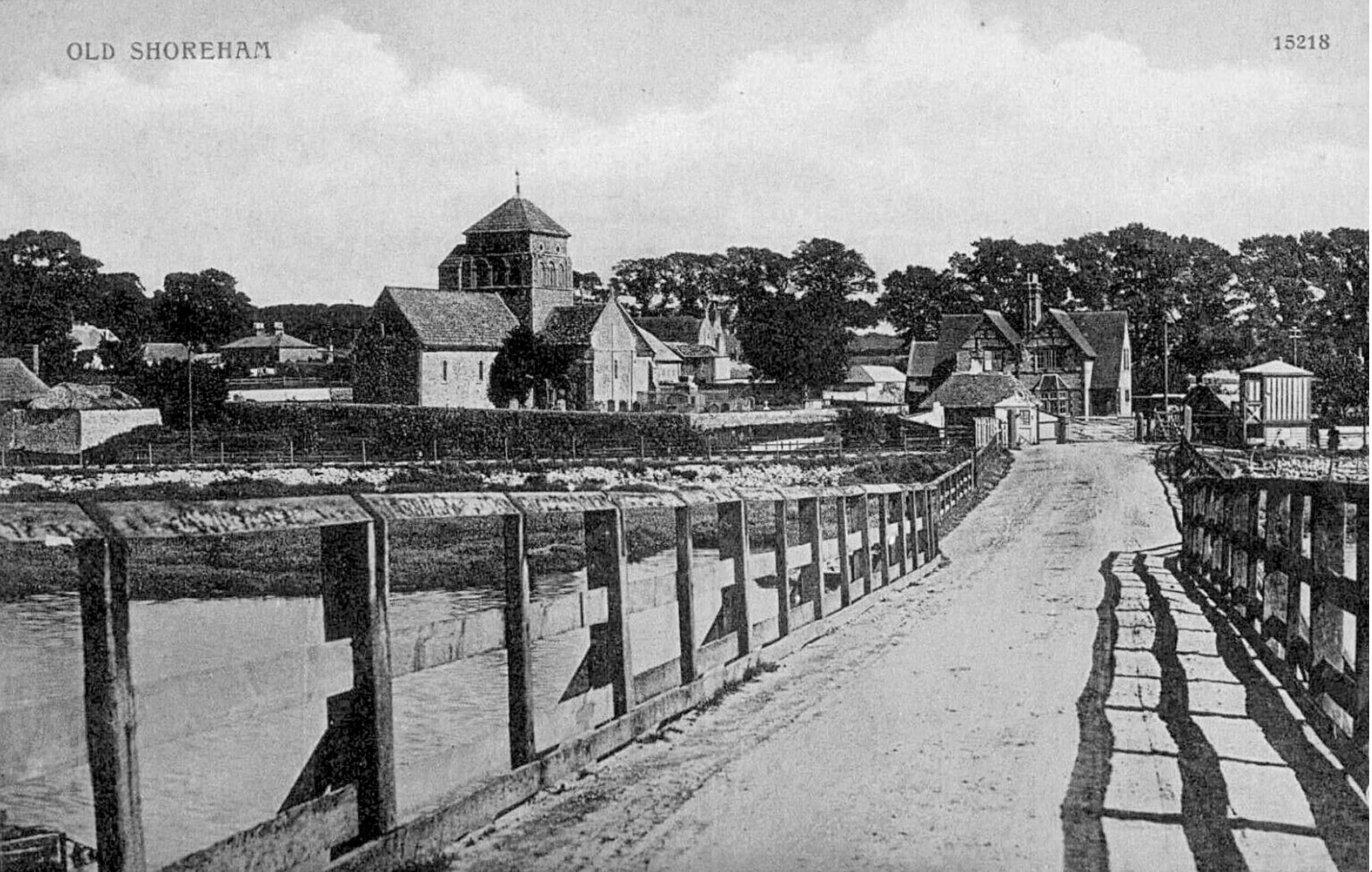
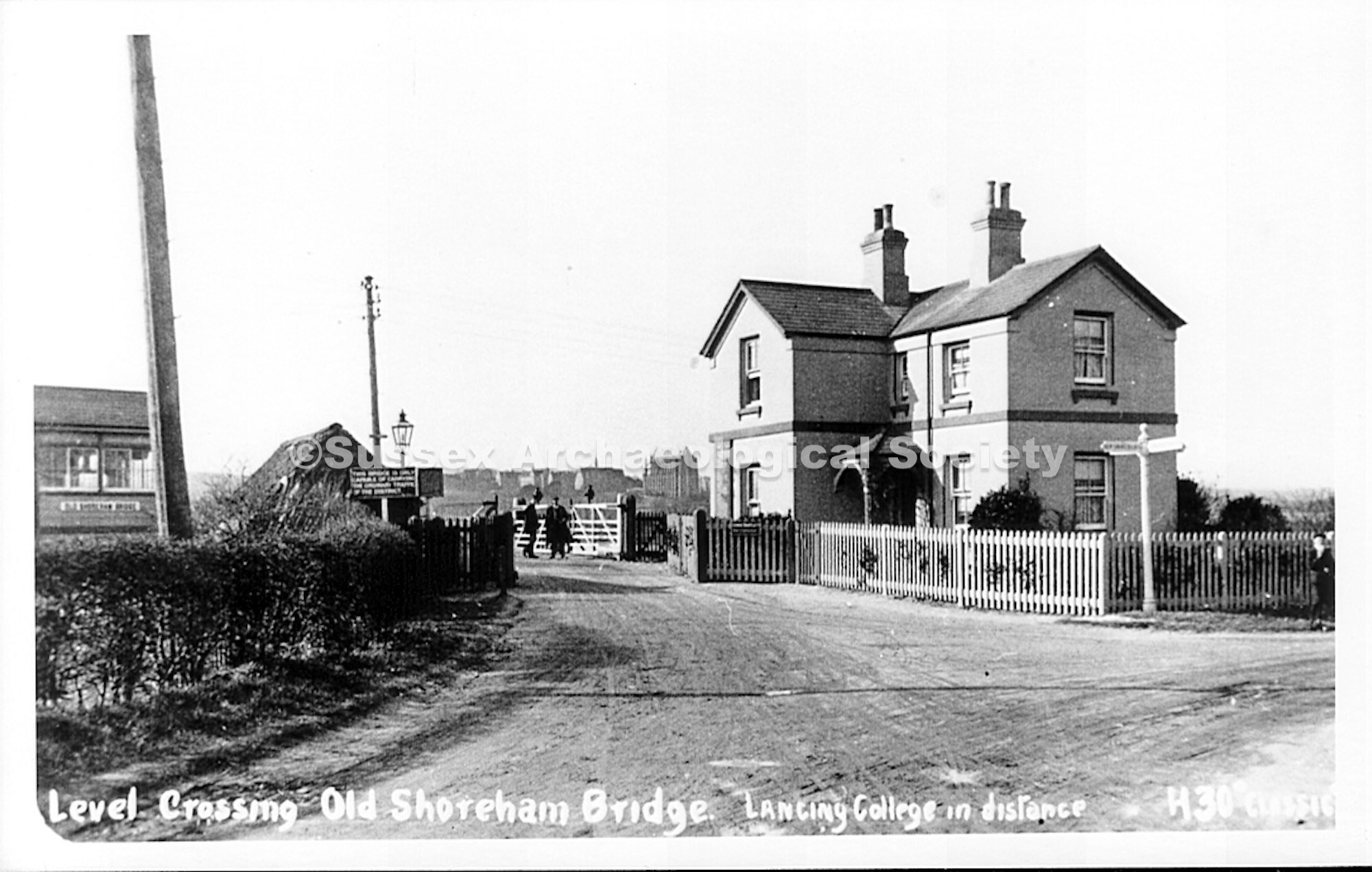
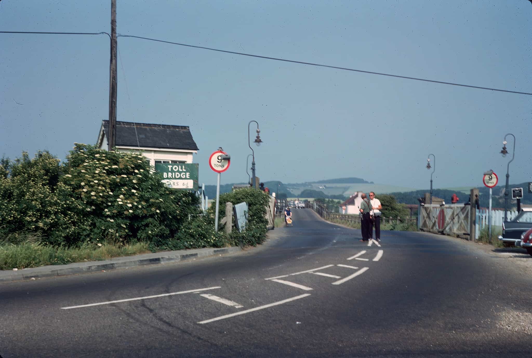
Adur Toll Bridge 1781-present
The original tollbridge of 1781 lasted 130 years until a major reconstruction in 1916. In 1847 a new river rail crossing was built to provide a dedicated crossing for the new South Coast Railway and the railway company acquired a controlling interest in the road Toll Bridge. Ownership passed to the newly created nationalised British Rail in 1947 and to West Sussex County Council, the present owners, in 1970.
The bridge was listed at Grade II* by English Heritage on 12 October 1954. Tolls were collected at the Eastern end up until the bridge was closed to road traffic in 1968, co-inciding with the iopening of the new A27 flyover a mile to the North. The bridge underwent a major refurbishment in 2008.
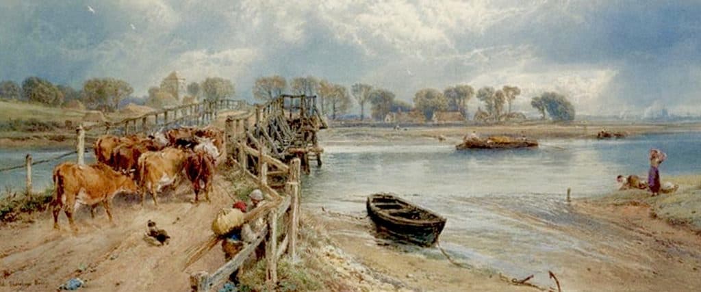
Norfolk Bridge 1833-1922, 1923-1987, 1987-present
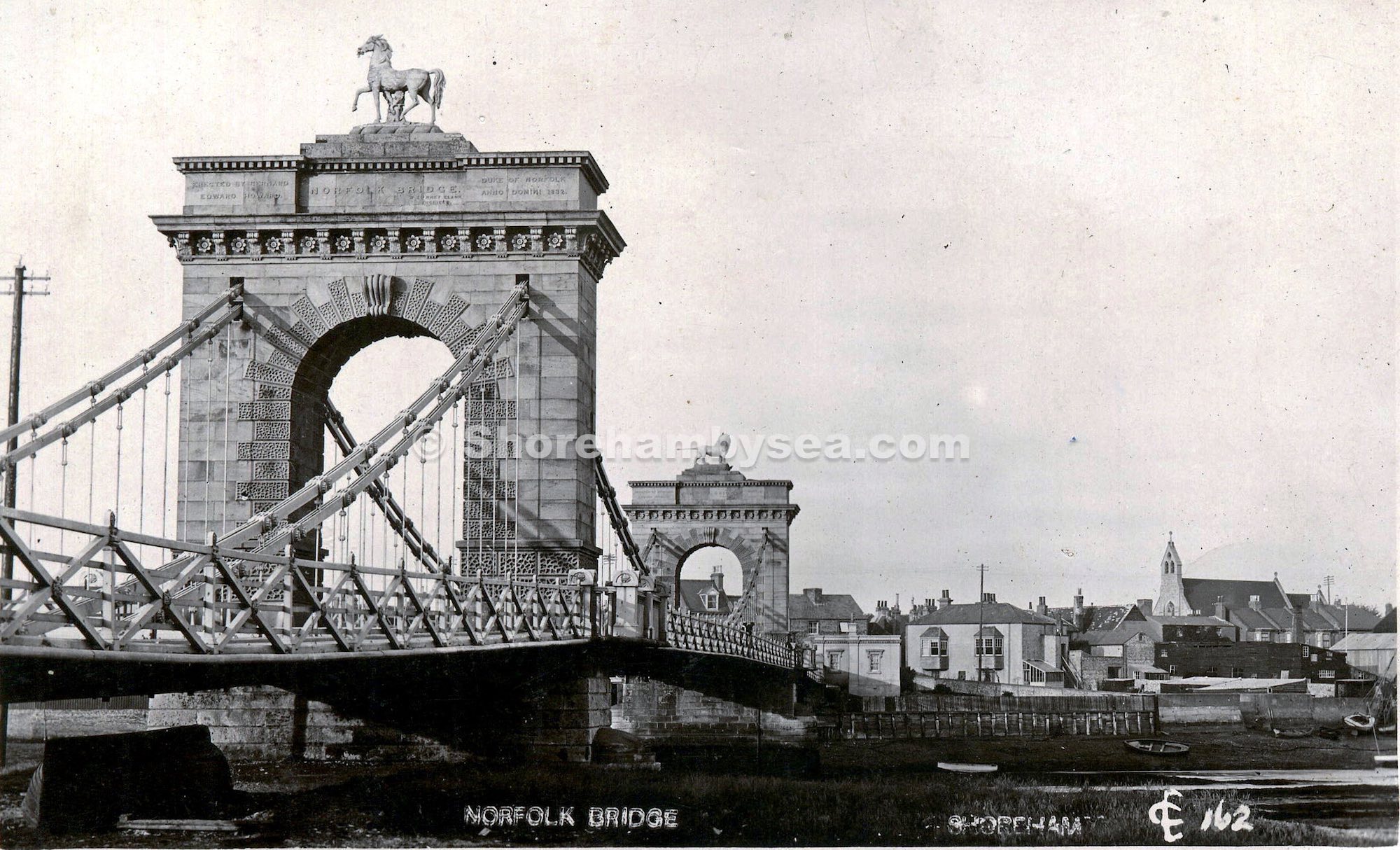
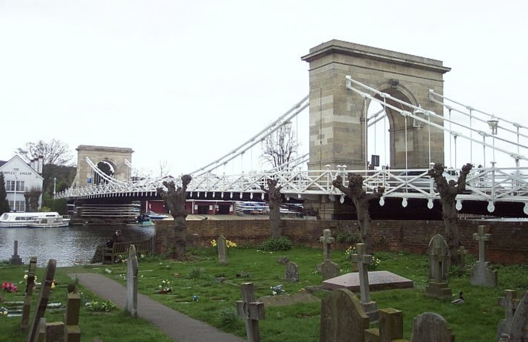
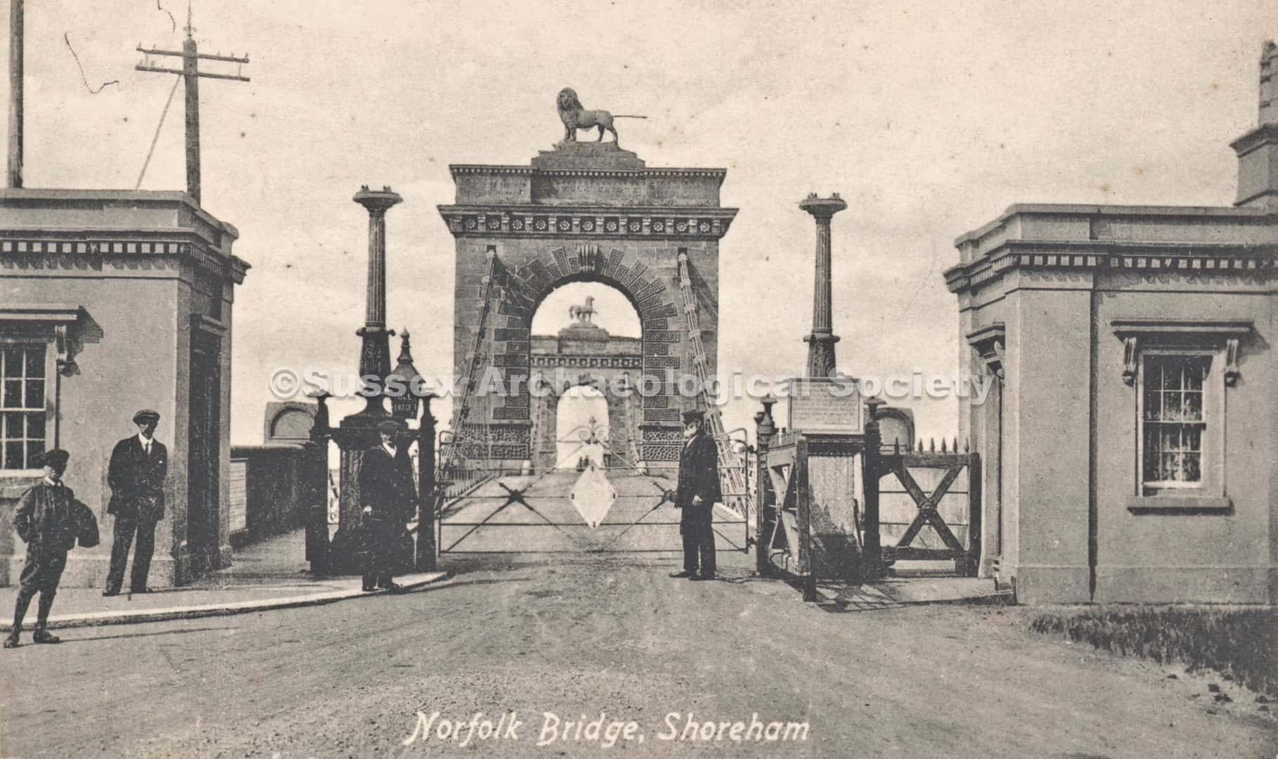
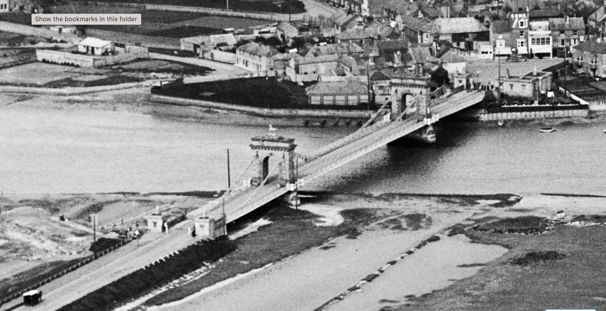
The first Norfolk Bridge was a chain link suspension bridge – designed after success with Hammersmith Bridge and with a smaller design at Marlow over the Thames. The Norfolk Bridge was a toll bridge and had 2 toll booths at each end. There was also a semaphore signal system to control traffic embarking onto the bridge.
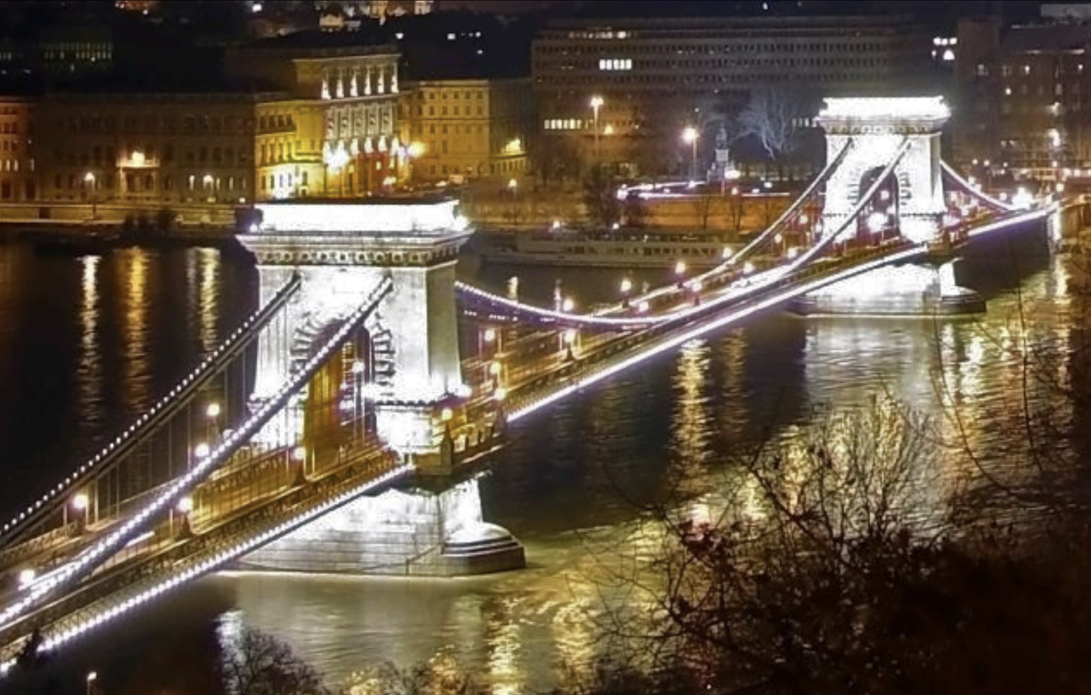
The suspension bridge had a twin – the iconic Széchenyi Chain Bridge in Budapest, built 16 years later in 1849. The designer of both bridges was English engineer William Tierney Clark and built by Scottish engineer Adam Clark.
The Budapest bridge required significant strengthening, and was completely rebuilt following bombing in WWII.
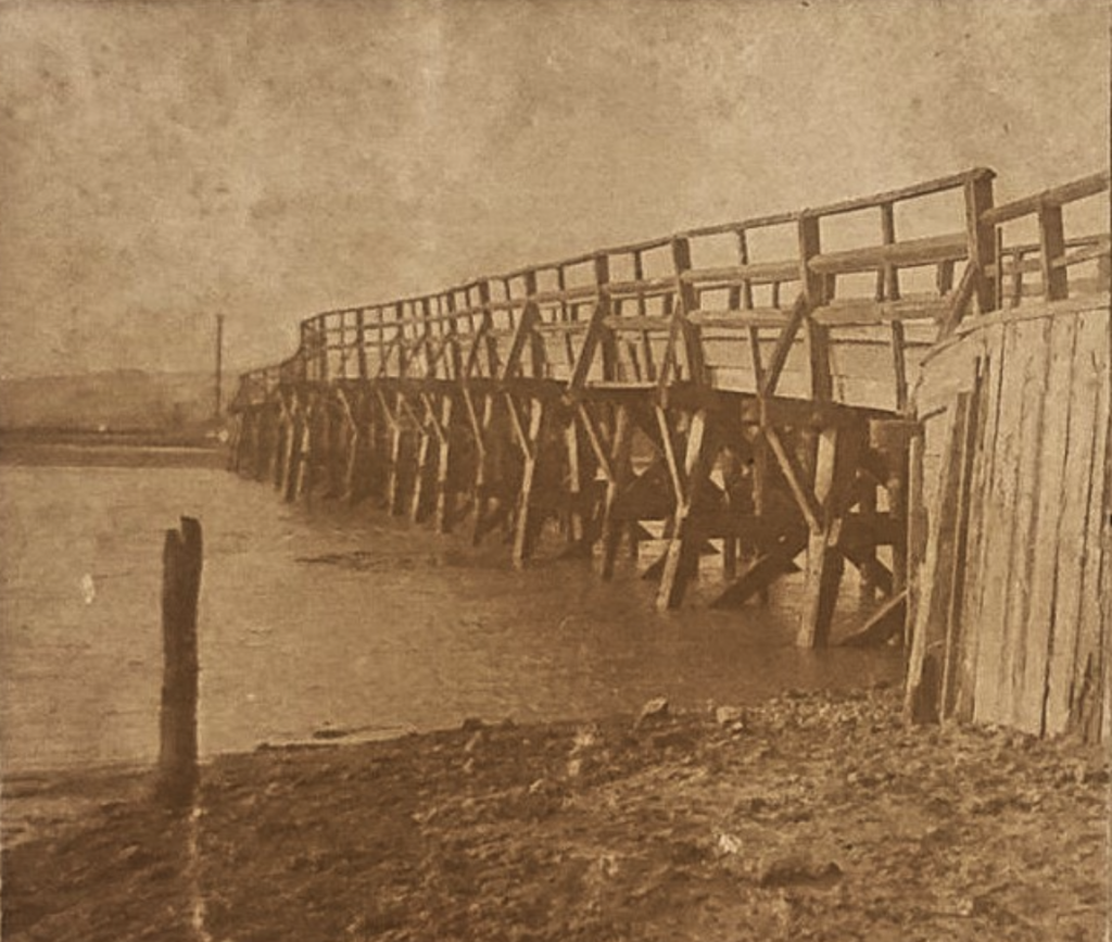
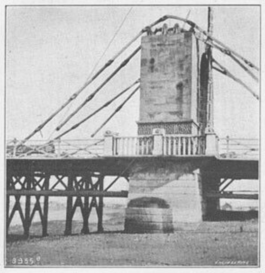
The Shoreham Chain Suspension Bridge was purchased from the Duke of Norfolk by West Sussex County Council in 1903. Within 10 years it deemed unfit for future use and a survey found significant defects in design. The cast iron cross girders supporting the deck supports were rusted, and over-strressed even by the dead weight of the bridge. Much of the timber planking of the deck was rotting. The saddles on the piers and the chain links themselves were immovable due to rust and faulty design. By 1915 it was evident that the increase in weight and volume of motorised traffic was causing further damage to the deck. Strengthening works and wooden “false-work” supports under the deck were installed as a temporary measure but by this time it was clear that a modern replacement was needed.
So by 1923 the two-pier suspension bridge had been demolished, new abutments and a new intermediate pier was built. Much of the reclaimed stone was re-used in expanding the piers. The 2 Coade stone statues of lion and horse were winched down and erected at Arundel Castle. A few parts of the original suspension bridge still exist. The massive chain ends are still underground within the abutment at the North end. Some of the pillars from the bridge walkways turned up in various front gardens of homes on Old Fort Road. There is rumour that the rods from the suspension struts were used to build the fences to the approach road from Lancing – but those rods predate the 1920’s.
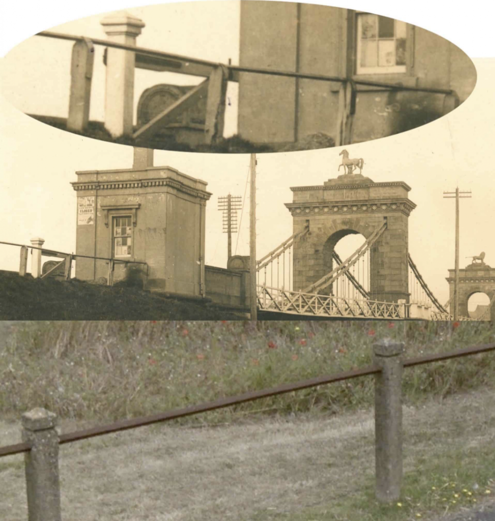
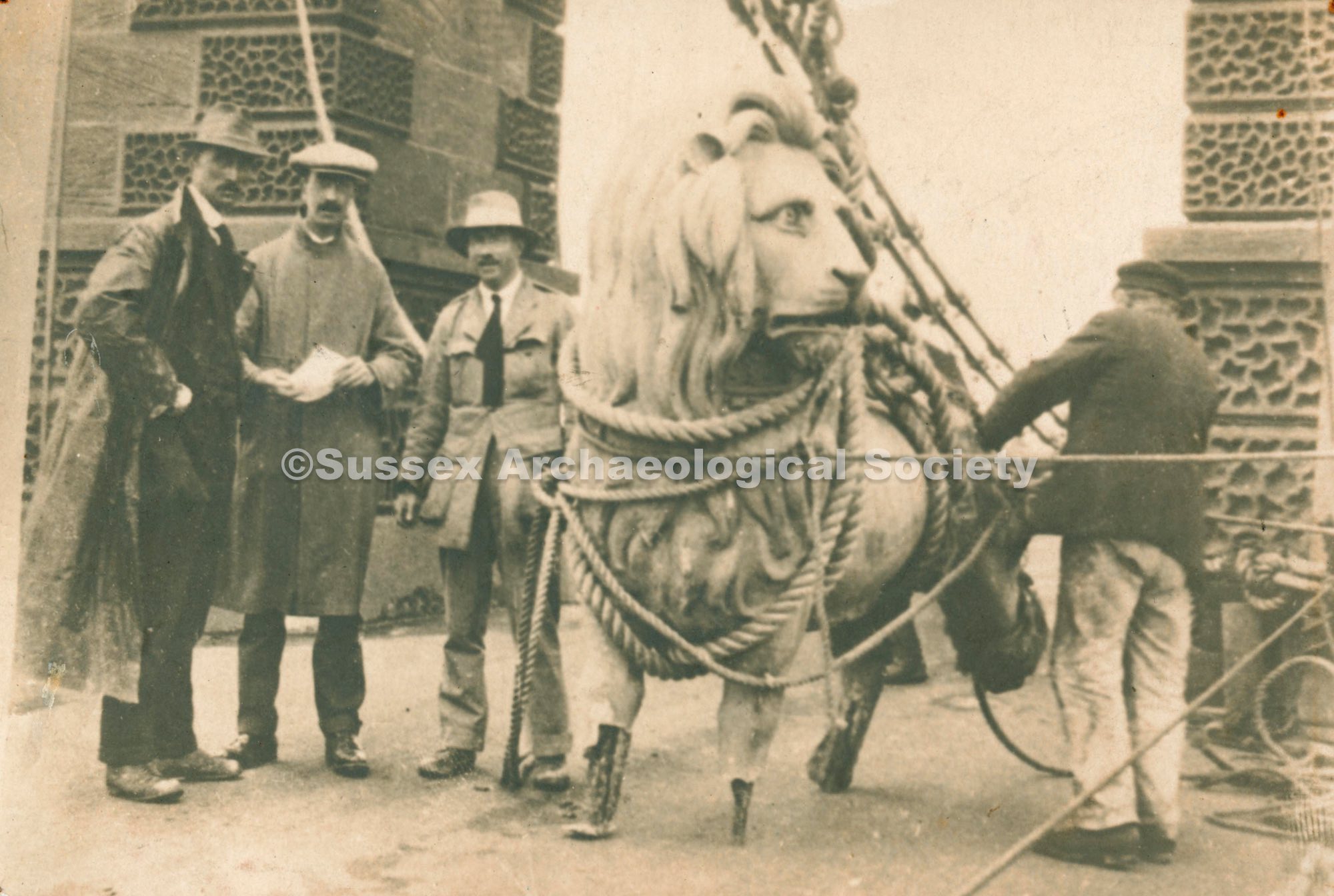
Both the Lion and the Horse were designed/ sculpted by William Woodington and cast from Croade Stone (Lithodipyra). Croade was a versatile composite material developed by Eleanor Croade that was erosion resistant and had a bright white surface. It is cramped around a metal form in moulds in sections. Our Norfolk Lion and Horse were probably created in Croade’s Lambeth premises. The Lion has a larger younger brother – in 1837 there was a 15 ton Lion placed on the Thames frontage of the Lion Brewery Lambeth – he looked very similar. He had two smaller brothers at the brewery gates – one of which now exists in gold at Twickenham Rugby stadium. The large lion became a wartime icon for British fortitude and was eventually moved to Waterloo Station prior to the Festival of Britain and painted red. He now resides on a plinth on Westminster Bridge. The Norfolk Bridge lion and horse had their feet repaired and have sat side by side at Arundel Castle for the past 100 years. This final placement has them looking at each other rather than turned away as they were for 90 years on the bridge.
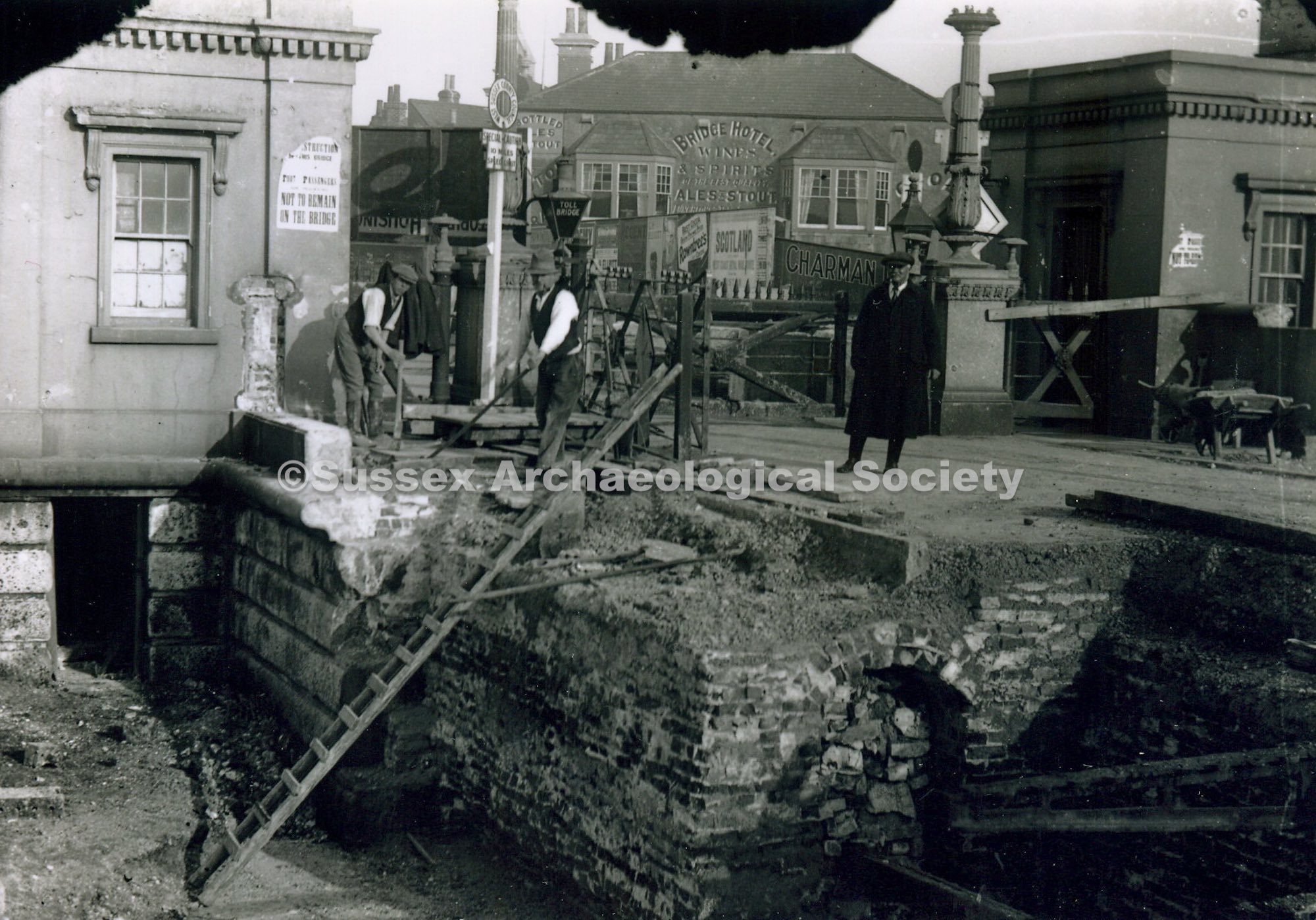
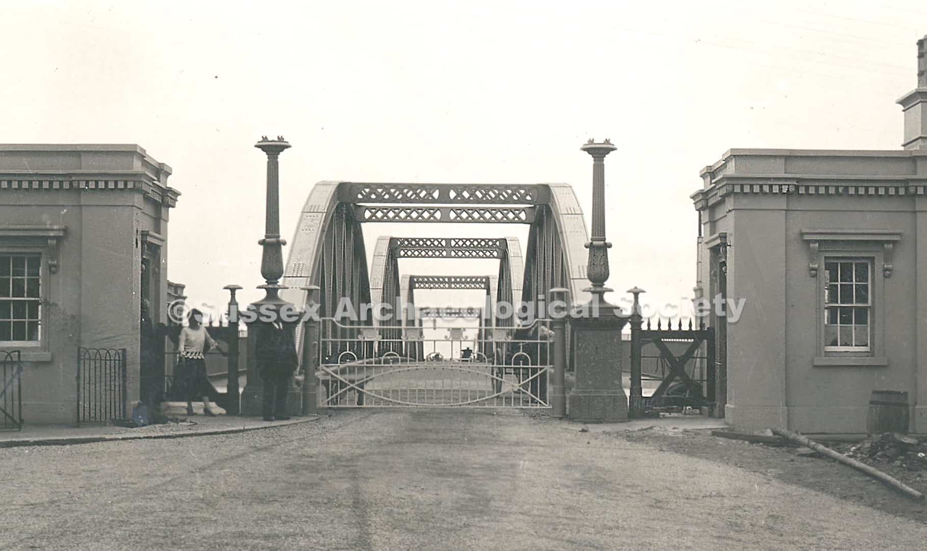
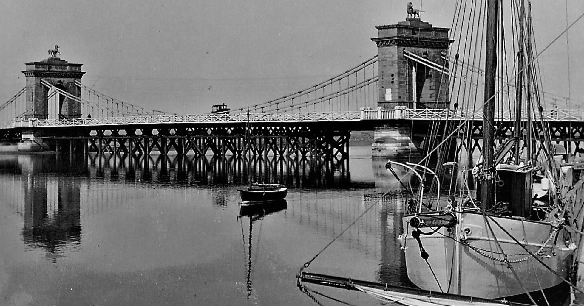
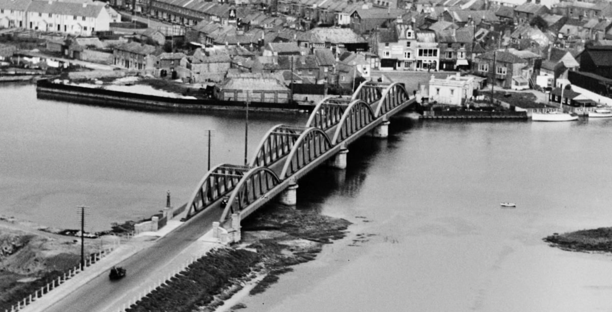
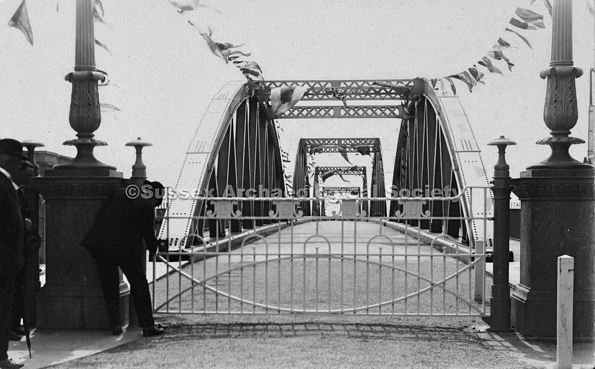
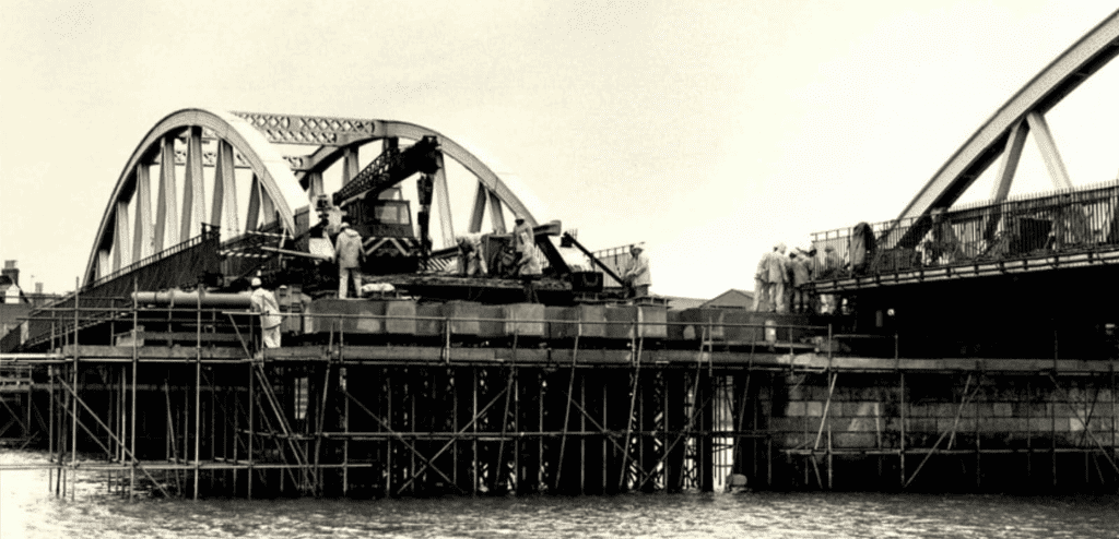
Norfolk Bridge No.2. 1923-1987
The new five-pier, four span bow string bridge opened in July 1923 initially as a toll bridge. The estimated cost was £45,000.
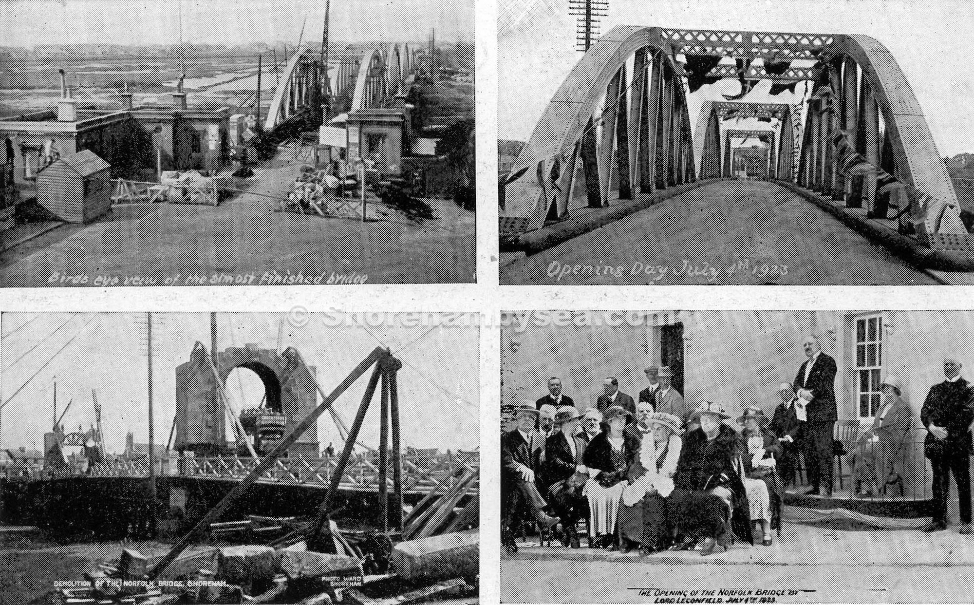
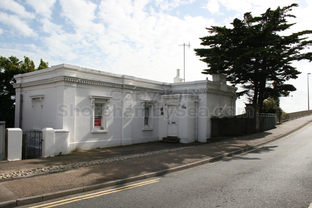
Note the Toll Booth’s at each end. The original cube toll booths, two at each bridge end were retained when the 2nd bridge was constructed. Only the North East booth was used for accommodation and gradually expanded over the decades. As you can see when the 2nd bridge opened in 1923, all four booths were extant, but by 1927 all had gone and the Toll House in its expanded form did not comprise any of the original 1833 booth.
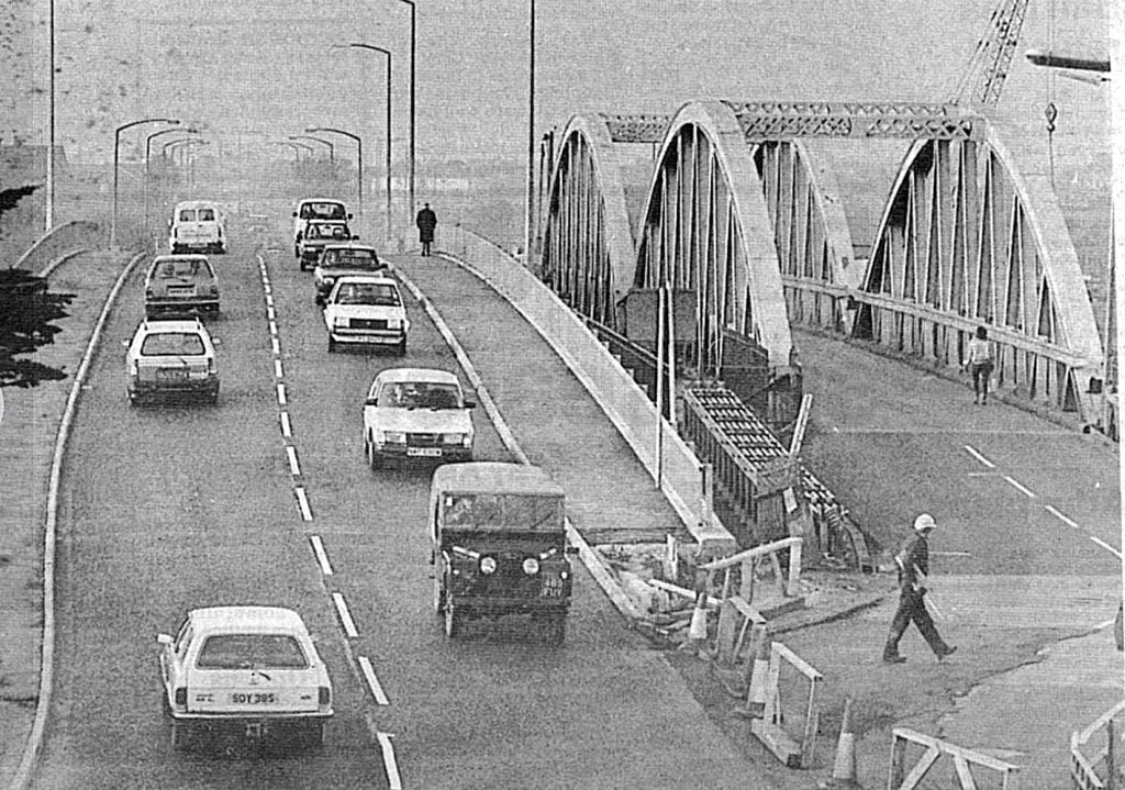
This second bridge lasted less time than the first. By the 1970’s it was unable to cope with traffic volumes and the restricted width prevented upgrade. There were notable collisions on the bridge, caused by large vehicles unable to pass on the narrow roadway.
Norfolk Bridge No.3. 1987-present
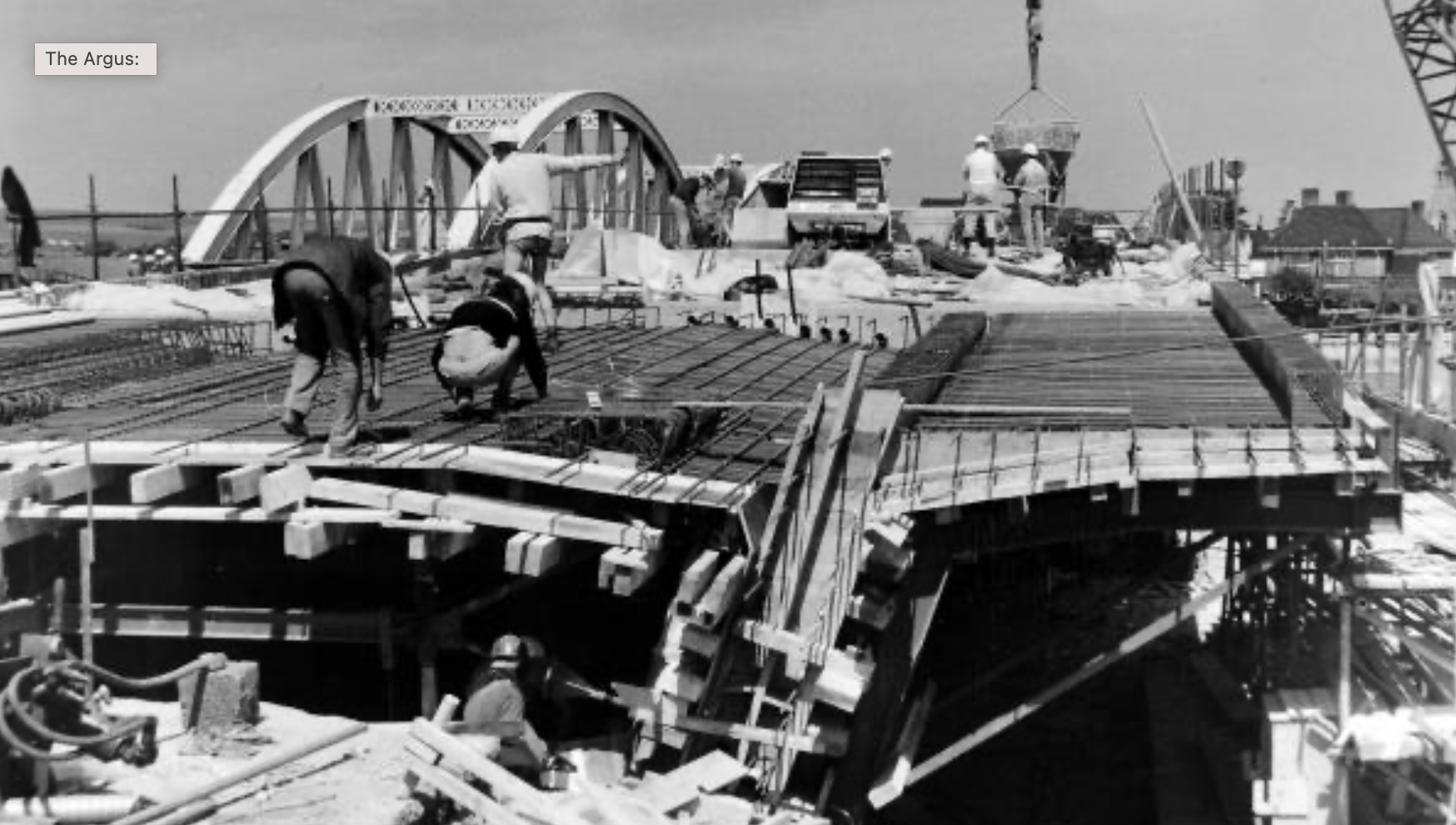
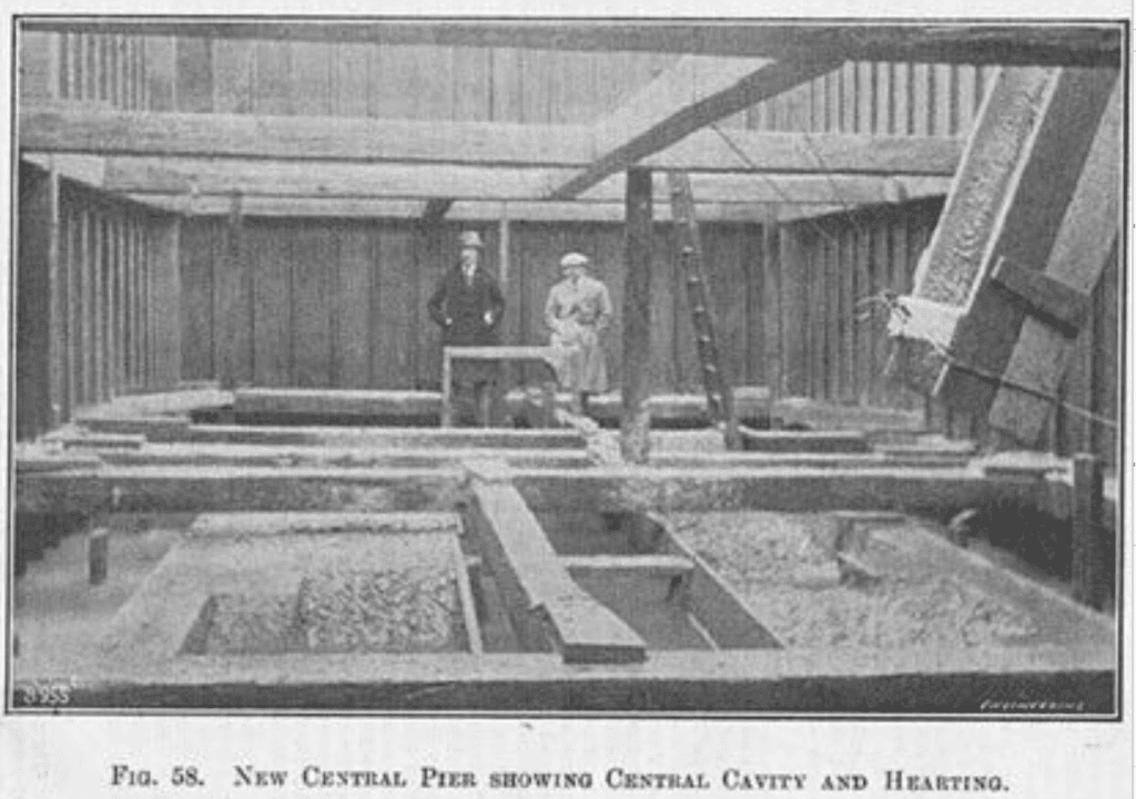
In 1987 a new bridge was constructed with a novel method to keep traffic running. Temporary piers were constructed in the river to the North of the Bow String bridge and over a number of days each original span was hydraulically winched sideways onto the temporary piers. Traffic was then re-directed onto the deviation over the river. The new bridge was then constructed onto the original piers in the same place as the original.
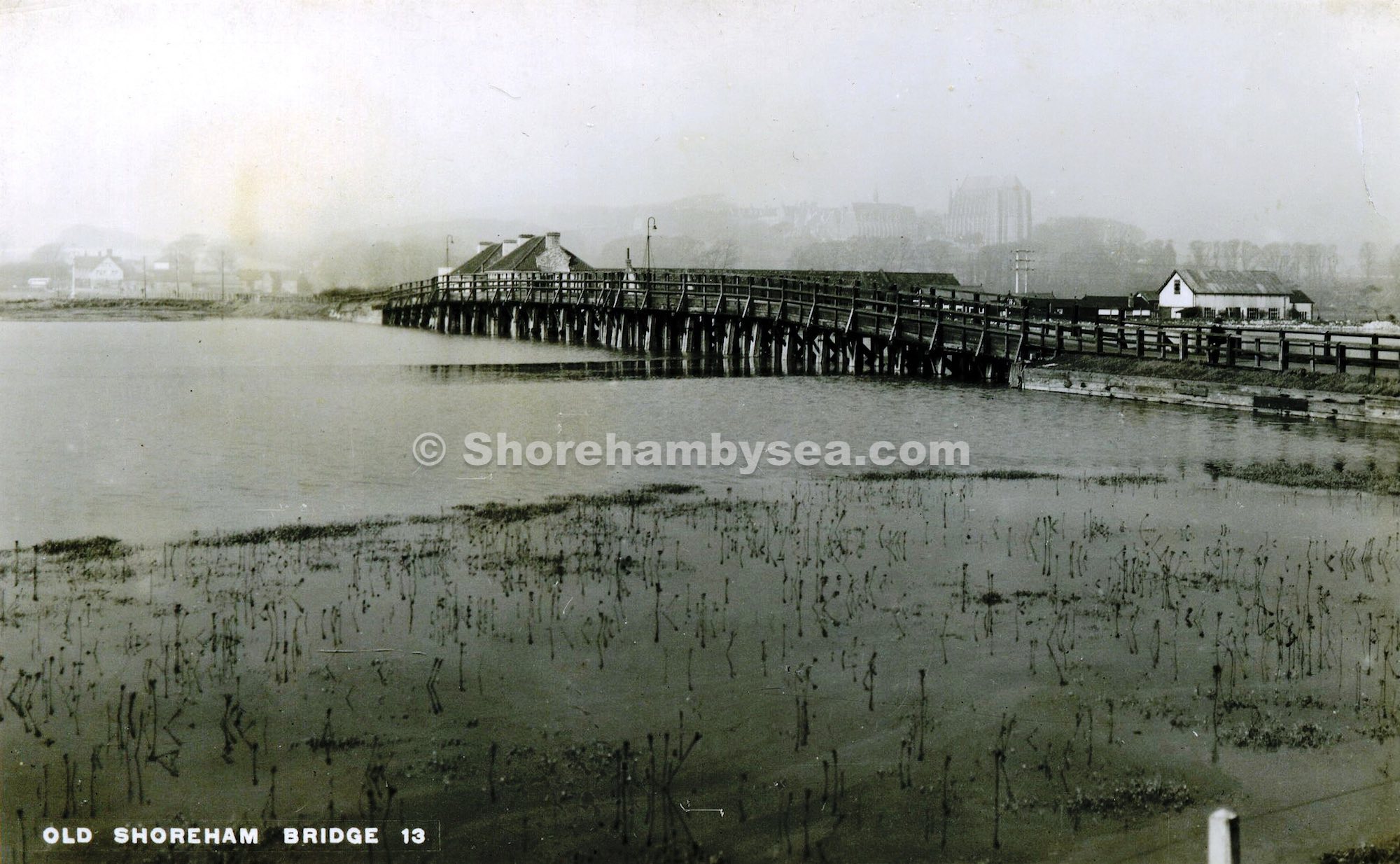
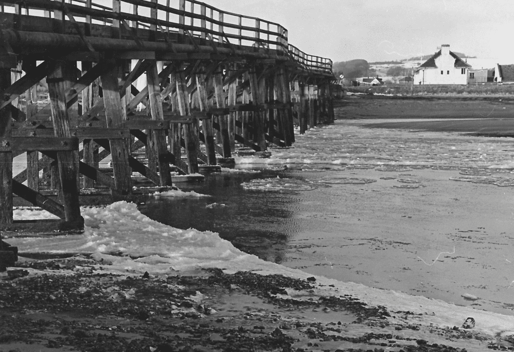
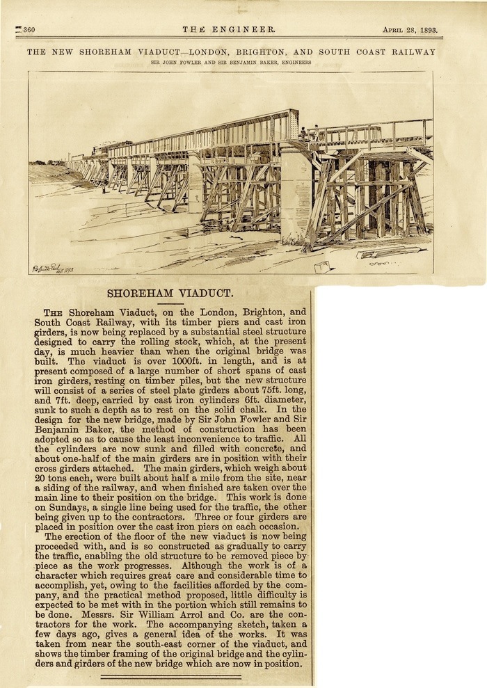
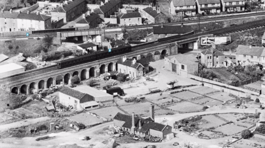
Adur Rail Bridge 1845-1896, 1896-present
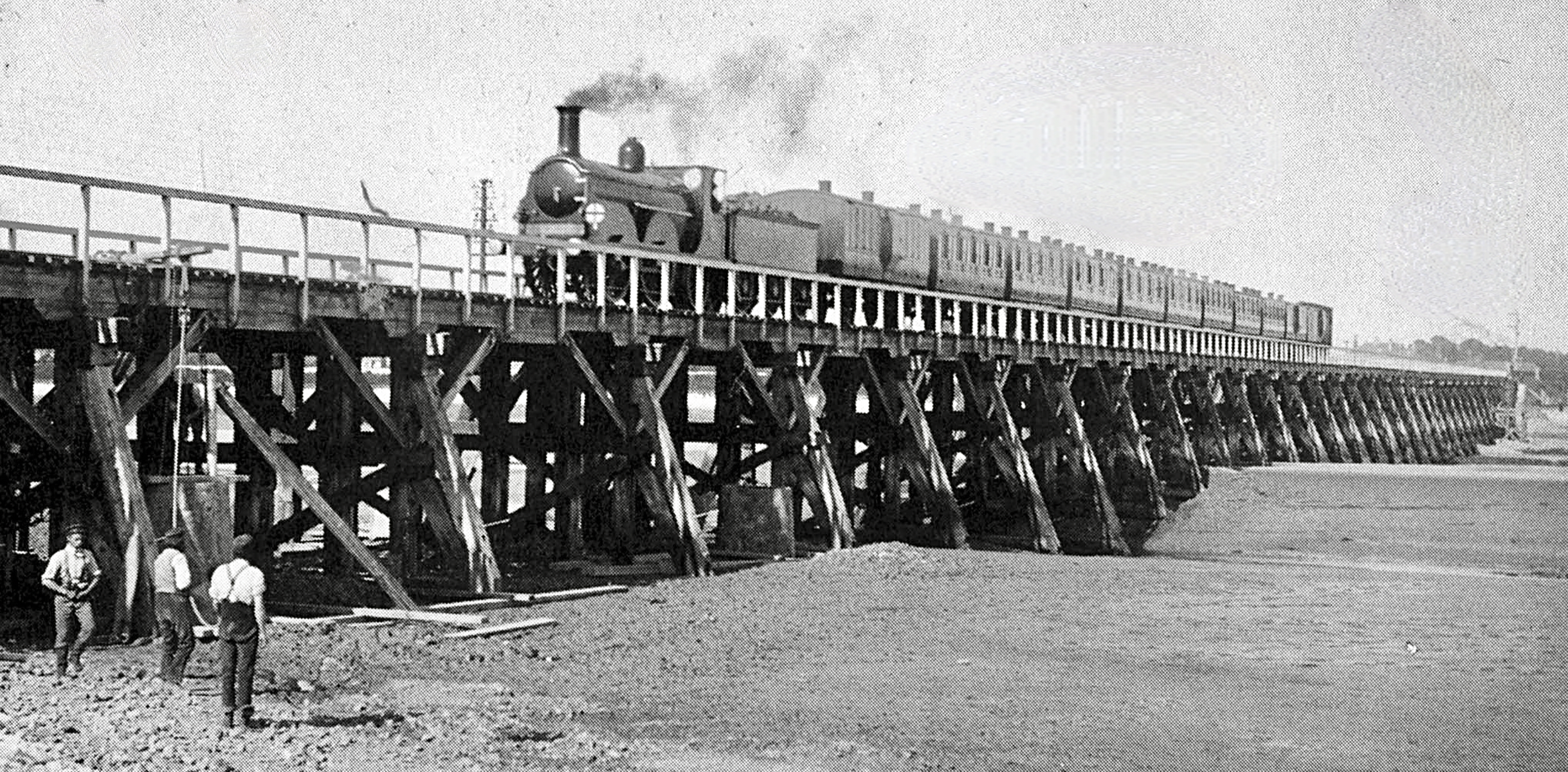
The original 1000 foot trestle bridge (1845) used a traditional wooden pier structure with cast iron girders. At the same time a substantial brick arch viaduct and embankment was constructed on the East side approach.
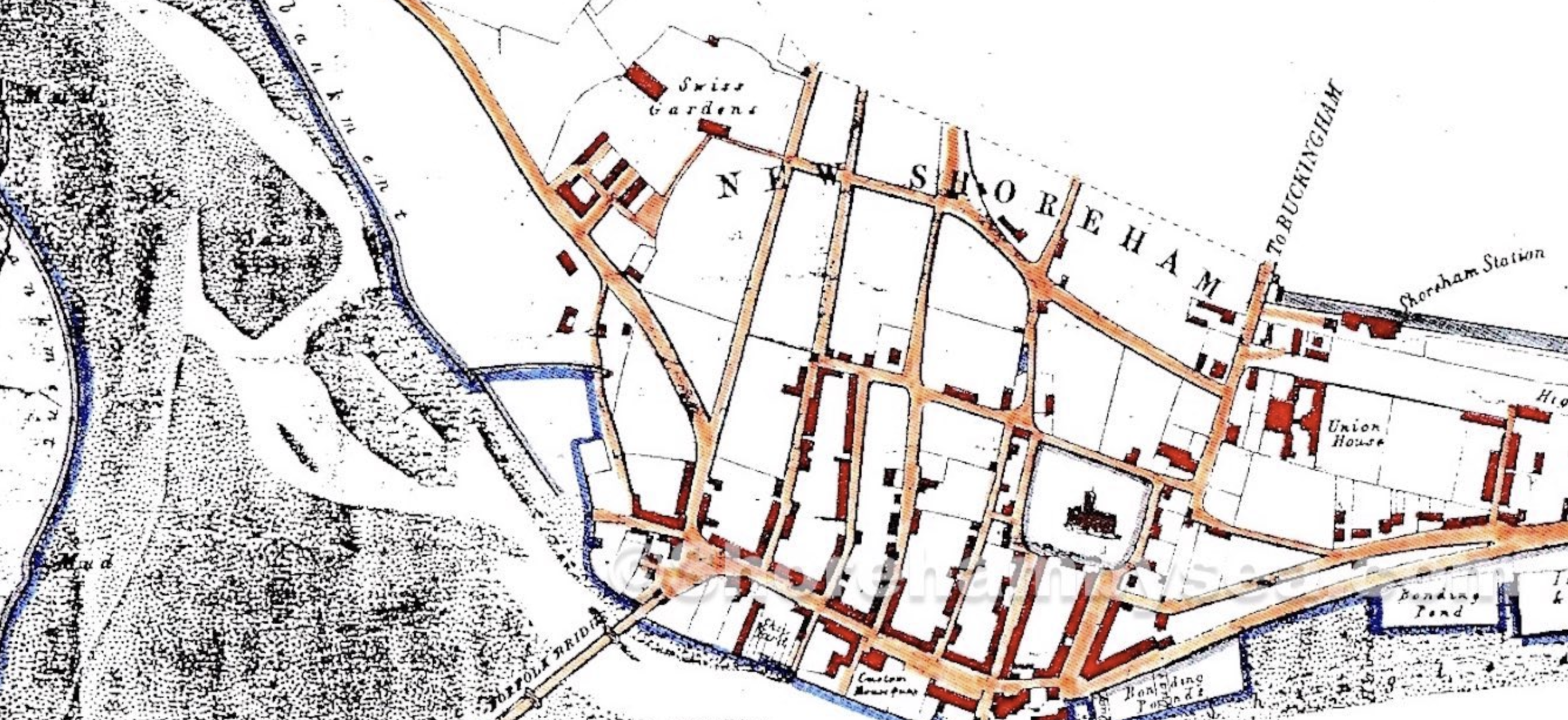
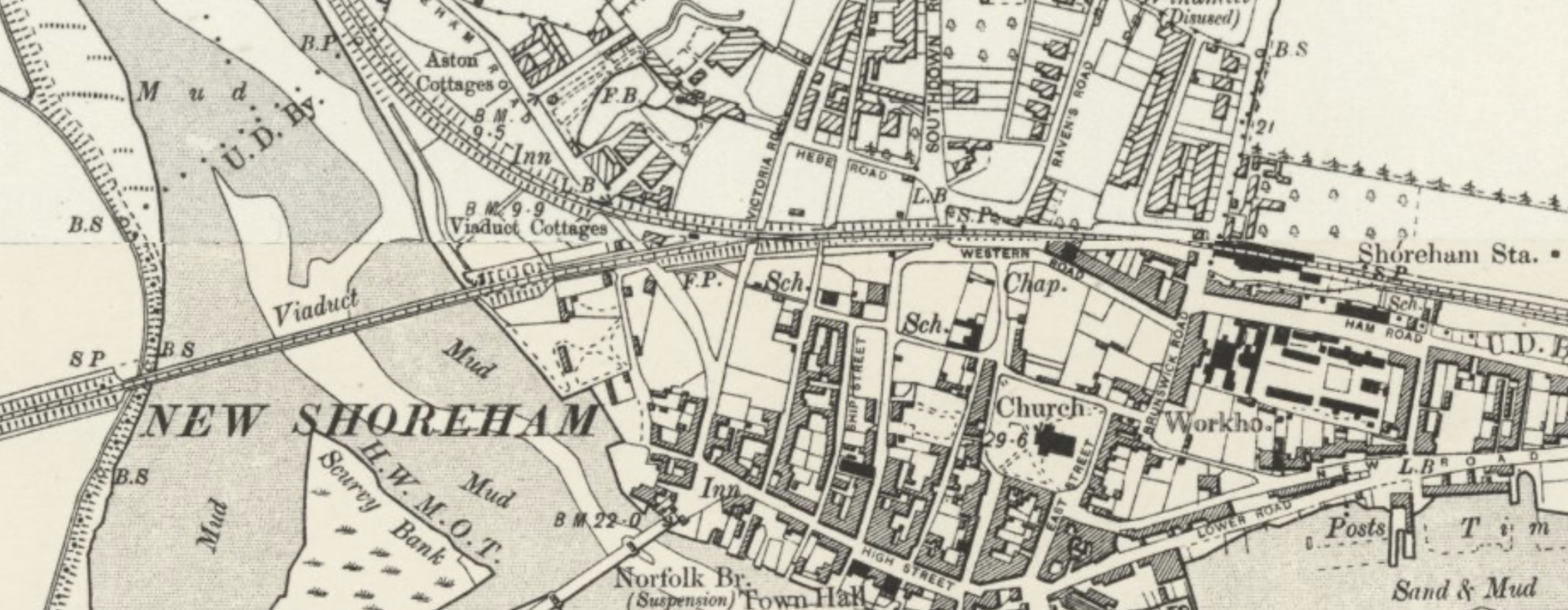
Before and after the extension of the railway. The road layout of Shoreham was revised to accommodate the embankment and incline to raise the level of the mainline extension to cross the Adur.
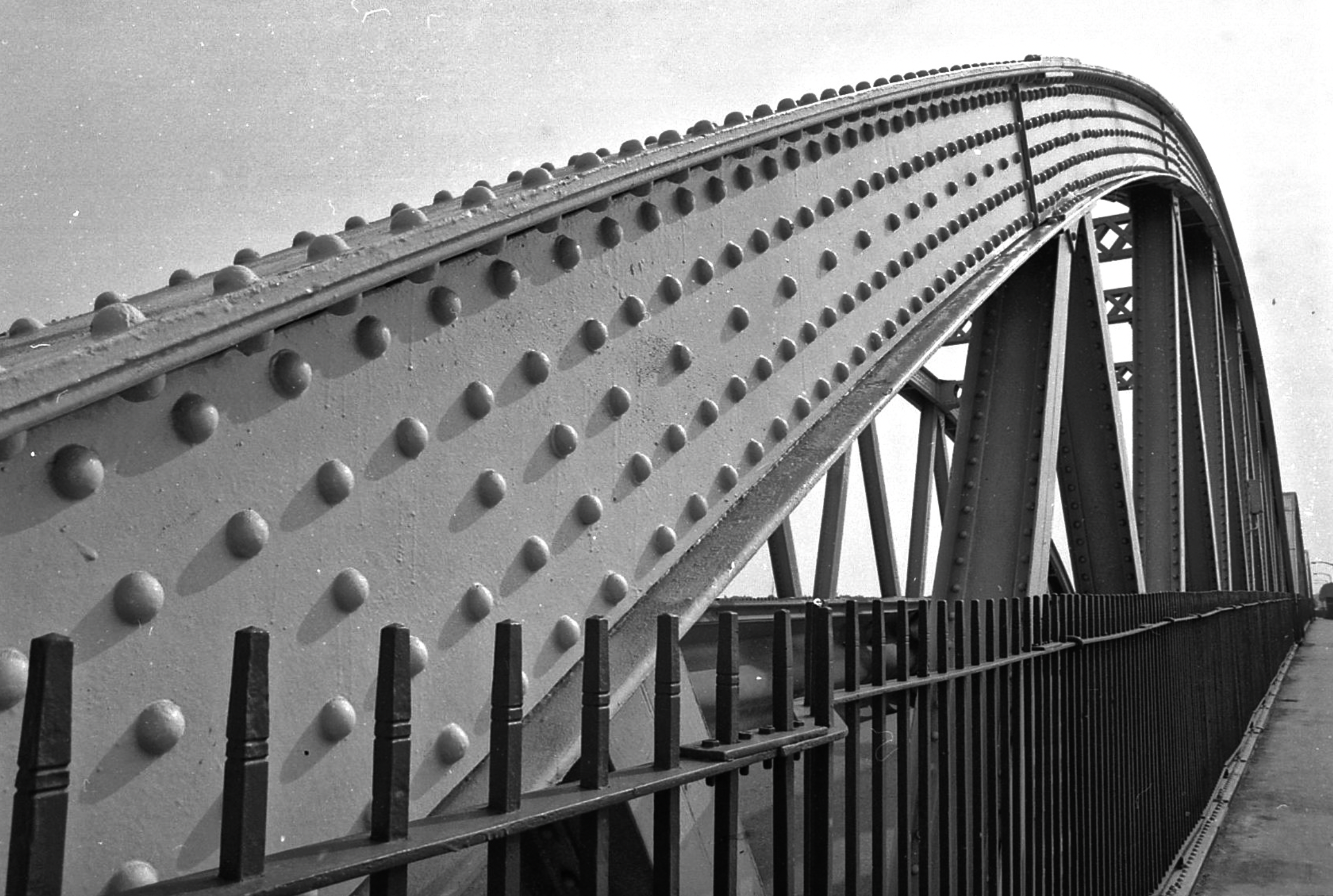
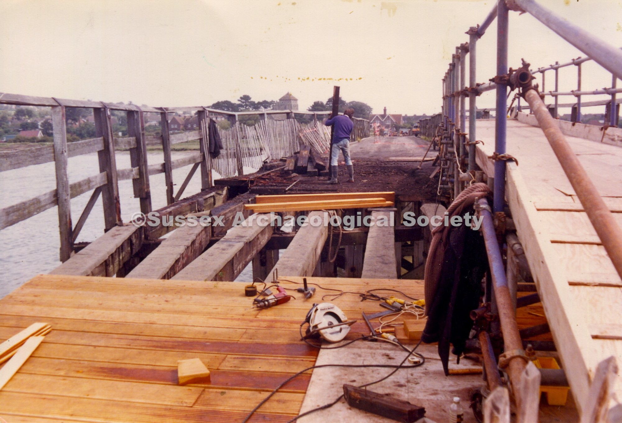
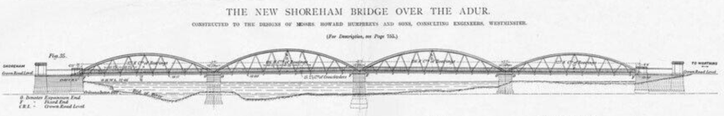
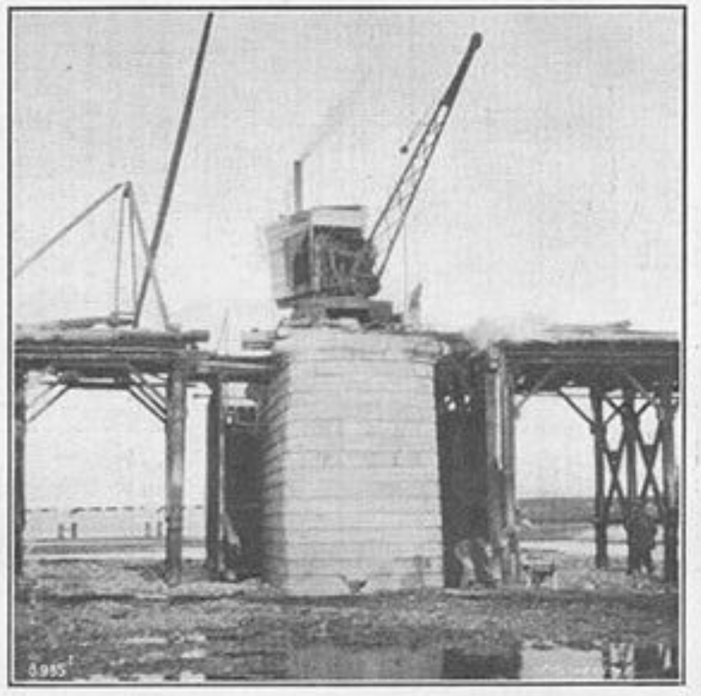
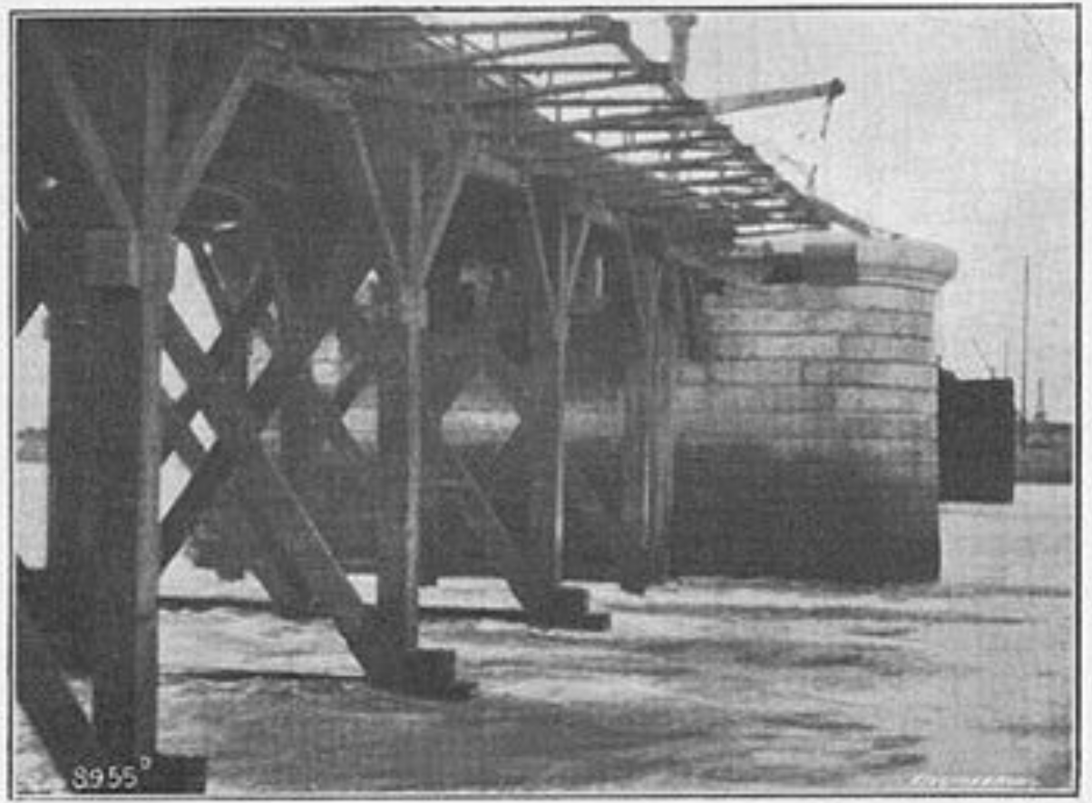
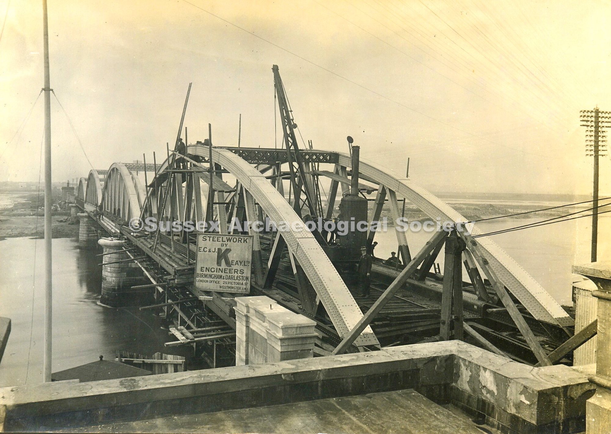
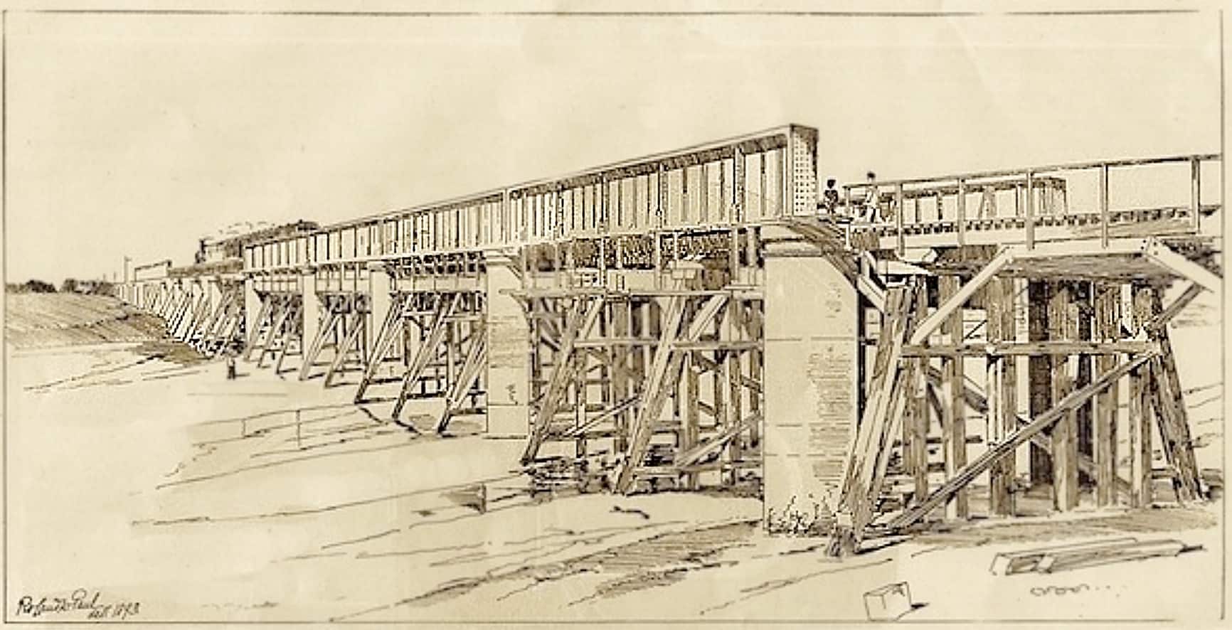
By 1896 the replacement came by the building of a 16-span, 360m-long steel viaduct, designed by Sir John Aird. It is one of the UK’s earliest steel structures. The bridge has cast iron supporting cylinders, 6 foot diameter that are concrete filled, secured 70 feet into the river bed to the chalk below. The main 20 ton steel girders were 75 ft long and 7ft high. Each was assembled at a site half a mile away (we assume adjacent the mainline at Ham Road sidings) and then shunted along the track to the bridge site.
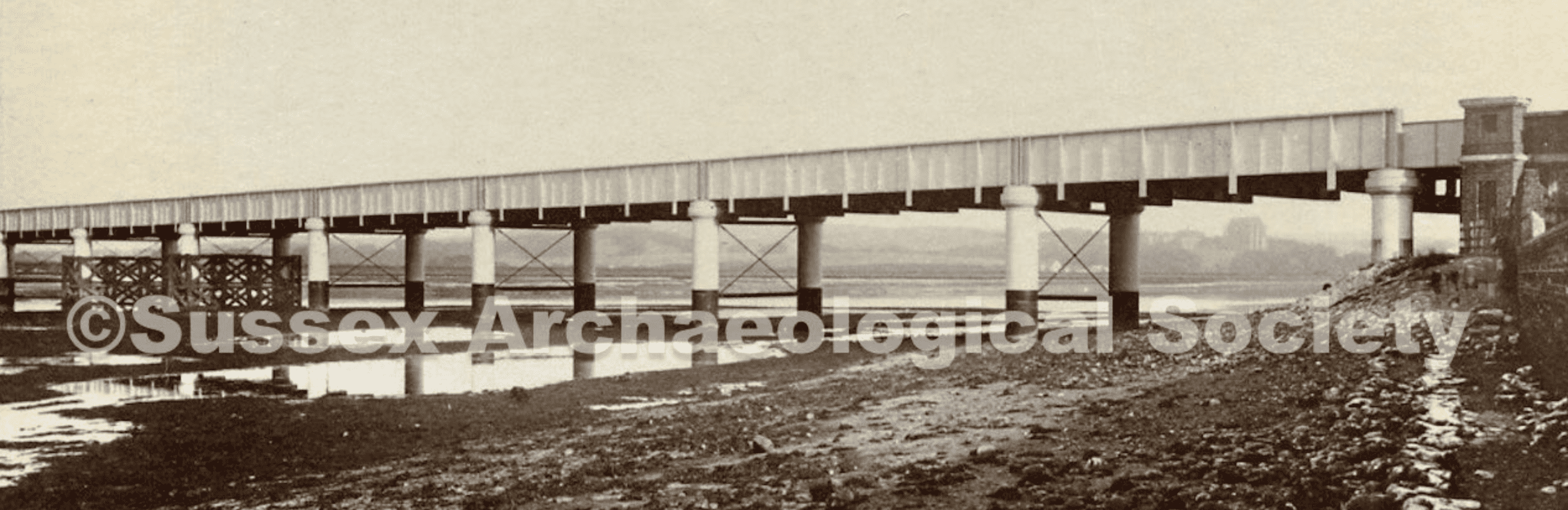
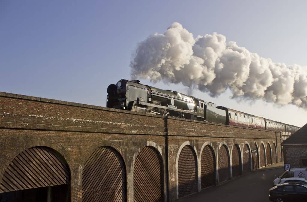
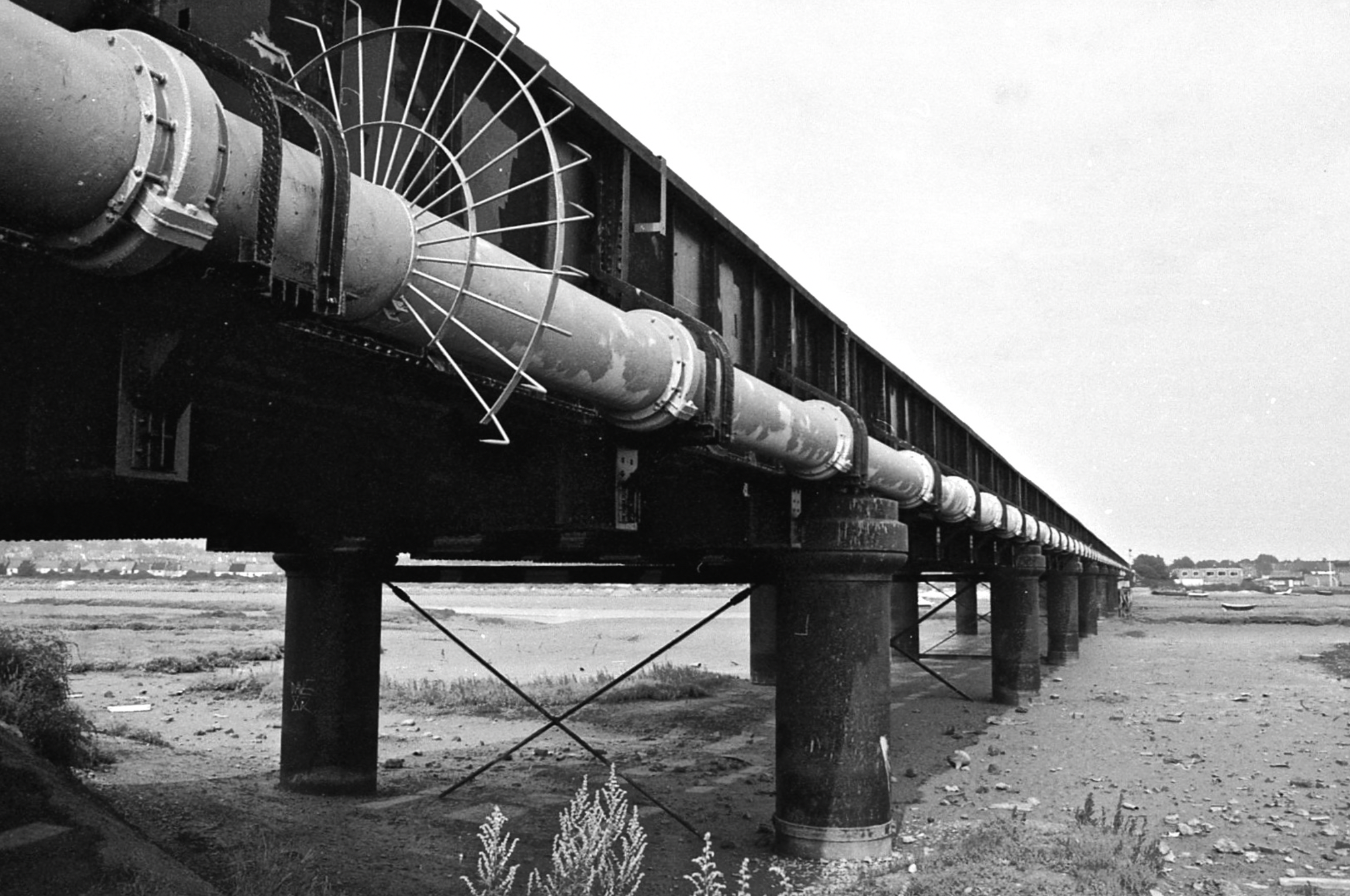
Those Shoreham residents of a certain age may recall the graffiti that often marked the steel faces of the bridge. Most notably for 6 or 7 years the bridge was adorned with the words “It’s Frothy Man!” that referenced a TV commercial for Cresta lemonade. In 2017 the 130 year old bridge was strengthened, repaired and repainted as part of a £9.5m investment by Network Rail. The old gas main that ran along the South side was removed.
Footbridge 1921-2013, 2013-present
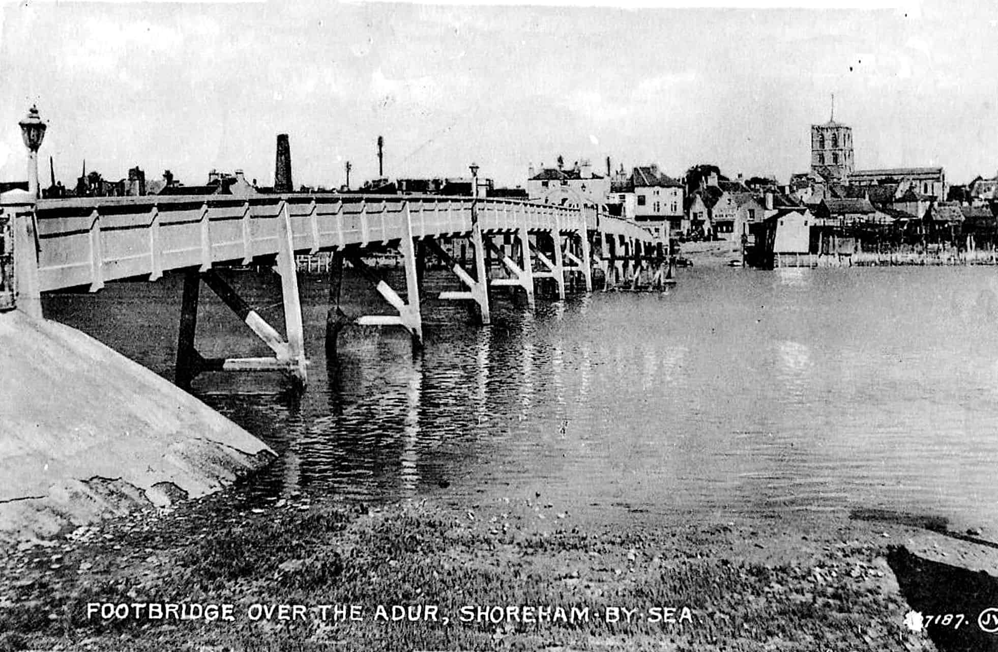
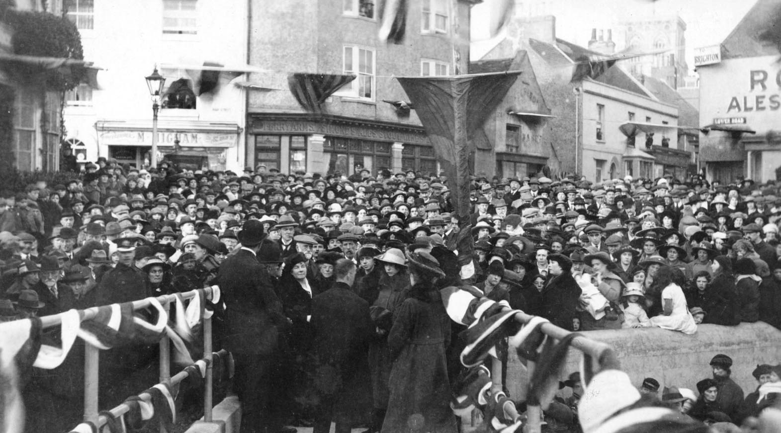
The footbridge was the answer to the rapid growth of building of chalets and bungalows on Shoreham beach. Upto 1921 the route to the far end of the Shoreham spit required travelling many miles via the Norfolk Bridge and Saltings in Lancing. The opening of the new footbridge heralded a new age for the beach and the event was well attended by Shoreham residents.
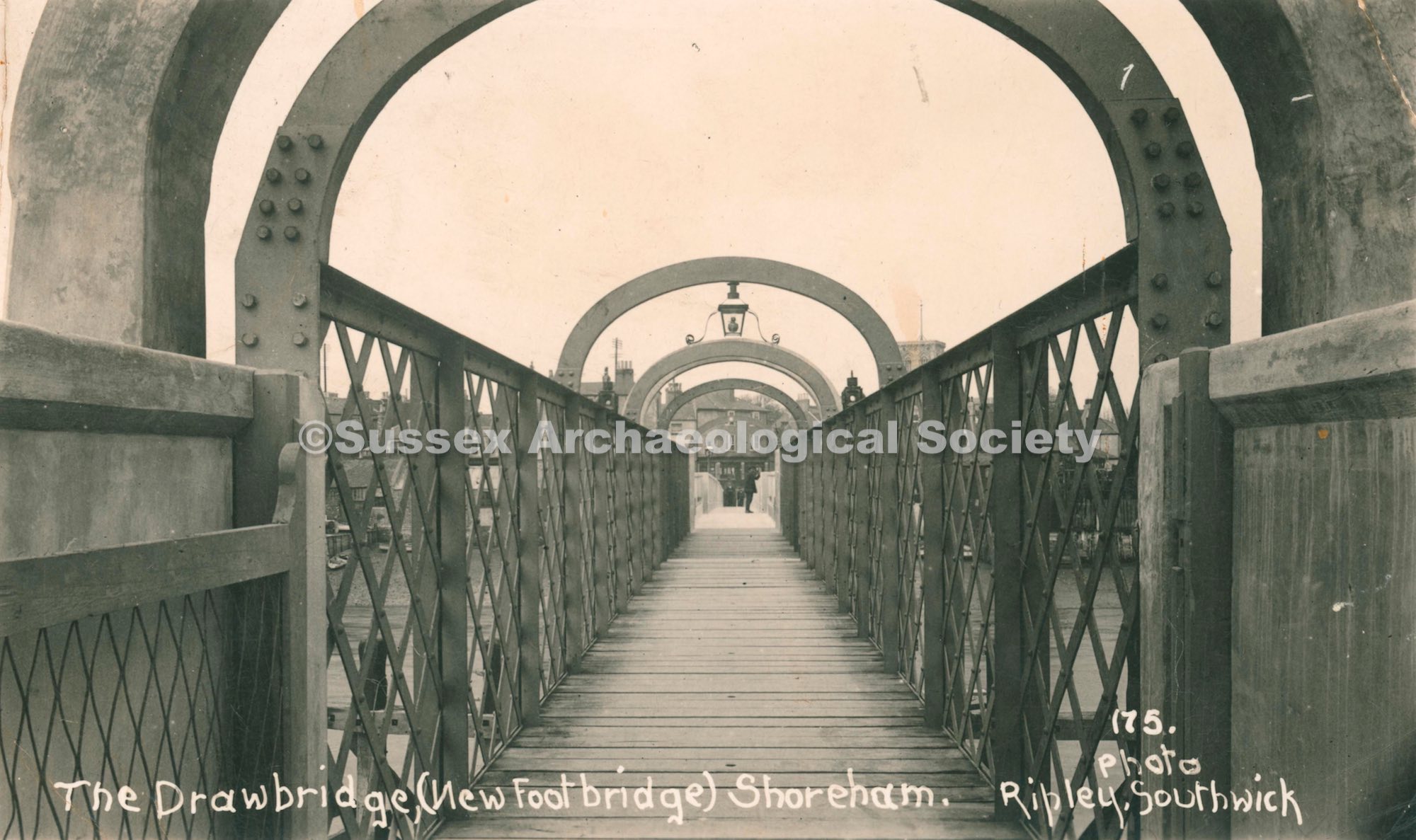
The bridge was constructed with precast piers and panels. The opening section in the middle was a travelling deck winched along rails within the bridge walls. The bridge was rarely opened and certainly I can’t think of more than a handful of occasions when it was opened in my lifetime from the mid 1960’s onwards. Initially tolls were collected at the town end – the collector seeking shelter in a tiny garden shed. Within a few years that was replaced by the bulbous concrete toll booth cantilevered onto the side of the bridge. It was out of use by the 1950’s and eventually demolished in the 80’s. Cycling was prohibited on the bridge – especially as many small boys would present a hazard and take joy in running and stopping to look down the 7-hole drains in the pedestrian deck revealing the river below.
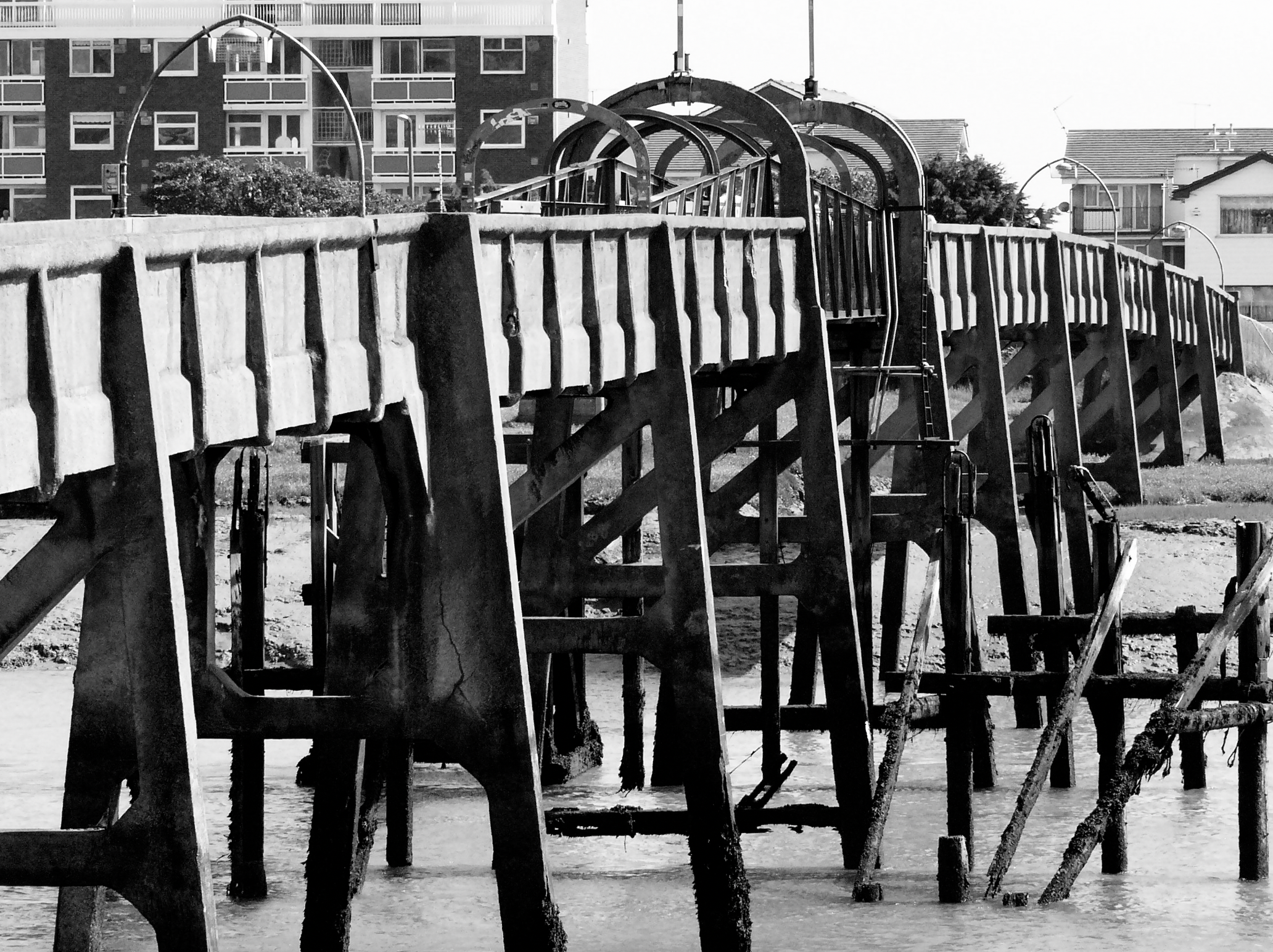
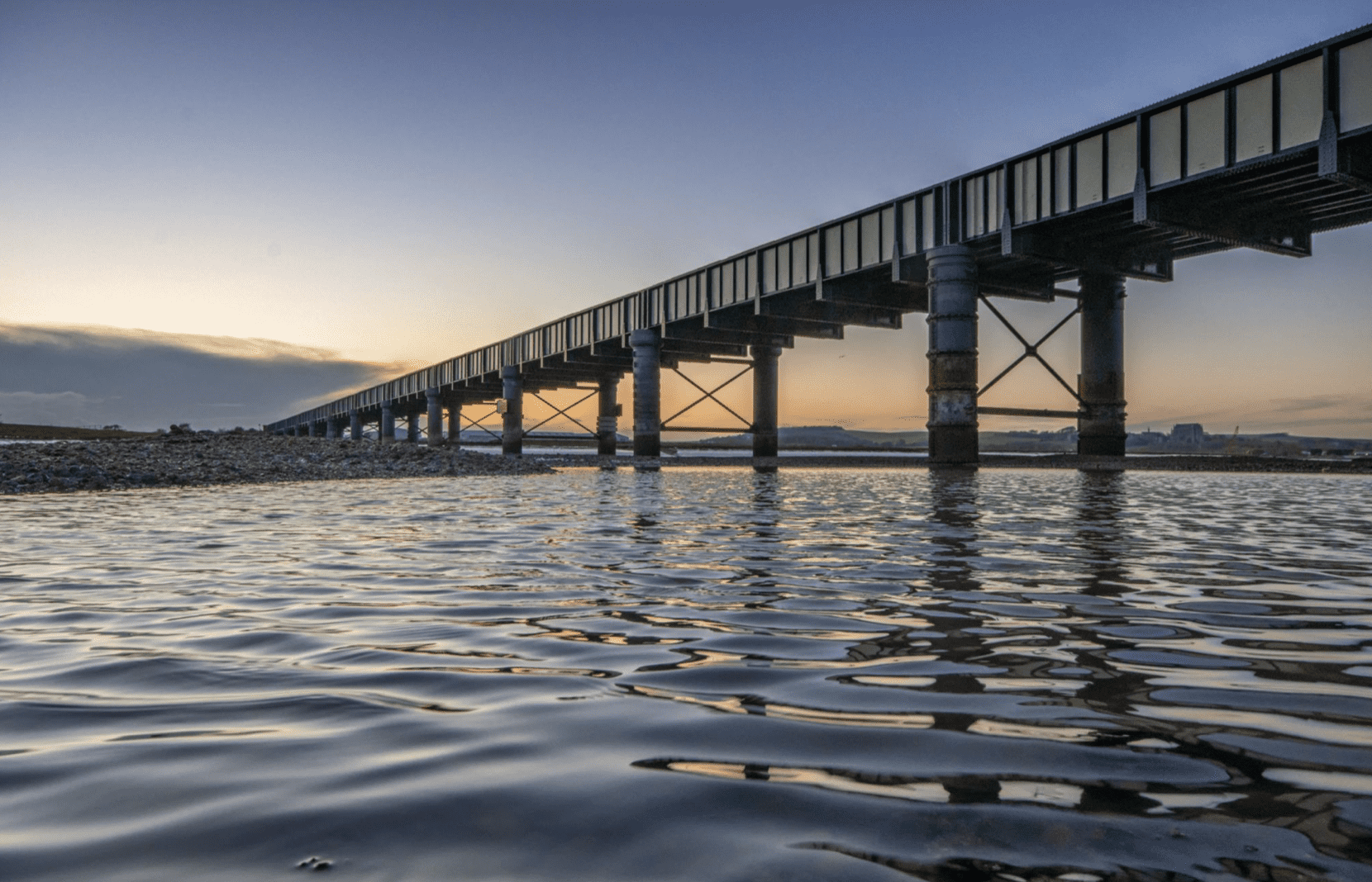
Adur Footbridge No.2 2013-present
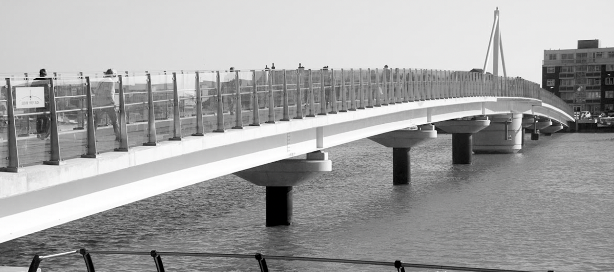
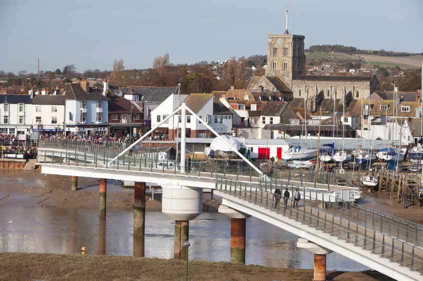
The replacement footbridge, inexplicably called the Adur Ferry Bridge, was a replacement for the concrete original that had become uneconomic to maintain. The position was diagonally across the Adur landing slightly to the east of the old bridge on the South side – following the route of the row-boat ferry service that operated 100 years earlier. The new bridge cost close to £9m to build, not least to provide bespoke glass balustrade panels. These panels were later shattered randomly by design faults. There has never been a time when at least one panel isn’t broken. Just like the preceding bridge, the new bridge had an expensive to maintain opening mechanism to allow, on the very rare occasion, for a boat into the basin 100 yards upstream.

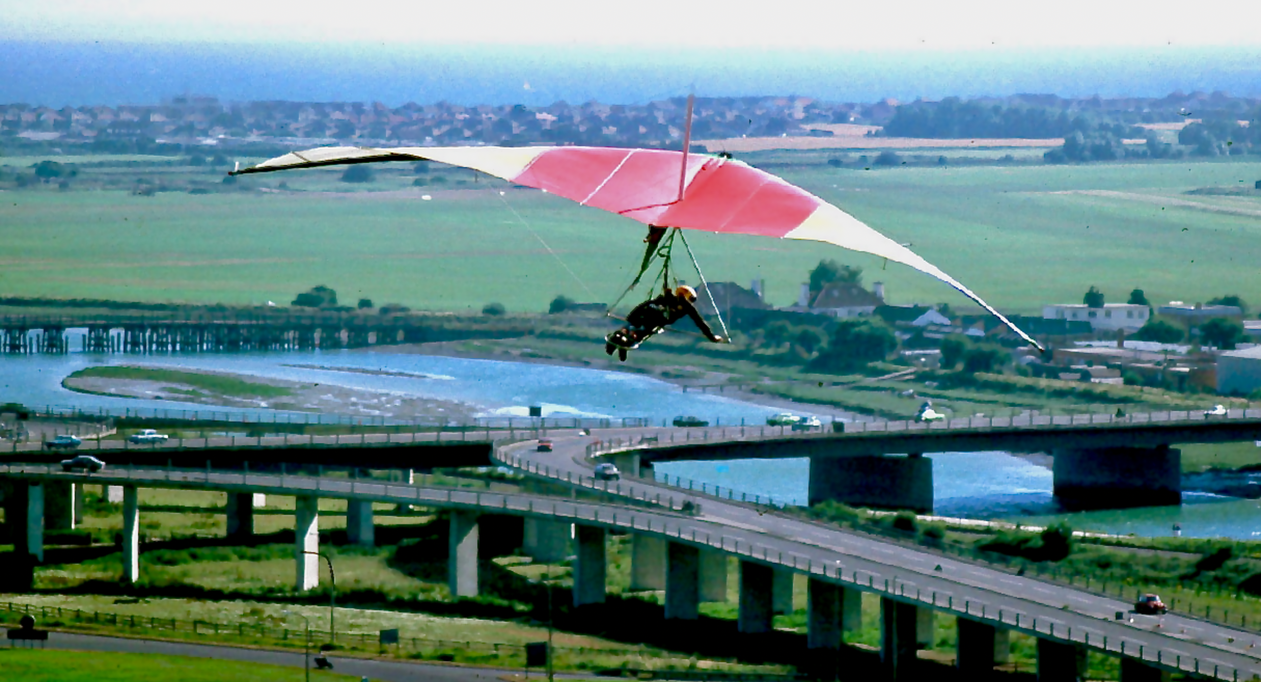
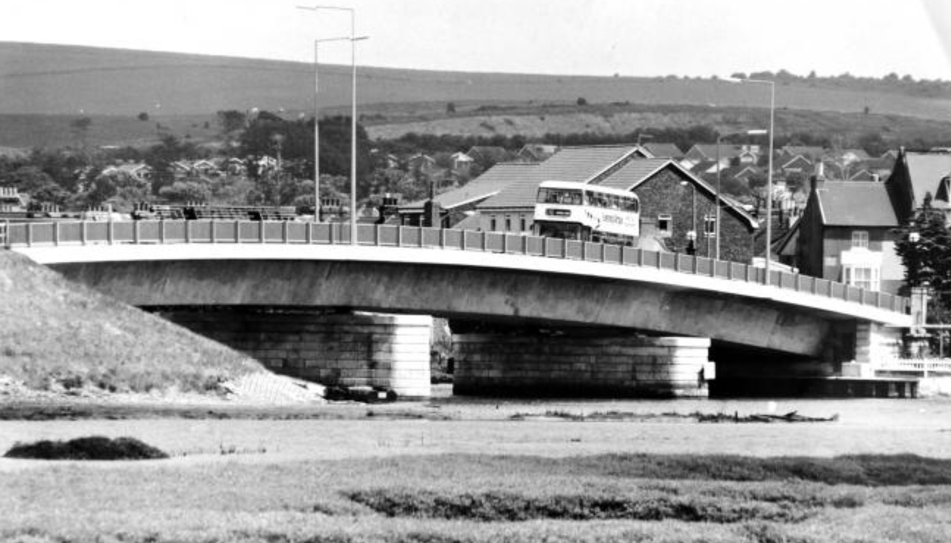
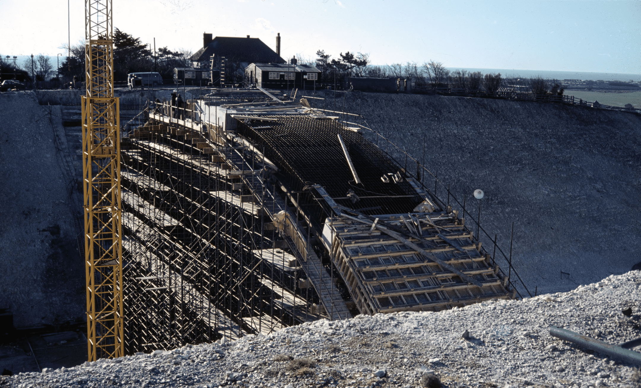
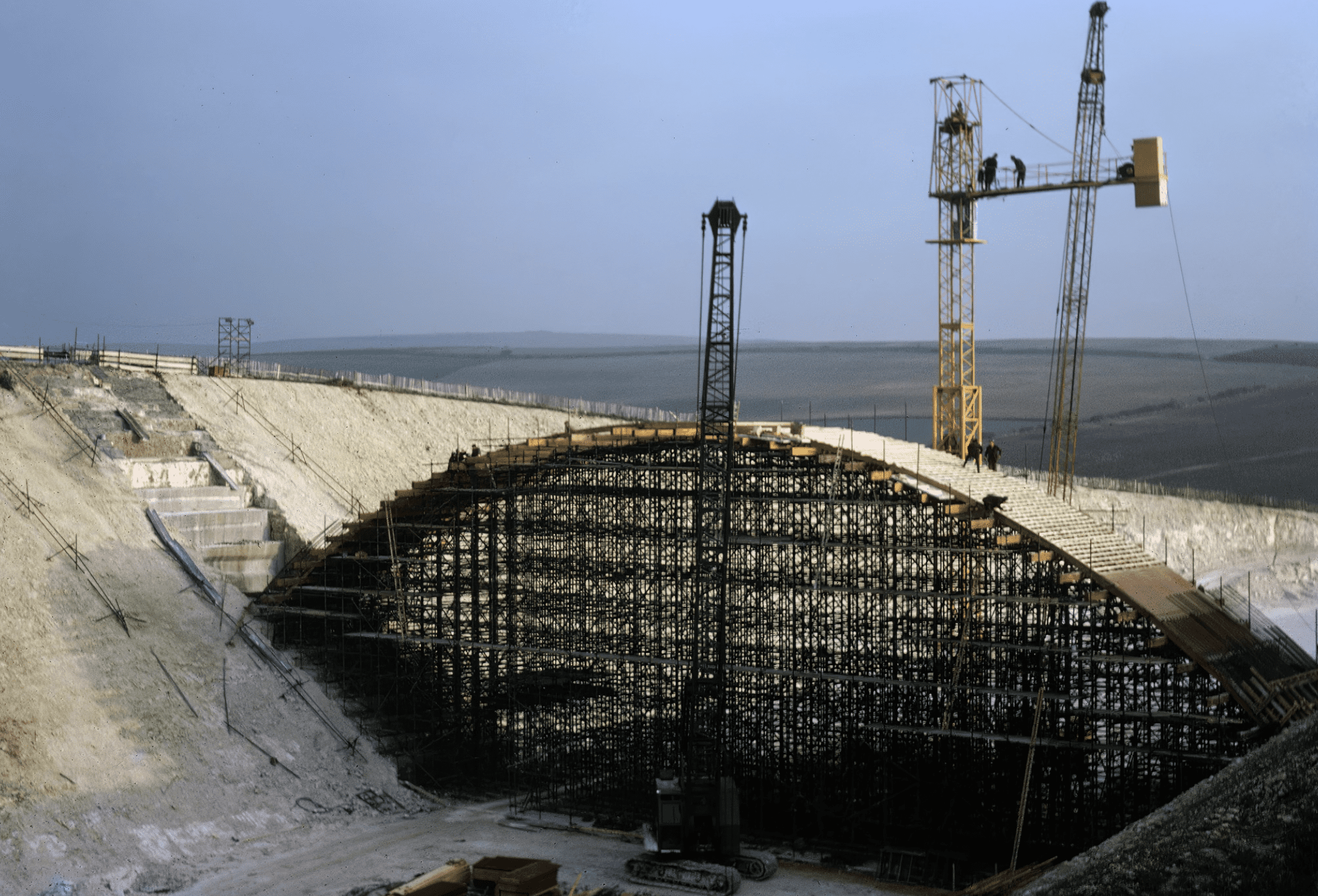
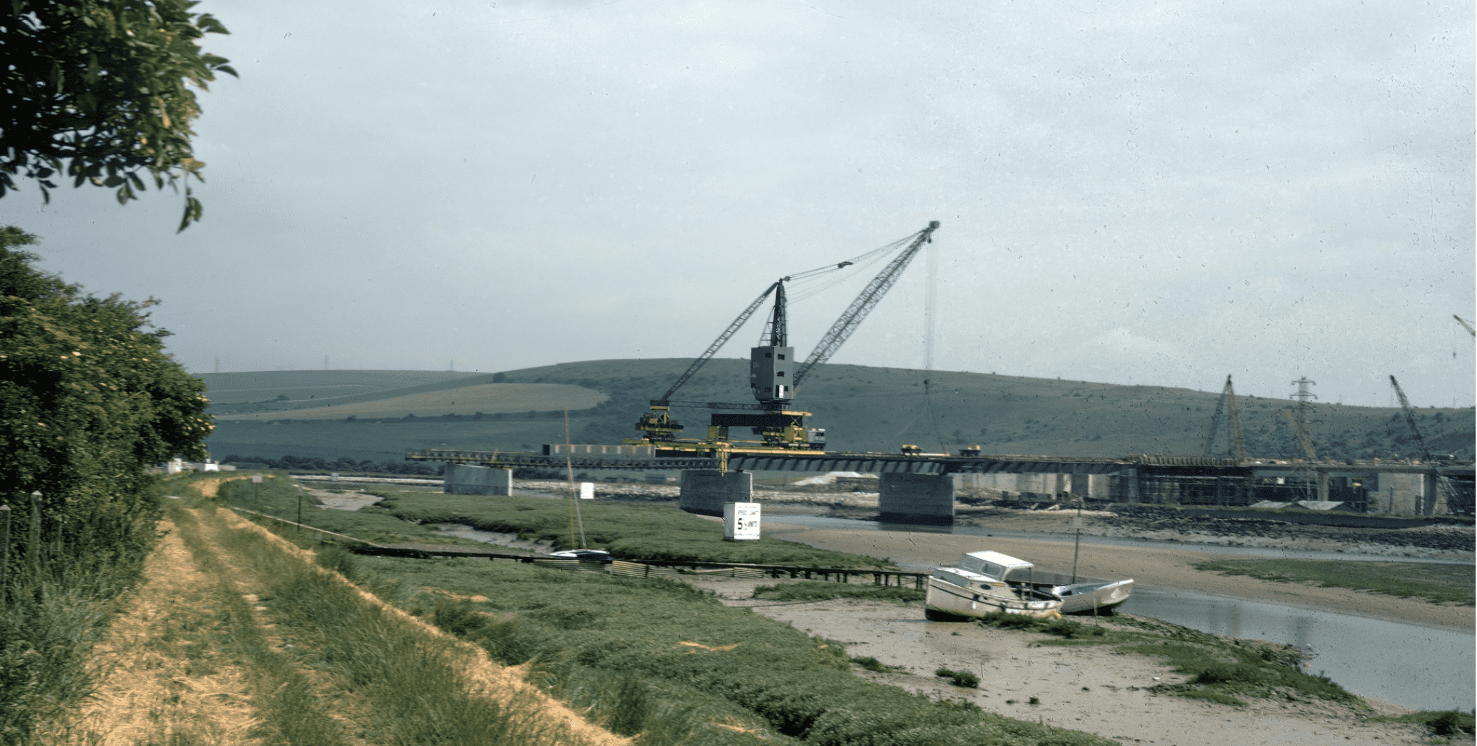
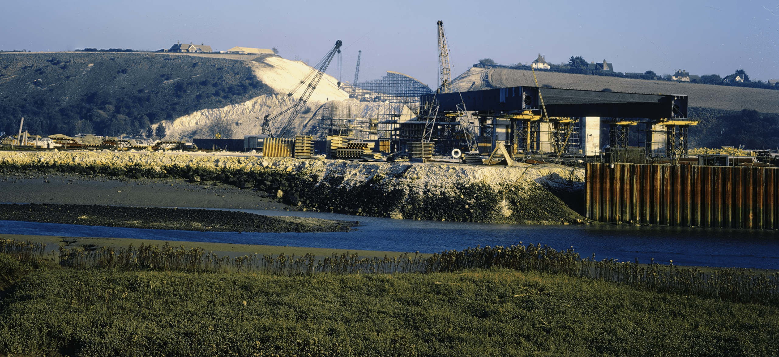
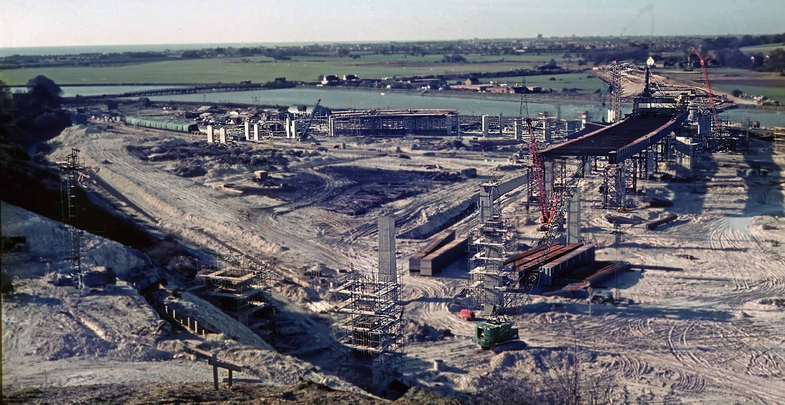
Adur Flyover 1969-present
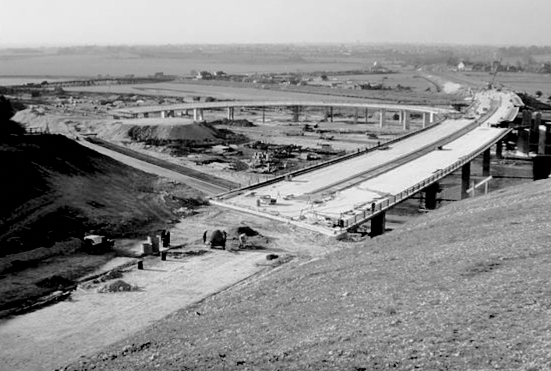
The glamorous sounding Folkestone to Honiton Trunk Road was to bring significant change to the Downs and river plain at Shoreham. By 1969 the ambitious plans to upgrade the A27 to bypass the conurbation of Shoreham, Southwick and Hove with a dual carriageway had seen a huge cutting excavated into the downs from Holmbush to the Adur. The Adur Flyover was the elevated section with cloverleaf road junction and bridge over the river that landed at the Sussex Pad. A new road bridge over the cutting at Mill Hill added to the scale of the project. Decades later the A27 was extended from Holmbush to Waterhall Hove via the Southwick Tunnel – over budget, undersized and 3 years late.
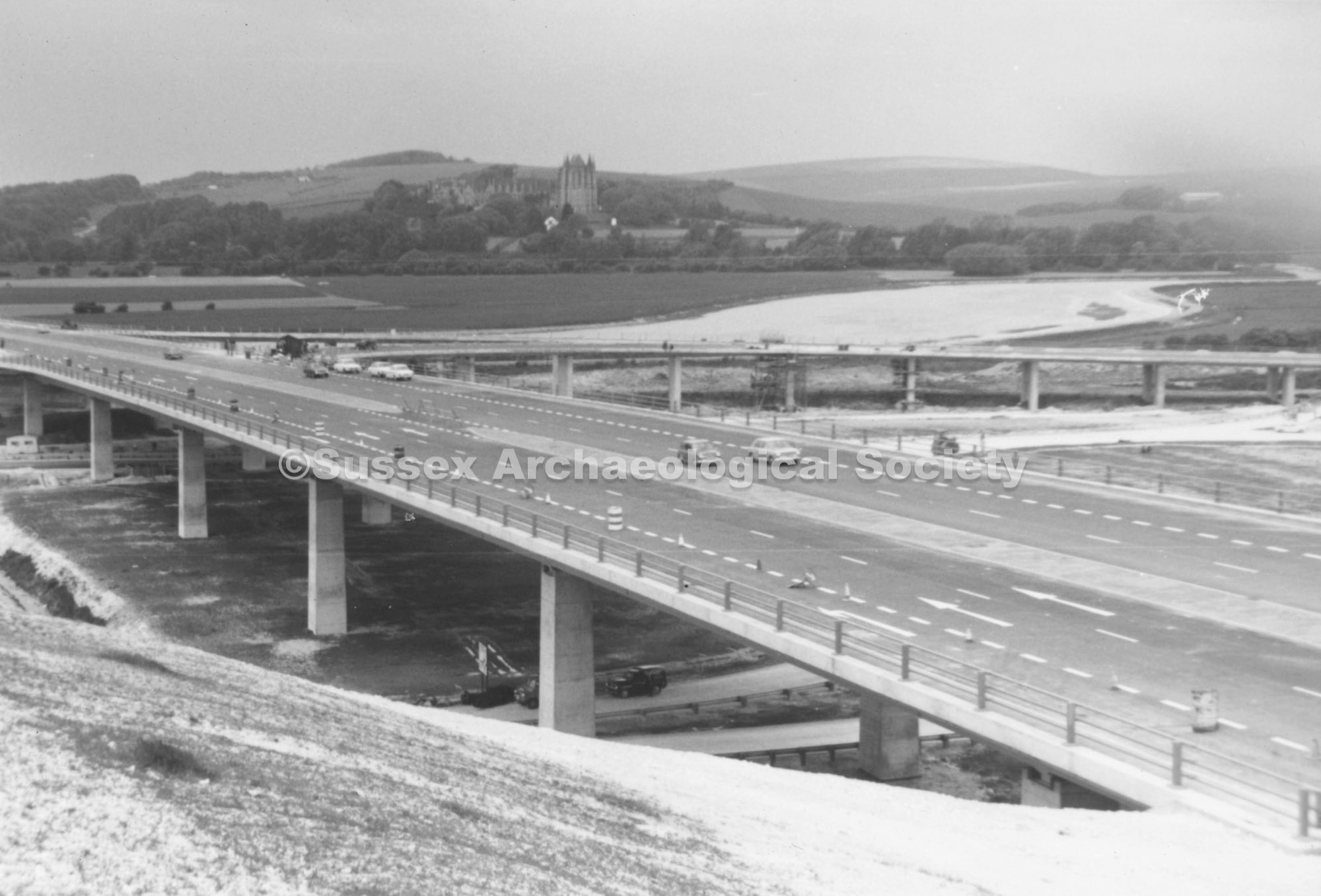
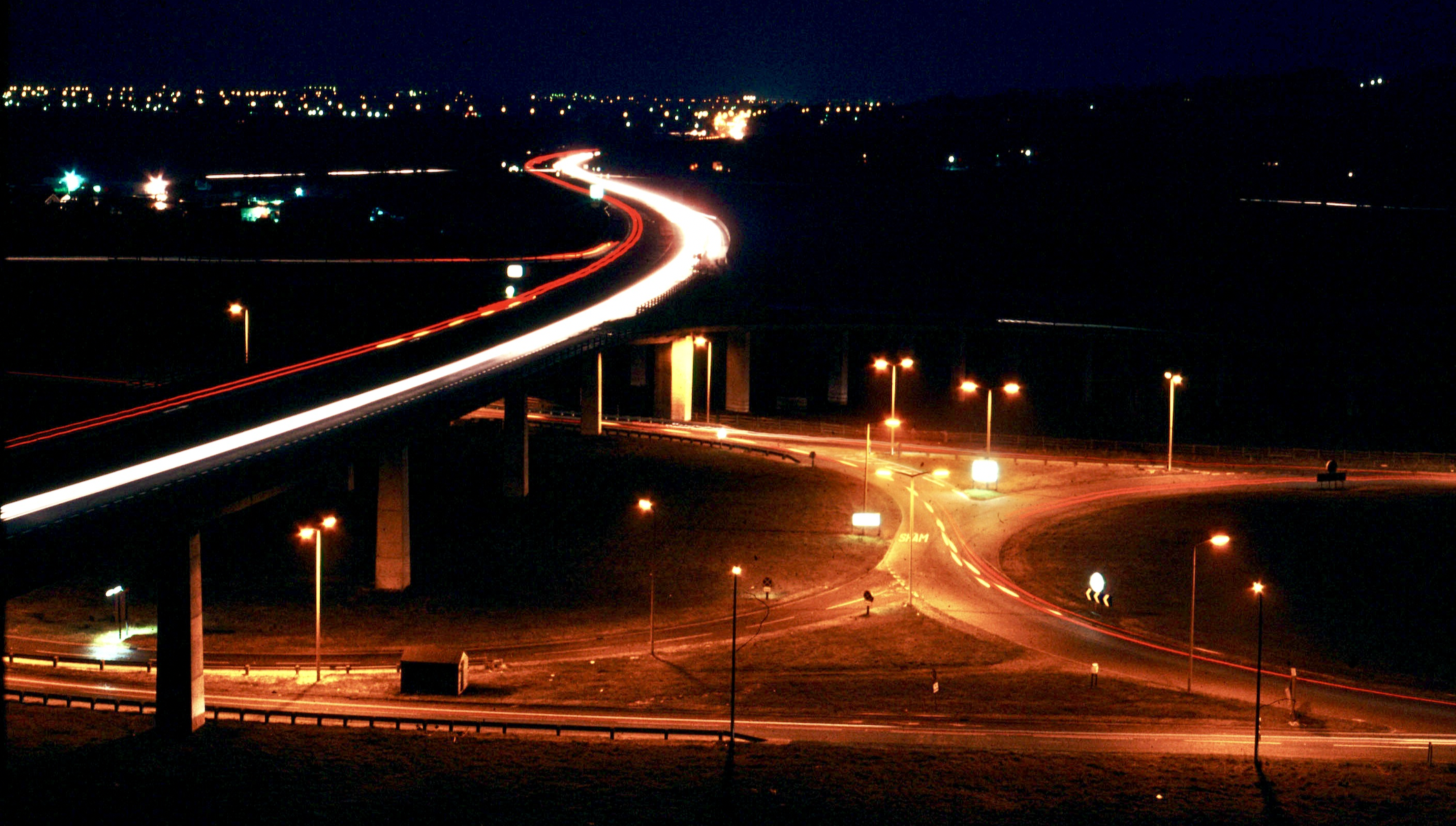
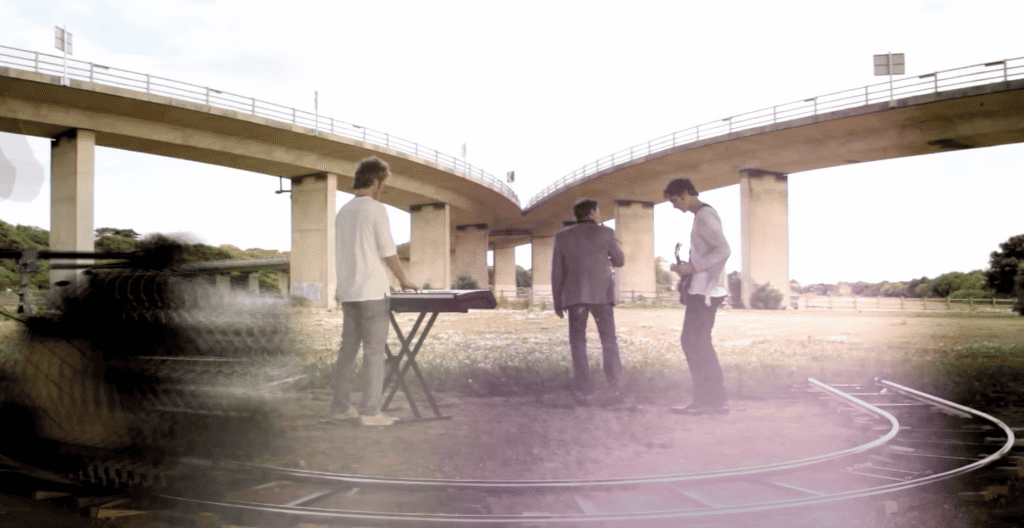
The flyover bridges have been the subject of significant structural repairs over the decades since 1970. They were also the backdrop for the final “a-ha” pop video in 2010 as seen here: