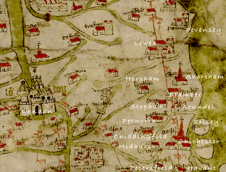
I’m fascinated by mediaeval history particularly concerning our area. Don’t know how long this resource has been on line but it provides a revealing glimpse of the places in c.1360 considered then to be more important. I’ve added the present day names and surprisingly (for me) it includes places like Stopham and Chiddingfold – Selsey at that time was an island! Shoreham is portrayed as quite a dominant town which of course it was then due to its shipbuilding industry but strangely the River Adur is not included. What it lacks in detail and proportion it makes up for by magically taking us back to a Tolkein-like middle earth seven hundred years ago (see the complete map shape of the British Isles) – an amazing feat for those times.
Well worth a visit – http://www.goughmap.org/map/
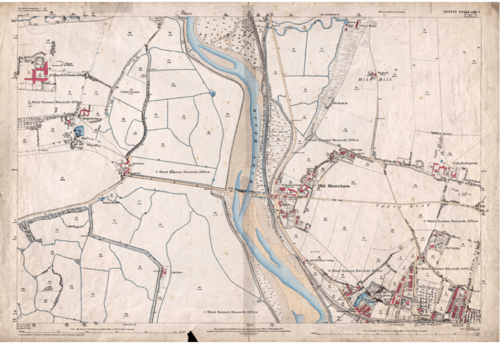
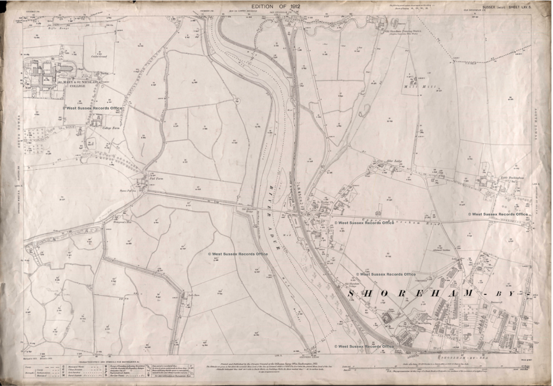
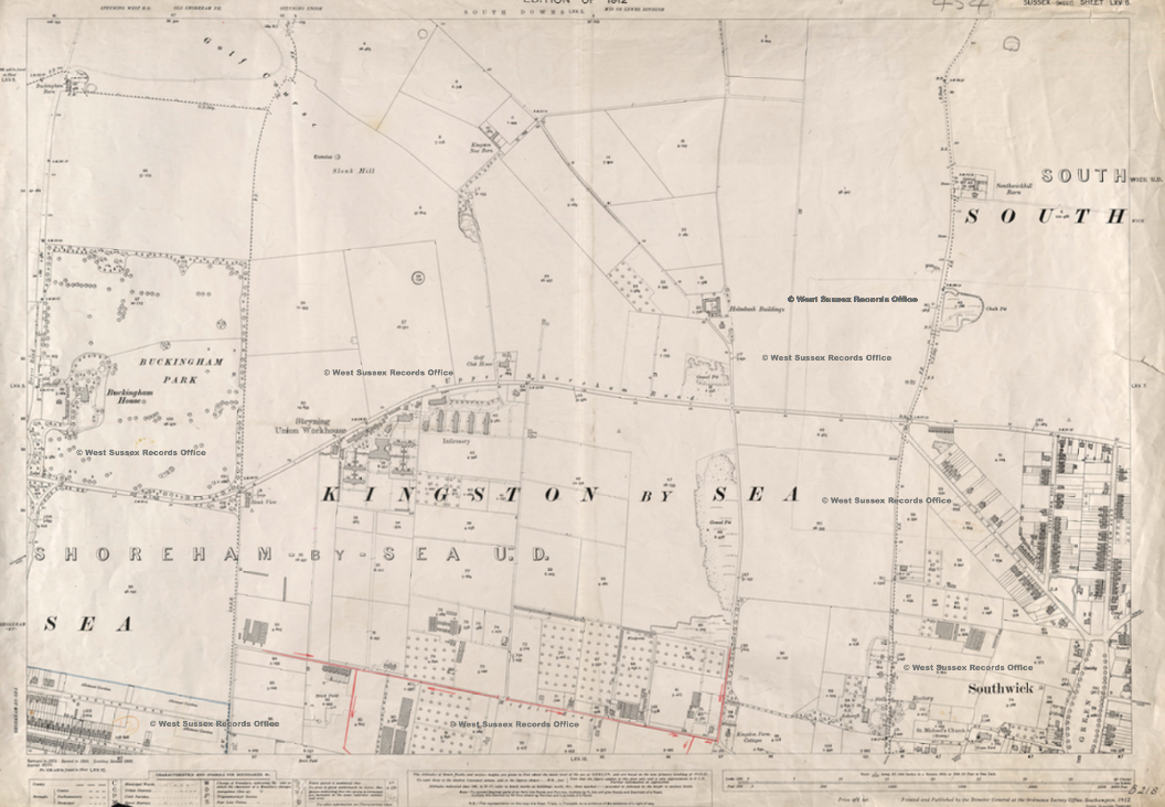
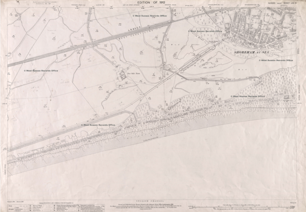
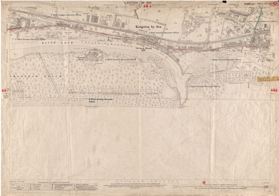
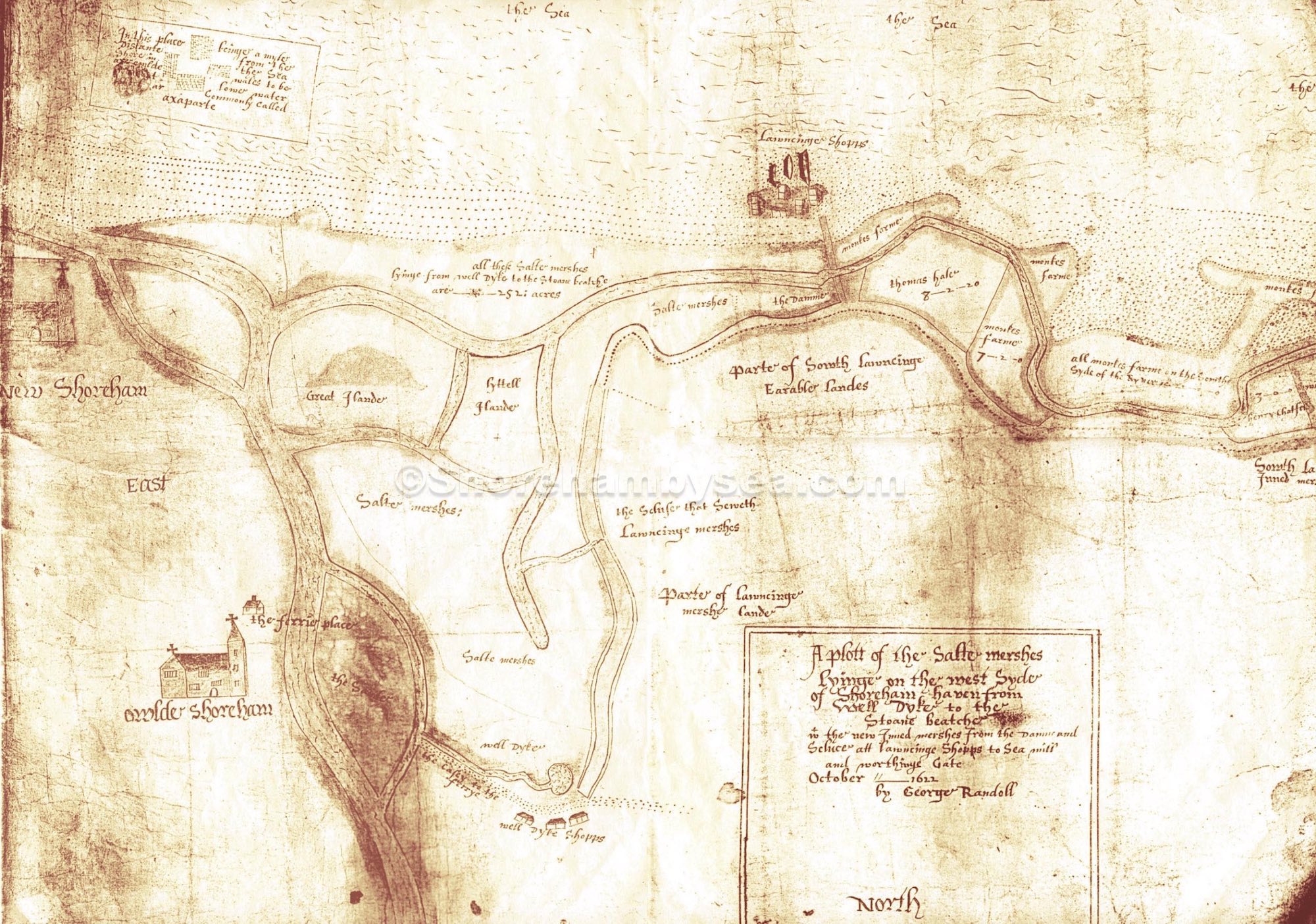
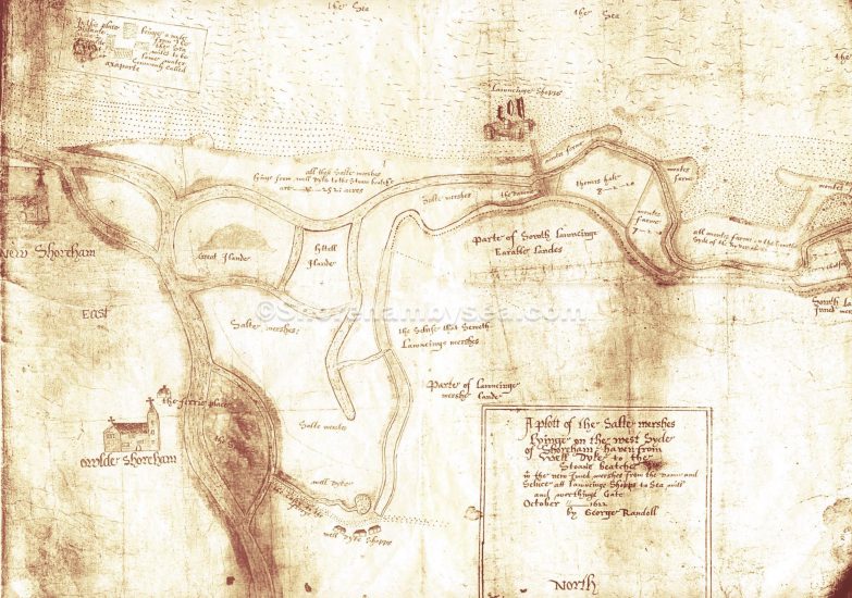 1622 Shoreham to Lancing Marshes Map – Although lacking in some detail and is incomplete (the original has the extreme west part missing) this is probably one of the earliest large scale maps of the area. Surveyed and drawn by George Randoll , presumably for the then owners of the land, it came into the hands of the Petworth Estate in 1784 when they purchased Pad Farm and some of the marshes. It shows the main course of the river around Old and New Shoreham. Unusually orientated north to south it covers the area from Well Dyke (near today’s Sussex Pad site) to the ‘Stoane Beatche’ (which shows the build up of the Shoreham Beach spit or peninsula – this is thought to have been long established and even by the 17th century the river is believed to have entered the sea as far west as Southwick). From east to west the map originally covered from Shoreham to Worthing Gate (map piece missing – now known as Teville Gate). Text in the top left corner refers to the submerged village of Pende reads ‘In this place being distant from the shore in the sea (axer?) could wales (rocks) to be (seen?) at low water which are commonly called axaparte – the old name for Pende. A ferry is shown at Old Shoreham where the toll bridge is now – the Lancing and Well Dyke ‘shoppes’ were, of course , workshops. Were these offshoots of the river man made for drainage or naturally formed? Apart from the main river little or nothing of them in their original position remains now although the section from ‘Salte Mershes’ opposite Old Shoreham down to ‘Lyttel Iland’ seems to have survived up to 1780 alongside a road through what is now the airport (Map5a) and although that road can still be seen on the 1912 map (Map12b) the ditch itself has disappeared.
Reproduced by permission of Lord Egremont.
A very rare map of bungalows and their names as they were in 1917 when the growth of Bungalow Town was really getting under way. There are (as to be expected) lots of familiar and new names on this, some for new bungalows and others that were obviously changed. The footprints for each bungalow are not accurate, though, with no real indication of their shape (as with the 1930’s map) only identical hand drawn rectangles for each showing their location. The map year fortuitously coincides with the 1917 street directory (also on shorehambysea.com website) but already that comes up with a few anomalies (different names for some properties on the same spot, probably in part due to frequent name-changes and different time of the year between the two publications – there are even different names for some of the roads!).
Continue reading “Bungalow Town Site Map and Index 1917”