This 20 minute video explores some of the content on the website and demonstrates some of the features.
Tom Jones
Pubs, Polo, Pirates or Knights – Tom Jones and The Crown and Anchor
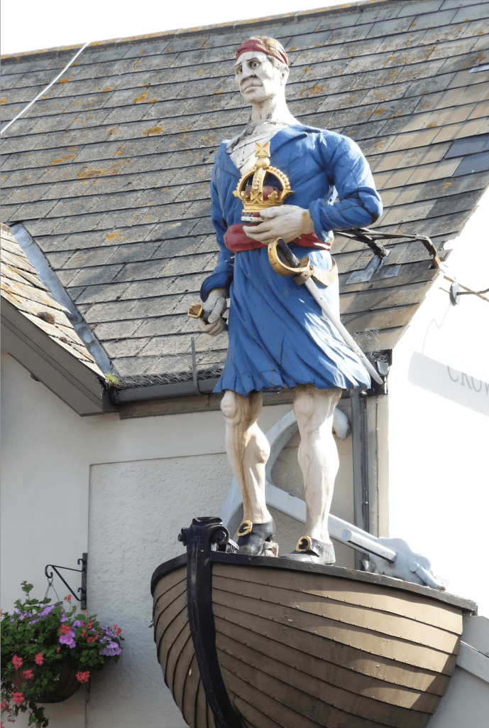
Anyone who has visited Shoreham will have noticed the prominent pirate figurehead mounted high on the Crown and Anchor. As a youth I used to always drive down to Brighton along the more interesting seafront route long before the bypass, and that pirate was one of the curious milestones along with the junior Battersea power station, rows of coloured beach houses and dilapidated pier. It was an unbelievable surprise for me to find out 30 years later, after living in Brighton for a decade then Australia for two, that it was a long-lost relative who originally put it there. While researching the origins of my orphaned grandfather, I pieced together an amazingly colourful detailed story from the late nineteenth century which, on reflection, ends at the Crown below that pirate and various signs above the door and on even the roof reading “Tom Jones“.
Zoom talk on Saving Shoreham’s History
The guest speaker for the January 2026 Shoreham Society talk is Paul Osborne, co-founder of www.Shorehambysea.com.
Find out more and sign up on the Shoreham Society’s website.
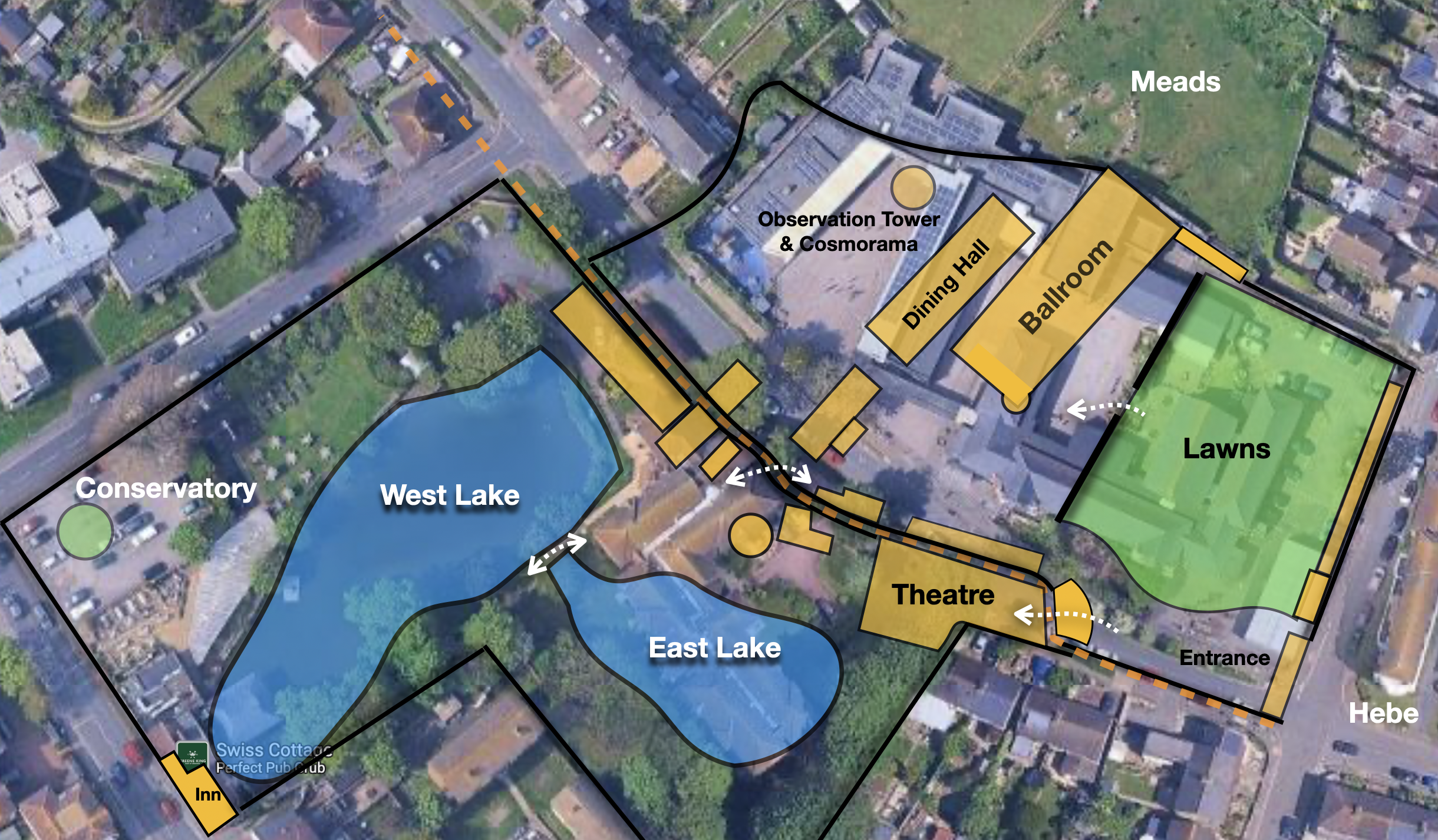
Accidents at the Swiss
Whilst the Swiss Gardens pleasure grounds were, for 70 years, the destination for fun and frivolity it had an unenviable record of hazard and danger.
1838 – not long after opening a drowning occurred of 15 year old William Booker. He was employed at the Swiss in maintenance duties. One of his responsibilities was to pump out water from the ‘floating temple’ tethered in the East Lake. On the morning of Monday 16th July 1838 he was discovered by staff drowned in the lake.
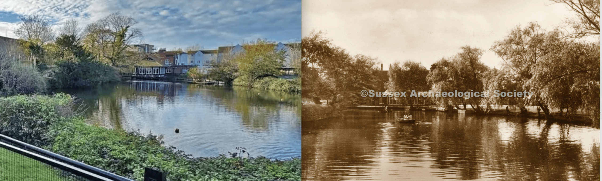
The clues to the past: Swiss Gardens
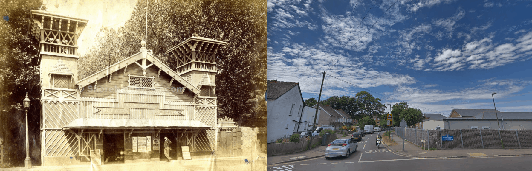
If you look closely there are a few clues to the former use of the Swiss Gardens School site – the Swiss Gardens pleasure garden (1838 – 1910). The Lake is the most obvious, to the South of Swiss Gardens road in the grounds of the Swiss Cottage pub. Hidden in the gardens of Homehaven Court is the remaining wall of the grand theatre.
Mystery Mystery Towers painting
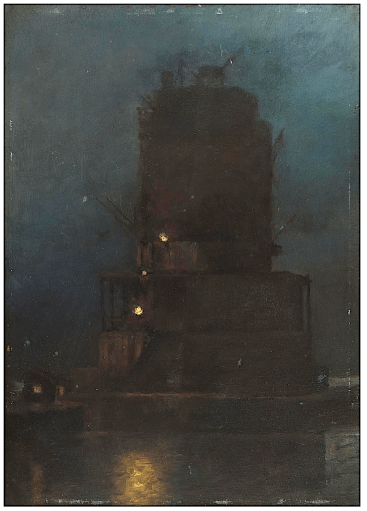
An enquiry from the Tate Gallery recently raised the question of when the above painting was painted. The Tate believed it was 1903. However if the image is enhanced it does reveal some significant details to identify the date. I’d suggest the artist was positioned at Turberville Wharf looking SW to the tower. The area at the far left of the painting is the base of tower 2, with sheds on its base – hence the light in windows (see photo below from similar position). There are also working lights on the tower – suggesting the towers were still occupied but near completed – note there are no signs of the large cranes on the land.
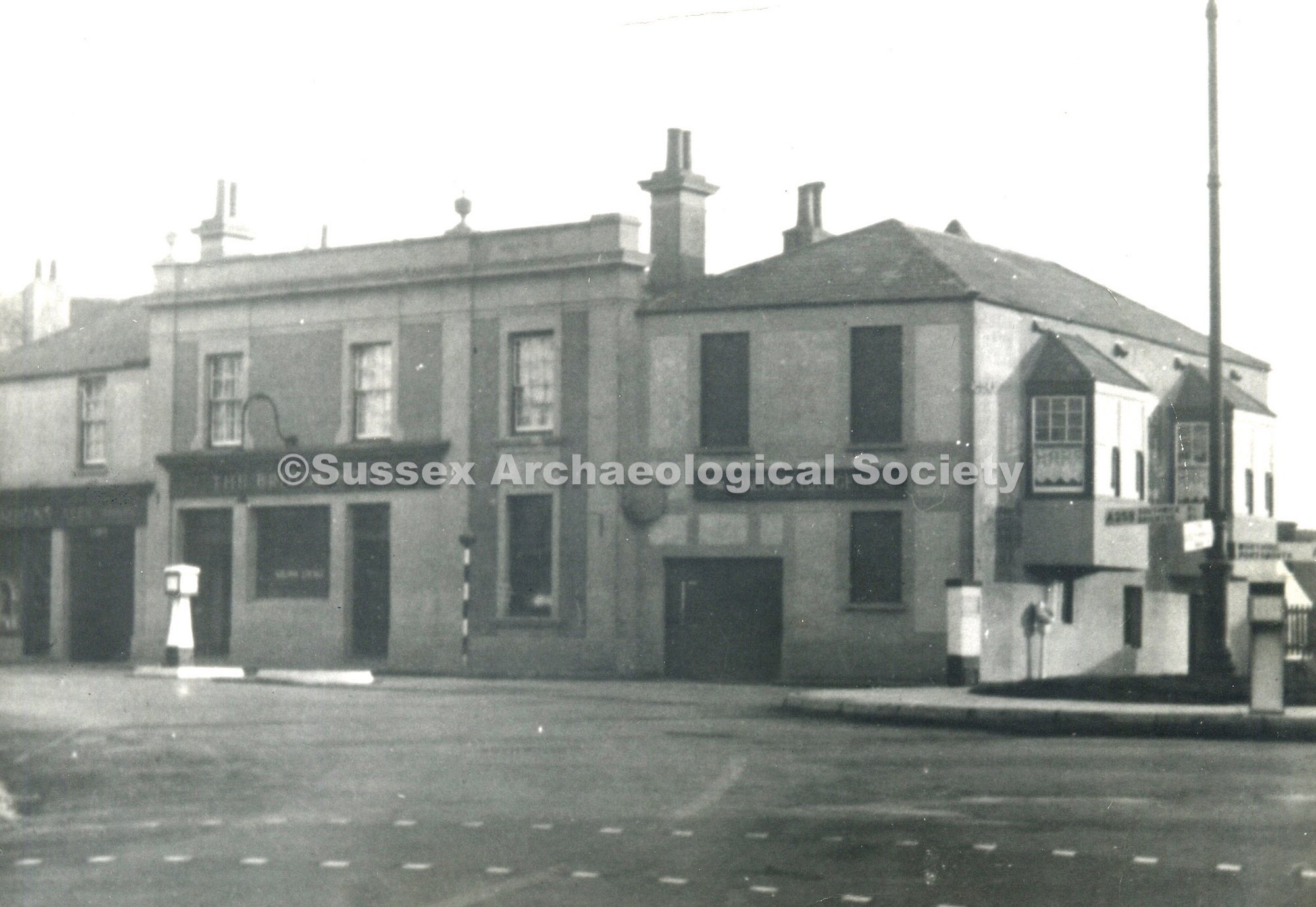
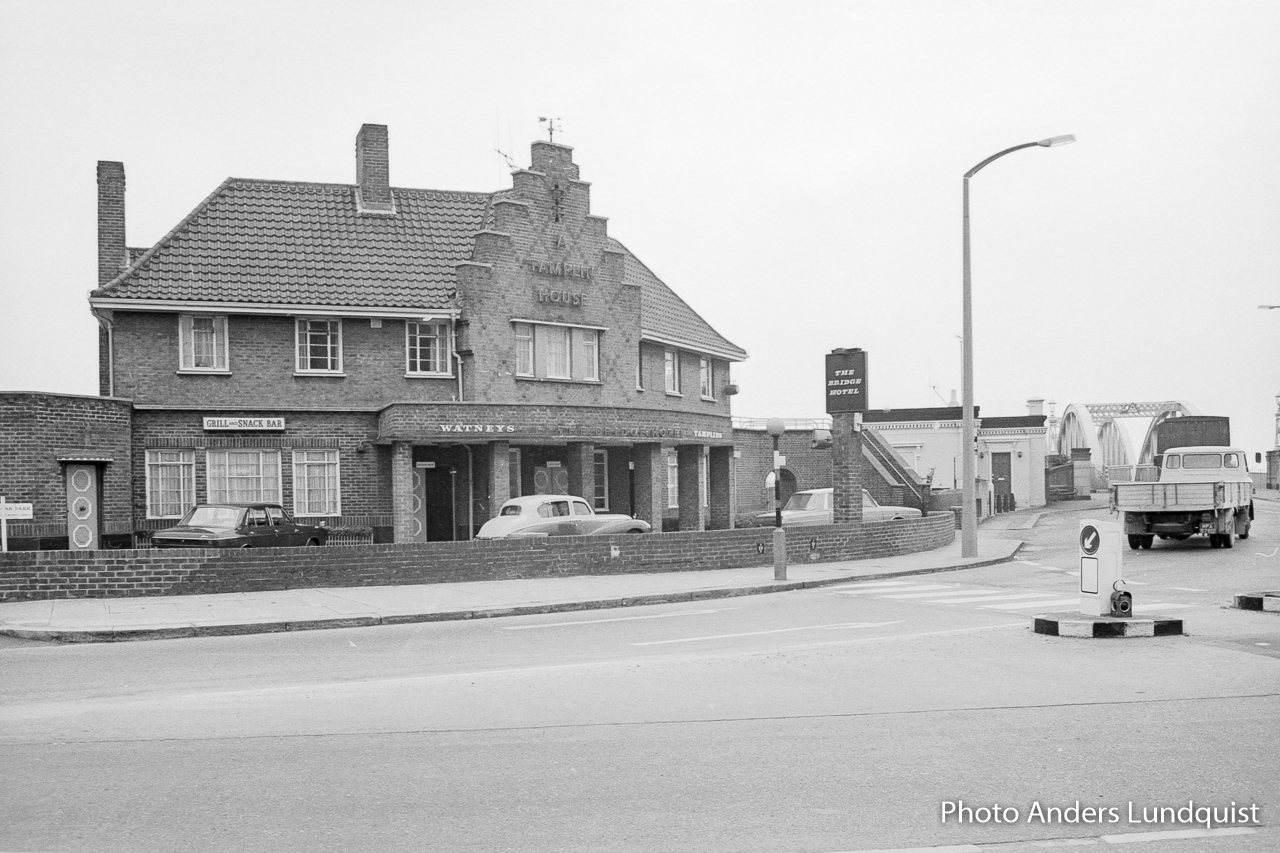
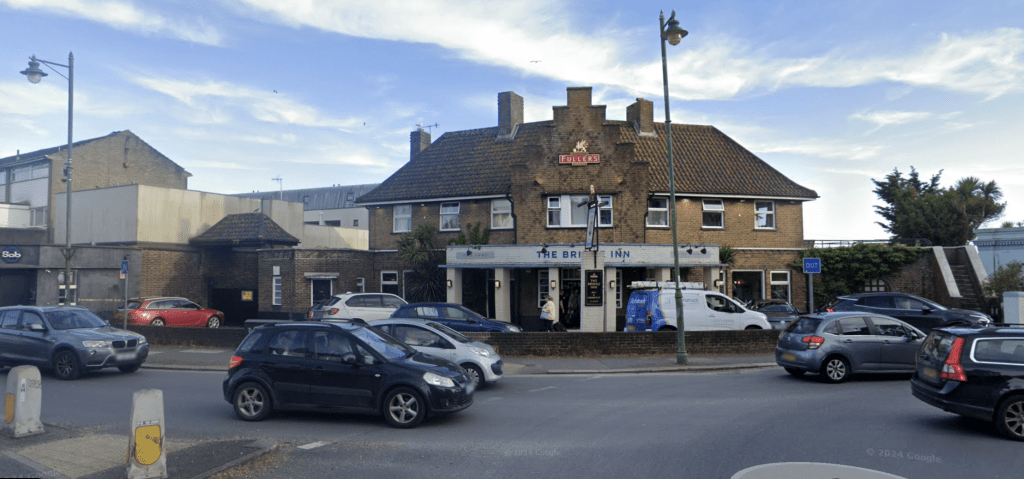
Continue reading “Mystery Mystery Towers painting”Bridge pub
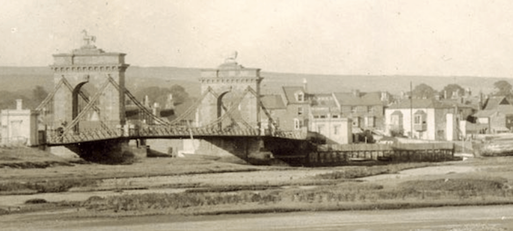
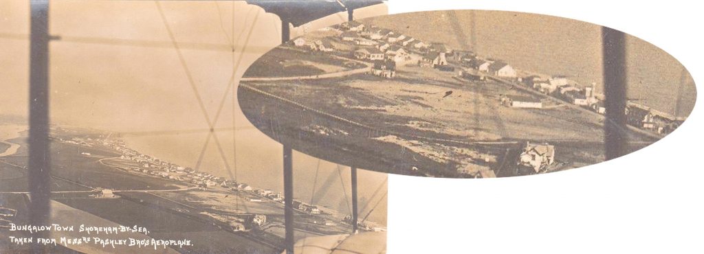
Old Fort Road from the air
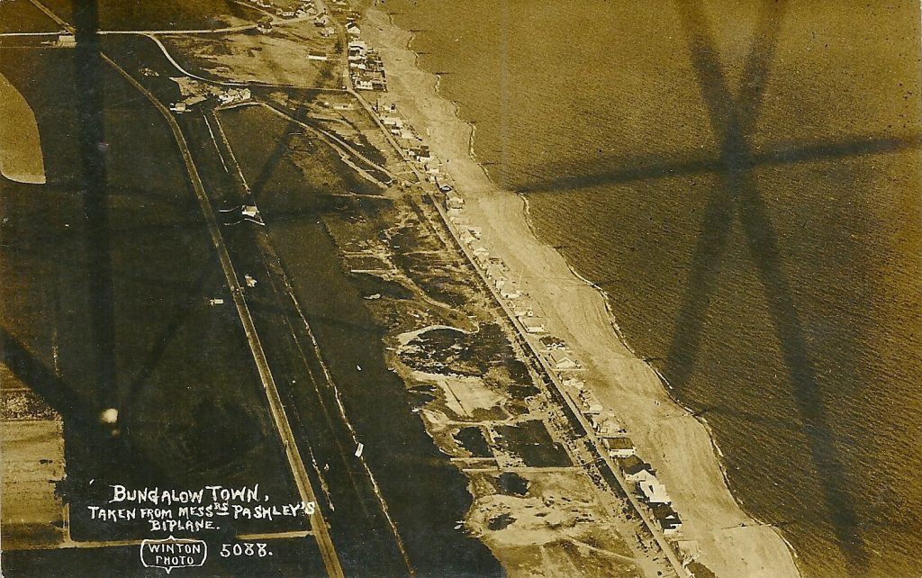
The Old Fort wasn’t considered old in 1913 – so much so that the beach road to the new bungalows was called Fort Road. The shingle spit of land in 1896 was still correctly titled Lancing Beach but by 1909 the maps showed it as Shoreham Beach. Perhaps the later title of Bungalow Town was to placate both factions… until the question of the airport name was mentioned!

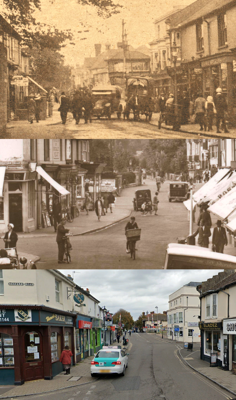
Brunswick Road – Then & Now
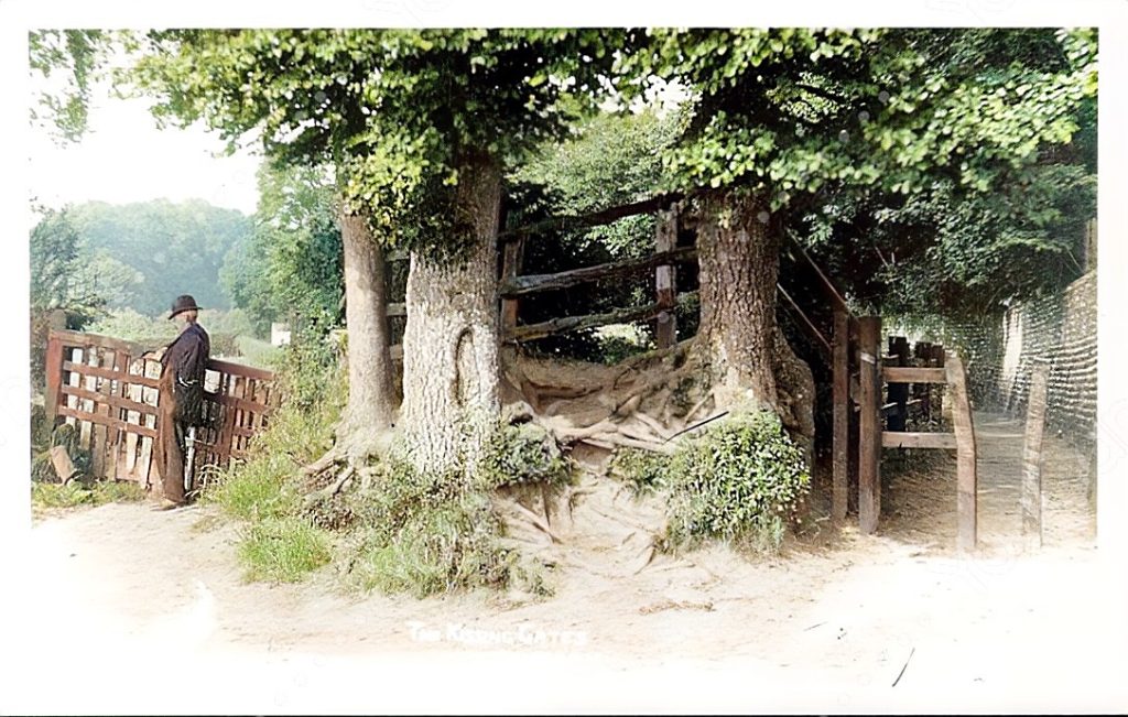
Kissing Tree Gate
This delightful photograph that is pre-1915 is of the twitten alleyway and gate at the junction of Southdown Road and Mill Lane. The field behind is Oxen Field – often used for town events and sports. The twitten was the route north to Little Buckingham, with a high flint wall on the boundary with the vicarage in Shoreham Court to the east.
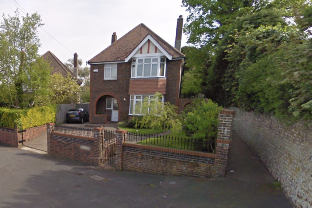
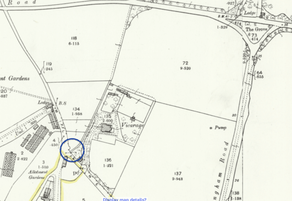
By the late 1920’s the field behind the kissing Tree was ready for redevelopment into Oxen Avenue. This view below is from the house to the left of the alleyway looking towards Upper Shoreham Road.