The recent re-discovery of the Buckingham Book and the uncaptioned contents has raised many questions about who in the Head family is in the photographs. With over 130 years elapsed since many of the photos were taken and the last of the subjects having passed away by the 1980’s there maybe only a few people who will have met any of them to identify them specifically. A few named photographs exist as references – notably Sir Henry Head, Hester Pinney and Christopher Head. But who are the others?
As you browse the scrapbook and scrutinise the faces do you see similarities that will help identify individuals? Most of the photographs are undated so it is useful to see Bernard Head in many group photos as we know he was born in 1876.
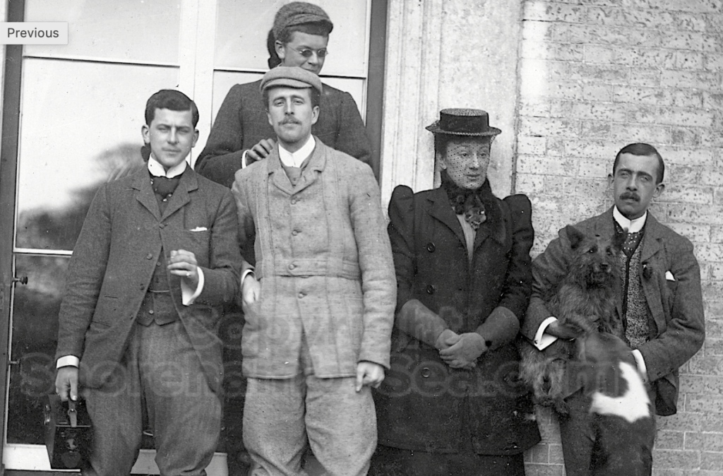
Mystery photograph 1:
Henry Head (far right), eldest son, seems to appear only once in the Buckingham Book in a family group photograph which I assume is mother and brothers. Bernard at the back, but is that Christopher (with the camera) and Francis on the left? And if Hester Head is in mourning then that would date this image within a year of Hugh’s death in November 1890. That would make Bernard 15 years old in this photo.
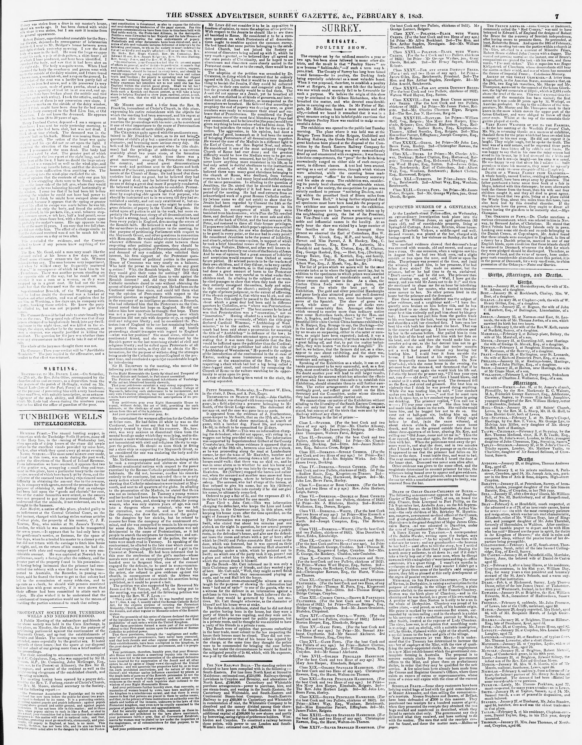
In 1853 the home of the local Squire Bridger was the scene of a night-time burglary. This was not unexpected after a series of break-ins in previous days. Servants had been put on watch in the darkened manor house and were armed with guns. They had not to wait long before a man entered the property through a window. When confronted and ordered to surrender he bolted for the exit. In the ensuing fracas he was shot in the back and clambered out of the window before dying in the garden outside. The reulting court case is outlined below.
1853 news report (click 5th column) “Burglar Shot” was justifiable homicide verdict at the Buckingham House burglaryI
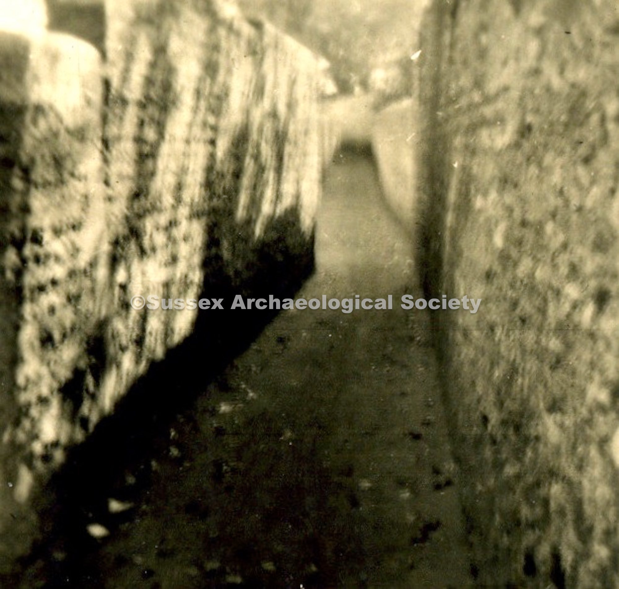
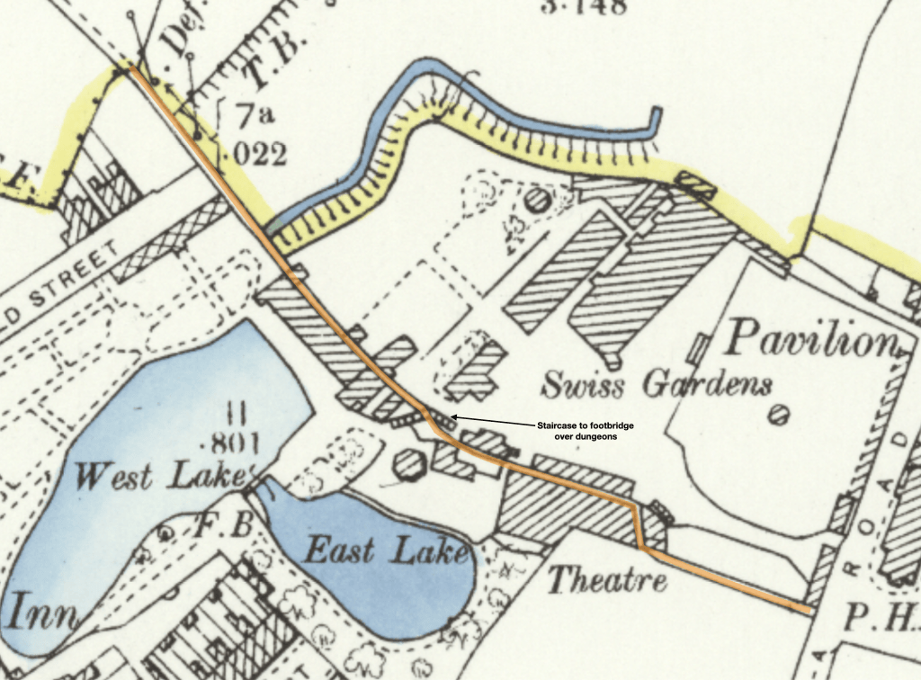
In 1857 there was a bit of to-do about the state of the Dungeons – a narrow high-walled alleyway between Victoria Road and what later became Connaught Avenue. It was the most direct pedestrian twitten (betwixt and between) between New Shoreham and Old Shoreham. It was dark, very boggy and in places was covered over by buildings straddling the alley making it a menacing place and earning the nickname “The Dungeons”. The alley bisected the Swiss Gardens site so had particularly tall sides for the entire length to prevent illegal access to the pleasure gardens on either side. For those patrons inside the Swiss Gardens there were wooden footbridges that bridged the alleyway.
The Dungeons looking East from under the Theatre c1910
The 1857 newspaper report: “We have carefully inspected the footway under the Swiss Gardens, and are of opinion that more head-room is required in that part of the passage immediately under the Swiss Cottage, that the height from the ground should not be less than 6ft. 6.; that the passage should be made a little wider under the cosmormamic views; that the pathway should be levelled and made clean; and the water drained off on the right side, from east to west; that the water-spout should be prevented from dripping in the passage; and that sufficient light be admitted for passengers to discern where they tread, -all of which suggestions Mr. Goodchild has engaged to carry out, under the inspection and to the satisfaction of the Surveyors.”
1914 map showing the alleyway and dungeons (marked in orange) passing under the Swiss Gardens Theatre and footbridge.
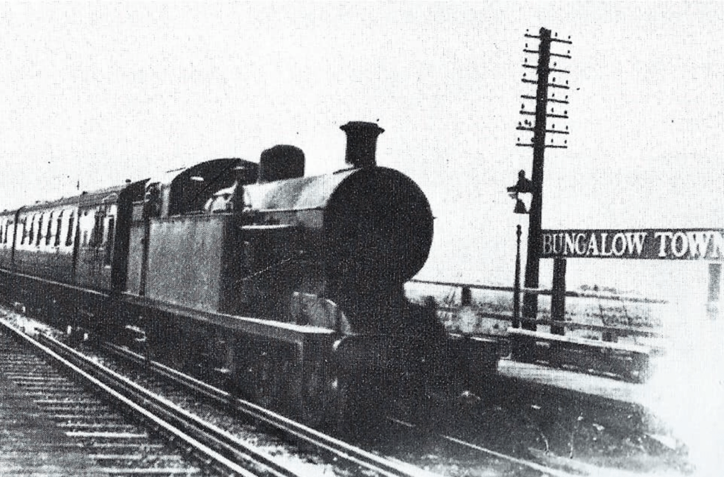
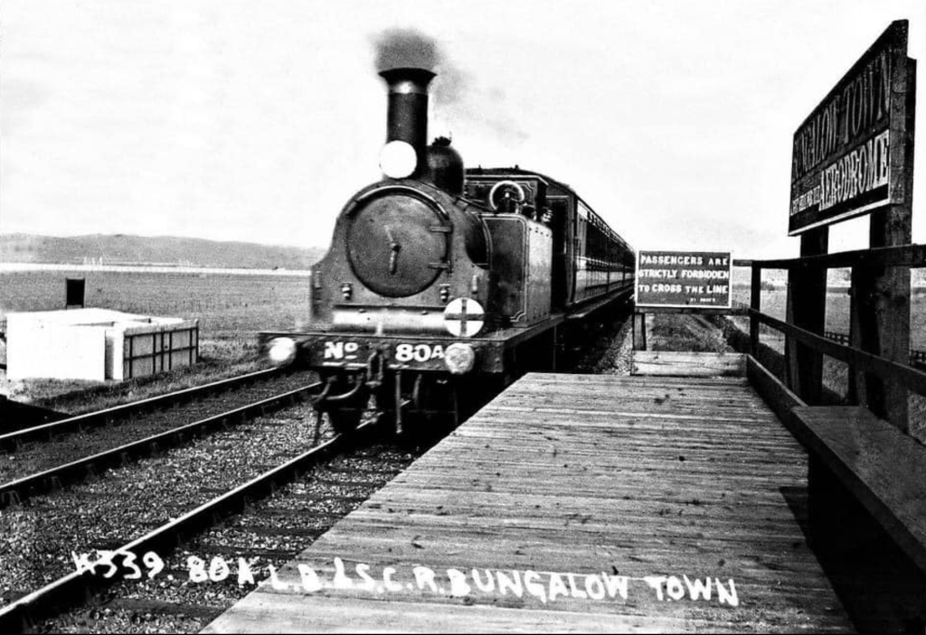
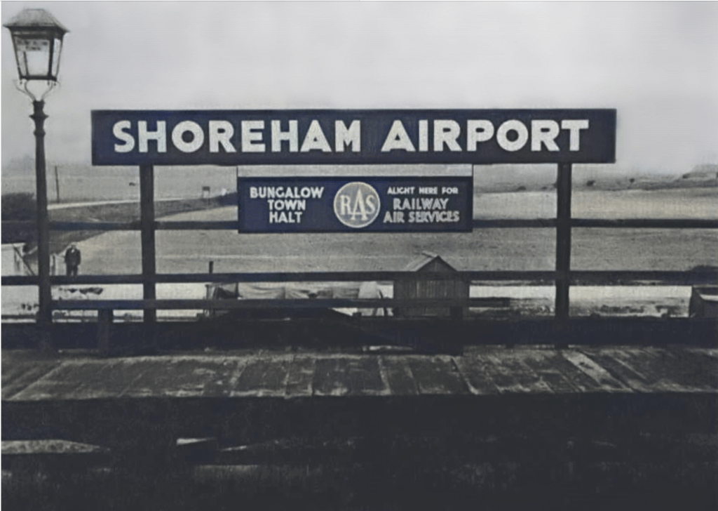
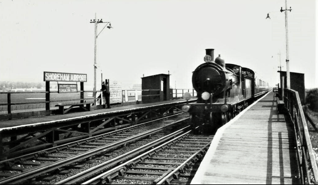
Bungalow Town Halt was opened in 1910 to serve the growing community of Shoreham Beach and the holiday camps at the Saltings. Latterly it was to serve the aerodrome immediately to the North, and station signage reflected this. The station was located 30 feet to the East of the rail bridge spanning New Salts Farm Road. It comprised two simple wooden platforms North and South of the tracks and wooden shelter. These were accessed by a steep footpath up the embankment from New Salts Farm Road. The station closed in 1933.
The station reopened as Shoreham Airport station in July 1935, principally to serve the new terminal building of Shoreham Airport. However after only 5 years the station was closed in July 1940.
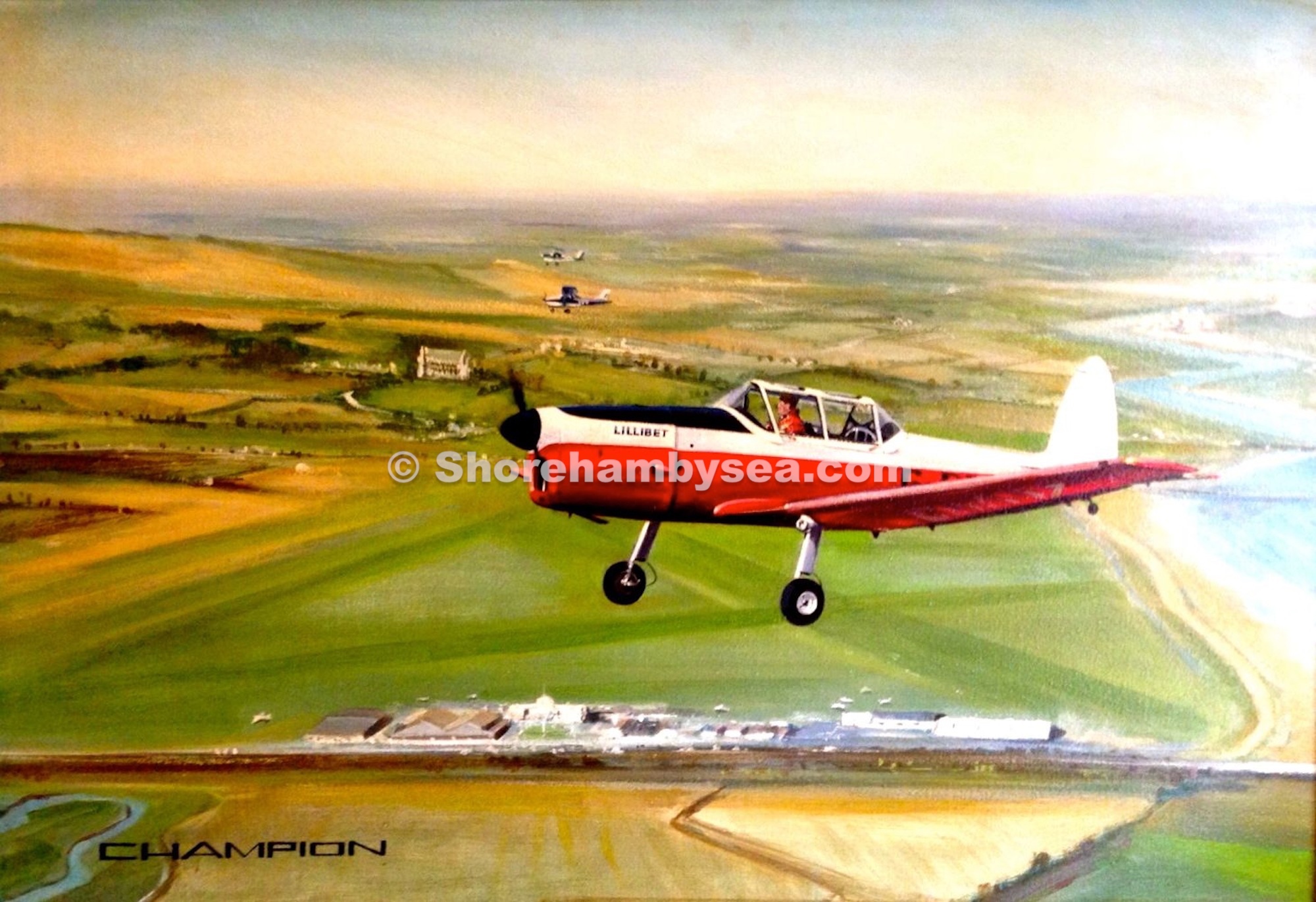
This is the history of a local Shoreham painting with its backstory. The painting is of Toon Ghose flying his De Havilland Chipmunk “Lillibet” over Shoreham Airport in the late 1970’s. This painting has for some time been present on the shorehambysea.com “Paintings” section, numbered B63. It was written with the aim of providing a provenance for the painting:
I remember seeing Toon at Shoreham Airport during the late 1970’s, just before my teenage years, where I was introduced to him by my cousin, Ashley (Ash) Roote. Ash learnt to fly at Shoreham and was a member of Toon’s flying club, where Toon also flew as an instructor. The Flying Club was called Toon Ghose Aviation, or TGA, and I well remember the TGA window stickers that were a ‘must have’ for ‘anybody who was anybody’ at the airport at the time!
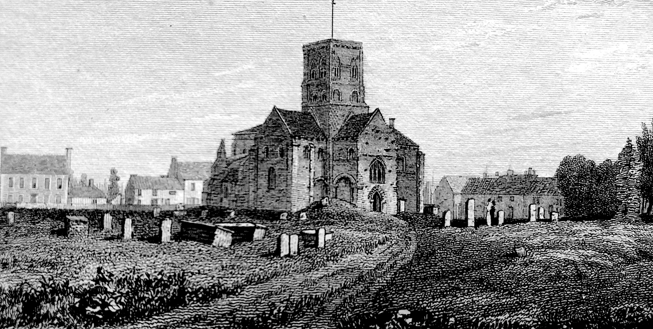
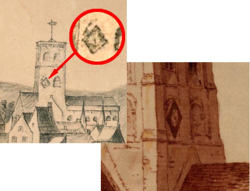
The church records show that the wooden, diamond shaped clock was first fixed to the south wall of the tower in 1828. However there is earlier evidence of a clockface on St Mary’s tower in the John Butler Sketch of 1786 and a watercolour of 1782. It is recorded that that face was moved and installed higher up in 1862. The East and West faces were added in 1898 – they are differentiated by their slightly convex blue faces. The South face had disappeared between 1898 and 1937 when it and the North face were installed – flat but thicker clockfaces. So it is only post-1937 that all four faces were evident.
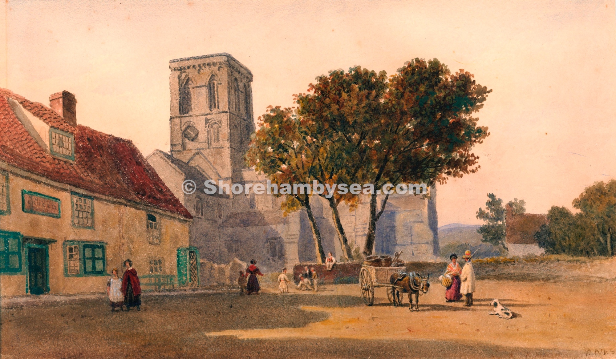
1786 Sketch with the church tower with, inset, an enlargement of the shape at the belfry window and detail from a 1782 watercolourNote the South face diamond shape clock. Watercolour painting by F. Nash (1782-1856) Continue reading “The Clocks of St Mary’s”
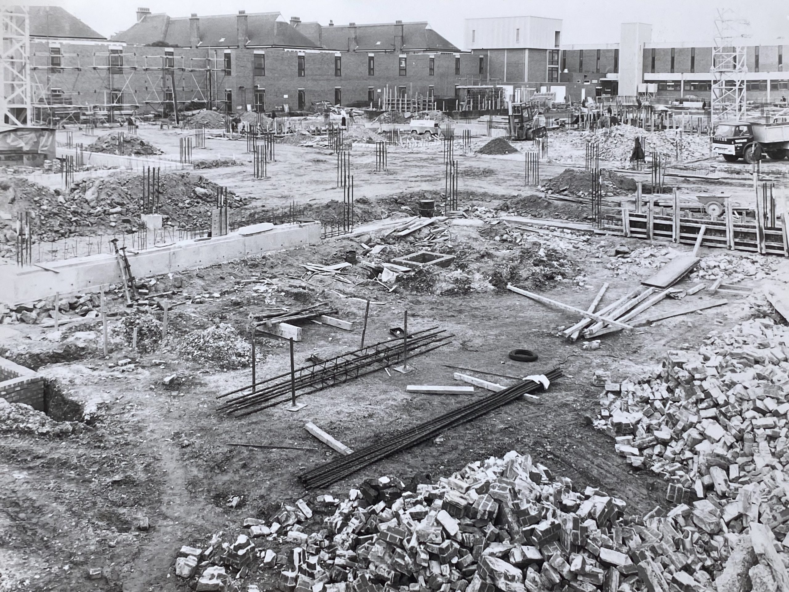
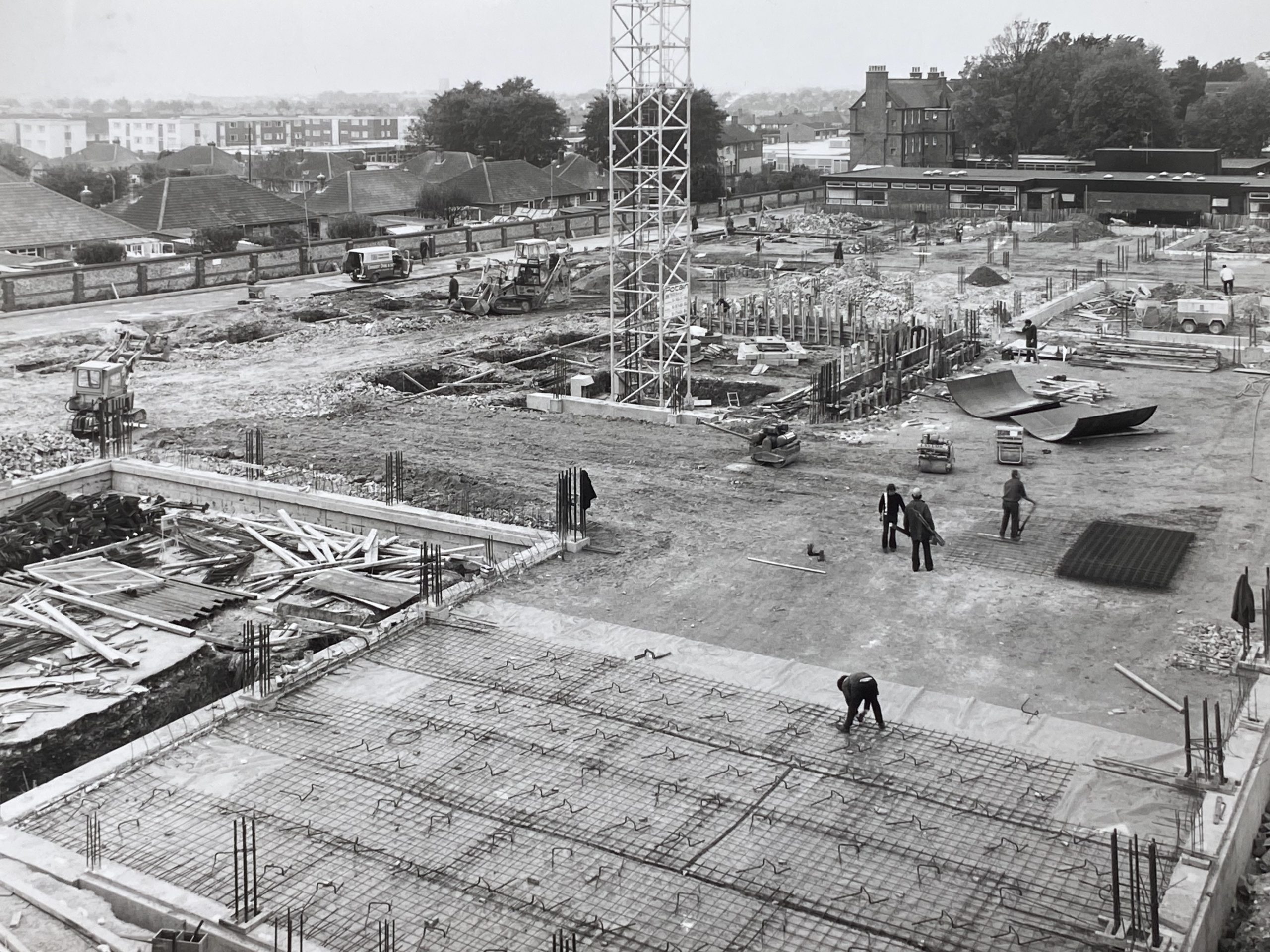
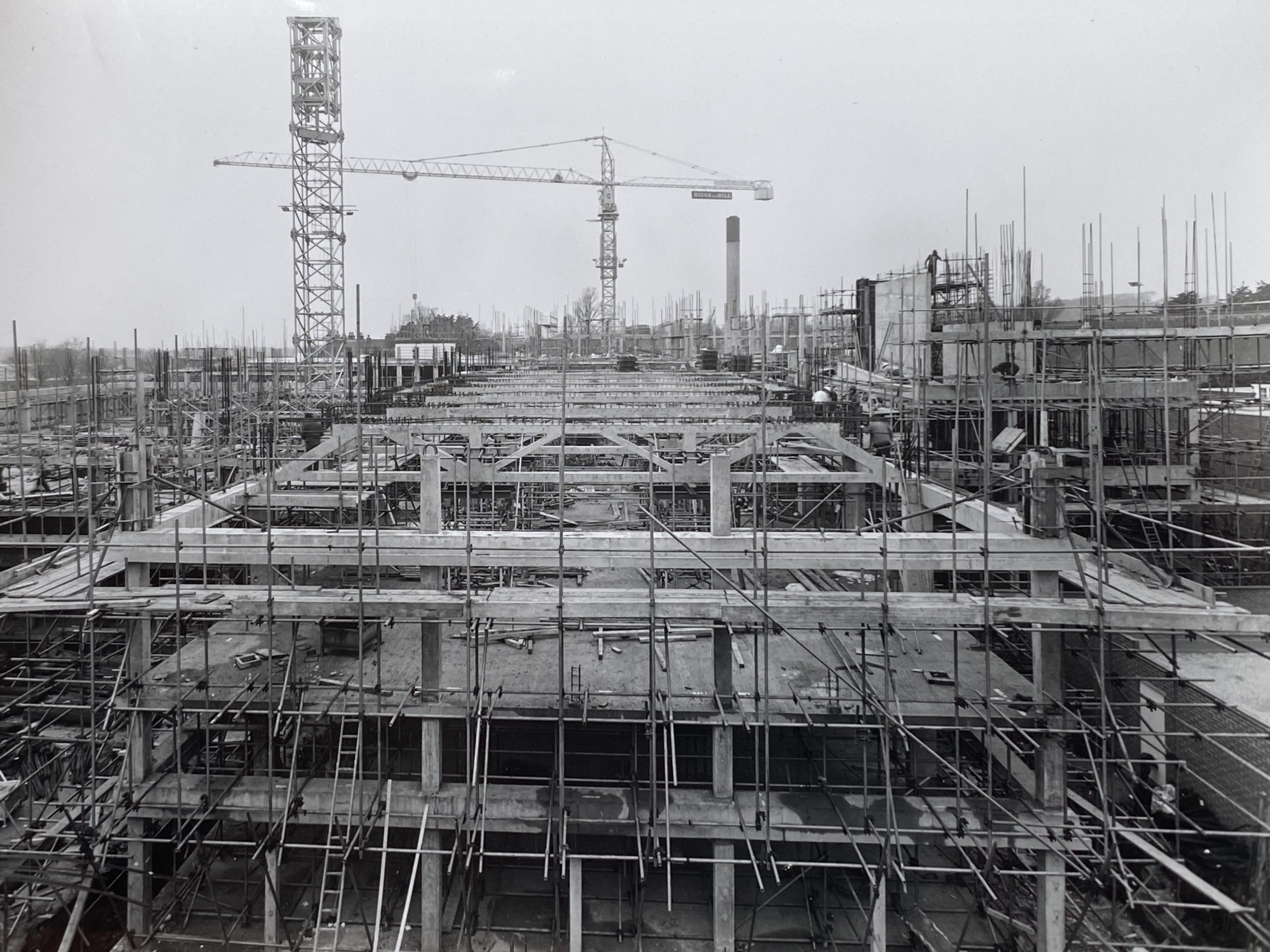
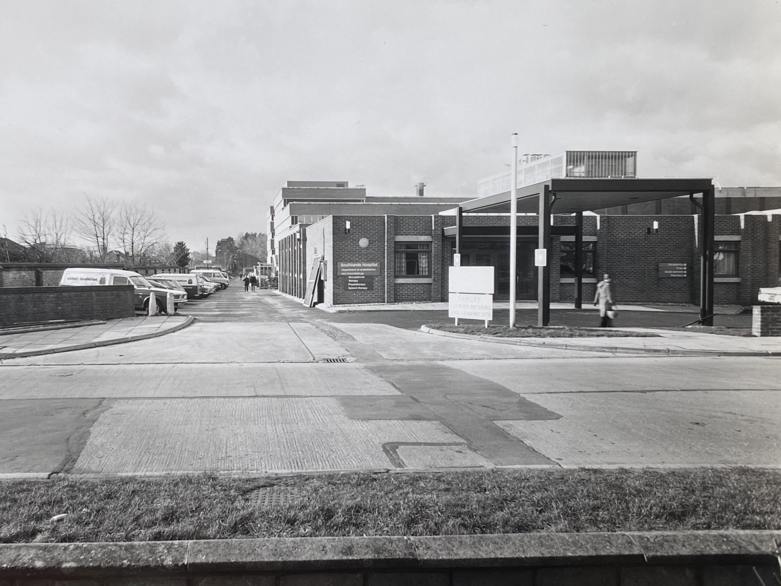
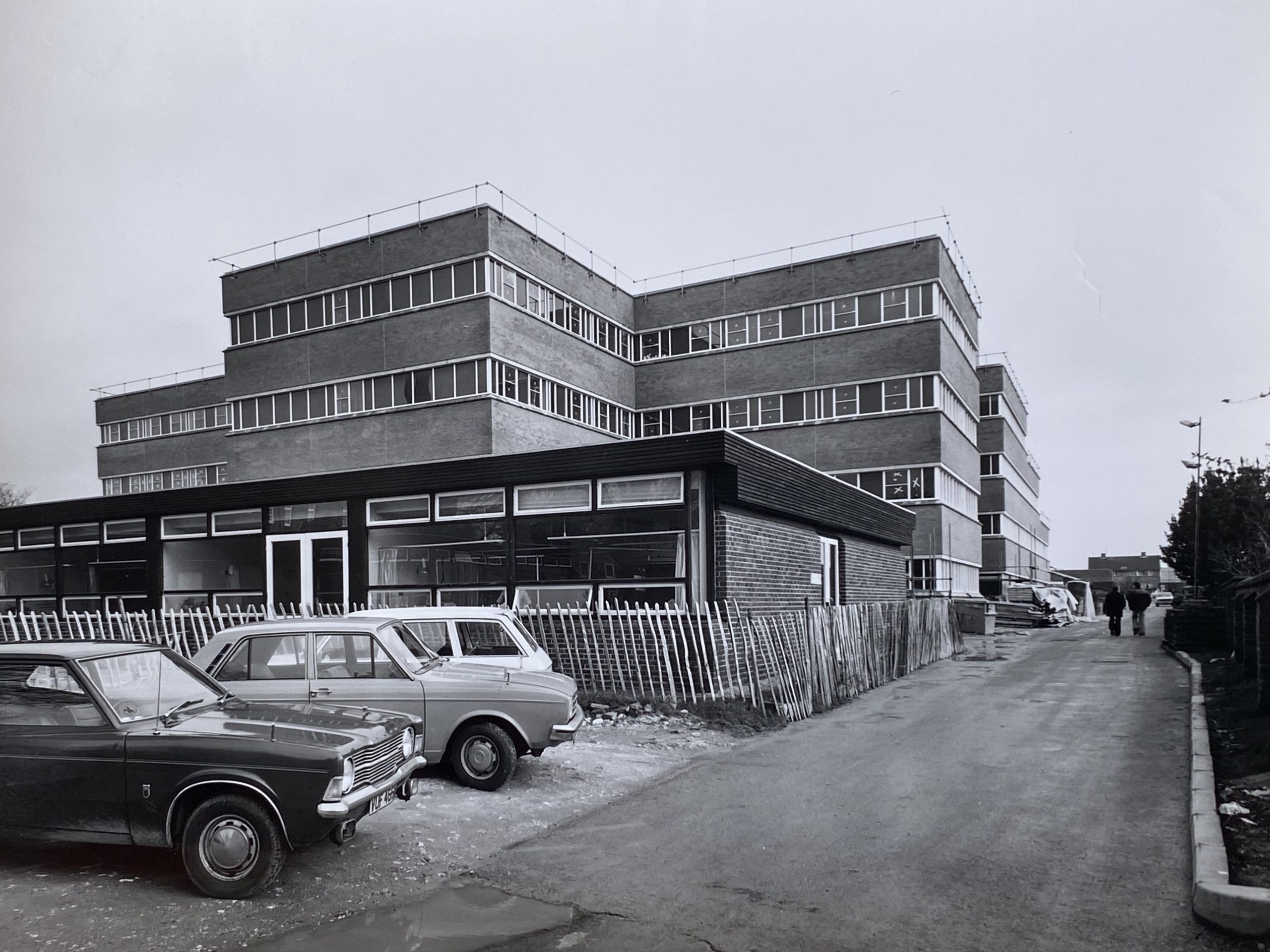
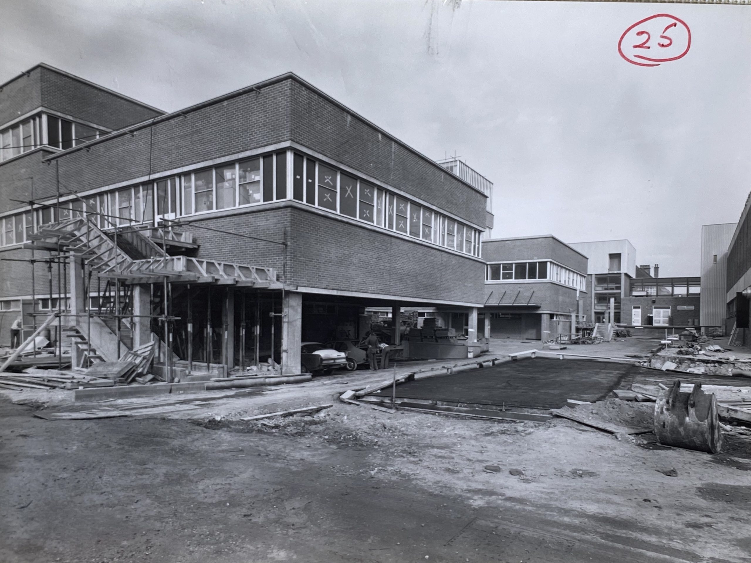
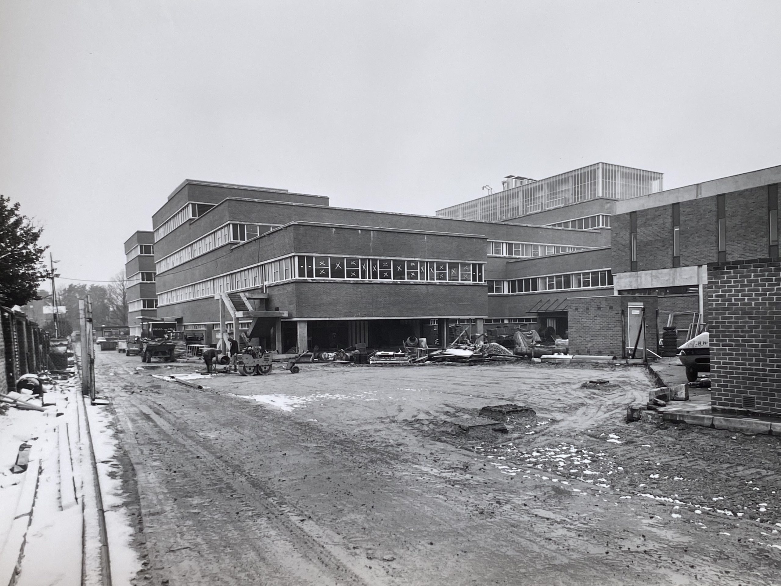
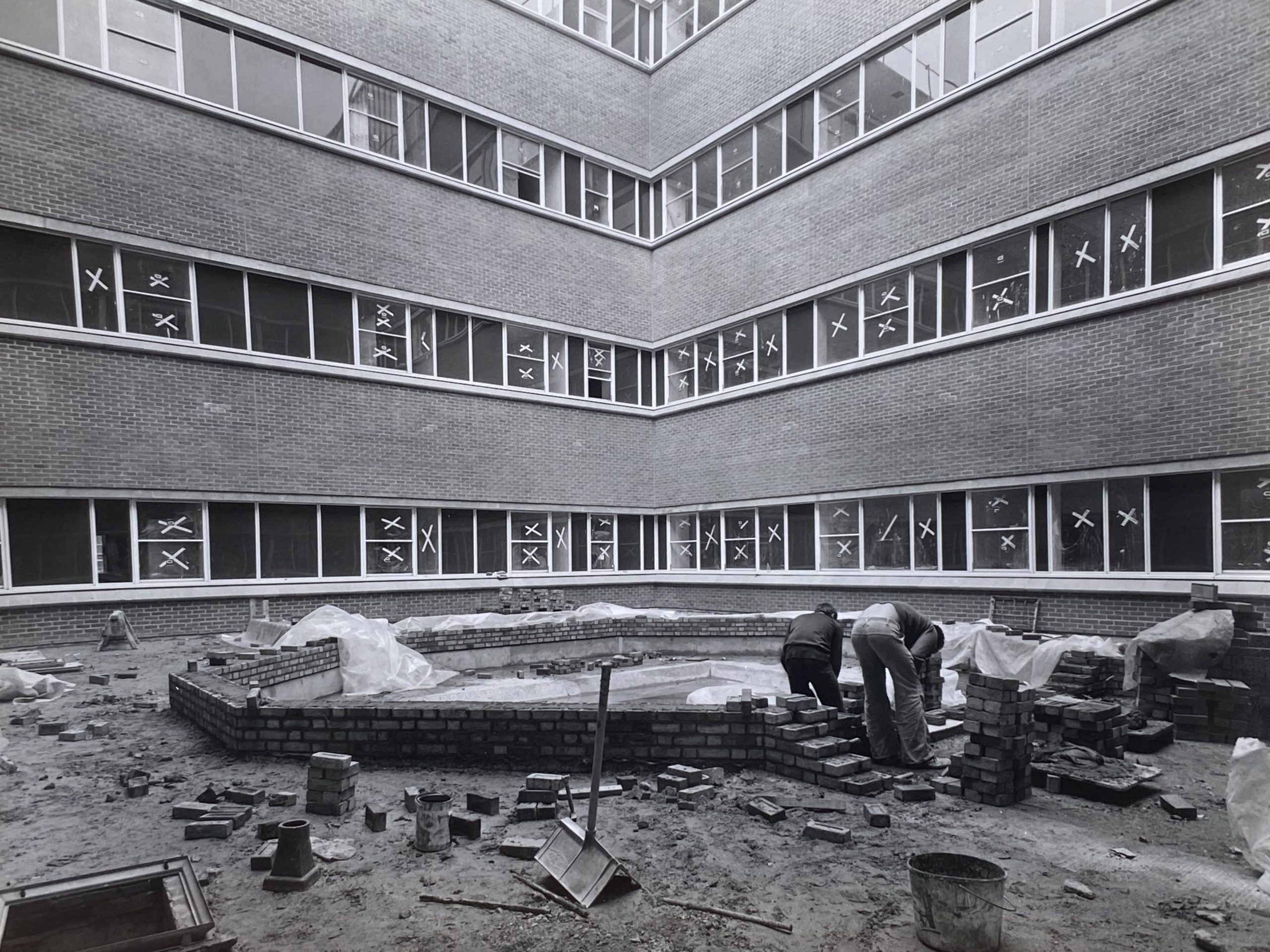
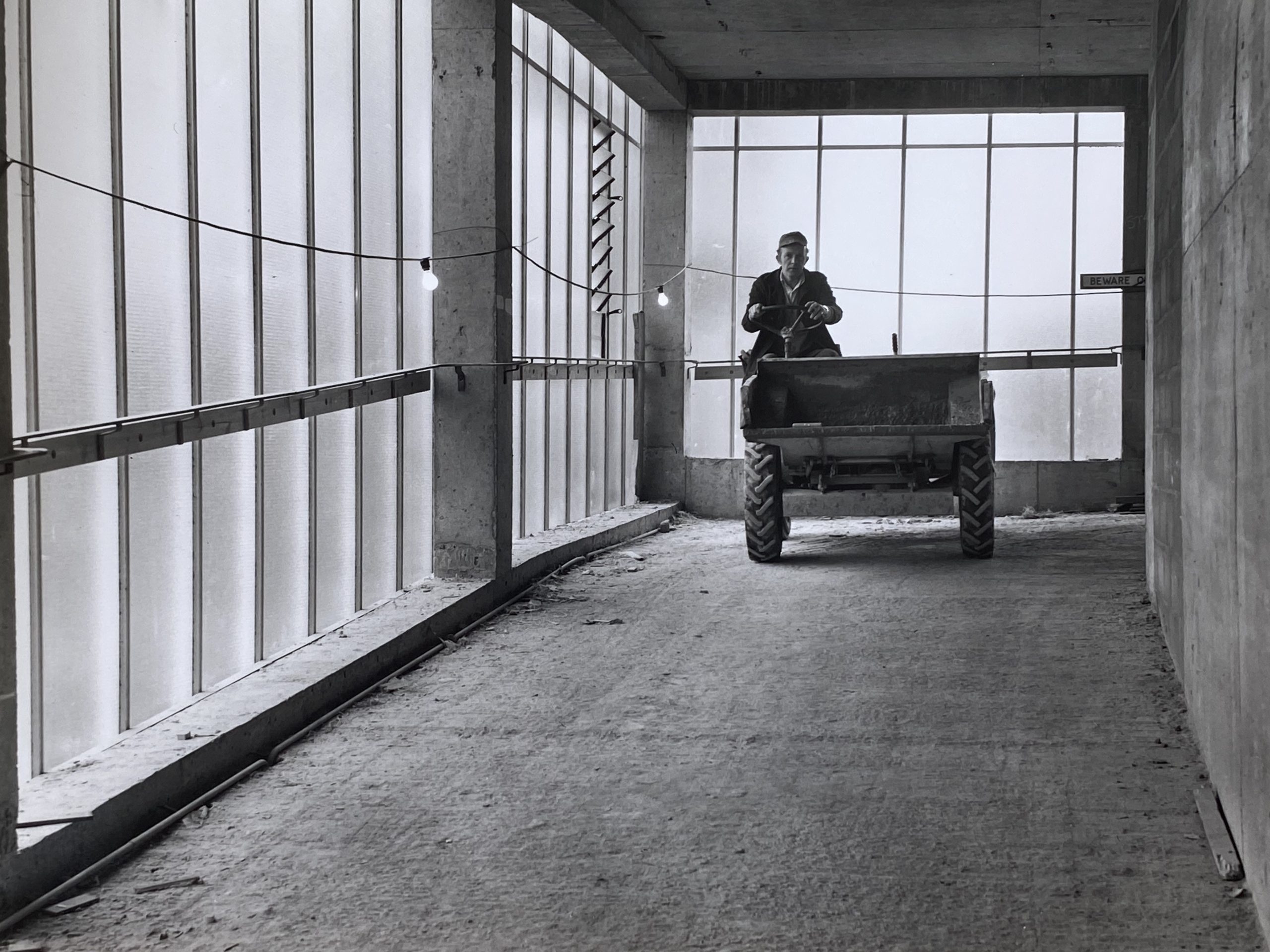
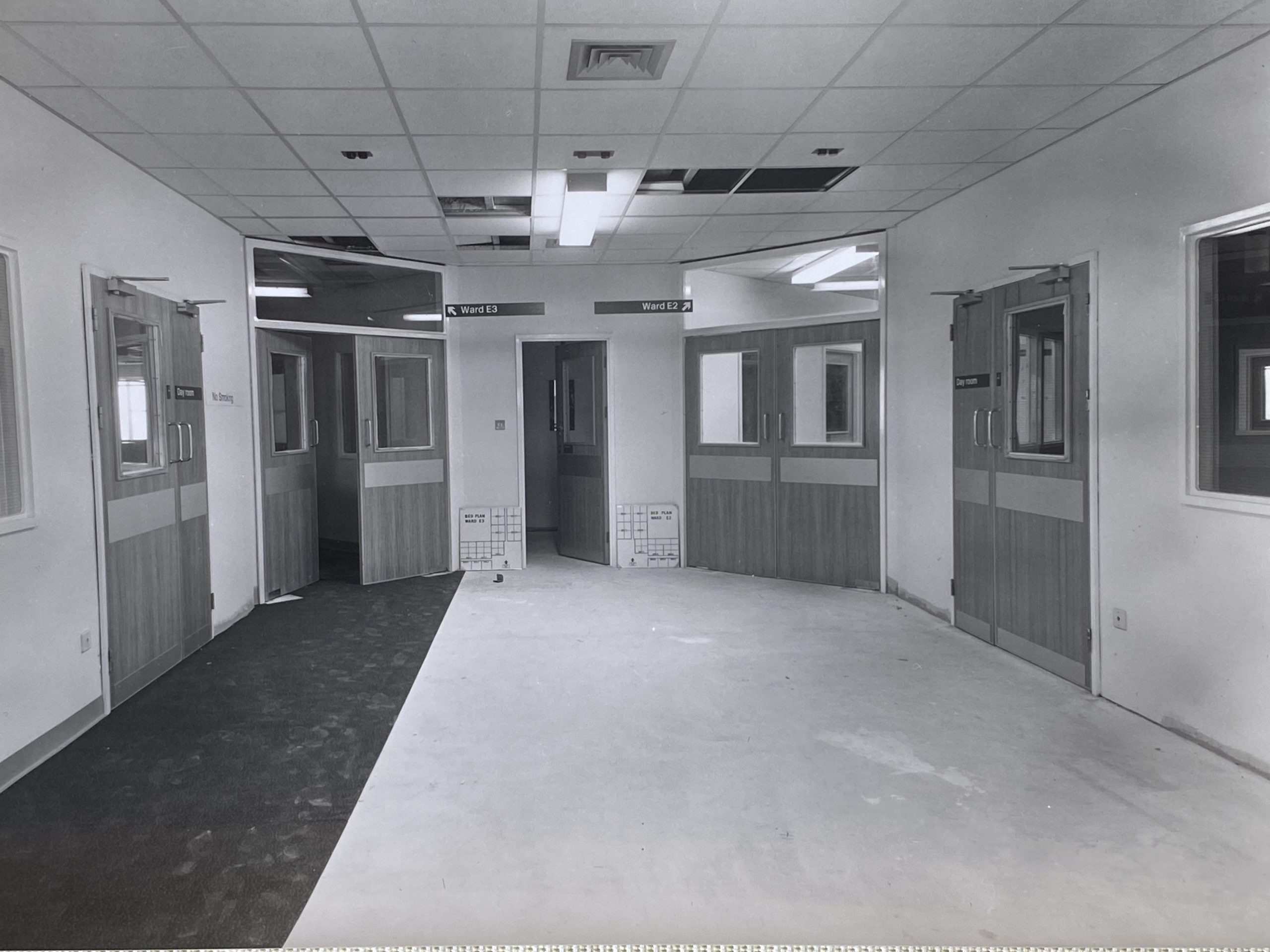
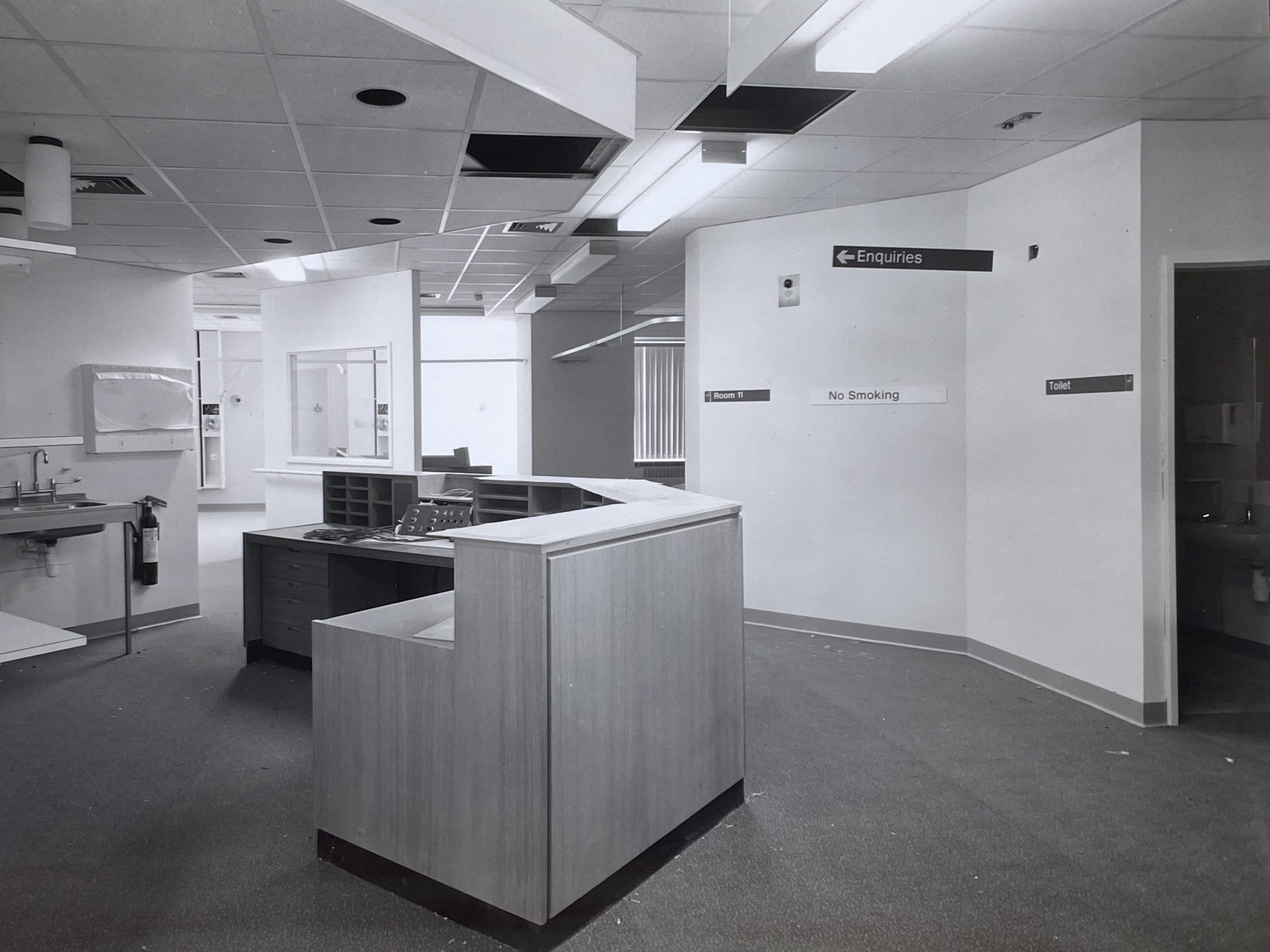
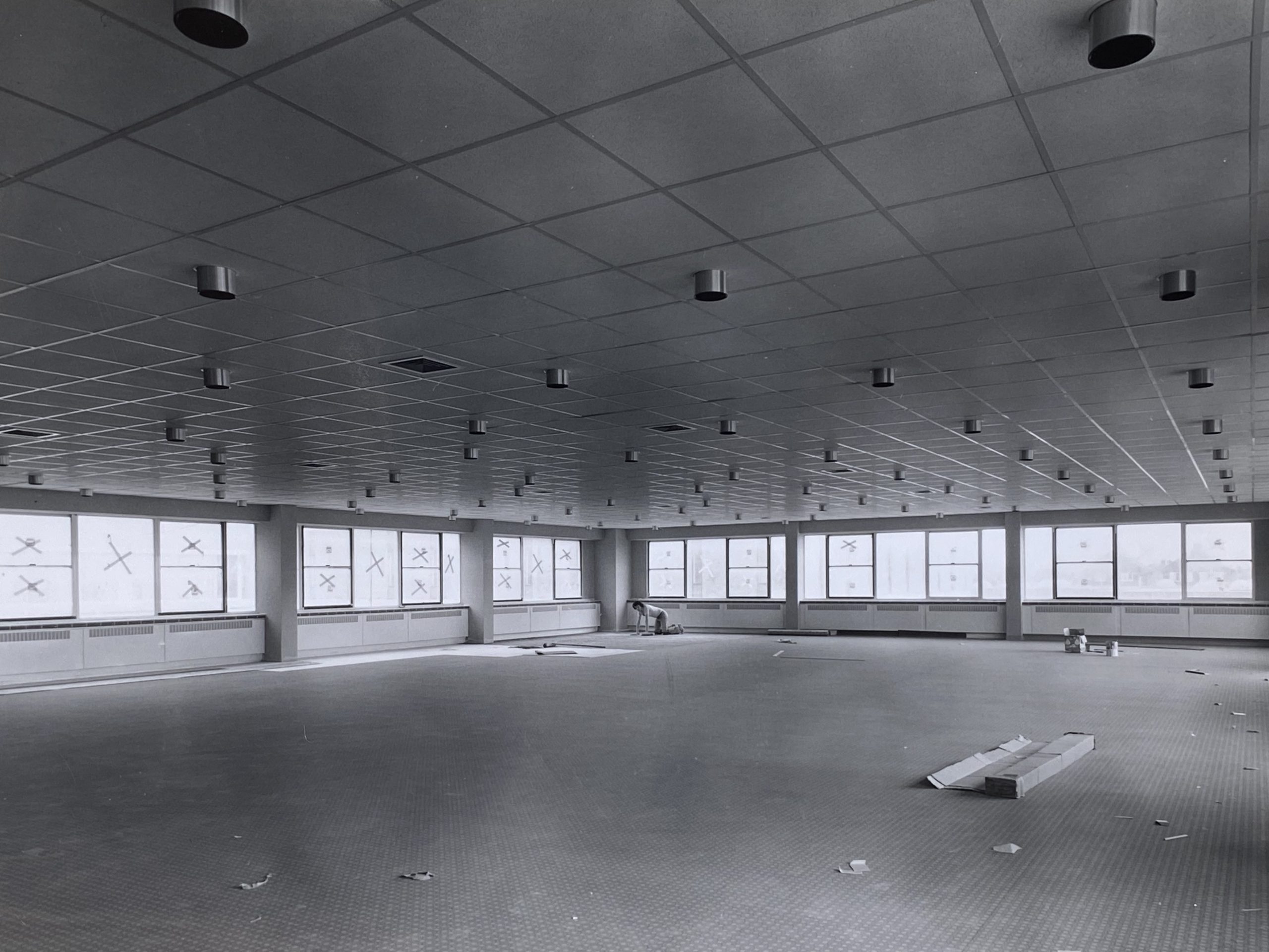
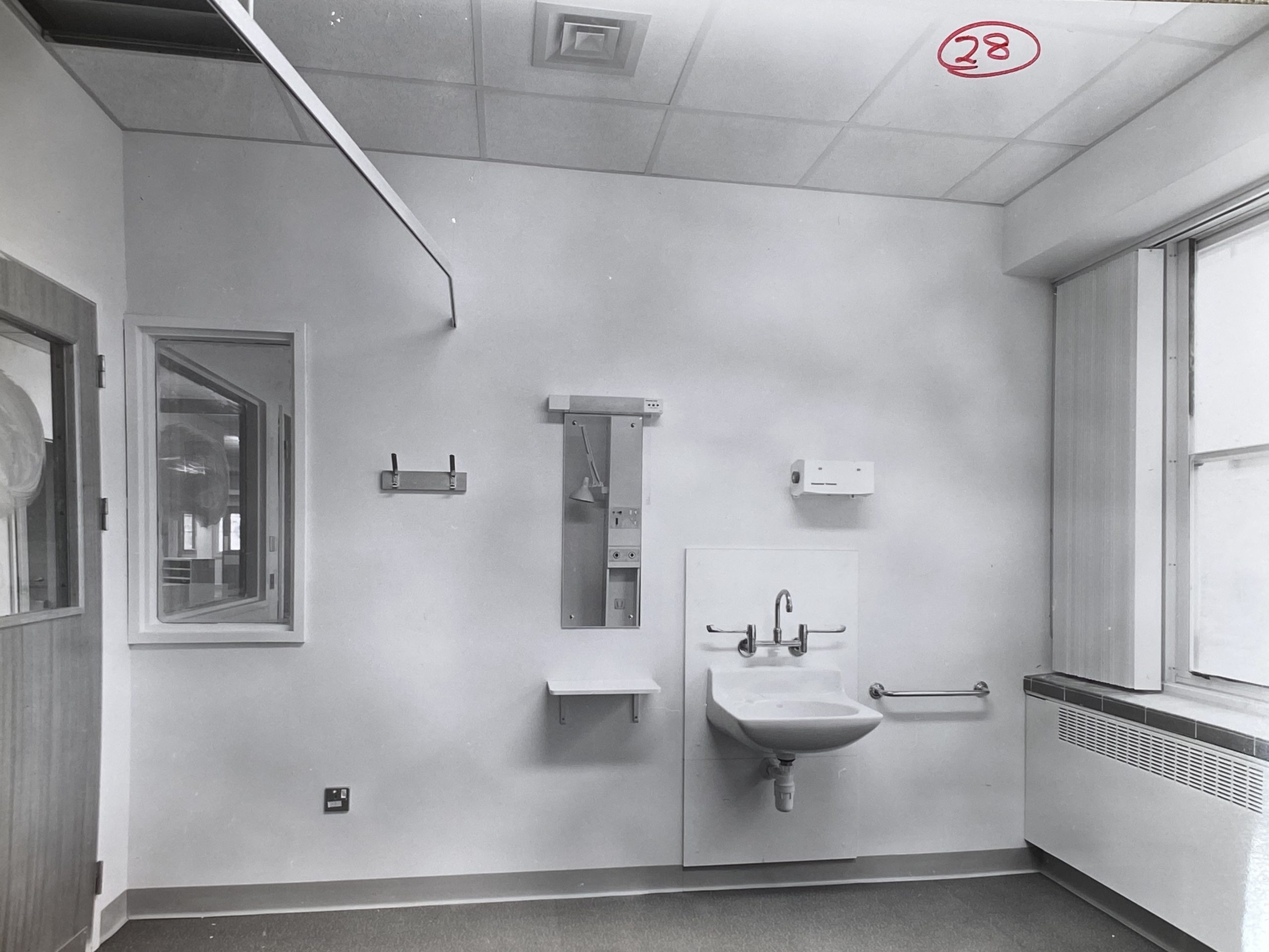
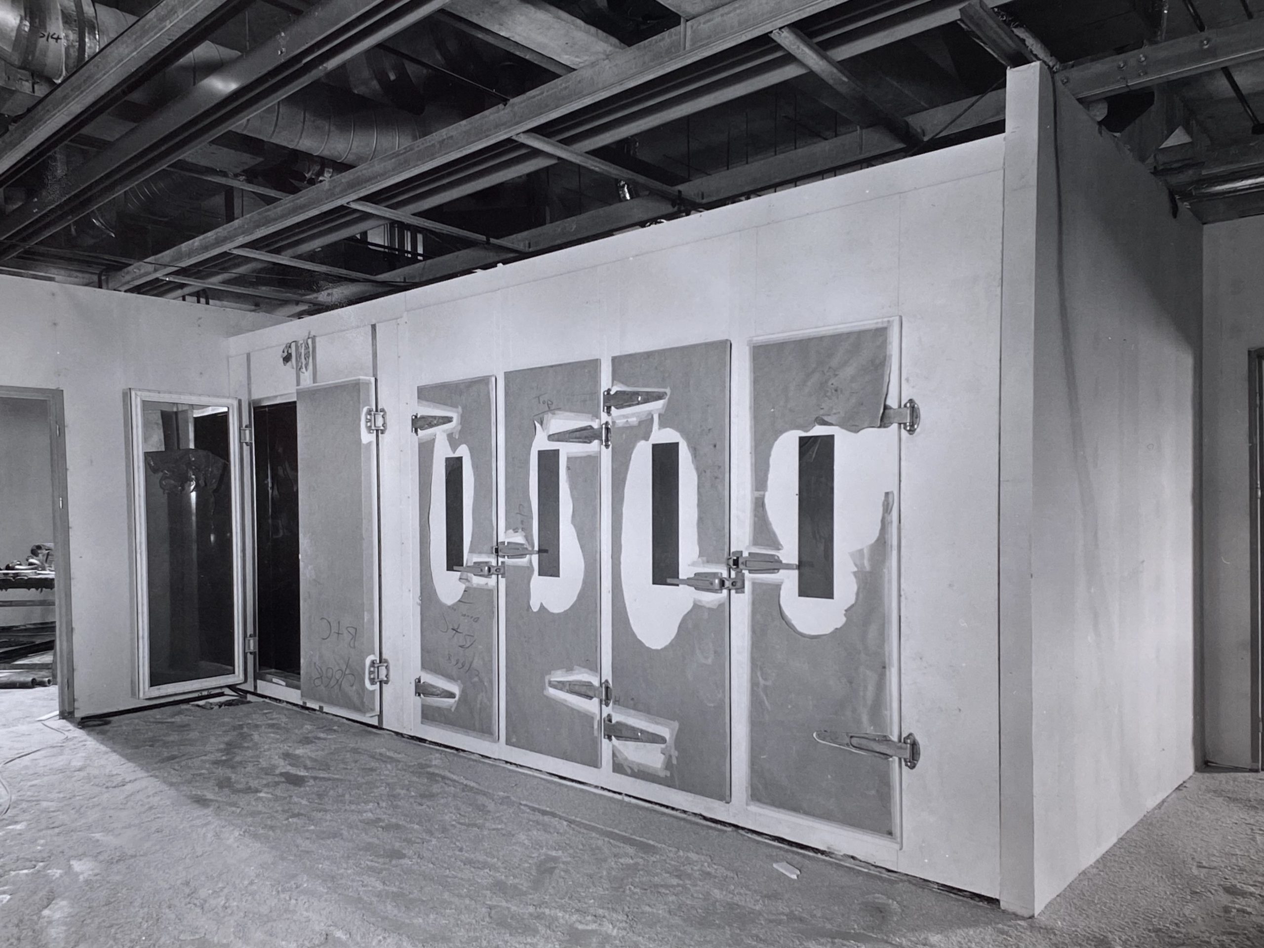
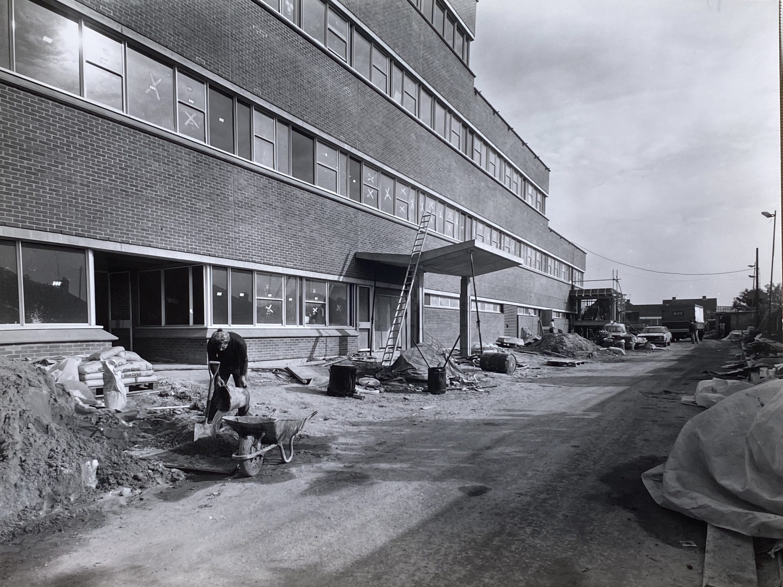
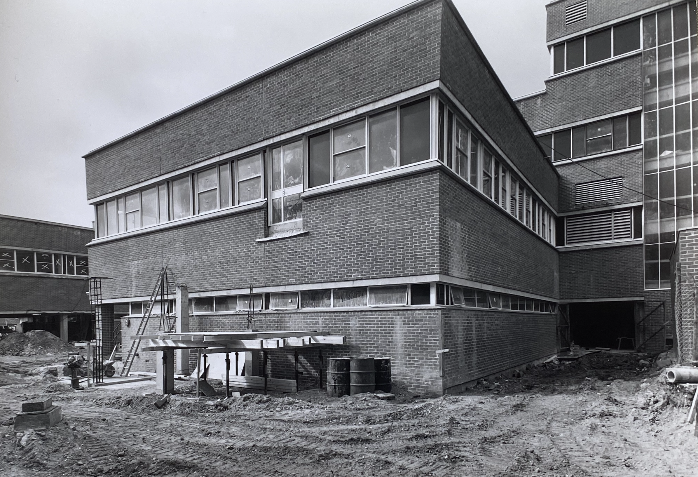
Thanks to Tony Clevett, Neil DeVille and Roger Bateman we have newly discovered scans of the construction of Southlands Hospital Harness block. This was constructed between 1977 and 1978. For the full history of this short-lived building visit the Southlands article.
Many of you will know of the monumental project to rebuild “Tally Ho”, who’s origins were at the old Stow’s shipbuilding yard at the bottom of East Street. She was built in Shoreham in 1910 as the “Betty” and had a varied career including completing the Fastnet race in 1927, traversing the globe, being wrecked in the Americas and eventually laying as a hulk for decades in the US. In 2018 she was rescued by Leo Goolden who set about rebuilding her to sail again. That project became a 6 year YouTube sensation that culminated this month with the re-launch of Tally Ho.
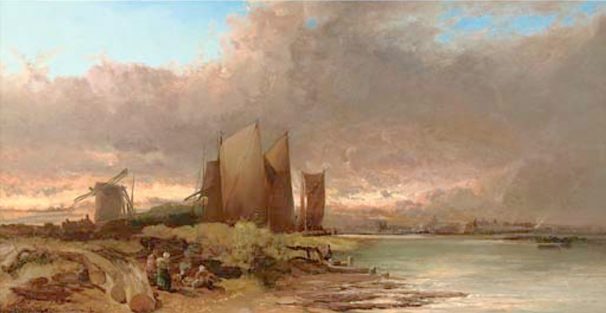
Fisherfolk on a Tidal Estuary 1874, Shoreham by James Webb 1825 – 1895
Could this be the viewpoint?
Nelson writes: I’m sure we discussed this painting some years ago on the old web site without coming to any real conclusion as to its exact location. Assuming the content is not artistic licence then the view almost fits the history we have of one part of the Shoreham river front area. The windmill could be the one that stood on Mill Green at Ropetackle and behind it rising ground in the distance that may be Mill Hill; the town to the right and the timber work in the foreground is perhaps where the flood arch is now.
There are two question marks of this though. The Norfolk Suspension Bridge had been well and truly built by the time the artist painted it and (if it is this area) should have featured as the centre piece of the painting so why has he masked the bridge with the boats’ sails? The Ropetackle mill (we know it was a post mill and the painting confirms this) and the land it was on was sold in 1790 to Daniel Roberts who built a large granary on it. This had burned down by the 1820’s but could it be that the windmill was at a distance from the granary and still standing at the time of the painting – it certainly looks dilapidated with only two sails?