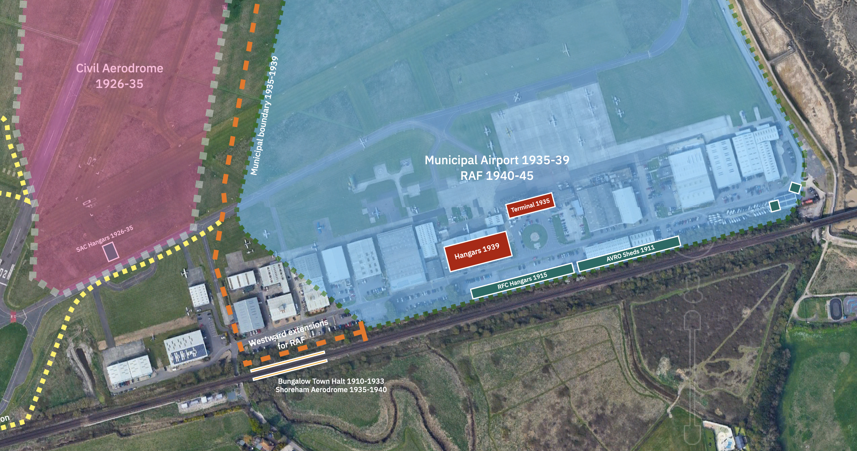
This pdf map of the entire site shows the expansion and change of use of the fields over time from 1910 to 1950. Compiled from various sources and original research of Tim Webb “History of Shoreham Airport” Pub.1996
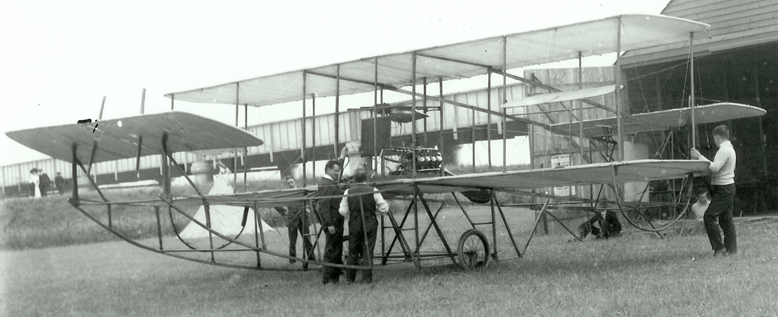
1910 – 1925
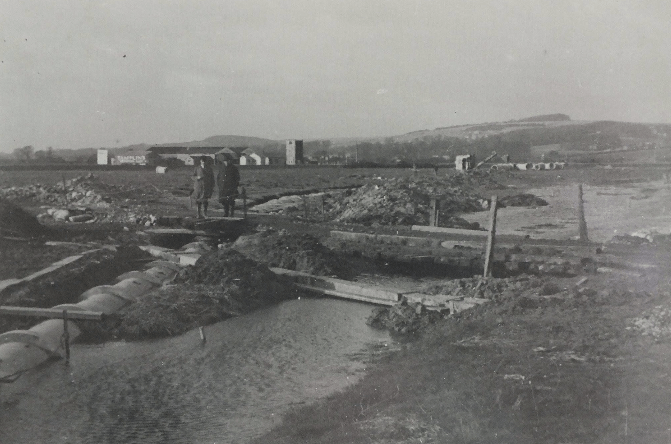
1925 – 1926 Easter’s Field
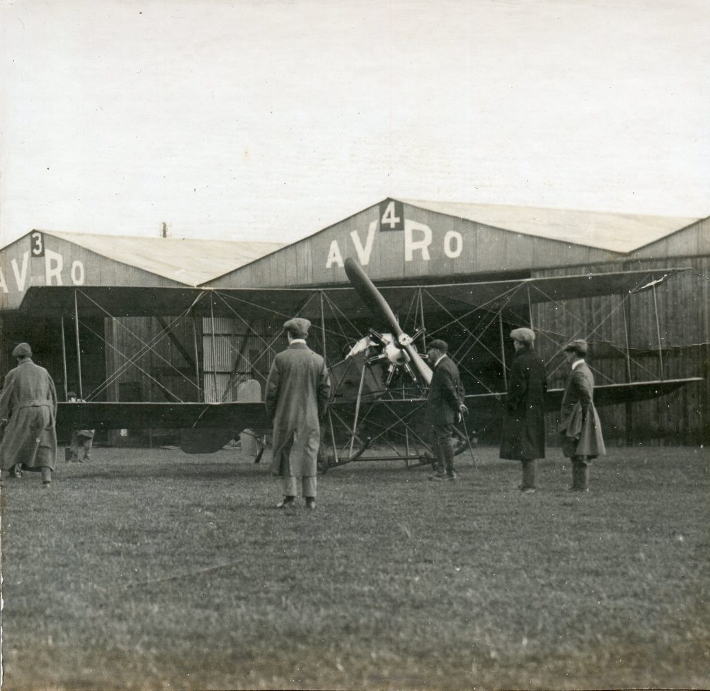
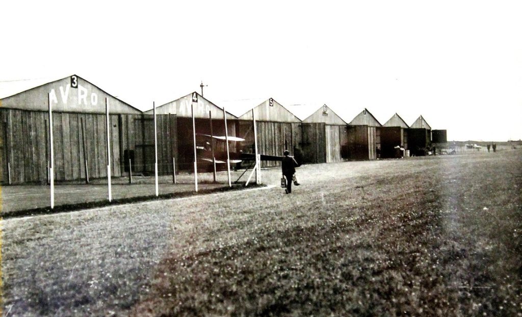
Between 1925 and 1926 the field to the West of Salts Farm was home to the Sussex County Aero Club with construction of aircraft in the barn to the rear and flights in Easter’s Field.
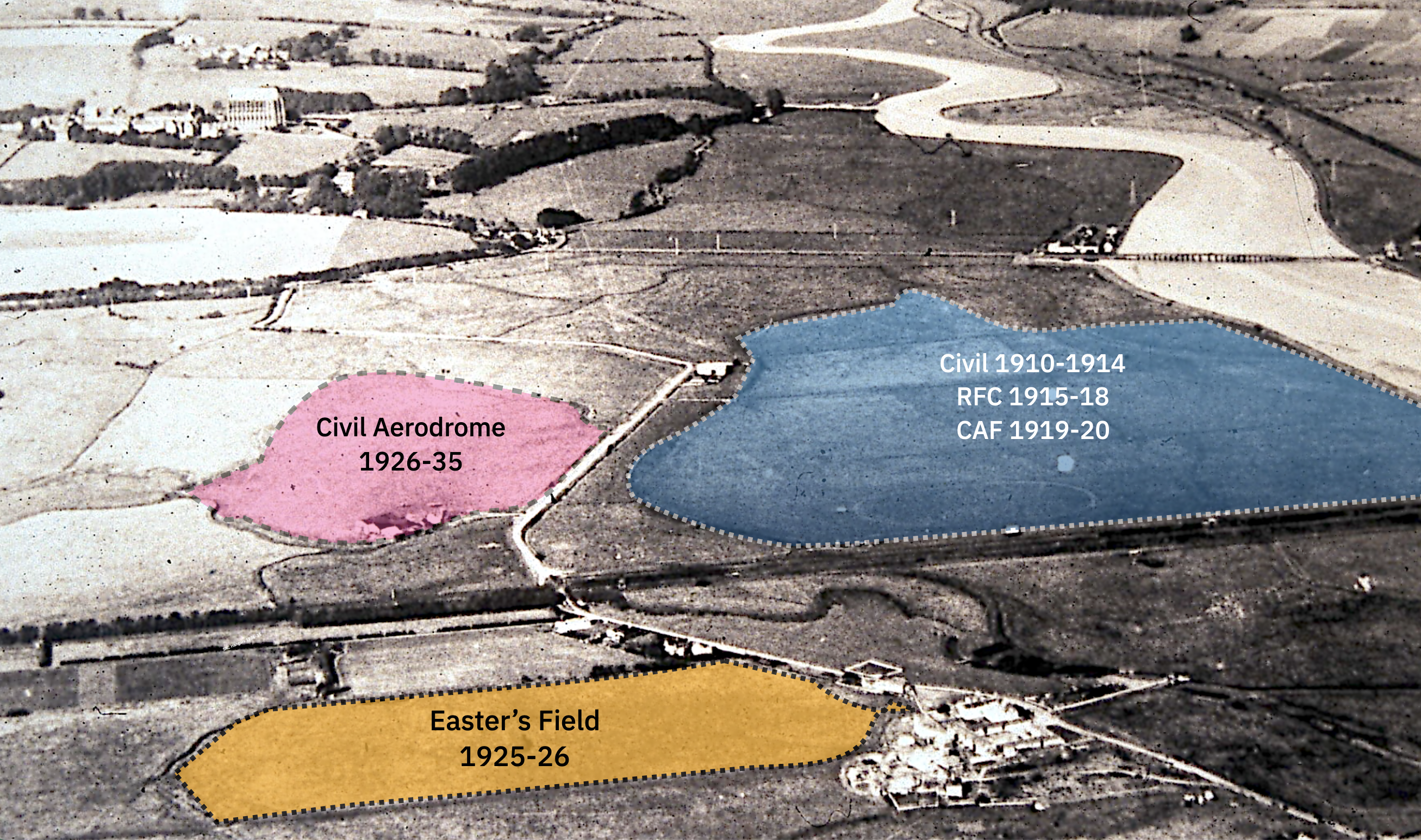
1926 – 1935 use of the Western field
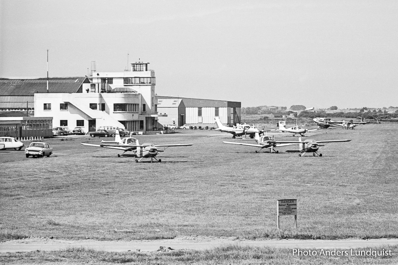
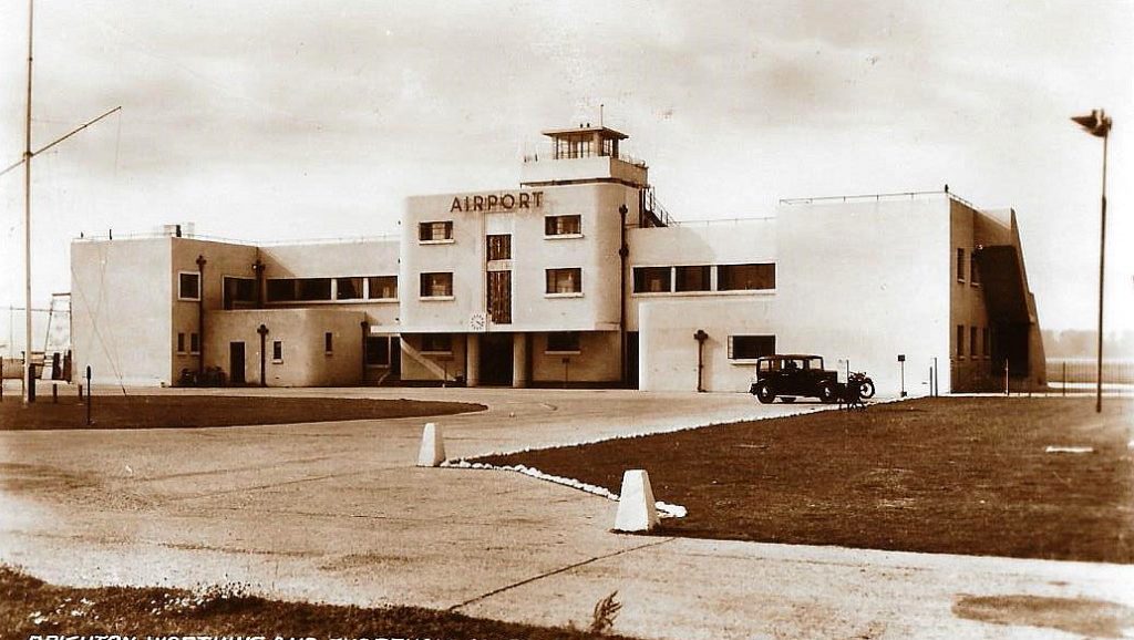
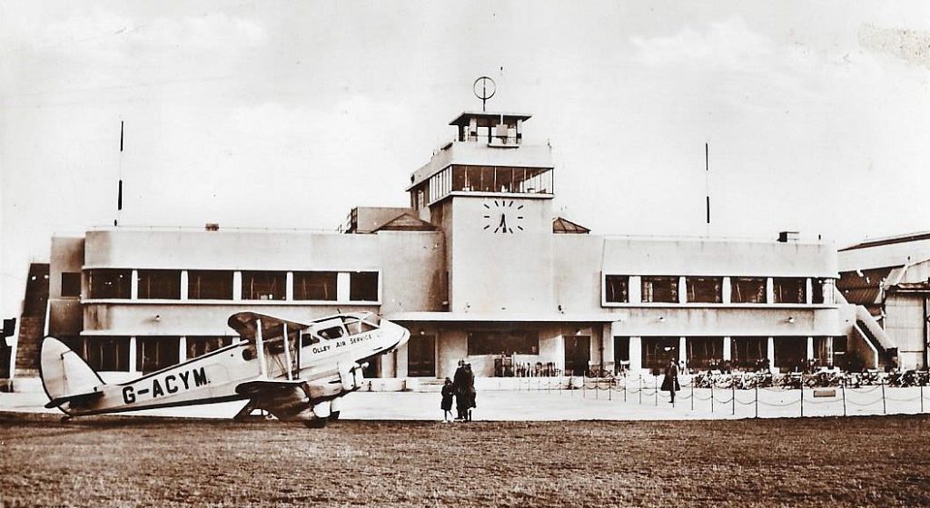
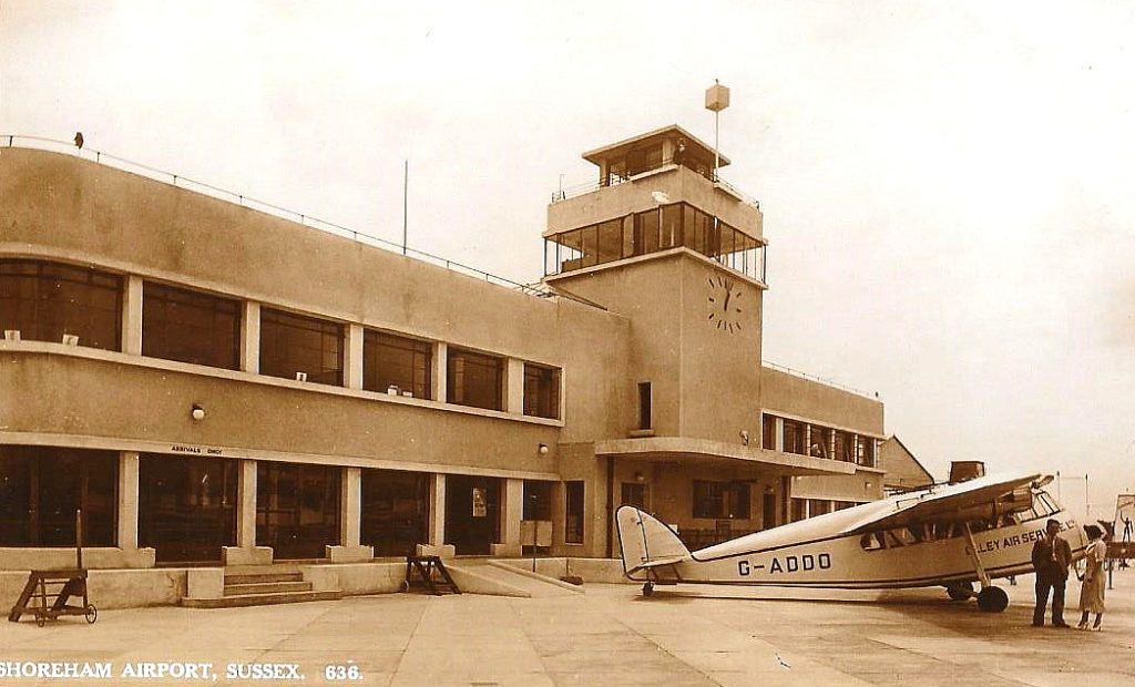
1935 – 1939 Municipal airport
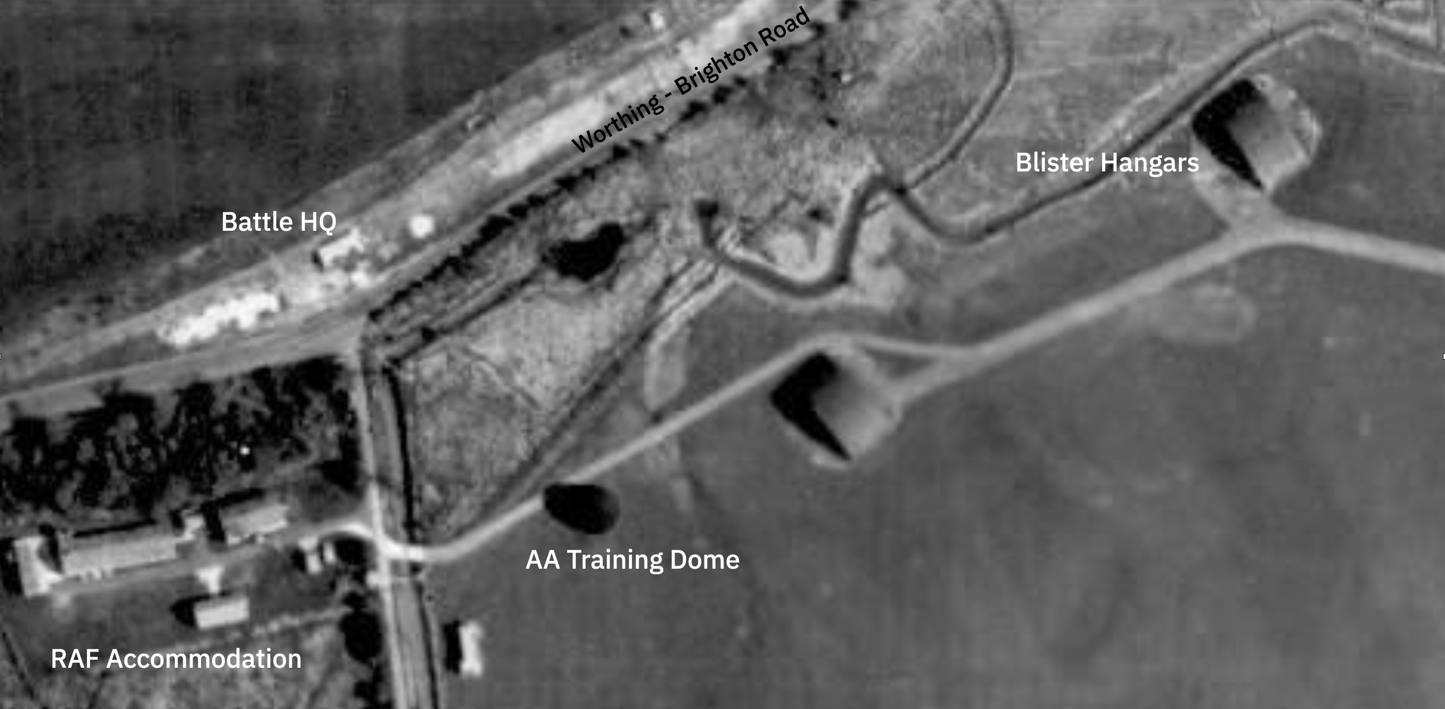
1940 – 1945 RAF use
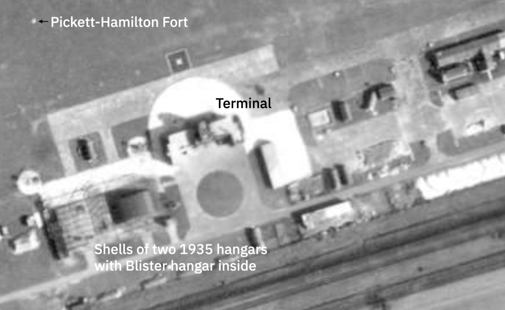
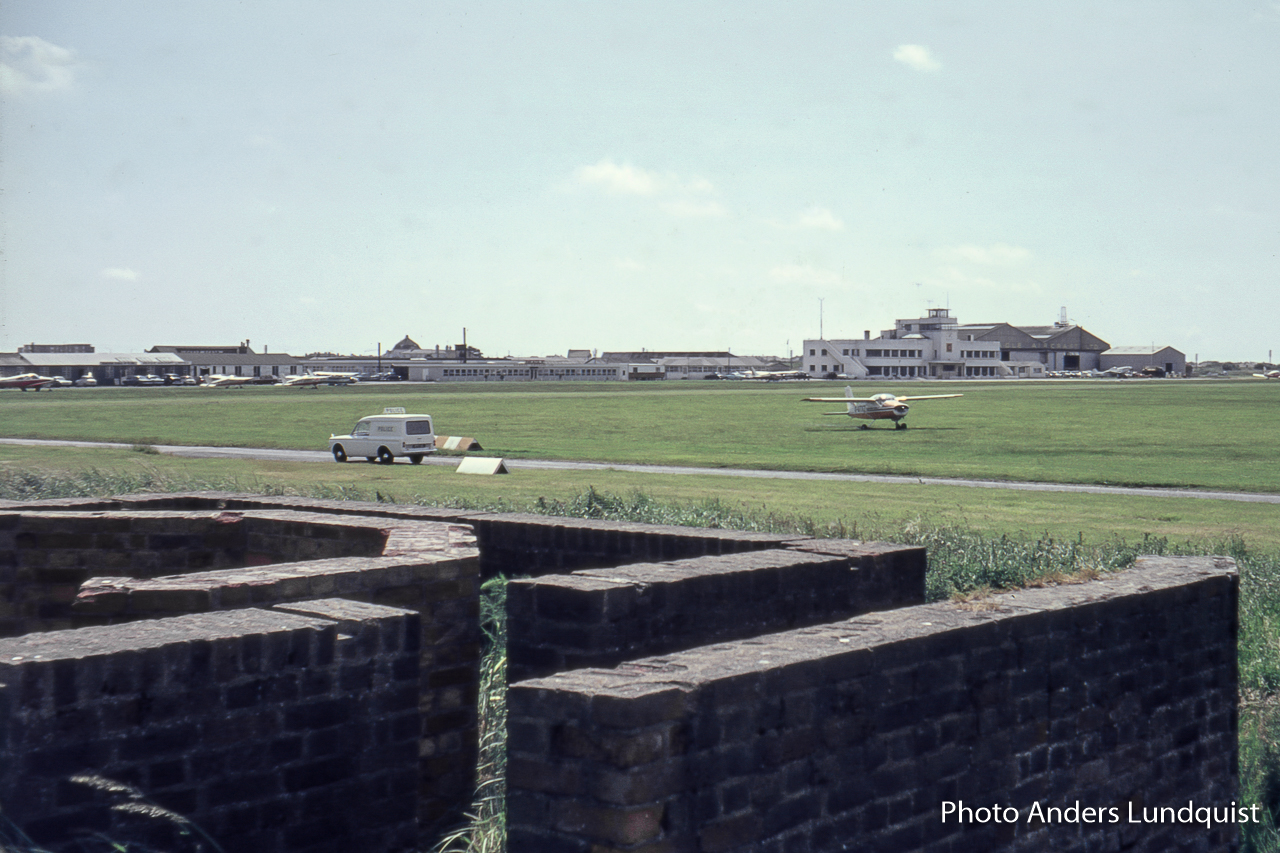
1945 – present Municipal airport