
– a collection of images from the galleries and collections of shorehambysea.com illustrating the changes to the area since the 18th century.
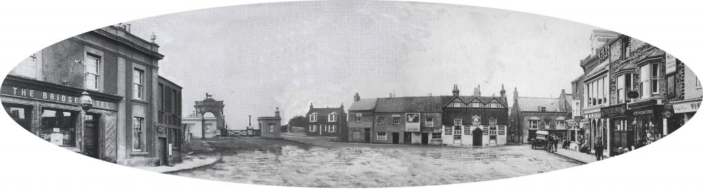
What a wonderfully eccentric place it was! Besides a fascinating ropemaking and shipbuilding past there were, in Victorian times, ancient buildings still standing, quaint cottages, wharf houses, a gas works and, spookily, a mortuary alongside an incinerator! In the Little High Street there were peculiarly shaped houses and strange, shop-like windows.
It was never a fashionable area, being part industrial and part residential where the poorer, labouring families largely dwelt. In 1817 William Butler’s poor grammar described it as being “the lower ‘hend’ of town” and goes on to mention a ‘pour new’ shop where he had ‘connections’ with Sarah Fillaps. Something of a mystery and perhaps a pawn shop (a corruption of the French ‘for us’) or as William’s escapades suggest one of the numerous brothels in Shoreham port then?
During the early part of the 19th century Ropetackle included wharf houses, sheds, a brickyard, coal yard, a bonding pond, Thomas Clayton’s deal yard, his cement factory, stables, a mixture of 17th to 19th century houses and even a mill pond. By the Victorian era there was also a sewage plant and of course the gasworks, flint-built ware houses, incinerator and mortuary. It all added to a certain air of eeriness and mystery to the area.
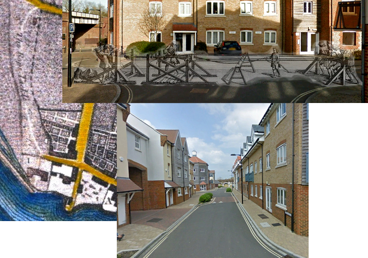
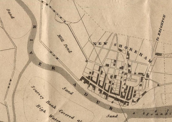
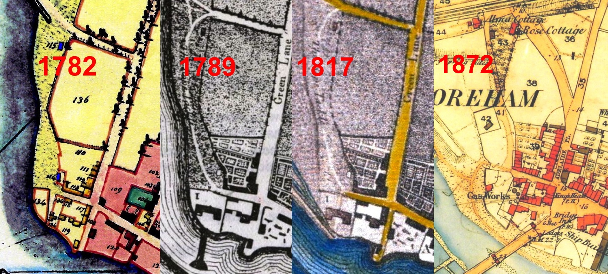
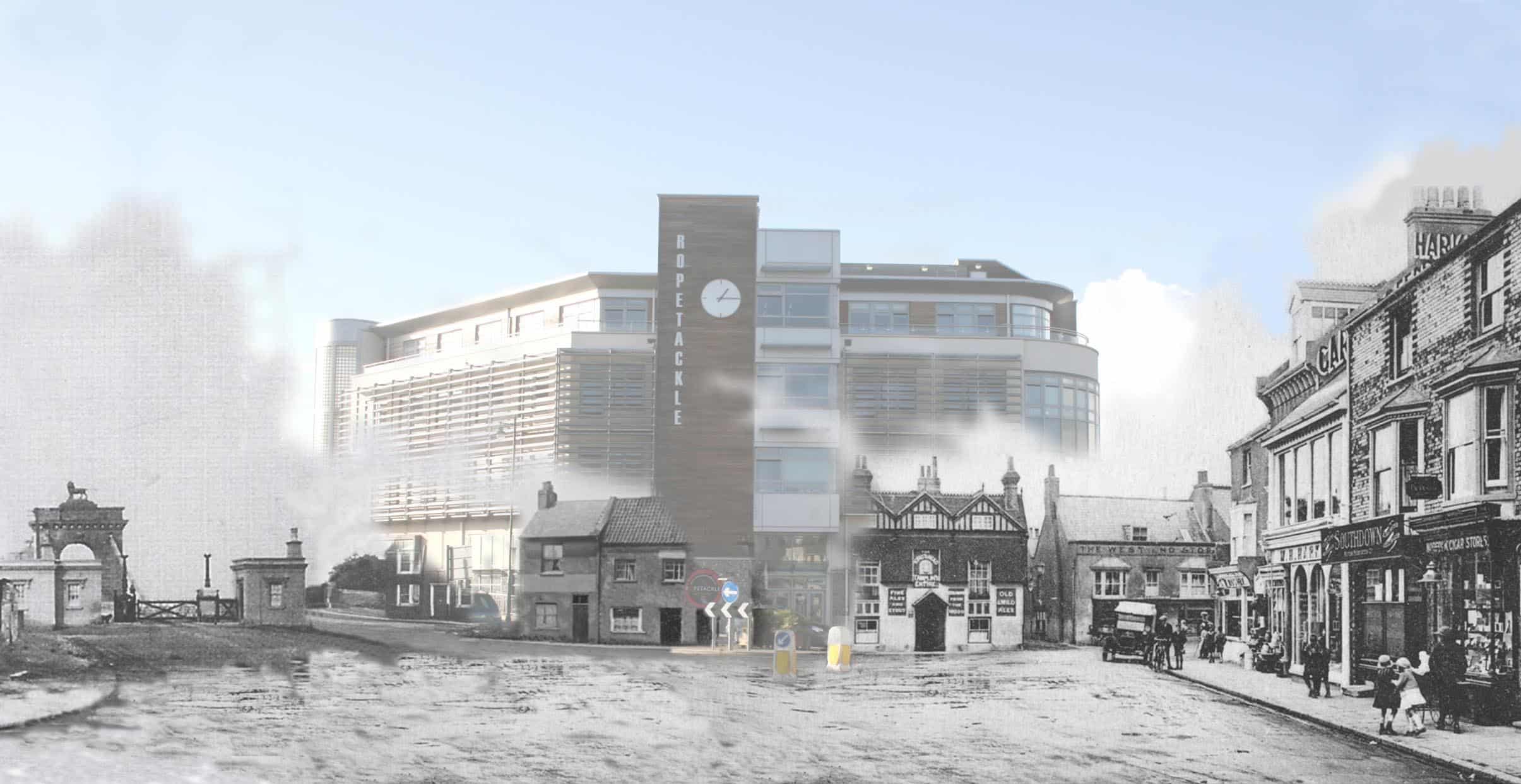
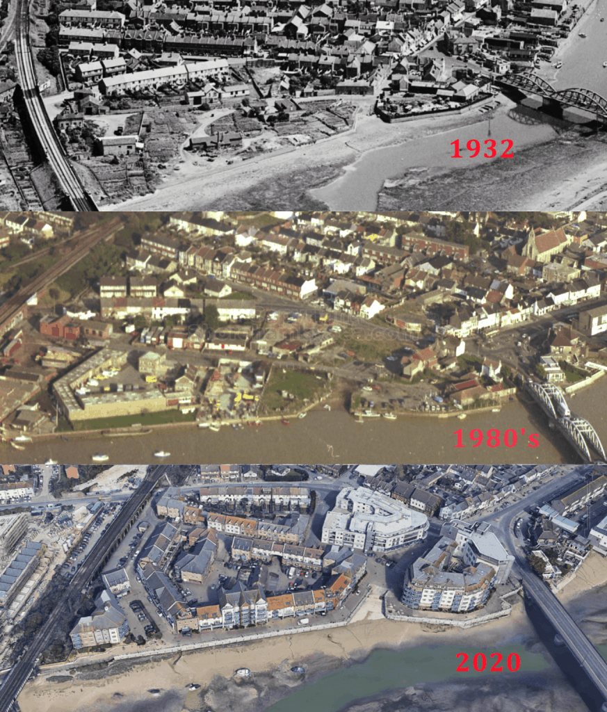
It is historically accepted as the area where Shoreham’s ropemaking industry existed, and likely the mediaeval ship building too, until 18th century when the Tillstone family moved the rope business to the upper half of West Street and Ropewalk above it. In the 1782 Survey it was recognised by the Upper and Lower Ropetackle fields or ‘closes’ that lay between today’s Swiss Gardens school in the north and near the Little High Street to the south, bordered generally on the east by Victoria Road, the High Street and Old Shoreham Road with the river on the west. On the 1789 map, before the land reclamation, its western extremity is marked by ‘The Rope Tackle’ path that lay on the west side of the Lower Ropetackle field. Nowadays the area appears to be accepted as extending from north of the railway line (the Ropetackle North development) down to the road bridge in which the earlier development and Arts Centre now stands.
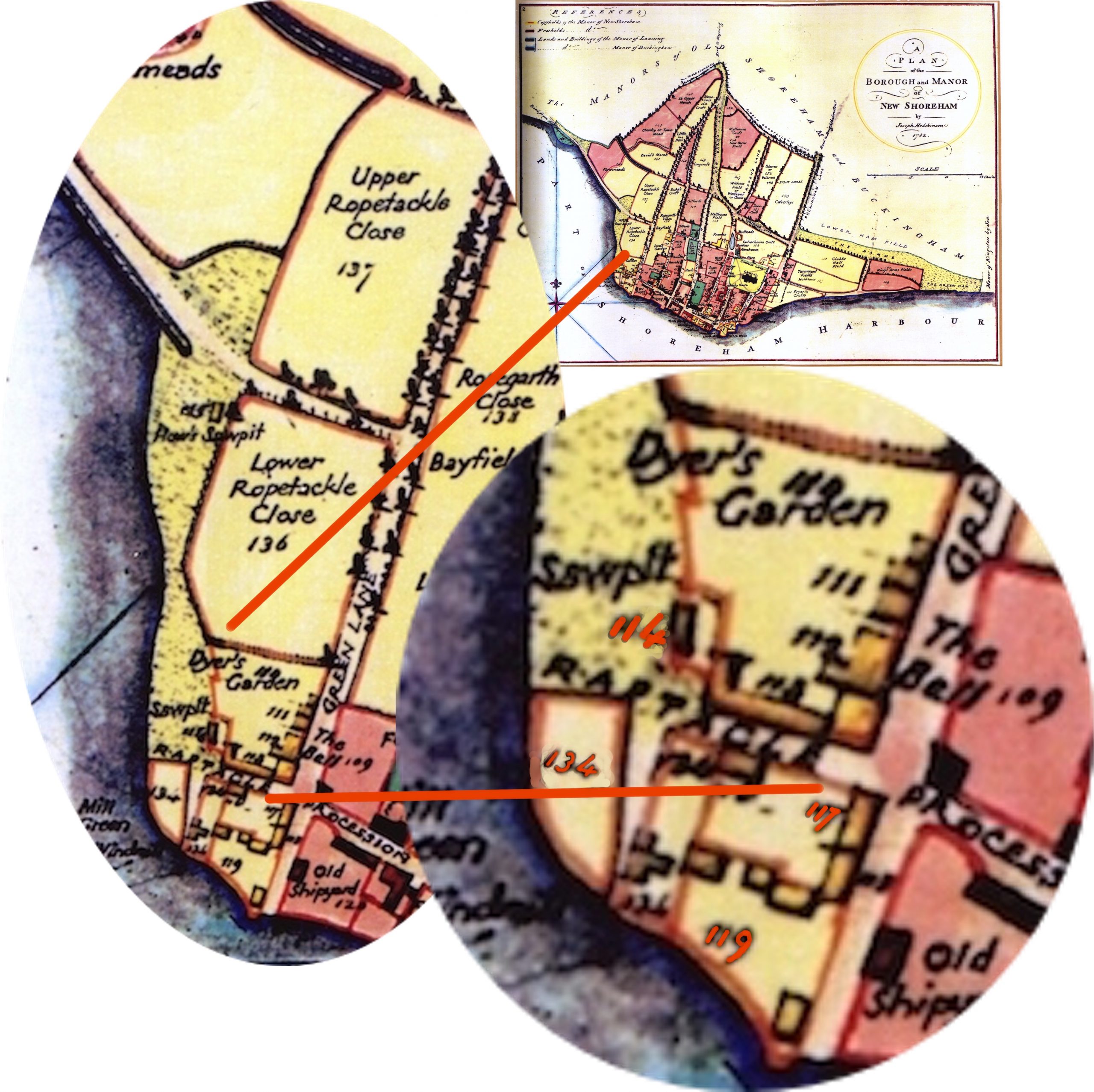
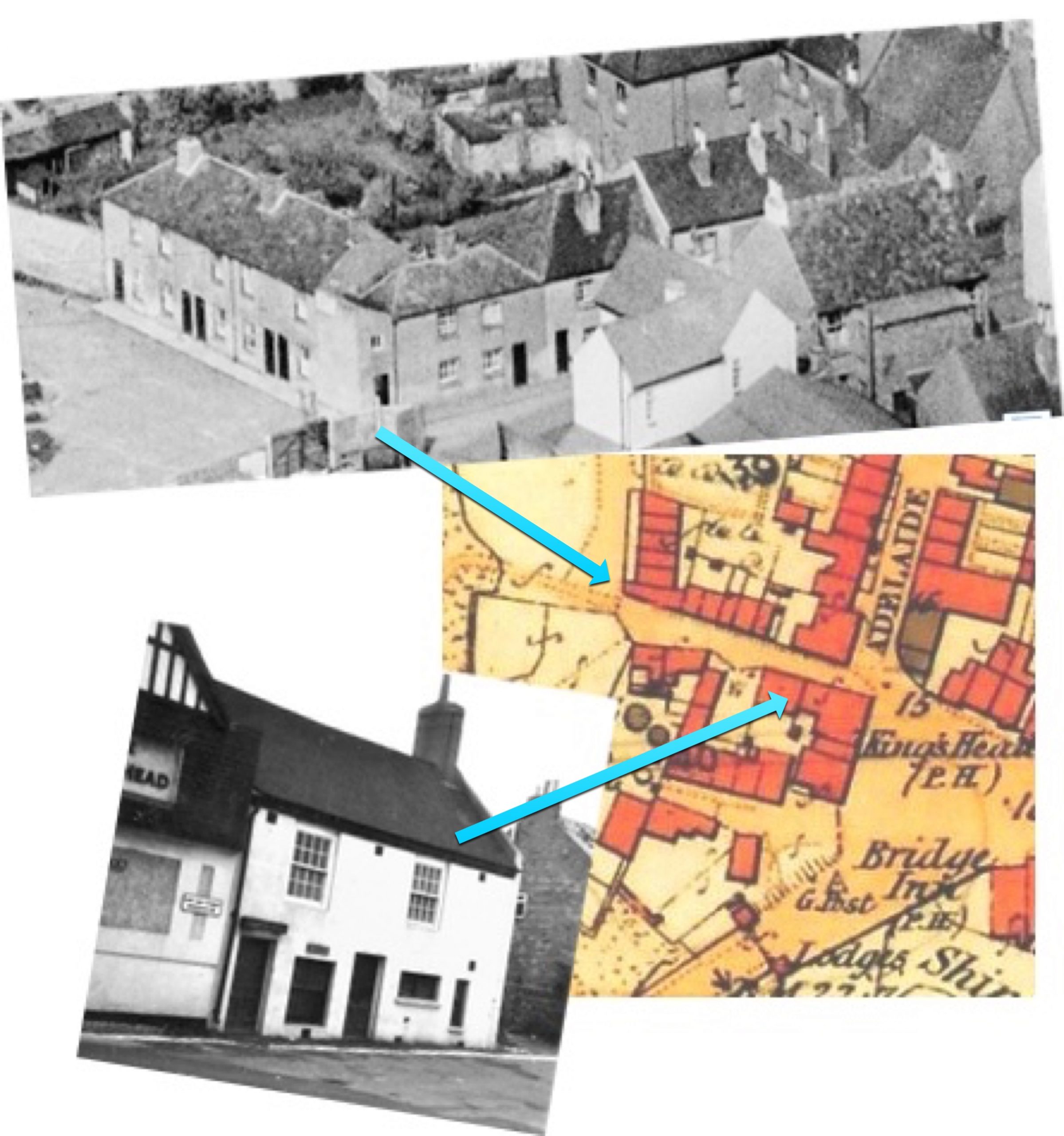
The 1782 Survey map shows that Ropetackle consisted largely of fields with just a small cluster of houses. The King’s Head inn (117) was there then and Mill Green on the corner plot (134) so called because of a windmill that stood there in earlier years. The Tilstone family made their ropes, stretching them up West Street to Ropewalk but they also had a shipbuilding yard on the site of 119. Timber for shipbuilding was still cut there as evidenced by the sawpits 114 & 115. Access to Lancing was by ferry.
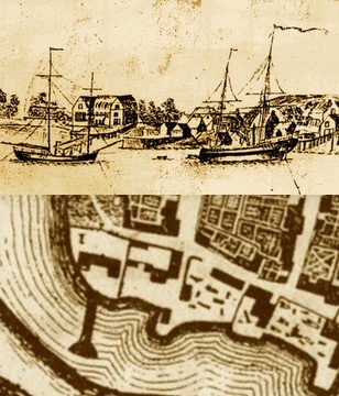
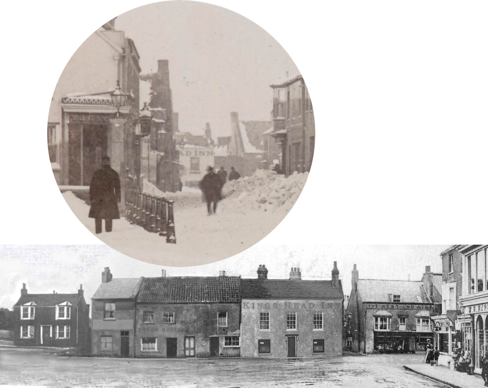
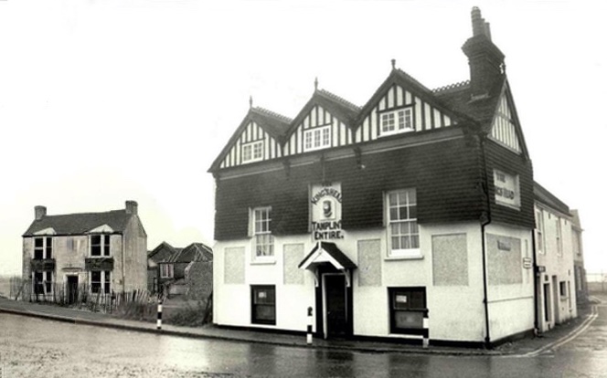
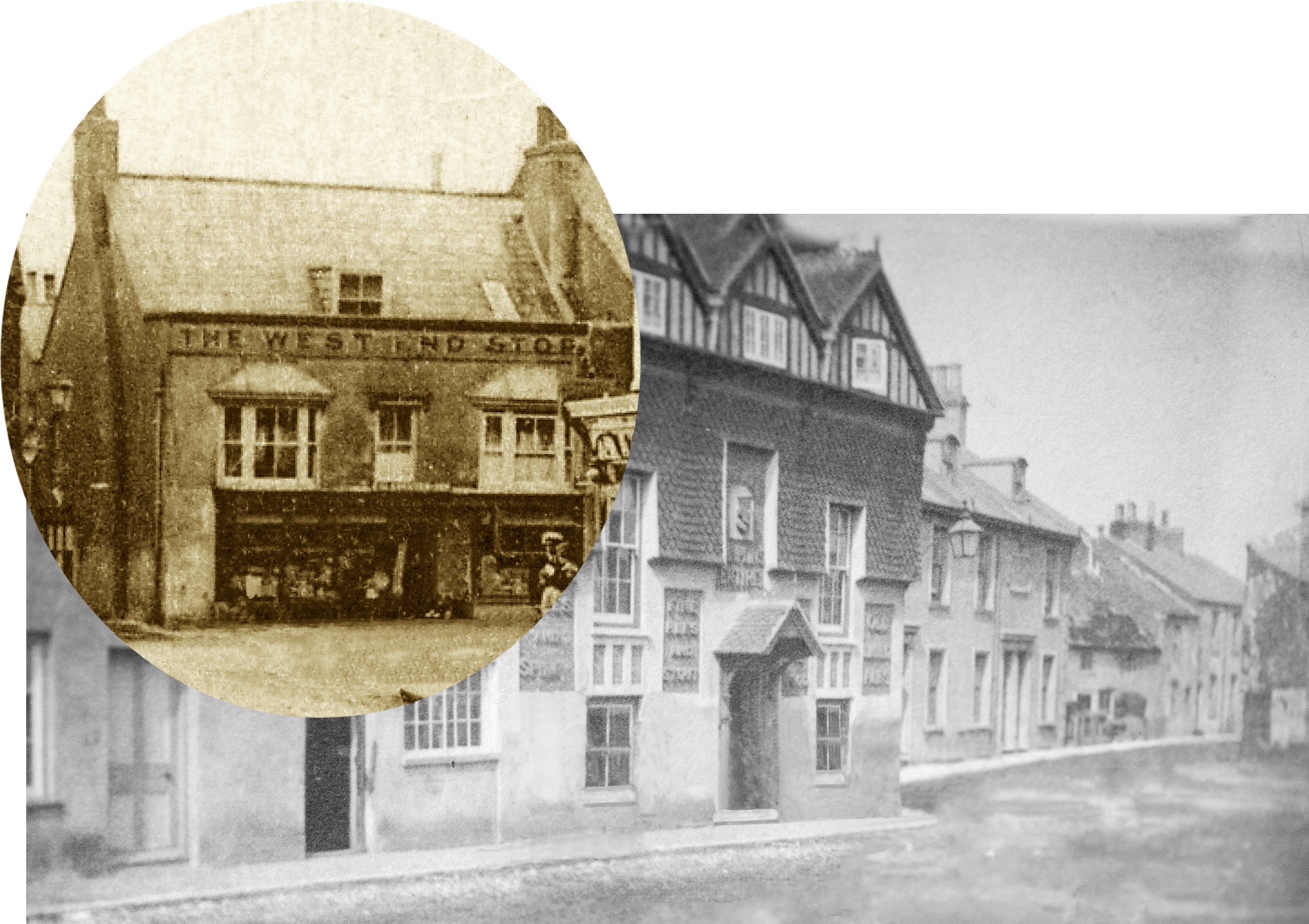
By 1789 Daniel Roberts had purchased the Mill Green land from the miller’s widow and built a large granary there together with a jetty. Daniel Robert’s granary and jetty is on the left. At the centre is that part of Ropetackle facing the High Street with the King’s Head and what was later ‘West End Stores.’ During the Napoleonic wars when fears of invasion were rife the militia were encamped on Mill Green and behind the King’s Head which was no doubt good for the pockets of the Tilstone family who owned the pub then.
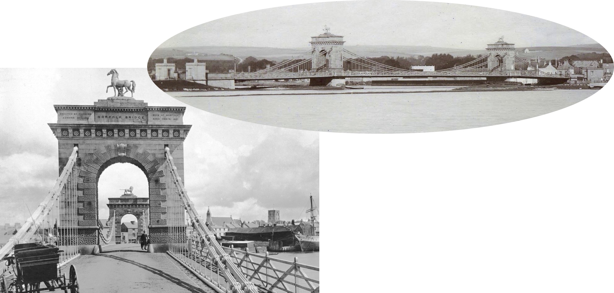
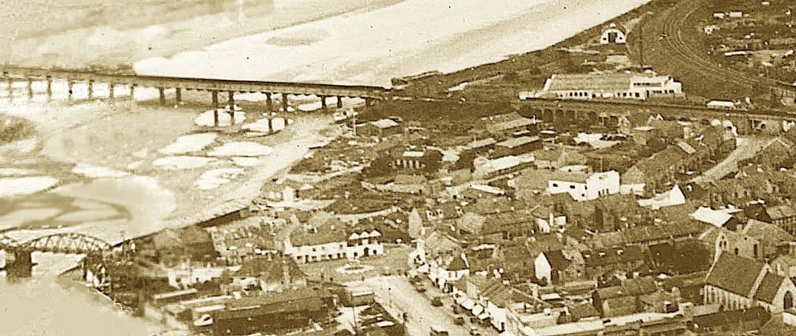
The 1833 Norfolk Bridge – not Ropetackle as such but an adjacent edifice that had an influence on its growth. It was an attractive suspension bridge replacing the ferry that operated there and became a favourite sightseeing venue of King William IV and his Queen during their frequent trips out by carriage from their summer retreat at Brighton. The number of buildings on Ropetackle doubled. By 1872 houses now extended further northwards up to the Old Shoreham Road/Victoria Road fork. Some of the older buildings were replaced by Florence Cottages bordering the High Street and Norfolk Cottages in the side street between the King’s Head pub and the bridge. In the years since the bridge has been replaced twice but sadly now looks nothing more than a road over a river.
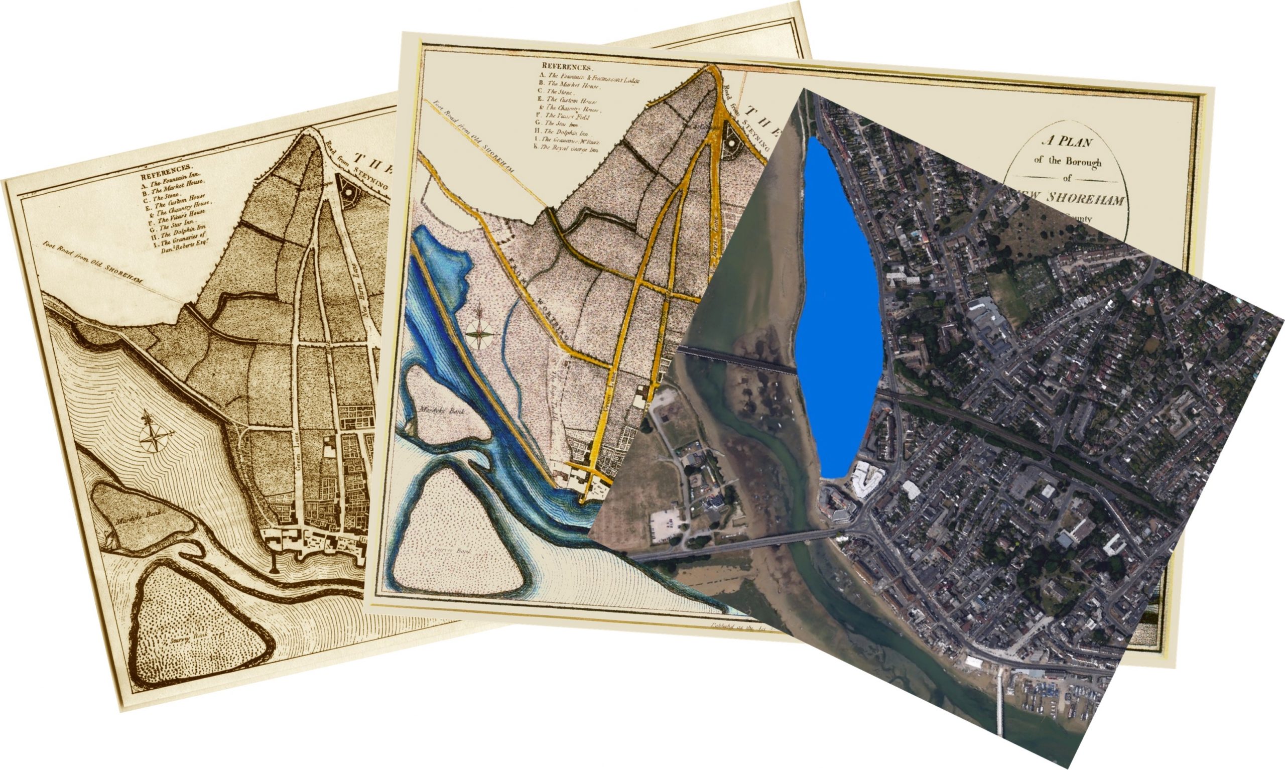
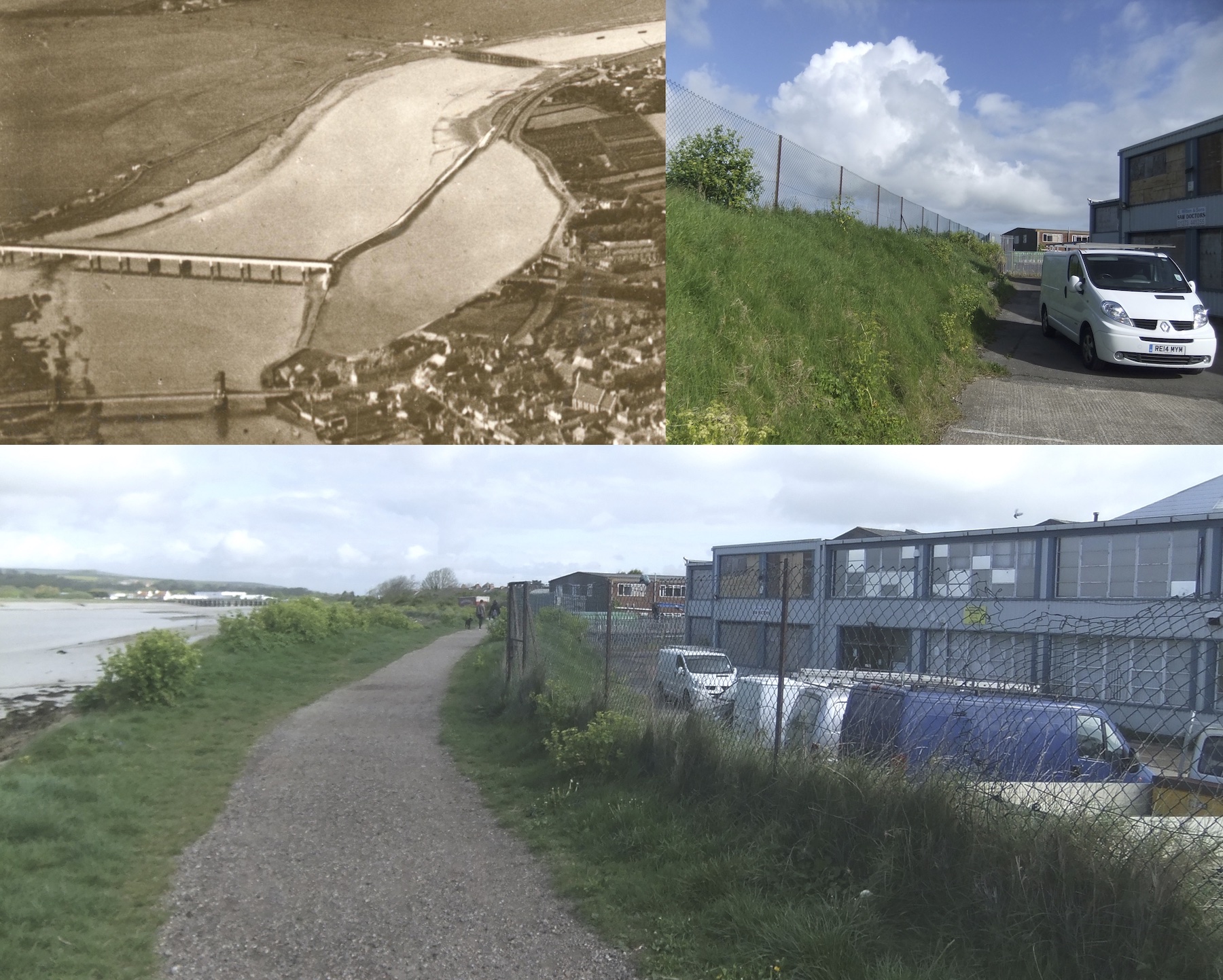
Between 1789 and 1817 a bank was built along the west side of Ropetackle in order to reclaim land and reduce flooding. For a short while the creation of a large mill pond to drive a tidal water mill was envisaged but does not seem ever to have been completed.
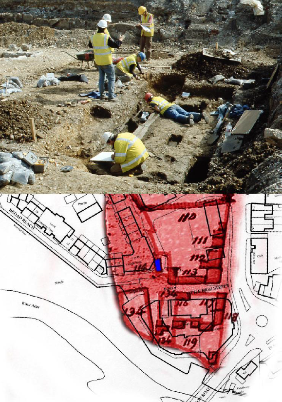
In 2003 Archaeology South East carried out an excavation of the area prior to the redevelopment of Ropetackle. Shorehambysea.com were involved in a small way by assisting the Senior Archaeologist Simon Stevens with one old map and references of the area in our records. This photo shows one of the saw pits under excavation and our 1782 map overlaid on a modern map that helped to identify the location.
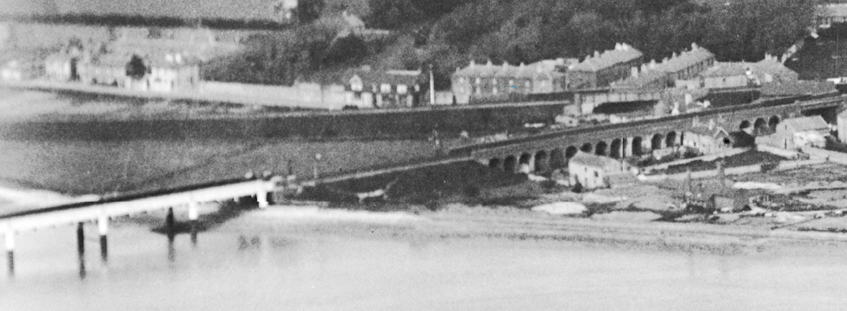
In the 1840’s the London Brighton and South Coast Railway punched a line through the northern half of Ropetackle on its way to Worthing and beyond then again in 1861 for the branch line northwards through the Adur Valley. For a while temporary railway huts sprang up for the workers and even their families – temporary maybe but permanent enough for some of them and their residents still remaining to be included in the census of 1851. In doing so the lines changed the character of that part of the area and included an impressive, arched brick viaduct through Ropetackle but only a wooden bridge on across the river that nevertheless took the weight of those heavy locomotives and carriages for sixty years until it was replaced by today’s iron bridge.
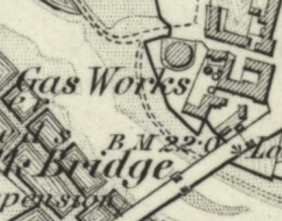
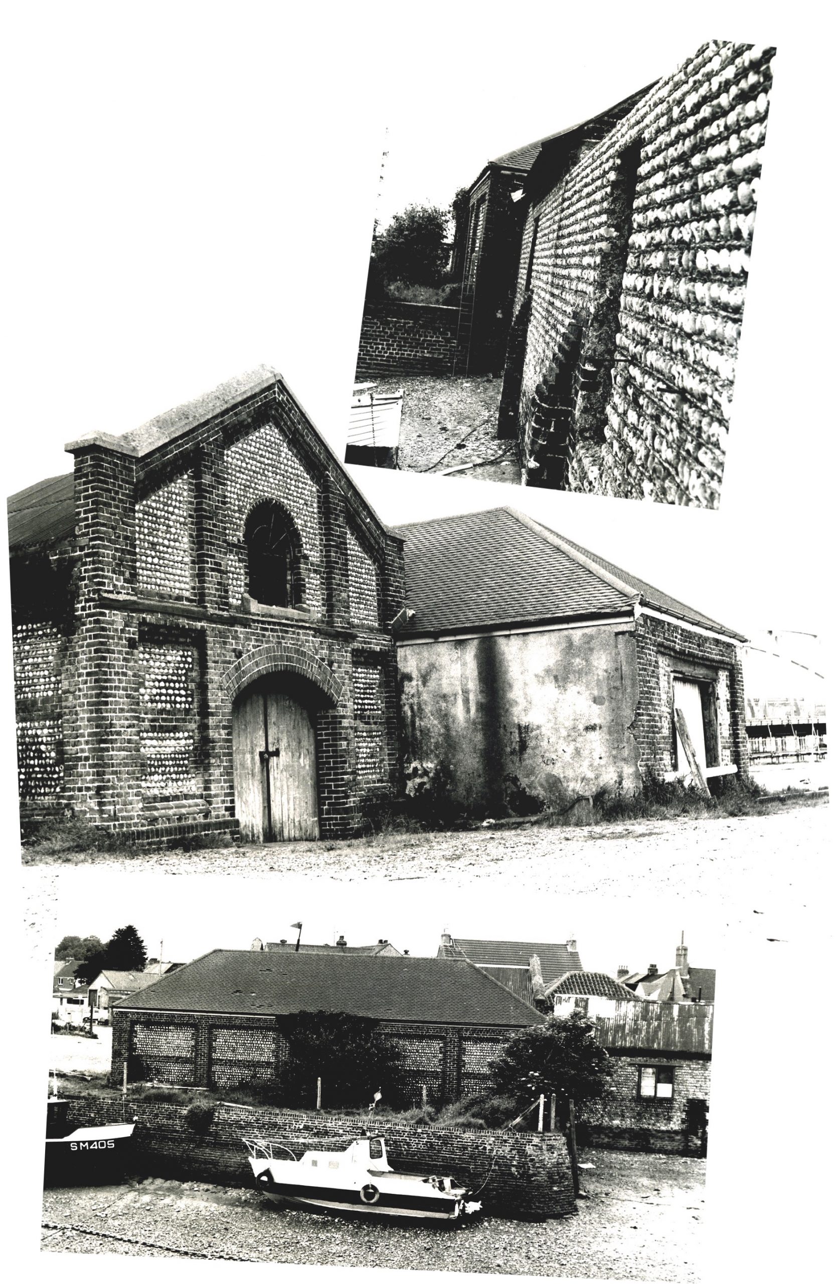
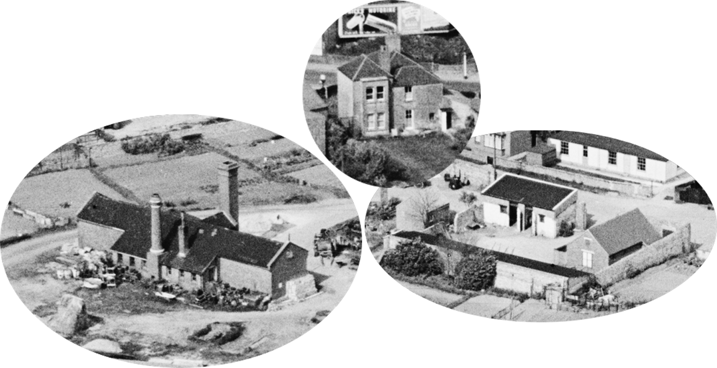
It was also around this time that the Gas Works Company built its ovens, chimneys and gasometers/gasholders at Ropetackle. Although tucked away well back from the houses in the High Street the largest gasometer was over 50 feet in diameter and probably tall enough for this and the chimneys to be seen above the rooftops. Initially, Shoreham folk were proud of their new utility and for a while Little High Street was alternatively named Gas House Street. Edward Vinall was one of the first managers there with Ropetackle resident Edward Winton one of the coke burners – Edward was the father of William Edward Winton who later became well known as the organiser of Shoreham’s regattas and carnivals.
Pollution must have been intolerable in the area though and even more risky for the coke burners. Fatalities amongst gas workers nationwide was high with many succumbing to lung disease that was in those days too easily dismissed as consumption (tuberculosis). Did Edward’s years working at the ovens cause his early demise? Maybe, he was just 52.
Eventually, the Brighton & Hove Gas Company acquired the business and tranferred it all to the Portslade works by the canal. Gasometers, ovens and chimneys were soon dismantled and by the end of the century no trace of the Shoreham works remained.
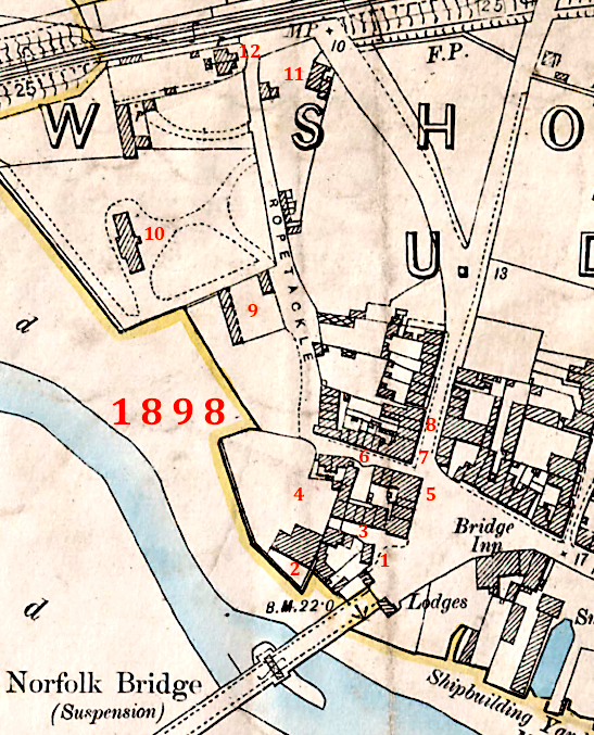
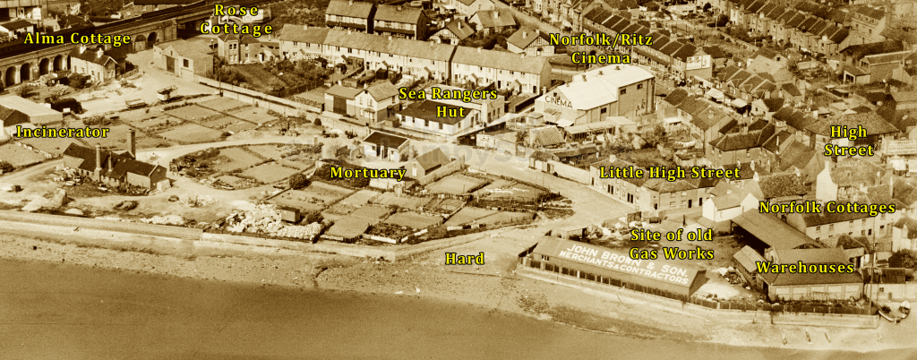
1 – May Villa
2 -Warehouses
3 – Norfolk Cottages
4 – Site of old Gas Works
5 – King’s Head Inn
6 – Little High Street
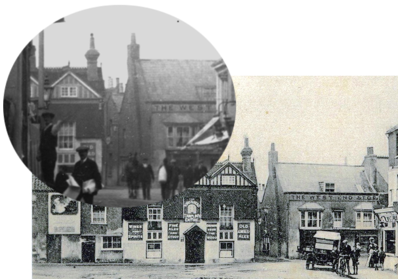
7 – West End Stores
8 – Florence Cottages
9 – Mortuary
10 – Incinerator
11 – Rose Cottage
12 – Alma Cottage
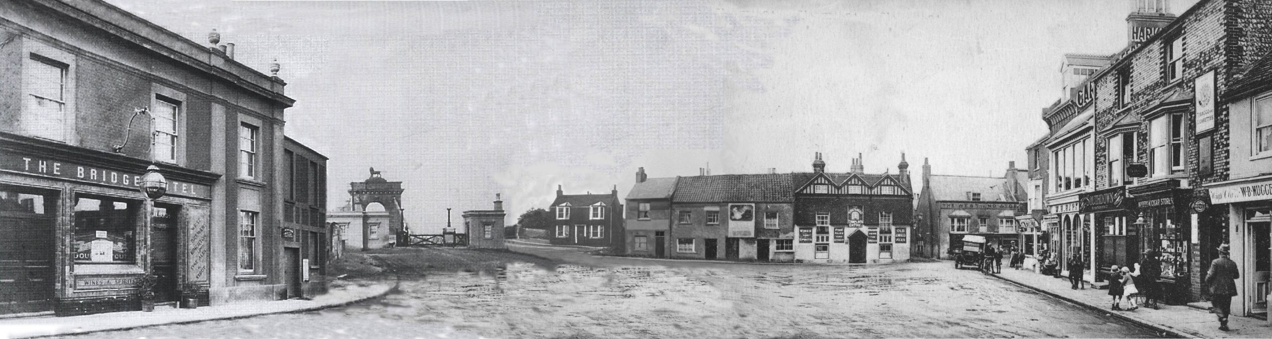
The Face of Ropetackle. This composite of circa 1910 photos has been put together in order to give an impression of the scene as it was then. Ropetackle faces us between the bridge and the westernmost shops in the High Street on the right. From left to right, May Villa is next to the bridge and between it and the next building is the short street where Norfolk Cottages were. The building with the large poster on the wall was where the Maple family of fishermen sold their oysters, followed by the King’s Head shown here shortly after its facelift, then the Little High Street gap alongside the West End Stores.
The Maples first moved to Ropetackle during the 1840’s. They were a very active family particularly in the sporting sense; Sam Maple, the head of the family, was a successful national sculler and is recorded as having won one of the cups for that event in the 1867 Shoreham Regatta. Of his sons Alfred and Arthur, the former rowed for Shoreham Rowing Club and both played for the town’s football club in the early 1900’s, then the most consistently successful club in Sussex.
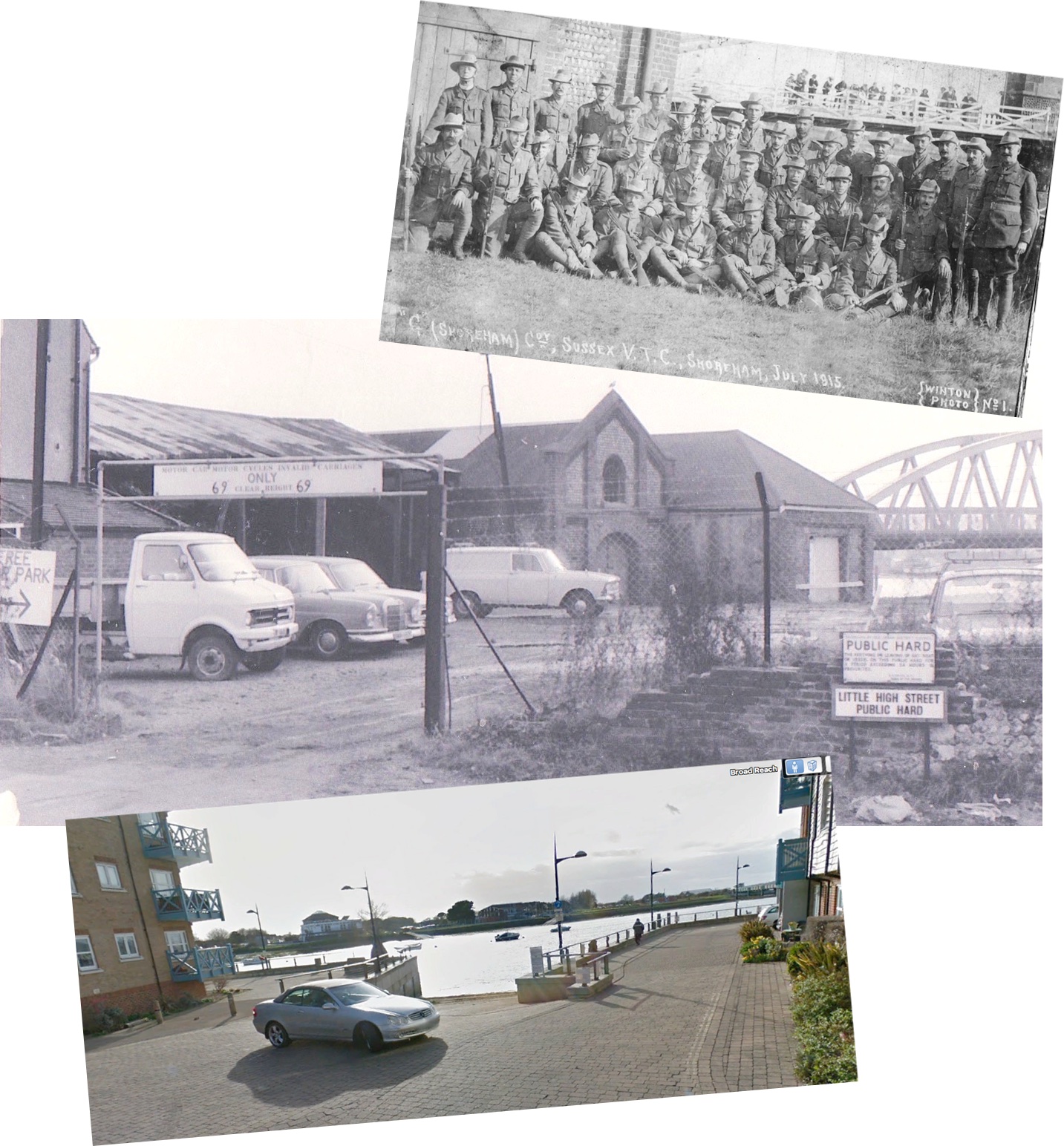
Centre: The warehouses by the public hard during the 1970’s.
Below: The public hard today – one of the few features that survive. (photos Winton collection, Ian Newman and shorehambysea.com)
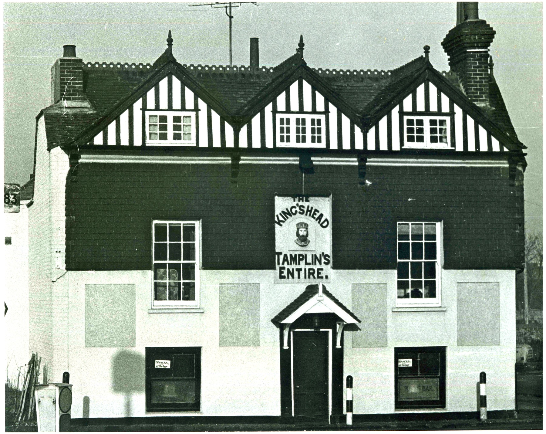
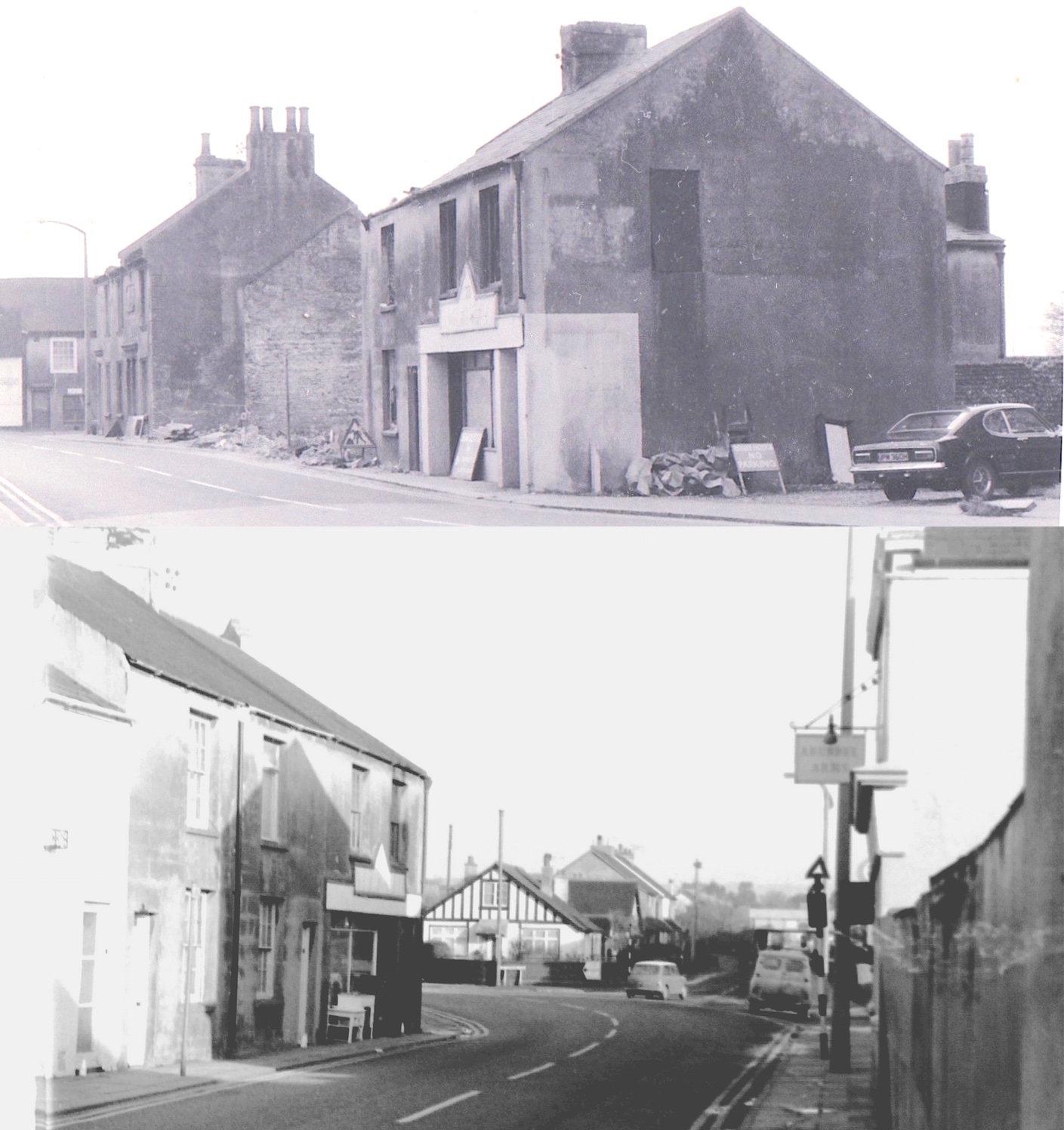
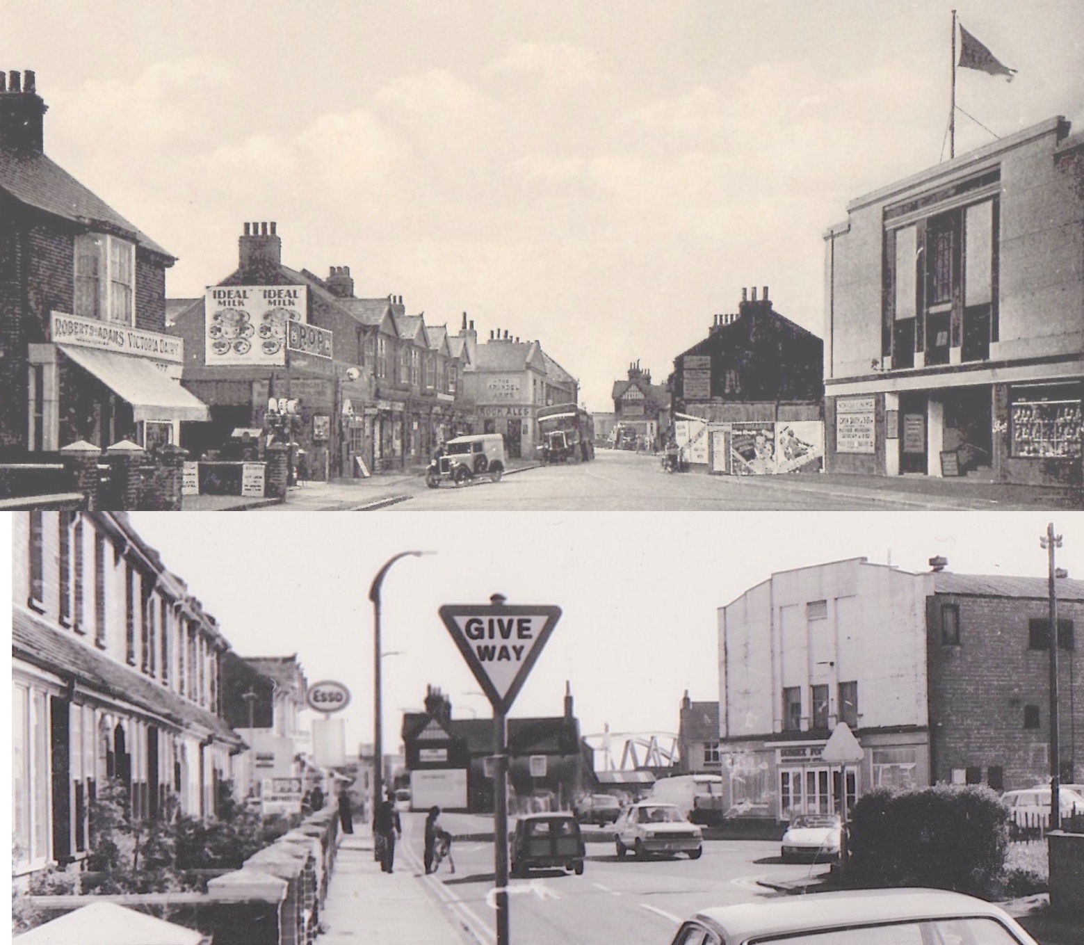
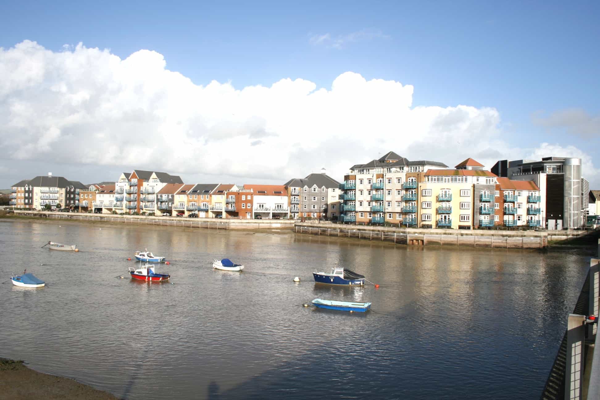
The pub was demolished as recently as the 1990’s because it was marginally ‘out of line’ of traffic flow coming around from the bridge. Its roof-line may have been modernized with a triplet of gables during the early 1900’s but it was ancient at heart and mediaeval in origin. Shoreham folk still remember the oak beams and the steps down into the bar below street level – a sure sign of antiquity. Much of Shoreham’s quaint village-like history here and along the High Street was demolished to provide easier access for traffic. Now things seem to have gone full circle and planners are pushing the motor-car out by building on the town’s car parks – a change of heart? – too late for Shoreham!
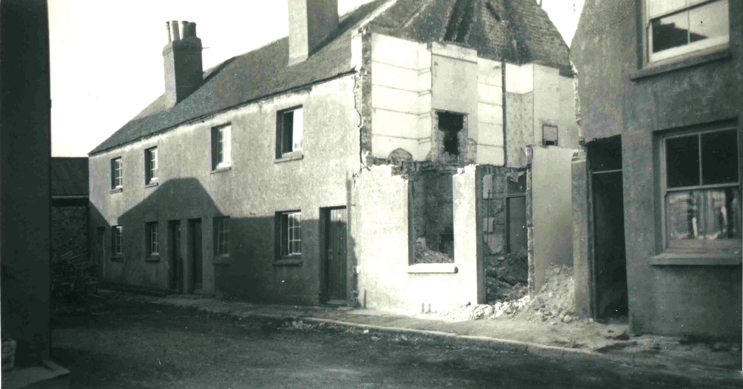
Of particular interest is the strangely proportioned building on the corner. Is it what was left of a partly demolished house; was it built like that to fit into a small space or did it have a special purpose? The 1872 map also reflects its irregularity as part of the longer building to which it was attached. Perhaps it or another of the buildings here was at one time the tiny one up, one down accommodation 13 feet by 8 feet at Ropetackle reported by an article in the Sussex Agricultural Express in 1892, where Frederick Parsons and his wife and seven children once lived in what were very cramped conditions. Bottom photo: Adjoining the back of the King’s Head was this small dwelling. The unusual window configurations perhaps suggests they were once shops.
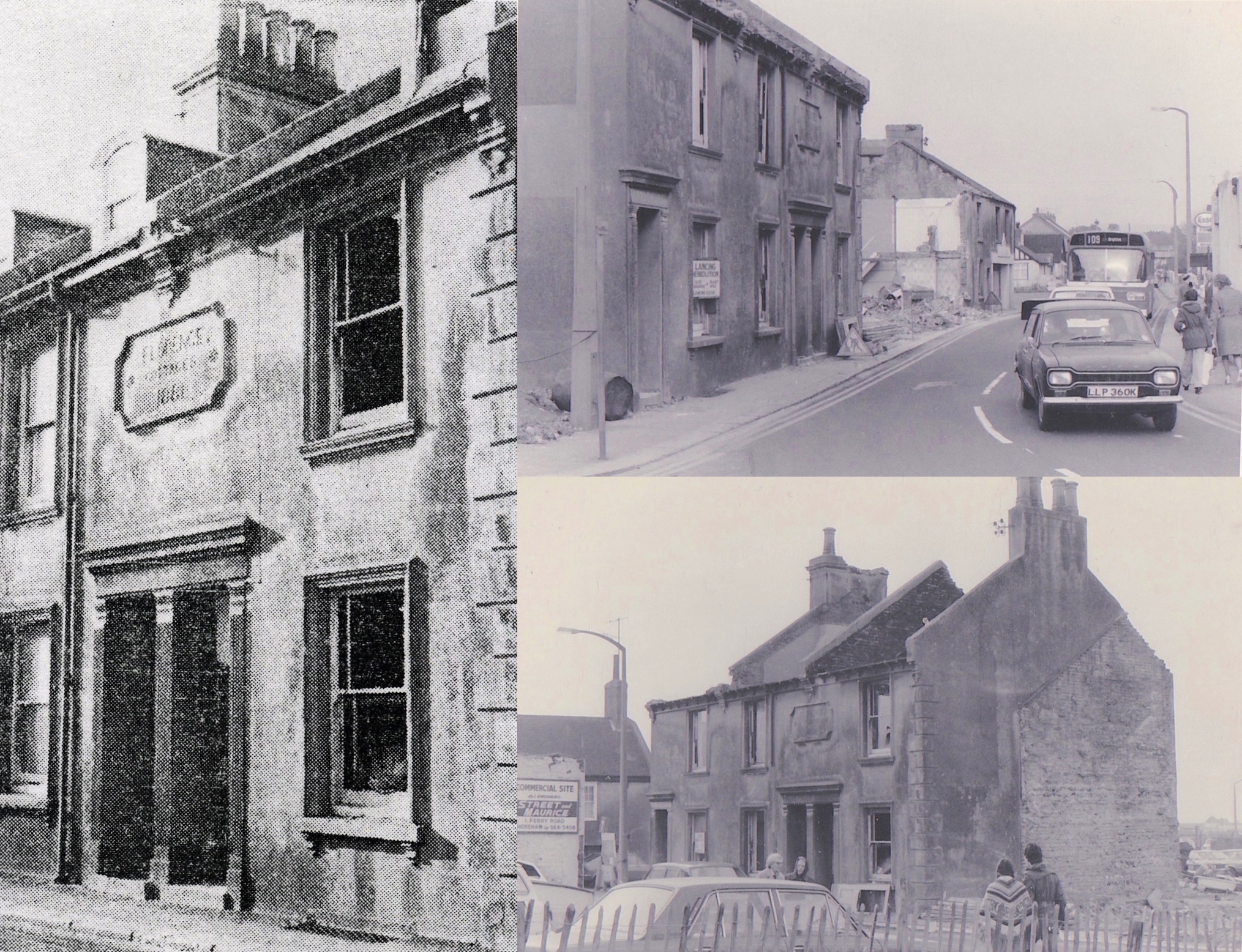
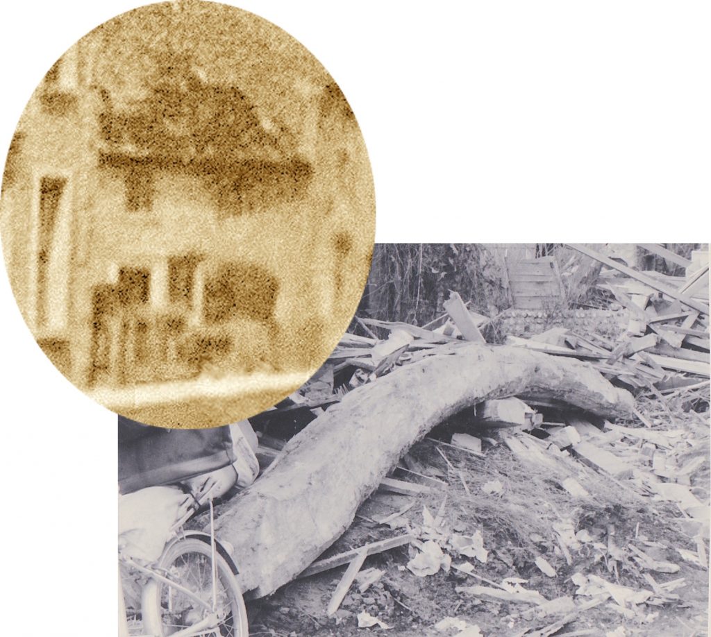
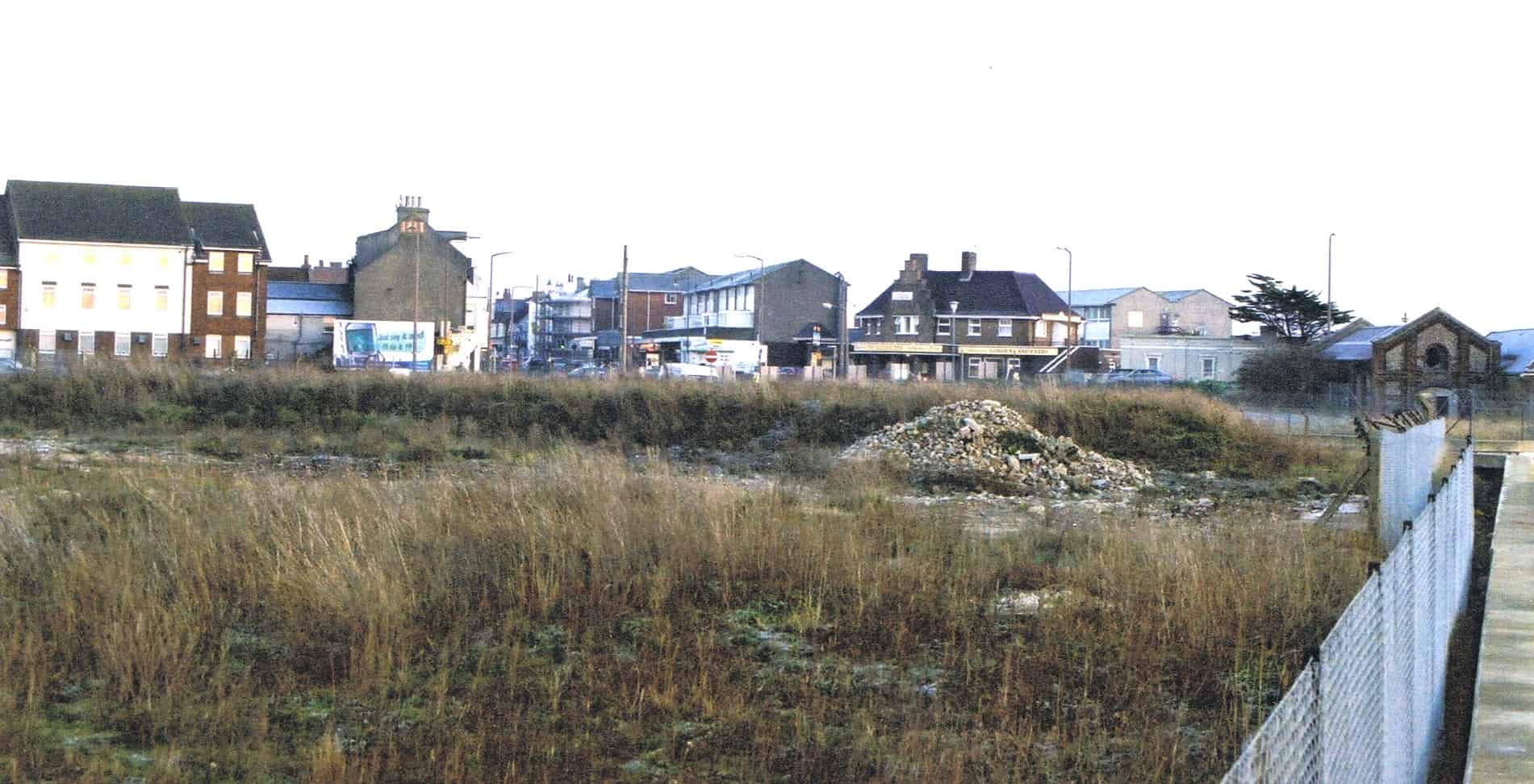
Florence Cottages. Even in the 1880’s redevelopment happened. Some of the older shops in this part of the street were replaced by a short terrace of three houses called Florence Cottages. Perhaps an attempt to upgrade the area but as it turned out they had not been well built, cracks appeared in the walls and they started to crumble. A succession of squatters and vandalism hastened the decay and in the 1970’s they were demolished along with much of the rest of Ropetackle.
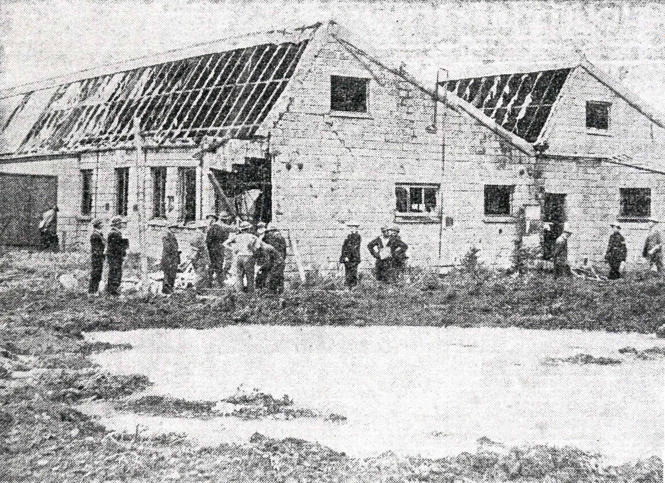
In between the fork of the railway line to Worthing and the branch line to Horsham a laundry was built during the 1930’s. Apart from having two glass roofs along its length the Imperial Laundry, to give it its name, did not otherwise have any particular architectural merit. It did though have a brief claim to fame during the afternoon of 26th September 1940 when bombs fell near the railway viaduct (probably the target). Houses in Buckingham Street across the road from the laundry were hit and another narrowly missed the laundry itself but the blast smashed most of the glass in the roofs where eight of the girl workers were cut by the flying glass.
This 1930’s view shows the laundry at the northernmost tip of Ropetackle and the large nissen hut beyond that was erected between the wars and survived until the recent residential development at northern Ropetackle.
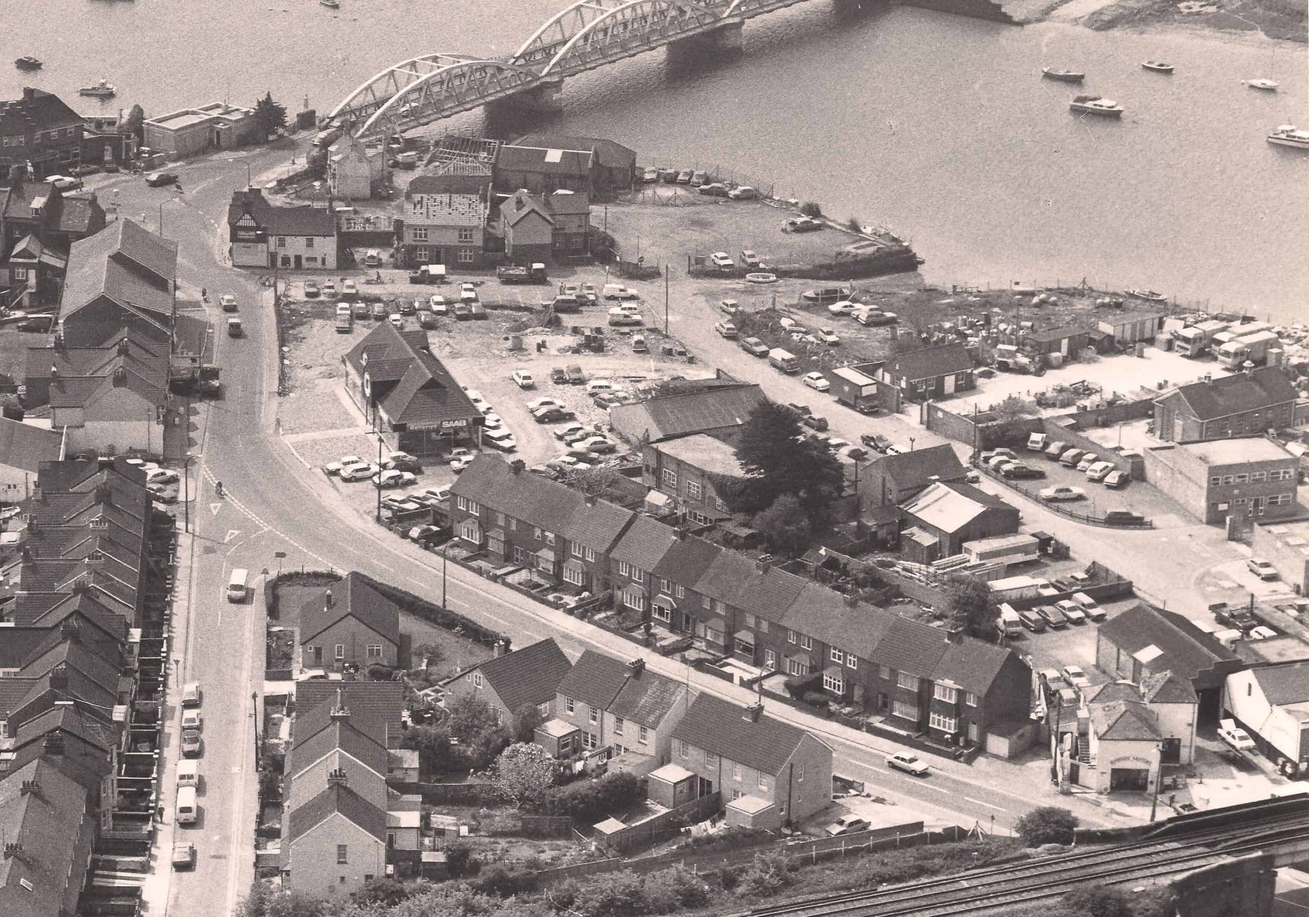
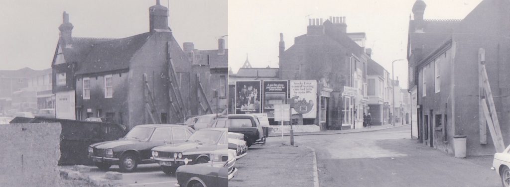
By the 1980’s Riverside Motors (Rose Cottage) still stood as did the King’s Head, May Villa and the warehouses but some show signs of being demolished. A few commercial buildings have been built but much of the cleared land now serves as car parks.
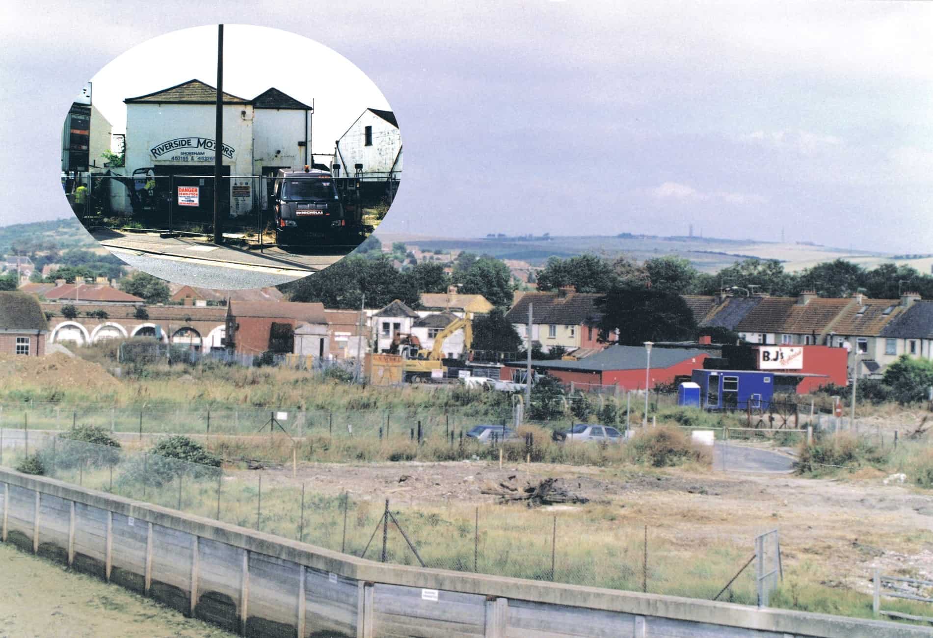
By the end of the last century and for many years Ropetackle was looking very run down comprising as it did wasteland and a few surviving buildings including Rose Cottage (centre and inset) albeit now considerably extended and used as a garage having lost any charm it may have had before. The red building was BJ’s nightclub – a less than permanent, partly wooden structure constituting a huge fire risk that nevertheless somehow survived for a number of years.
Late attempts were made to save the ancient King’s Head but demolition was pushed through on the grounds that it was an obstruction to traffic. Looking east with the King’s Head and May Villa now gone and just the warehouses still left.
Roger Bateman, Shoreham, November 2020
Sources:-
1782 Survey http://www.shorehambysea.com/1782-survey-new-shoreham/
Mills, Millers and Millwrights http://www.shorehambysea.com/mills-millers-millwrights/
Ropetackle Archaeology http://www.shorehambysea.com/archaeological-excavations-ropetackle-2003/
Shoreham Rope and Sailmakers https://www.shorehambysea.com/1400-2/
John Butler’s 1786 Sketch Examined http://www.shorehambysea.com/john-butlers-1786-sketch-shoreham-examined/
Shoreham’s War https://www.shorehambysea.com/shorehams-war/
A Small Book of Letters https://www.shorehambysea.com/small-book-letters/
Census Returns, Parish Records and Directories https://www.shorehambysea.com/category/not-printable/census-parish-directories/
A really interesting summary of Ropetackle. Is this published in book form? I notice that Nelsons is listed as the publisher but cannot source it. Can you help?
I was a “Maple”. Interesting to read a bit about our family.
My Grandfather was Alfred, his son generally known as Ray was my father. His sister was Gladys, who carried on the tradition of rowing, until becoming very deaf and hitting a pier of the pedestrian bridge. We ended up in Bexhill in East Sussex. Dad died there but I moved to Southampton where I worked for the Ordnance Survey. My older sister, Carol lives in Bridport in Dorset.
Great to hear from another member of the Maple family – there are more articles on here of the Maples Noreen as I’m sure you know.
Please can you tell me what the Longshore pub at shore ham was called in the sixties or seventies . I seem to remember it was something to do with an Aeroplane or Aerodrome or something to do with the airport at Shoreham. I have so enjoyed reading all about the area and the past.
Would so appreciate a reply, thank you
The Royal Coach opened in 1958 as The Royal Coach. The only pubs with a tenuous aeronautic title would be the The Pilot ( in Southwick) or The Sussex Pad to the north of the airfield.
Unfortunately we have no street directories for that period but I know it was called the Royal Coach for some time around that time
The Royal Coach ?
Interesting. My grandfather came from Ropetackle. Joe Bradford (christened Wallace Bradford). It was a carpark by the time he showed me the road. He was born around 1911, one of 13 children ultimately. I only ever met his brother Charlie, who was living with his wife Peggy in Gordon Road during the seventies. Joe married Ivy Tester from Portslade and had one son Royston (my father). They lived for about 60 years at Cherrydene, The Street, Old Shoreham. Joe worked for the Rawlings ship building company and also did gardening and was also a bricklayer. Apparently, he helped build Cherrydene and the other 5 houses next to it (3 semi-detacheds), I think in the thirties. They rented it at first and then were allowed to buy it. Ivy worked as a part-time cook for Mrs Rawlings at lesser foxholes opposite. Her brother Fred Tester and sometimes my grandfather used to do the gardens of lesser foxholes. You just had to squeeze through the tall hedge opposite Cherrydene and there you were, in a Narnia enchanted garden with a series of narrow fishponds cascading down the hill to the large house overlooking the Adur, (magical to a child).