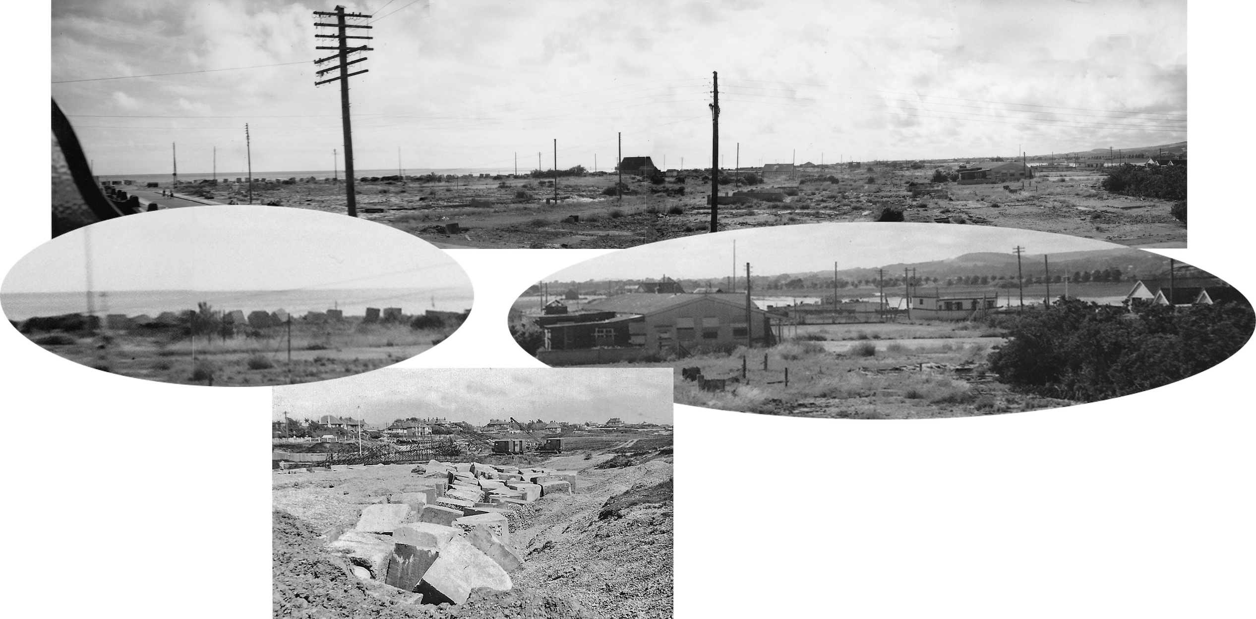
An interesting panorama of four photos sent to us by Chris Mead. Taken by his father in 1946 from one of the flats above the shops in Ferry Road it looks out westwards across a barren landscape following the wartime clearance of most of the bungalows. Amongst those that survived were West and East House(s) on the extreme right. Just beyond the old sports club are two house boats, the one on the right is Skylark and to the left of it is what looks like an MTB that to me is very similar to one that survived until recent years – perhaps someone remembers it’s name?
Why were the two bungalows in the centre of the view left untouched I wonder? The smaller one was named ‘Barge’ but the larger doesn’t appear to have been named and is just noted as No. 81 on the BT Properties list.
Lastly, along the shore can be seen the anti-tank blocks that were removed a few years later – the lower photo of blocks at Lancing gives an idea of them closer up.