
Nelson writes:
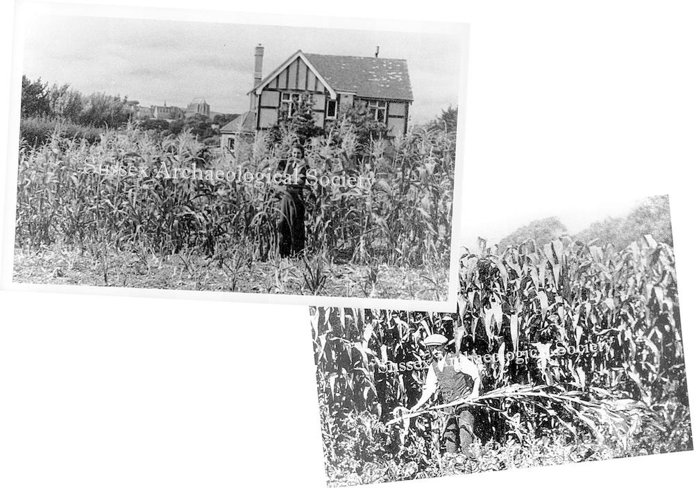
In the Sussex Archaeological Society’s Bob Hill Collection there are these two photos. One is of a mock-tudor house fronting on to a field(?) of maize and Lancing College in the background but there is no description. The other is of a man cropping maize in a field that the accompanying notes say was on the north side of Upper Shoreham Road between what is now Downsway and Buckingham Avenue.
Were both photos taken in close proximity to each other? Where is that house now?
Peter Beatle and Linda English came up with accurate suggestions as to the location (The Street) which we can illustrate from other photos in our collections. It also seems from the 1933 map that the strip down to the road was split in half, still being cultivated and explains why the maize is shown in front of the house!
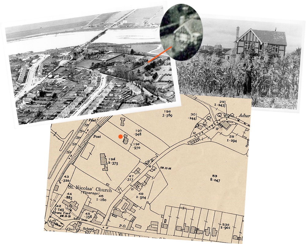
Interesting photo. I can also see part of the Rawlings family home (‘Lesser Foxholes’ ) and its grounds to the right of ‘Mystery house’. And on The Street are the houses my grandfather helped build (including Cherrydene) when they still had elm trees in front of them. I used to sit on the tree stump outside Cherrydene as a kid. Dutch elm disease had caused the trees to be cut down but that stump was there for decades afterwards.