Shoreham’s Tidemills

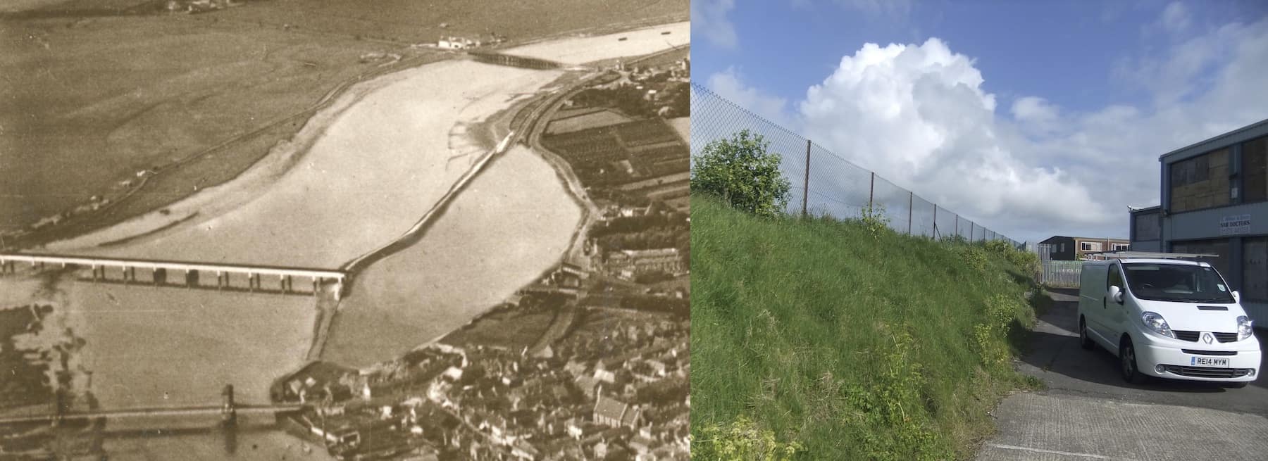
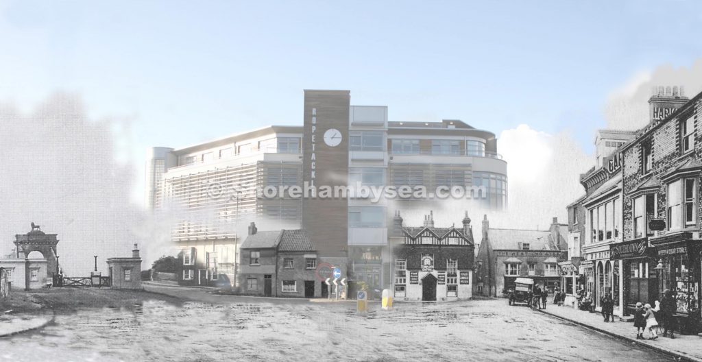
Back in the 1780’s today’s river bank at Ropetackle was thrown up to reclaim land and reduce flooding. In 1813 though the enterprising owner of the land between the bank and the Old Shoreham Road filled it up again by breaking through the bank at the southern end to allow tidal ingress and egress then offered it for sale as a tidemill. The mill pond is recorded in Clegram’s map of 1815 but after the railway came through only the lower half  seems to have survived as a tidal pond into the 1870’s but there is no record of an actual tidemill to utilise the flow ever being constructed.
This photo-shopped aerial photo with the railway viaduct removed gives a good idea of the original size of the pond which together with the photo of the height of the bank/depth of the water gives an indication of the considerable volume of water it would have held.

Kingston Eqypt

These three buildings look to have been of the right age to have existed at the time of the naming of the area ‘Egypt’ (after the Battle of the Nile 1798). It was awful to see them demolished but whenever we drove through it the huge warehouses there made it feel like passing through a deep and gloomy chasm. The Inn had it’s view to the south completely blocked and seemed always in shadow – I always wondered how on earth they managed to survive financially. 

East Street c1900

A somewhat different East Street circa 1900 with Eade’s Store where Toast by the Coast is now and next door George Hedgecock’s shoe shop (nowTeddy’s).
Lower photo from the Hedgecock Collection on this website

Swan Inn, Church Cottage in the twitten

How many of Shoreham’s old houses used to look – it’s previous use as an inn is alluded to in the 1782 Survey where it is noted as the ‘sign of the swan.’ At some time in its life it also seems to have been named ‘Church Cottage.’ The first time that name appears at the twitten addresses is in 1890 when both the house and the small westerly extension were shown as ‘Church Cottages’ but not in the singular until 1917.
Congratulations to the owners for revealing this lovely old sign!

Continue reading “Swan Inn, Church Cottage in the twitten”

King’s Head – High Street

Still finding previously unnoticed discoveries in photos we’ve known for years. We’re told that the King’s Head was Georgian in the main and even mediaeval at heart – you had to step down from the street into the main bar, often a sign of a building’s antiquity. It had it’s three gables added in the 1890’s and this is the first time I’ve noticed a photo (taken after the snow storm of 1881) providing a hint of how it looked before. Perhaps a photo of the complete building will turn up one day.
Kings Head 1967 ©`Anders Lundquist
The West End and what replaced the Kings Head. Montage by ©Roger Bateman

White Lion Street

Often missed on the 1872 map is the name ‘White Lion Street’ in the place of West Street. It was renamed as such, for a short while at least, due to the influence of the landlord of the White Lion Inn. We only have a vague aerial shot and an acute angle view of the Inn but this computerised reproduction gives more of an idea of how it looked.

Dilkusha bungalow and storm damage 1913

Continual searches through our collections over the years do lead to some images sticking in the memory and these are three of them. At the top is the well known postcard of Dilkusha bungalow and below it a view from the beach-side of the storm damage (1913 I think) to it and its neighbours, then another from the Widewater side.

History under a car park

A little known story is  about the demolition of the lovely old cottages in Middle Street that were replaced by today’s car park. Why just those in between other similar cottages in the street? It seems the whole row  were considered then to be unfit for human habitation and, true or not, one of the criteria was said to be a lack of natural light (which of course many old buildings do suffer from). During the inspection of those in Middle Street the  council official responsible for approving the demolishing had reached the cottages beyond today’s car park and, when asked if she needed the light on to be able to see, replied she could see perfectly well. In doing so she could not then condemn it and that, I am told, is why the rest survived.

Map from 1360

I’m fascinated by mediaeval history particularly concerning our area. Don’t know how long this resource has been on line but it provides a revealing glimpse of the places in c.1360 considered then to be more important. I’ve added the present day names and surprisingly (for me) it includes places like Stopham and Chiddingfold – Selsey at that time was an island! Shoreham is portrayed as quite a dominant town which of course it was then due to its shipbuilding industry but strangely the River Adur is not included. What it lacks in detail and proportion it makes up for by magically taking us back to a Tolkein-like middle earth seven hundred years ago (see the complete map shape of the British Isles) – an amazing feat for those times.
Well worth a visit – http://www.goughmap.org/map/

Details hidden in photographs

Dating photos can often be difficult but sometimes there’s a clue that makes it easy. This photo of the High Street has a poster for a film on the side of one of the buildings that was released in 1921.
(enlargement and increased contrast of the poster since added to make it all readable)