Bungalow Town residents Helen Larman & Arthur Godfrey talk about their experiences.

The history portal for Shoreham-by-Sea, Sussex, England
Bungalow Town residents Helen Larman & Arthur Godfrey talk about their experiences.
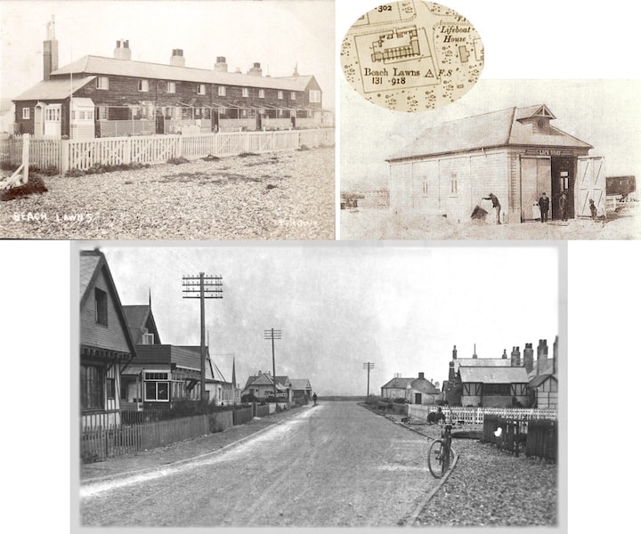
The old Blockade /Coastguard cottages and the lifeboat house stood on the beach at the junction of Beach Road with Ferry Road. The postcard (below) from Howard Porter shows a very unusual rear aspect of it on the right with the lifeboat house just beyond it.
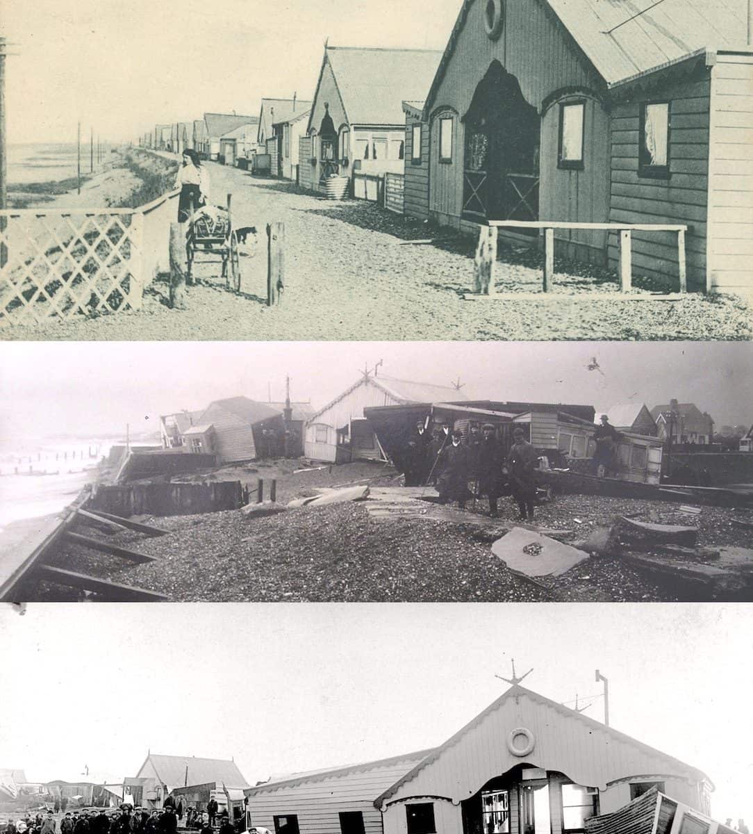
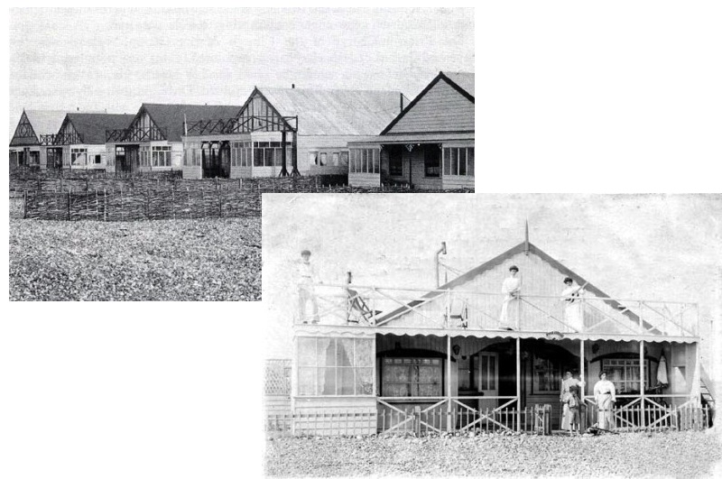
Continual searches through our collections over the years do lead to some images sticking in the memory and these are three of them. At the top is the well known postcard of Dilkusha bungalow and below it a view from the beach-side of the storm damage (1913 I think) to it and its neighbours, then another from the Widewater side.
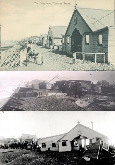
A successful bid for a set of 1913 storm-damaged bungalows on the beach provided a bit of a challenge as none of the bungalows in them were identified. An extensive trawl through our collections eventually matched them all and even managed to identify a long standing mystery bungalow that by coincidence stood close by!
You’ll see what we mean:- http://www.shorehambysea.com/catty-brown-and-framnaes/
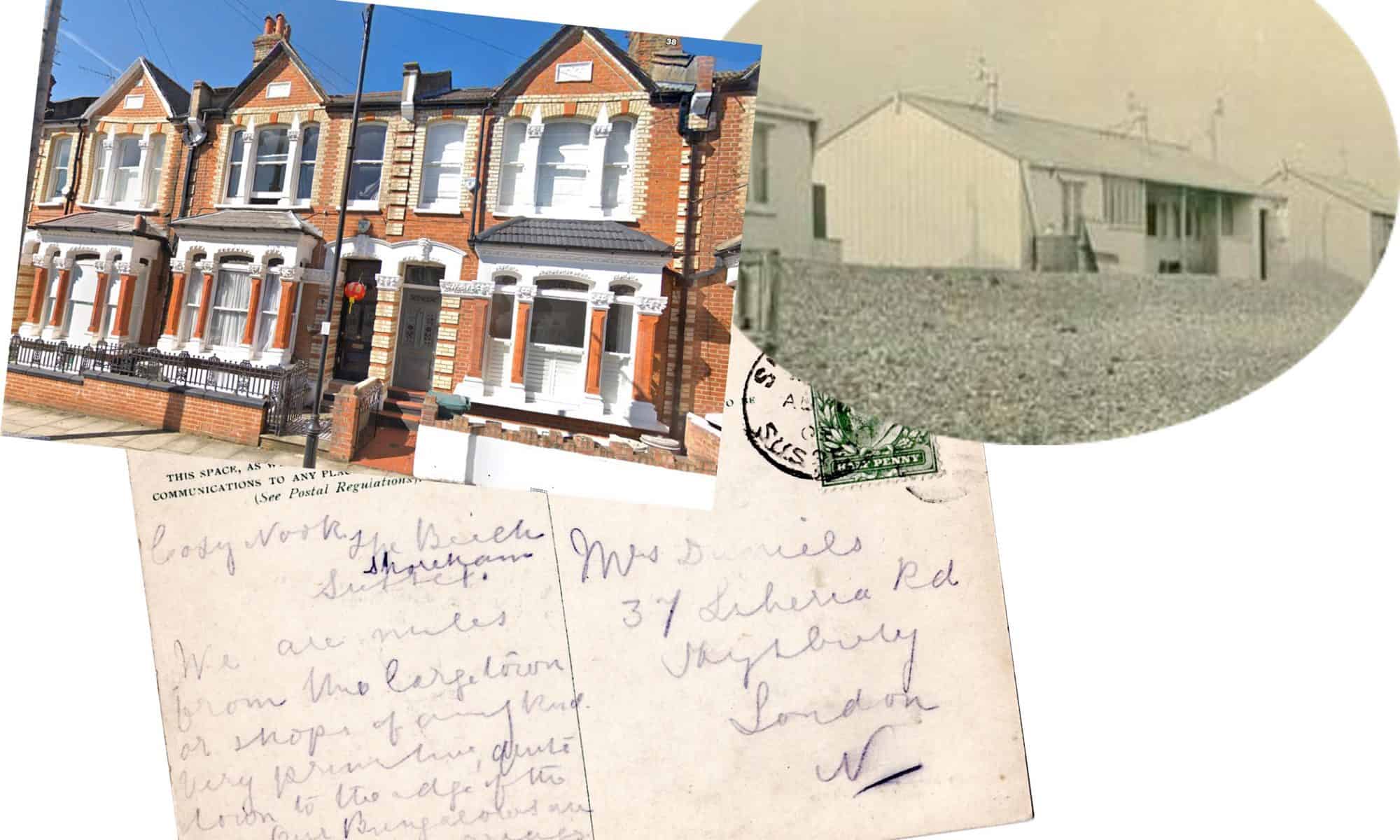
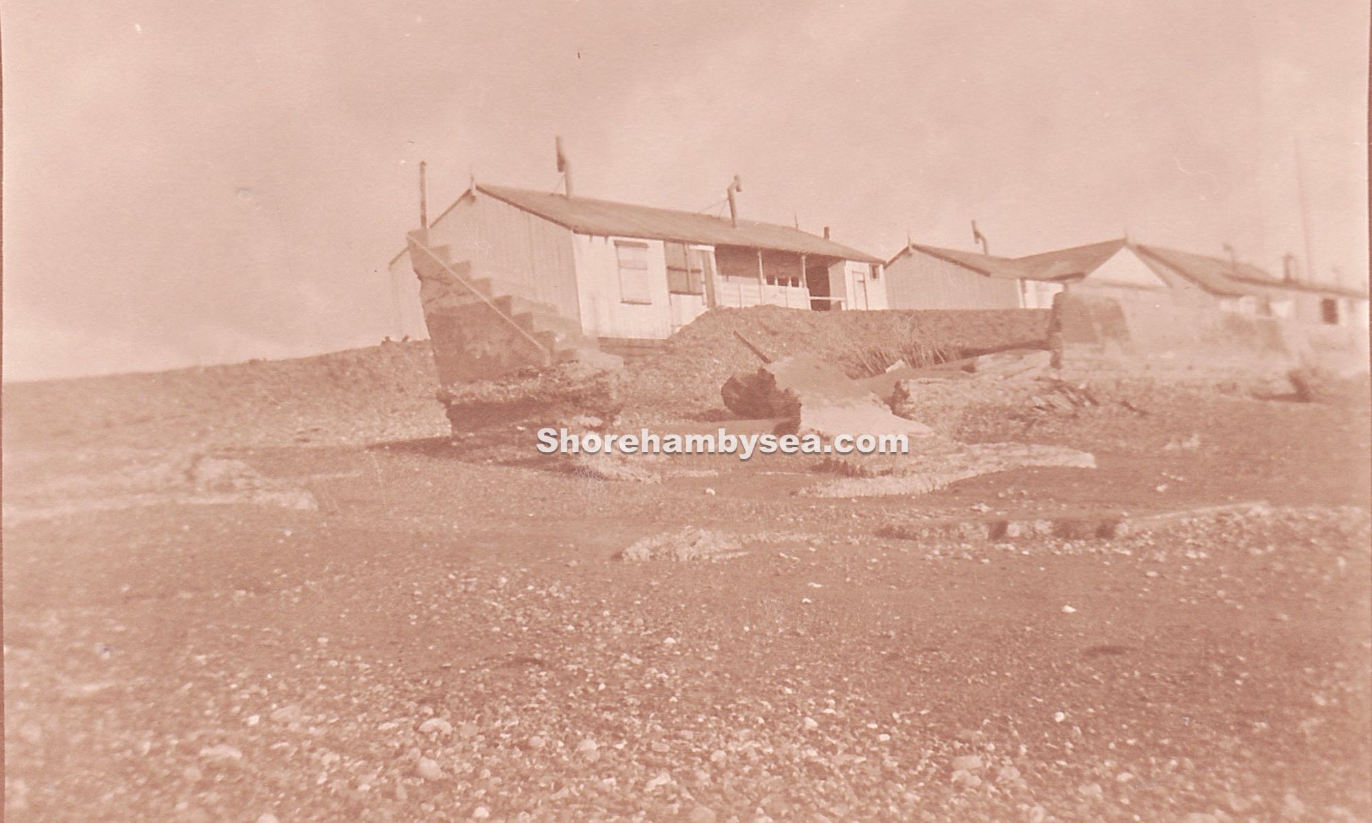
A bit of a coincidence this – looking through some of our collections and found a postcard from a Nelly Bayle to Mrs Daniels in Highbury. Nelly was staying at Cosy Nook in August of 1908, one of the bungalows that was damaged in the 1913 storm described in the earlier Catty Norman article and gives us a different take on the accommodation compared to the glowing compliments usually seen in postcards home. The lady doesn’t seem too impressed with Cosy Nook nor it’s ‘old carriages’ and you have to admit it did look quite plain. For her it was miles from anywhere and located as it was near the centre of Widewater beach I suppose it would have been a fairly long walk to a sufficient number of shops at Shoreham town or Worthing the other way. She thought it ‘very primitive and quite down to the edge of the sea’ – something of a prophetic remark bearing in mind the subsequent storms.
37, Liberia Road was part of quite an attractive neighbourhood so perhaps Nelly was used to better things but of course she may not necessarily have lived there………. servant or companion perhaps? you could go on forever wondering couldn’t you!
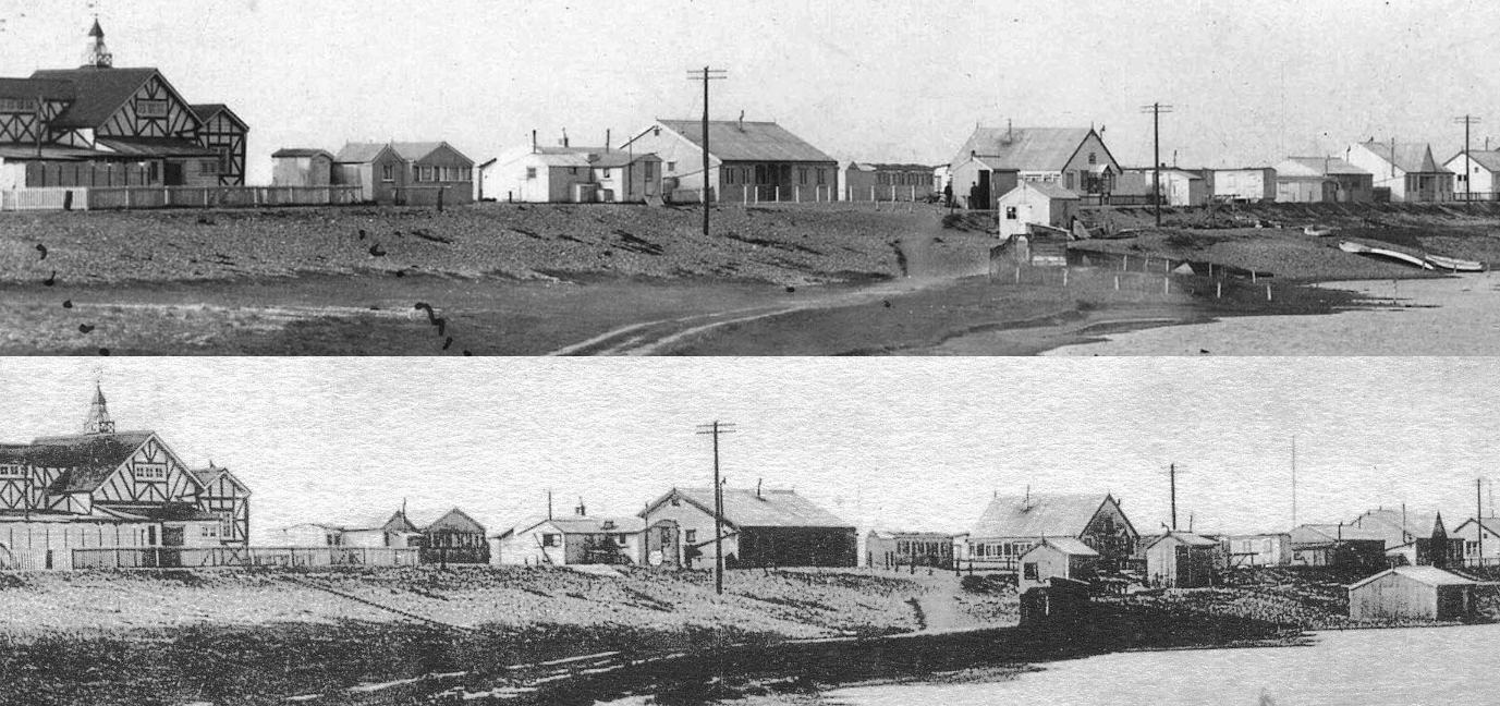
I’d always thought these two photos were identical (apart from the quality) until I looked more closely. There can’t be more than a few weeks/months difference between the two.
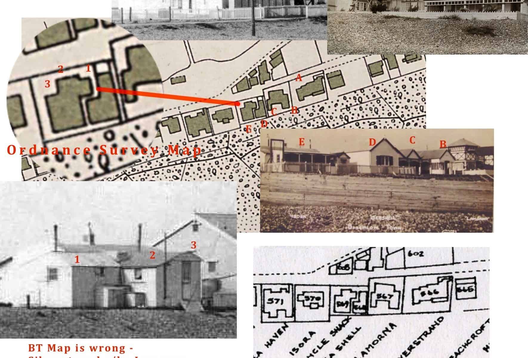
Not of much interest to many perhaps but this cautionary note is for those researching Bungalow Town property locations:-
For many years now it has been known that the 1930’s Bungalow Town property map (in Shoreham Library and on this website) to be unclear in places as regards the rather indistinct way some of the bungalow names are noted against the property footprints. Nevertheless the map remains a good indication of where most of the bungalows were, in fact many have been proved correct through old photographs (e.g., name signs on the walls of the buildings etc.,).
One glaringly obvious inaccuracy though has to be the misnaming of the well known ‘La Morna’ (1) as ‘Silverstrand.’ The attached illustration footprint of property number 566 clearly matches ‘La Morna’ as do the features indicated in the photographs of the neighbouring properties. Obviously this has the effect of shunting the order of names on by one but due to the indistinct labelling the names that appear on the map some properties later continue to match correctly against proven bungalow locations.
(1) A high resolution copy of the ‘La Morna’ photo shows a lifebelt on the wall with the building’s name on it.
(2) The property map is here http://www.shorehambysea.com/bungalow-town-property-map-1935/
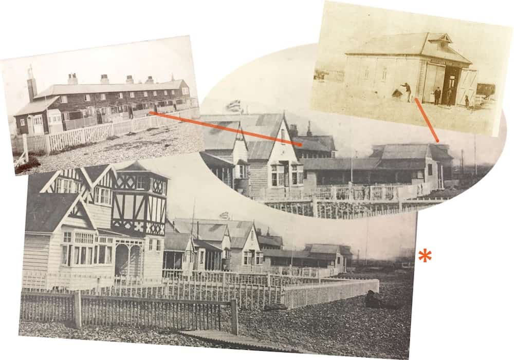
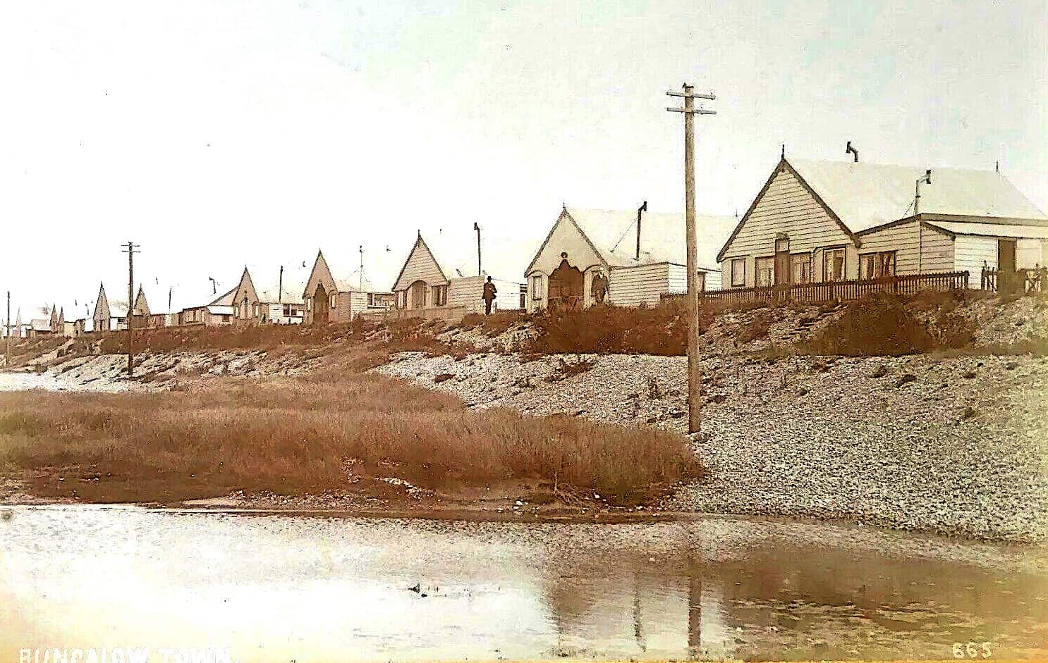
A postcard that shows a fairly usual view west of the beach end of Ferry Road but one that unusually includes the old lifeboat house that stood there next to the coastguard cottages up to the 1920’s. On the extreme right of the card marked by the asterisk more bungalows nearer to the sea are just visible that were built after 1912 and narrows the probable date of the card.
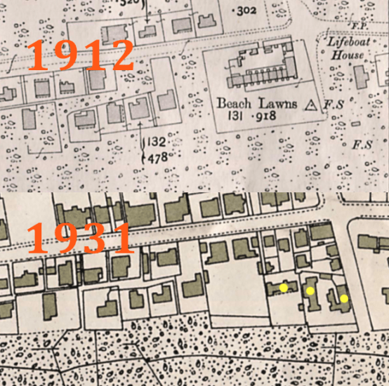 The Ordnance Survey map of 1912 doesn’t show any buildings nearer the sea but obviously there must have been. Another example of even OS maps not being as accurate as you would think.
(The bungalows in question are marked in yellow)
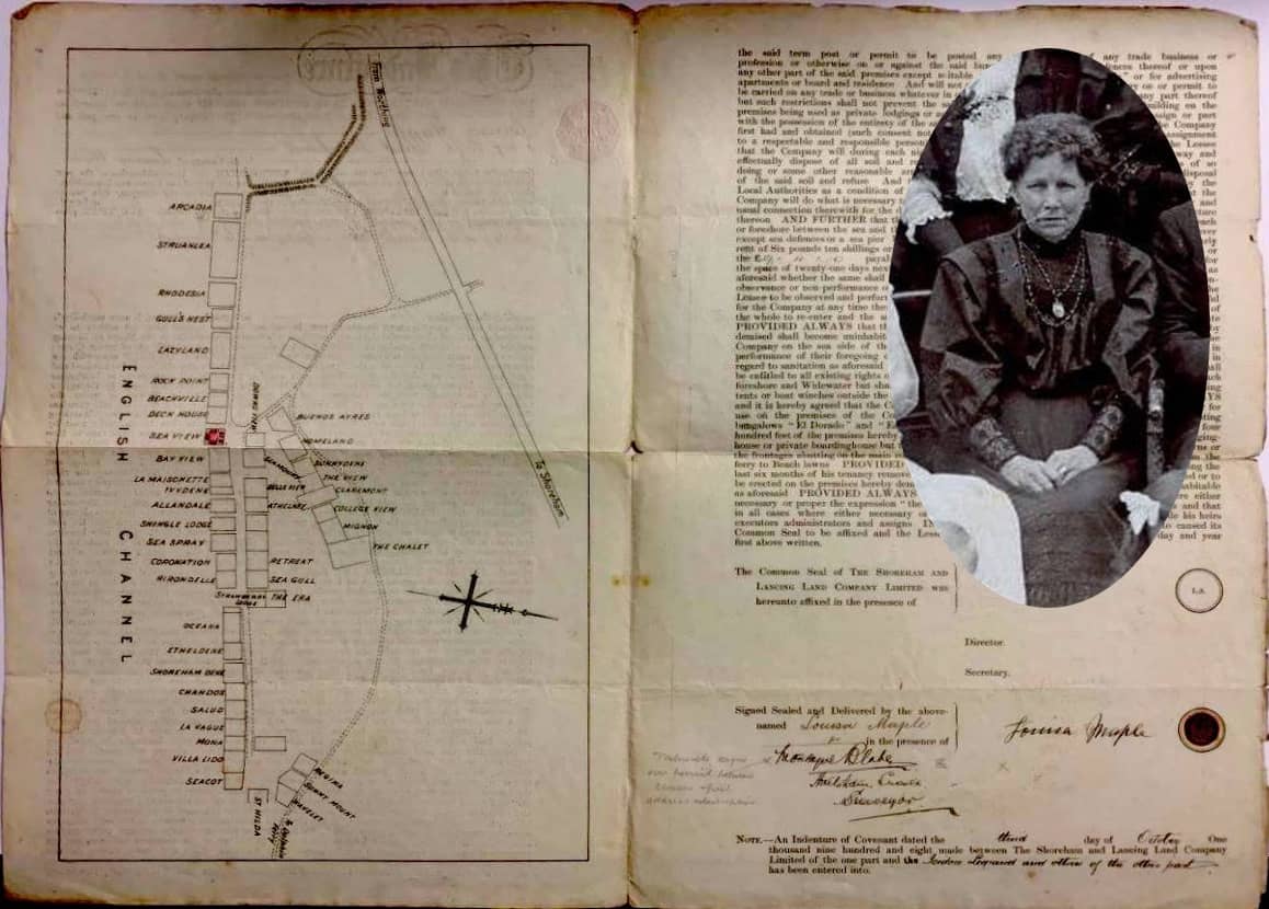
Interesting extract on e-bay from the 1908 deeds of Sea View owned by the Maple family. They sold their fish and oysters from their shop at the west end of the High Street – more here http://www.shorehambysea.com/a-fishermans-tale-the-maple-family/
Detailed plans like this of Sea View and surrounding bungalows are invaluable for confirming location and names at a specific time, particularly as the names were often changed. Inset is Louisa Maple, who signed the document, matriarch of the family at the time – husband Samuel had died just a few years earlier.