
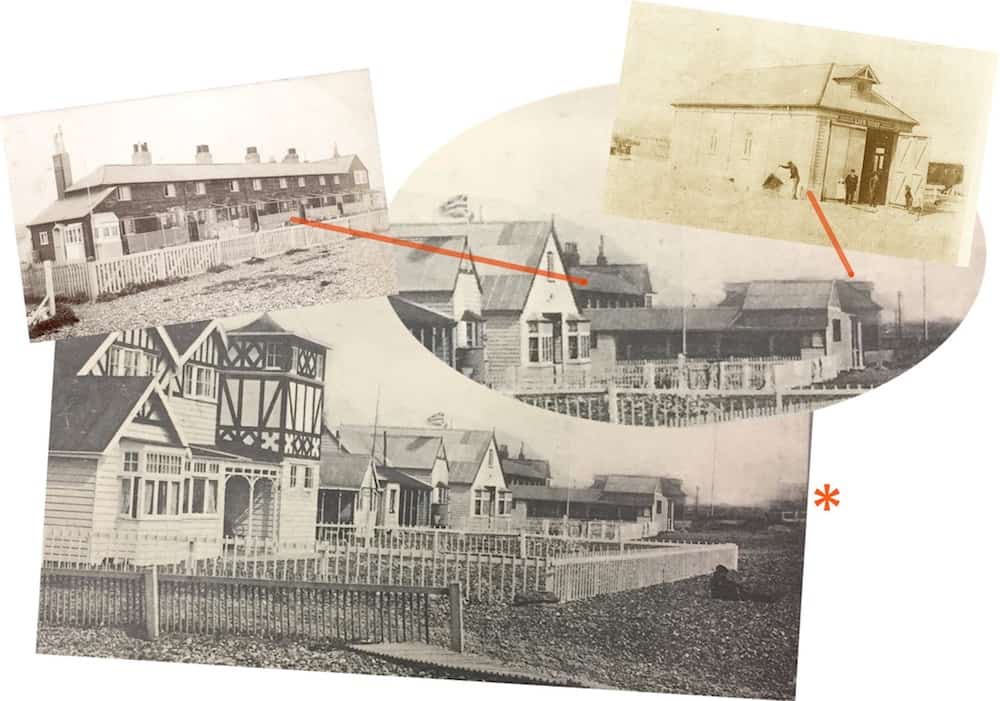
A postcard that shows a fairly usual view west of the beach end of Ferry Road but one that unusually includes the old lifeboat house that stood there next to the coastguard cottages up to the 1920’s. On the extreme right of the card marked by the asterisk more bungalows nearer to the sea are just visible that were built after 1912 and narrows the probable date of the card.
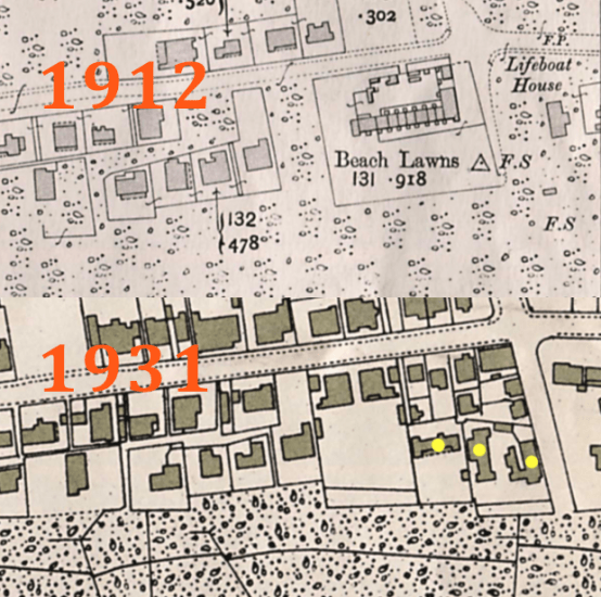 The Ordnance Survey map of 1912 doesn’t show any buildings nearer the sea but obviously there must have been. Another example of even OS maps not being as accurate as you would think.
(The bungalows in question are marked in yellow)