No, not a Christmas card but a copy of a group of Shoreham panoramas over the centuries that we put together before the latest footbridge was built – all it needs now is for some kind soul to take a ‘today’ photo from the top of Pacific Court to update it.
Coastguard Cottages Southwick
Our local Coastguard Service was originally located in the cottages on the beach at the end of Ferry Road but by the early 1900’s were relocated to Kingston then soon after to purpose built accommodation at Southwick. Sad to say the view of them there is now obscured by later buildings incredibly permitted to be erected in front of all of them except for the Chief Officer’s house that fronts on to the main road.
This photo of the cottages as they once appeared is a composite produced jointly with Neil De Ville.

Panoramas of Shoreham
– Albion Place looking east to The Duke of Wellington and Tarmount beyond
– The town from the church tower circa 1920. Due to it’s size this has to be a much reduced copy and as yet is not totally finished.
(click on the image to enlarge it )
Ham Road
East Street c1900
A somewhat different East Street circa 1900 with Eade’s Store where Toast by the Coast is now and next door George Hedgecock’s shoe shop (nowTeddy’s).
Lower photo from the Hedgecock Collection on this website
White Lion Inn
Often missed on the 1872 map is the name ‘White Lion Street’ in the place of West Street. It was renamed as such, for a short while at least, due to the influence of the landlord of the White Lion Inn. We only have a vague aerial shot and an acute angle view of the Inn but this computerised reproduction gives more of an idea of how it looked.
History under a car park
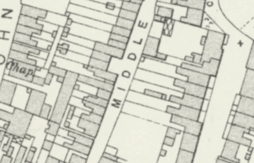
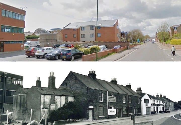
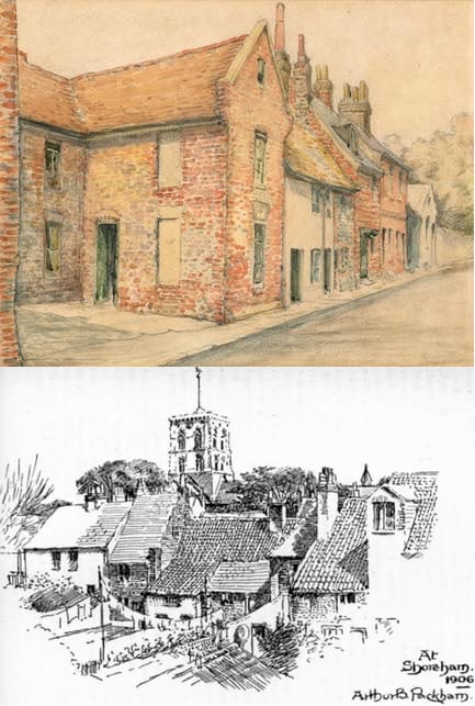
A little known story is about the demolition of the lovely old cottages in Middle Street that were replaced by today’s car park. Why just those in between other similar cottages in the street? It seems the whole row were considered then to be unfit for human habitation and, true or not, one of the criteria was said to be a lack of natural light (which of course many old buildings do suffer from). During the inspection of those in Middle Street the council official responsible for approving the demolishing had reached the cottages beyond today’s car park and, when asked if she needed the light on to be able to see, replied she could see perfectly well. In doing so she could not then condemn it and that, I am told, is why the rest survived.

High Street 10 years on
2009 was the first part of the High Street Photo project to record the shop fronts of every shop.
http://www.shorehambysea.com/street-photo-project/high-street/
Is the High Street a better place 10 years on? Anyone fancy doing the same for 2019?
As for 100 years ago, this then and now slider demonstrates the evolution of the West End.
Details in photos
Can’t see that this has been posted before but it’s a small part of a larger photo and one of my favourites for detail:-
Passer by exhaling smoke from his fag,
Impatient man in car (and, yes, it’s a Model T Ford) with noisy kids thinking ‘How much longer – is she buying the bloody place!’
Automobile Association bonnet badge (blimey, do you remember those!)
Lad with wheelbarrow imagining how pleased his Mum will be when he brings fresh horse manure for the garden back through the house.
Evidence of an itchy-bum outbreak in Shoreham (that’s lowered the tone a bit!)
Tracing photographs
From right to left, anti-clockwise:- A newspaper cutting of an otherwise anonymous group and Shoreham location has ‘Standen Family’ written on it. A check through our street directories shows the Standen Brothers at Southdown Nurseries in Mill Lane (where the greenhouses are in the aerial photograph). A 1950’s parade of Morris dancers provides a closer view of the nursery just beyond the lodge to the cemetery and lastly a view of the entrance and shop in the 1930’s.


