Speedy trip around Shoreham

Filmed in 2013 this video by Steve Edwards was inspired by a similar amateur film made by Paul Plumb 50 years earlier in 1962 – titled A River Runs Through Our Town.

2013 video made by Steve Edwards

That whole original 1962 film is not available as unfortunately an error in the Screen Archive South East seems to have clipped the original 90 minutes short by 18 minutes. However there is a recent copy of the clip ( at 9m18s) pasted below (ignore the non-original captions and music):

Copy clip of the 1962 film

Old Fort Road from the air

Widewater in 1913

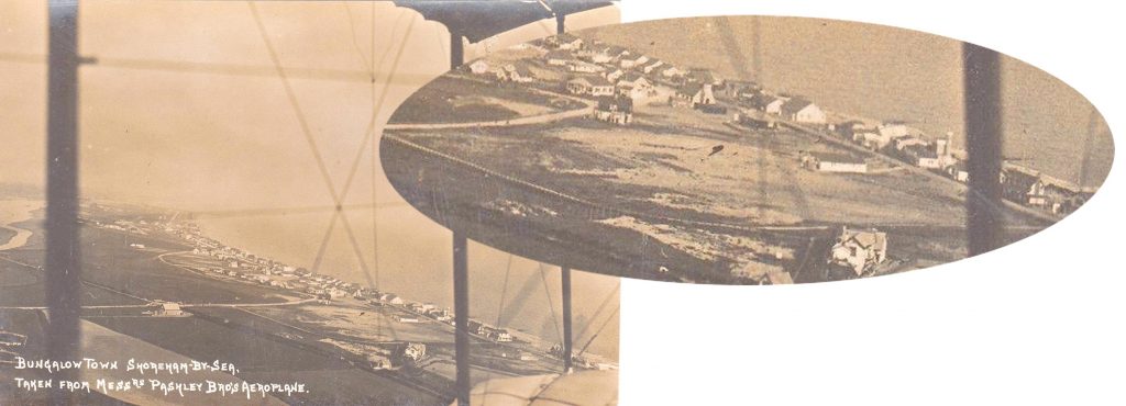
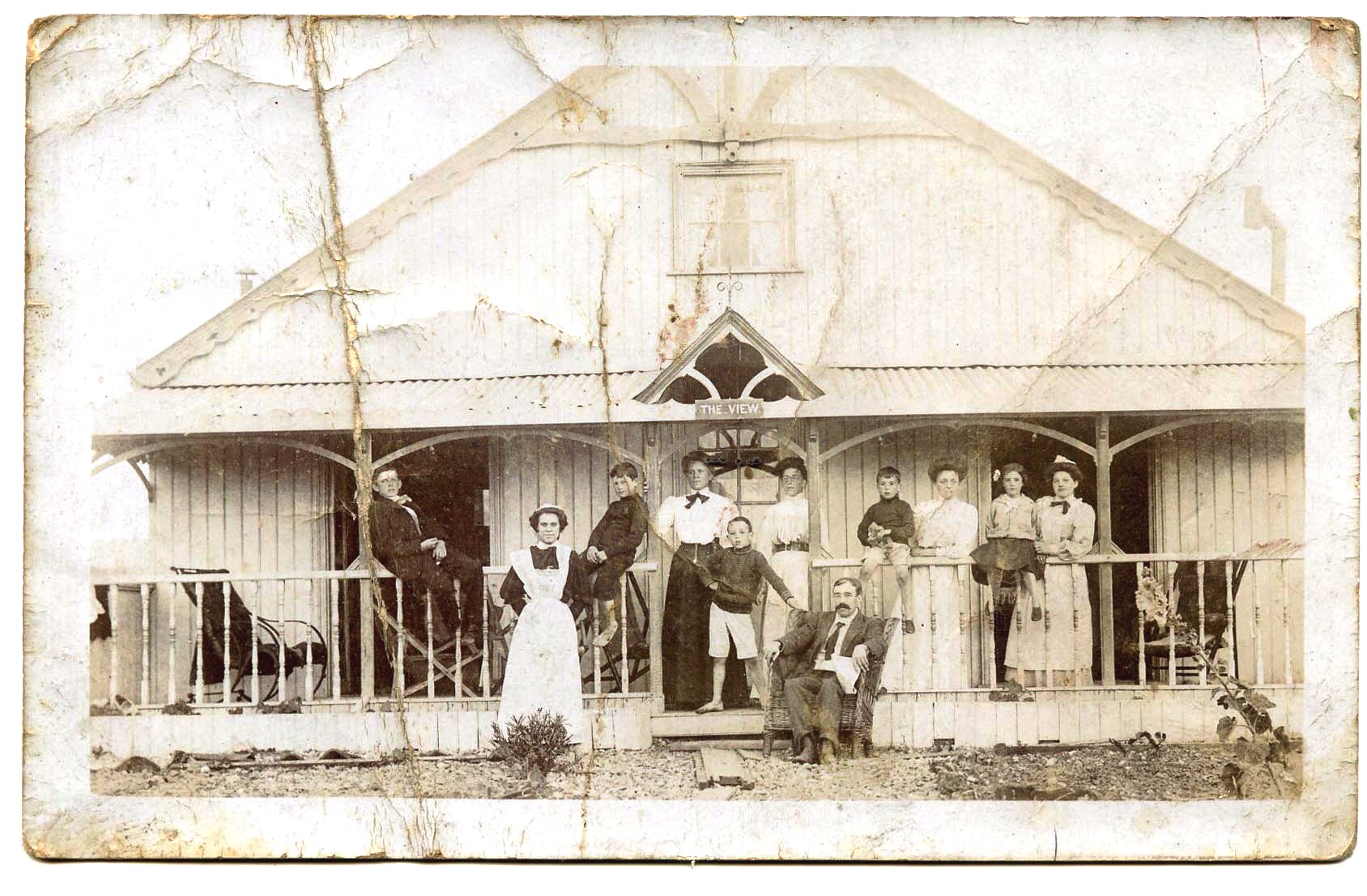
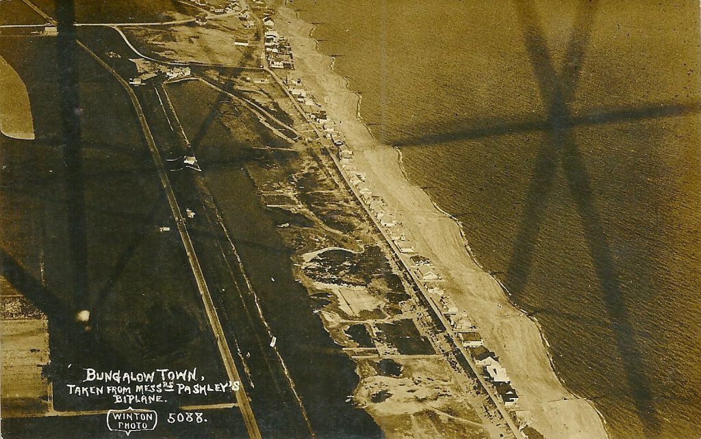
The Old Fort wasn’t considered old in 1913 – so much so that the beach road to the new bungalows was called Fort Road. The shingle spit of land in 1896 was still correctly titled Lancing Beach but by 1909 the maps showed it as Shoreham Beach. Perhaps the later title of Bungalow Town was to placate both factions… until the question of the airport name was mentioned!

Inset: Good Shepherd Church ©Doris Steers Collection
OS Maps 1896 & 1909

Kissing Tree Gate

This delightful photograph that is pre-1915 is of the twitten alleyway and gate at the junction of Southdown Road and Mill Lane. The field behind is Oxen Field – often used for town events and sports. The twitten was the route north to Little Buckingham, with a high flint wall on the boundary with the vicarage in Shoreham Court to the east.

History of Shoreham Street Names

by Gerry White

As a child I read that Wilmot Road had been named after Lord Wilmot a supporter of King Charles, and his son Prince Charles, who escaped to France, this could not have been done without the help from the Noble Lord.

I also found out that Lennox Road, was named after an earlier Member of Parliament, who had represented Shorcham. I had never before given much thought to the origin of Street names. Therefore I decided to make notes and to find out more about other streets in this ancient town.  I was not disappointed. 

Continue reading “History of Shoreham Street Names”

Middle Street

A little known story is  about the demolition of the lovely old cottages in Middle Street that were replaced by today’s car park. Why just those in between other similar cottages in the street? It seems the whole row  were considered then to be unfit for human habitation and, true or not, one of the criteria was said to be a lack of natural light (which of course many old buildings do suffer from). During the inspection of those in Middle Street the  council official responsible for approving the demolishing had reached the cottages beyond today’s car park and, when asked if she needed the light on to be able to see, replied she could see perfectly well. In doing so she could not then condemn it and that, I am told, is why the rest survived.

1914 & 2020 image from NLS and Bing. https://maps.nls.uk/geo/explore/side-by-side/#zoom=19.7&lat=50.83261&lon=-0.27595&layers=168&right=BingSat

Coronation street views

Lofty writes:
King George V was crowned in June 1911, and a grand street procession was organised which marched through the town. The two postcard views below show part of this.

In the first photo the procession is at the west end of Ham Road, just about to turn left into Brunswick Road. The second photo shows a different section of the procession which is heading westwards along the High Street.

Jack’s Bargain Store

The shop, formed part of Victoria Terrace, on Victoria Road It was next to Jock Hamiltons Garage, and faced the Ritz Cinema, which is now demolished, and replaced by the RopeTackle development . Jacks Bargain stores extended it’s trading space by setting several tables, out side onto the pavement. The tables, were covered with numerous boxes, of all manner of used domestic utensils, rusty meat mincers, lay alongside an old cribbage board, or some well worn eating knives and forks.

Continue reading “Jack’s Bargain Store”