
A fascinating response to our article on Southwick’s Indian Temple https://www.shorehambysea.com/southwicks-indian-temple/ from Miranda Bowen nee Sweet who lived there in the 1960’s and well worth including here:-
‘My family moved into Ivy lodge in 1955 and I lived there until my marriage in 1967. My Mother and Father continued living there for several years afterwards. I remember digging up colourful mosaic tiles from the back garden and was told that these must have belonged to the remains of the foundations of the Indian Temple. There was an eau-de-Cologne fountain under the floor boards of the ‘long room’ in Ivy Lodge. This was circular and also mosaic with Eastern influences. The reservoir was still in the cellar when we lived there. The present owners who bought the house from us may or may not know of its existence.
Ivy Lodge was haunted by several notables. An elderly gentleman, a little girl and half a cat. (The tail end). Other apparitions were seen or felt by my family and we became quite used to them. It all made for a colourful childhood. MB’
Did you know? – part 9
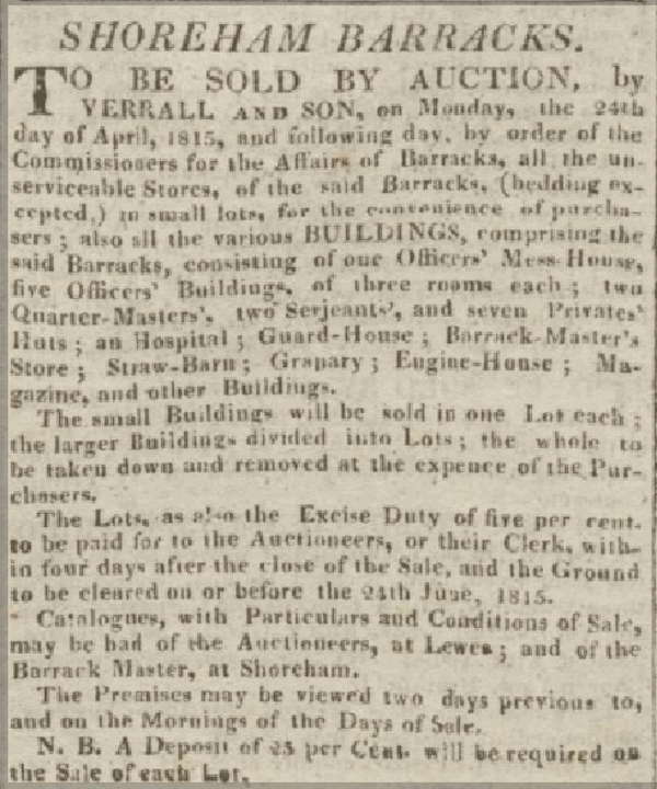
Did you know….. that during the Napoleonic invasion scares Shoreham’s largest barracks was between Southdown Road and Ravens Road consisting of an Officer’s Mess House, five Officers’ Buildings of three rooms each; two Quarter-Masters’, two Sergeants’ and seven Privates’ Huts; an Hospital; Guard House; Barrack Master’s Store; Straw Barn; Granary; Engine House; Magazine and other Buildings.
Did you know? – part 8
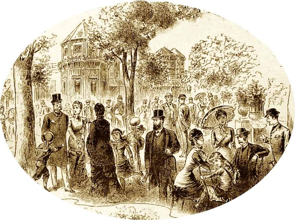
….. that Shoreham’s Swiss Gardens was once a famous and well attended attraction.The biggest attendances were achieved when societies, clubs and companies organized their annual functions there. The southern arm of the Manchester Unity of Oddfellows held their annual fetes at the gardens often amounting to 4,000 visitors (1852). In 1856 Messrs.Truman and Hanbury the owners of the London brewery, the largest in the world then, hired a complete train from the capital to Shoreham for their workers, their wives and sweethearts.
Did you know? – part 7
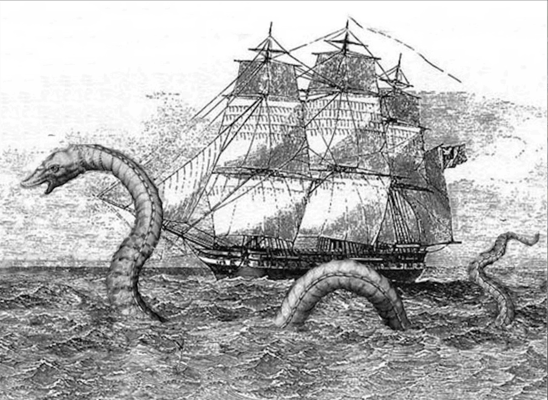
…. that in April of 1856 Captain Guy of the ‘Imogen’ arrived at Shoreham from a voyage that took them through the Azores where, he stated, he and his crew saw a large sea serpent – “The creature was in view for a full 35 minutes …. and had the same appearance that I have before seen represented in drawings but without the hairy mane and more like a large conger eel. It was a full forty feet long above water and from the wake it left I would say sixty feet would not be an exaggeration.”
Did you know? – part 6
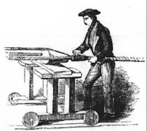
Did you know…. that the Tillstone family’s sail and ropemaking business during the 18th century stretched their ropes from West Street up to, and through Ropewalk. During their manufacture the ropes were stretched, twisted and tarred from the winding house and winches, up to the top of the Ropewalk where there were similar winches or capstans – for anyone working there or walking by the shouts of the workers, the creak of the winches, ringing signal bells and the pervading smell of tar must have left a strong impression on the senses.
(see https://www.shorehambysea.com/1400-2/ )
Did you know? -part 5
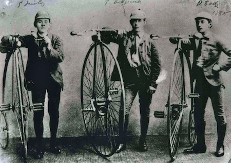
Did you know….. a penny farthing cycle race to Bramber Station and back on 10th July 1888 was won by Arthur Eade (of the Eade’s Stores family). This photo three years earlier shows three members of the newly formed Shoreham Cycling Club:- George Tinsley, a blacksmith; George Hedgecock who later ran a successful bootmakers/shoe shop in East Street; and Arthur Eade
Did you know? – part 4
… that Shoreham was supportive of the Parliamentarian cause during the Civil War and in the 1640’s was home to a strong defensive force of several hundred Cromwellian soldiers. The harbour and riverside were also fortified with cannon and troops and defences were also set up at Bramber (Beeding) Bridge (the nearest river crossing to the south). At the time of the siege of Arundel a skirmish with the Royalists took place at Bramber Bridge in January of 1644 resulting in the death of nine Royalists and the capture of another. One of the Parliamentarian dragoons was also killed and it seems that others may have later succumbed to their wounds as St.Mary’s parish records for that month shows Captain Dike, Captain Carleton and ‘six soldiers buried.’
Did you know? part 3
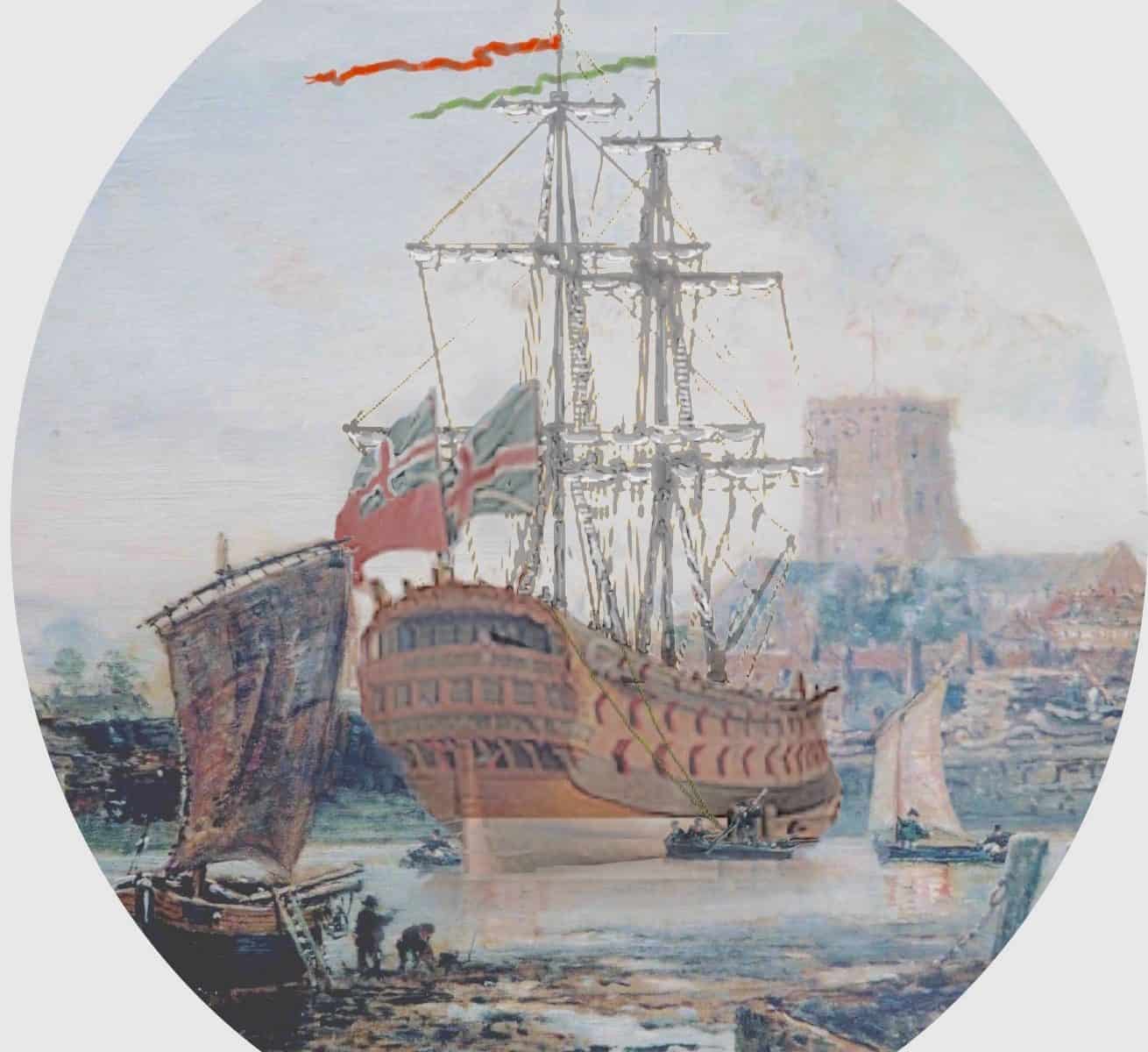
….. at 533 tons, length 104 feet and armed with 48 guns HMS Dover was probably the largest vessel built at Shoreham for the Royal Navy. Launched in 1653 she saw action at the Battle of Lowestoft 1665, the Four Days Battle and St. James Day Battle the following year, the Battle of Martinique 1667 and Battle of Solebay 1672. Her duties took her to the Mediterranean, Newfoundland and Ireland and during the 1690’s captured three French ships Lion Eveille, St. Antoine and Marianne as well as a privateer the Beaulieu.
Did you know? part 2
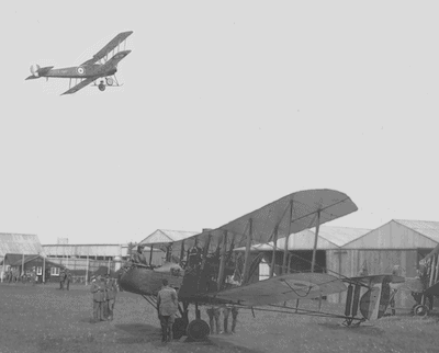
Did you know? – that Sir Oswald Moseley, 6th Baronet, leader of the pro-German British Union of Fascists, learned to fly with the Royal Flying Corps at Shoreham airport during WW1
Did you know? part 1
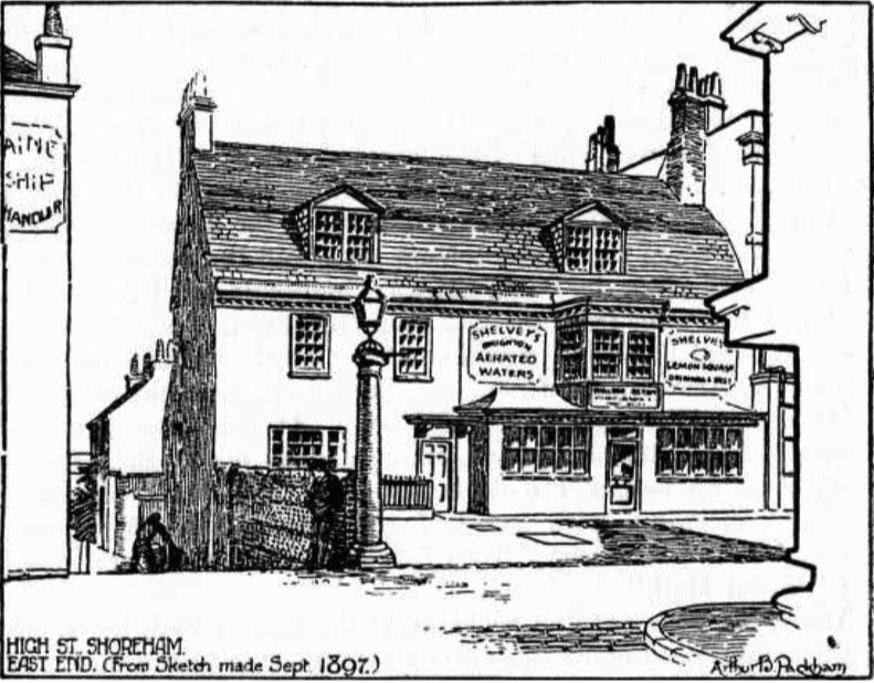
– that the ancient Parliamentary Stones that once stood in the road by Stone House (now the solicitors’ office next to Coronation Green) and the two surviving 18th century tuscan columns from the ten that once supported the 1711 Market House in the High Street were removed during the 1938 road widening. In 1983, Reg Leggett, a long standing crusader for the preservation of Shoreham’s architectural history wrote “When I last heard of them….. they were reposing in the Council yard in Ropetackle, and some of us in this town would like to see any missing or damaged sections of these columns (and stones) made good and that they be re-erected (as near to their original sites as is practical)…………….”
We are still waiting
Image: Arthur Packham’s drawing of the stones and the easternmost column in use as a lamp post