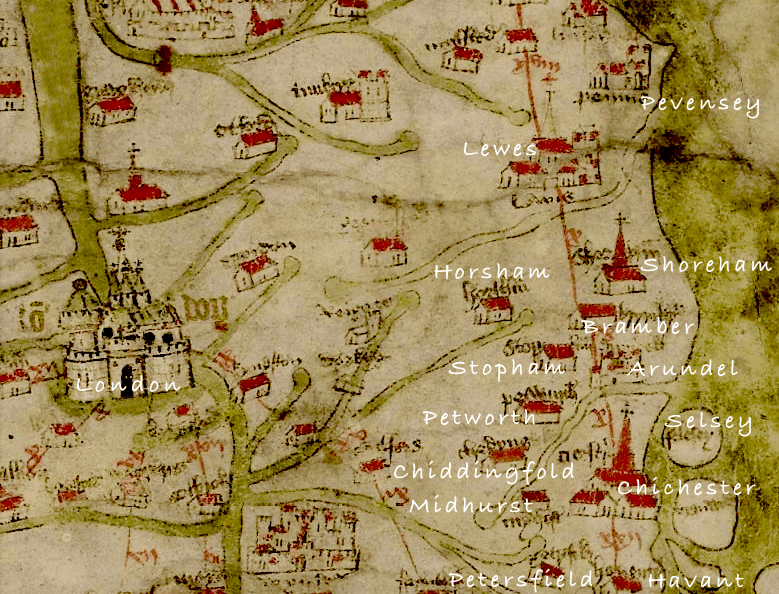
I’m fascinated by mediaeval history particularly concerning our area. Don’t know how long this resource has been on line but it provides a revealing glimpse of the places in c.1360 considered then to be more important. I’ve added the present day names and surprisingly (for me) it includes places like Stopham and Chiddingfold – Selsey at that time was an island! Shoreham is portrayed as quite a dominant town which of course it was then due to its shipbuilding industry but strangely the River Adur is not included. What it lacks in detail and proportion it makes up for by magically taking us back to a Tolkein-like middle earth seven hundred years ago (see the complete map shape of the British Isles) – an amazing feat for those times.
Well worth a visit – http://www.goughmap.org/map/
Map from 1360