Nelson writes:
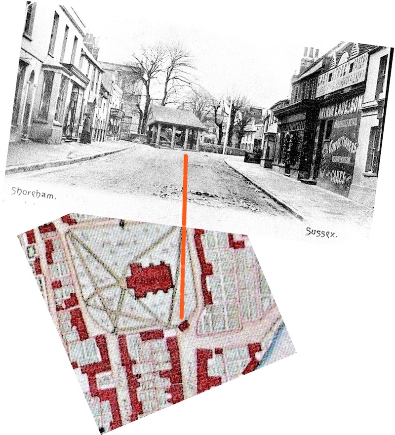
For a few years what remained of the High Street market house, a canopy on ten columns, was rebuilt in East Street in the 1820’s before being removed again….. the 1828 map is the only map that shows it’s footprint.

The history portal for Shoreham-by-Sea, Sussex, England
This blog contains articles and posts taken from the Shorehambysea.com Forum.
Nelson writes:
For a few years what remained of the High Street market house, a canopy on ten columns, was rebuilt in East Street in the 1820’s before being removed again….. the 1828 map is the only map that shows it’s footprint.
Nelson writes:
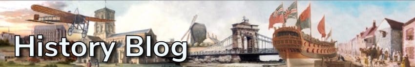
New discoveries are still turning up. This partly forgotten snapshot from the Winton family album turns out to be the Maple fishing family’s shack, later rebuilt to become Sea View on the beach near the church.
Most of those in the photo are friends or relations including the Winton and Hedgecock (East Street shoemakers) families. Of particular interest is 1 Arthur Maple who built a number of bungalows on the beach and later became Superintendant for the Sea Defence Commissioners at Shoreham. Arthur and his brother Alfred 2 played football for Shoreham during the club’s most successful years and Arthur excelled at rowing, just like his father Samuel 3 who had been a champion national sculler in his earlier years. As part of the fishing business the Maples also fished oysters in the years when they were plentiful and sold them from their shop next to the Kings Head in the High Street.
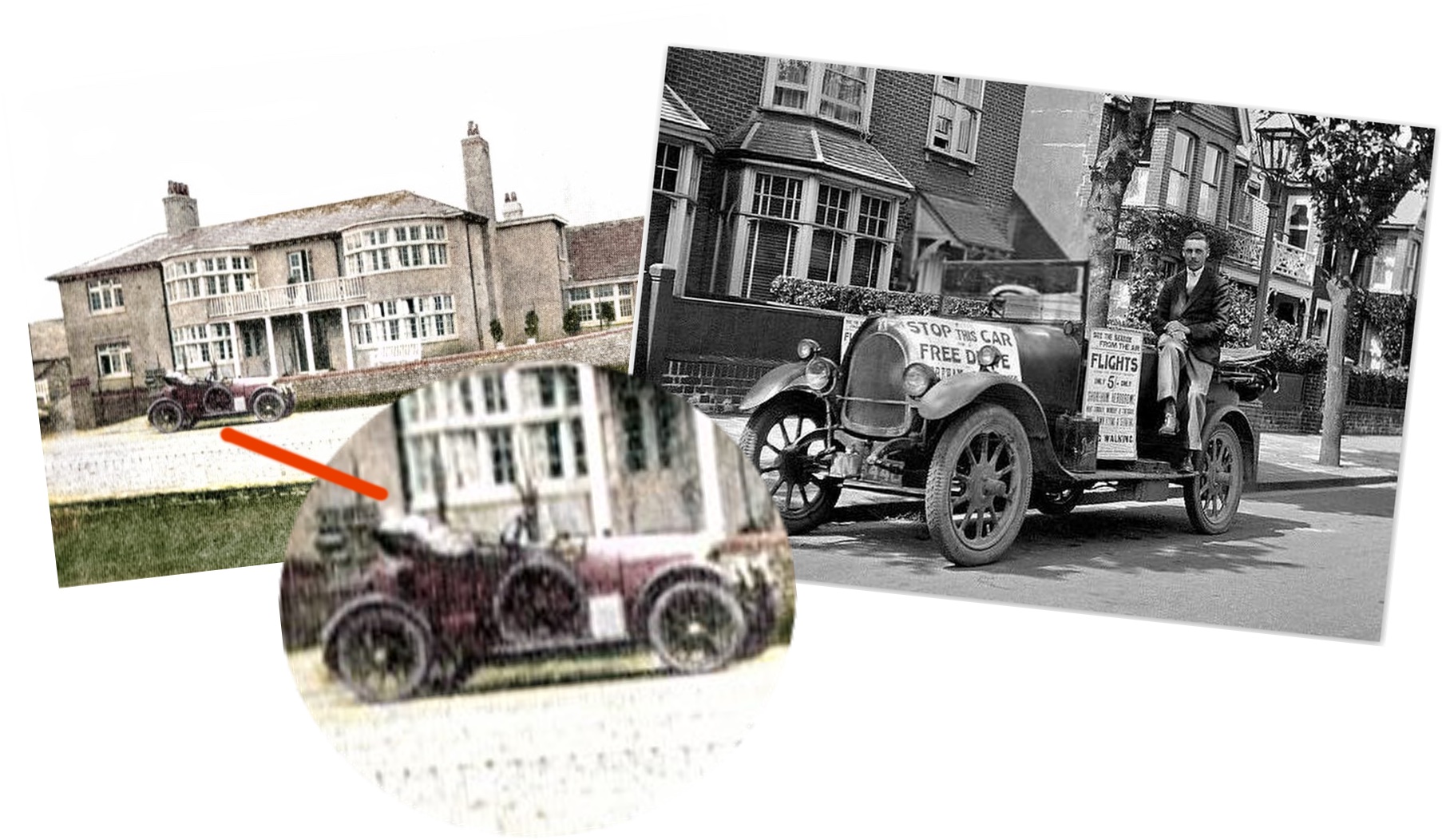
The old aero club at Salts Farm shows a car outside which reminded us of another photo of George Miles in the same car that he used to bring customers to the airport for flying trips with his brother Fred. In those days George lived in digs in Pembroke Avenue, Hove where he parked the car still decorated with the posters pasted on it. (Photos courtesy Neil De Ville)
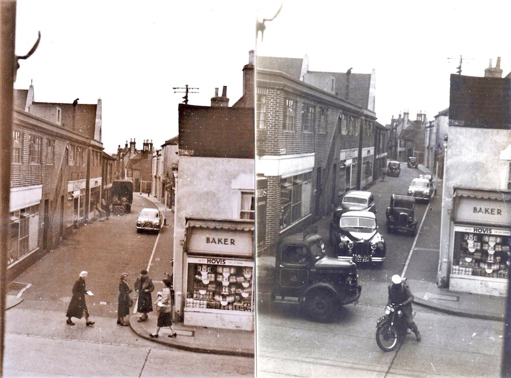
Only just realised recently that we have an almost identical photo to one advertised on e-bay some while ago. Here they both are – dated around the 1950’s when Haslett’s fish shop was in John Street and seemingly taken within a short time of each other.
Nelson writes:
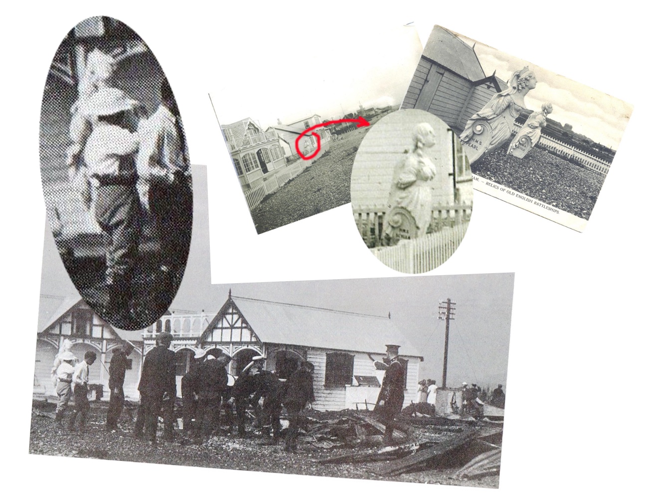
August 2020. The things we overlook. We often look back on old posts and in particular this one that we were fairly sure was of the Kittiwake bungalow fire. We’ve only just noticed another clue that helps confirm it. The Kittiwake owner had two ships’ figureheads (HMS Pearl and HMS Scylla) in the ‘garden’ but look what’s being rescued in the distance left – can’t be absolutely sure but looks very much like the Pearl figurehead!
Subsequent photos of the rebuilt Kittiwake show the Scylla figurehead in the front but no trace of Pearl unless that was round the back – did it go missing that day? Another thought is that those figureheads were solid wood yet seems not to be too heavy for that gentleman!
Nelson writes…
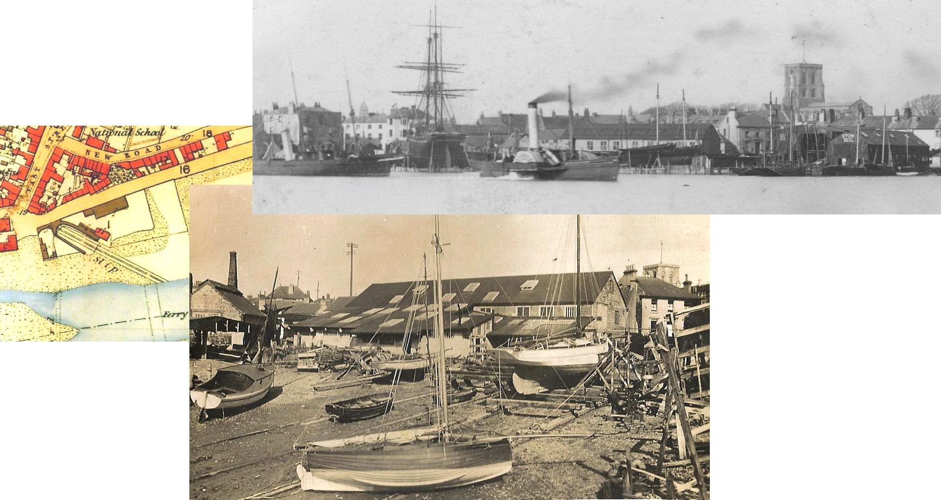
October 2021. Quietly disappearing without a murmur recently was what must have been the last survivor of the once many buildings associated with Shoreham’s ship building industry.
Originally workshops and offices for Dyer & Son’s yard from the 1860’s and later taken over by yachtbuilders Stow and Sons the building and moorings were eventually acquired by the Sussex Yacht Club. Pedestrian access on that side of the Brighton Road will now be enabled but another piece of Shoreham history is lost.
Nelson writes:
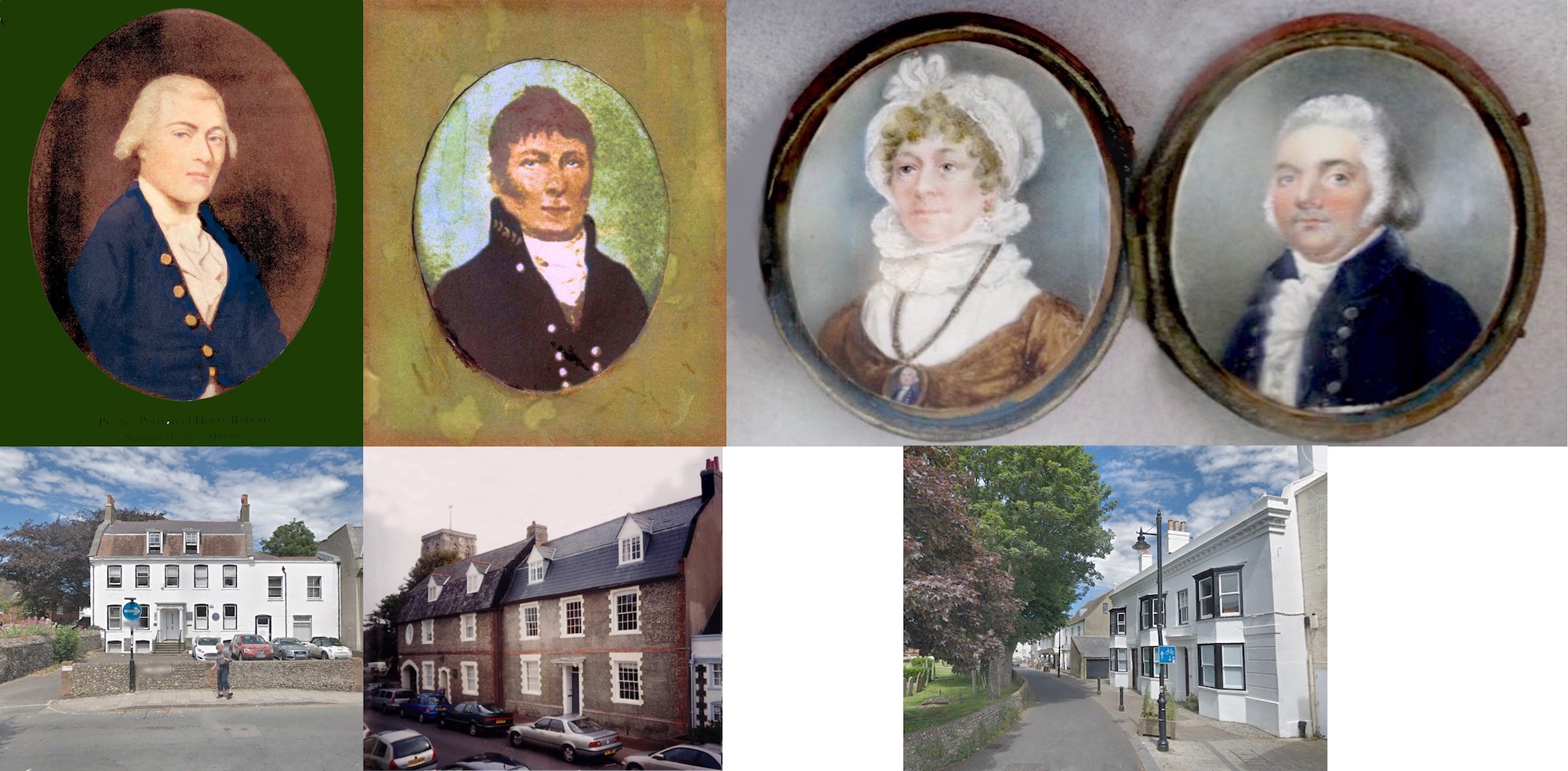
Images of 18th century Shoreham residents are few and far between but we do have these four:-
Henry Roberts, hydrographer who sailed with Captain Cook and mapped the Australian oceans. Henry lived initially in Church Street before moving to St.Mary’s House.
John Butler, another Church Street resident – he captained ‘The Hound’ customs cutter and his exploits are recorded in ‘Memories of a Shoreham Seafaring Family’ on this web site.
Elizabeth Hawkins, John Butler’s sister who married John Roberts Hawkins
John Roberts Hawkins, an earlier captain of ‘The Hound’ under whom John Butler initially served as first mate. Hawkins and his wife lived at Chantry House in East Street.
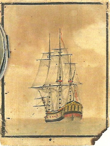
Lofty adds to the story: Apparently, Henry Roberts was a bit of an artist himself.
The image below is of a 4 x 3inch (10 x 7cm) drawing with watercolour highlights which has been attributed to him and was sold recently at auction. The drawing is of HMS Resolution at anchor, probably sketched off the coast of Tahiti between August 16th – 24th in 1773.
At the auction (April 2022) it realised £32,000 against a pre-sale estimate of £10,000 – 20,000.

Shorehambysea.com is featured in the upcoming Heritage Open Days – Friday, Saturday and Sunday 14th-16th. A few of our videos will be featured as a celebration of the historical assets of the town.
The featured videos can be seen below:
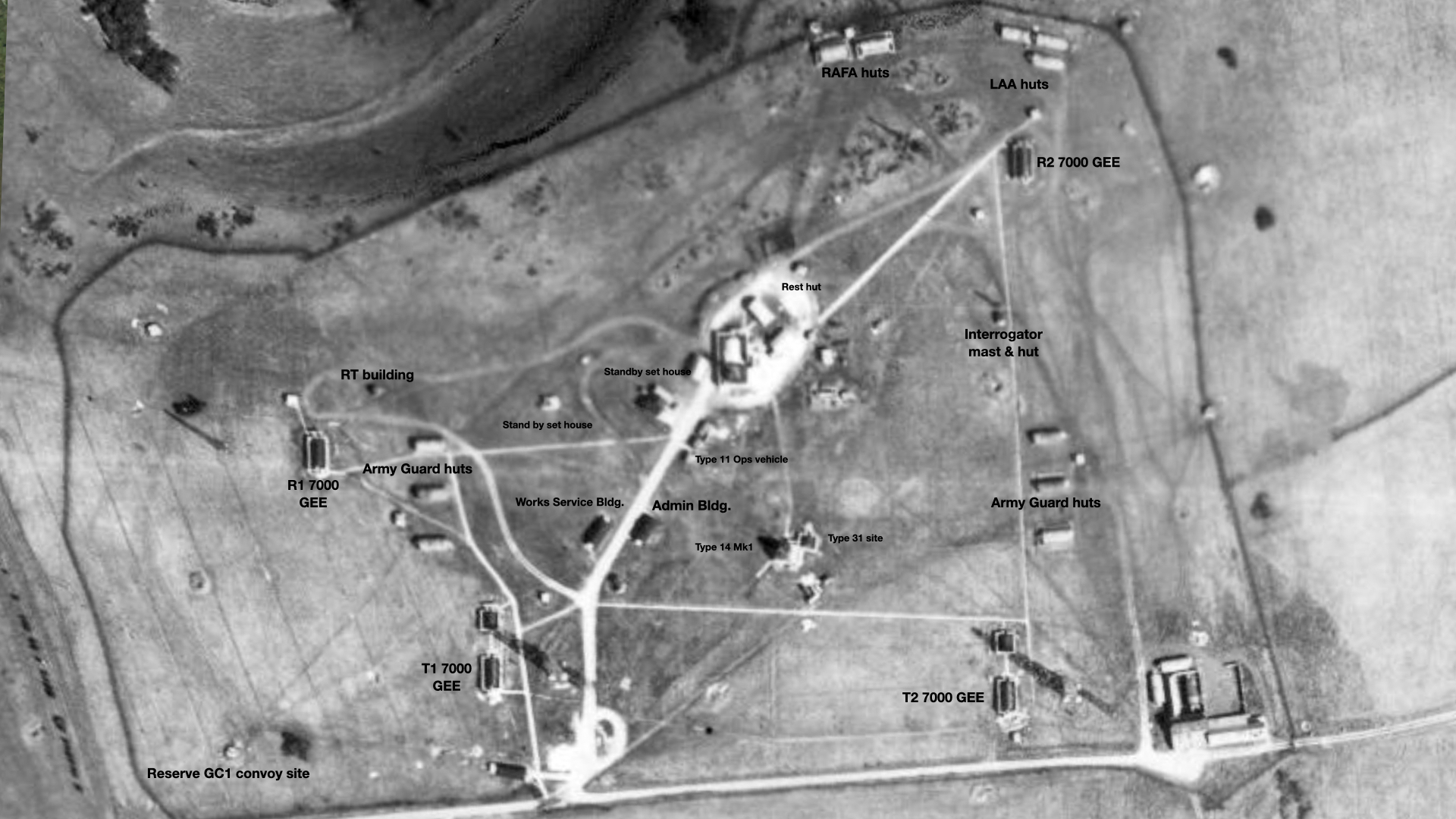
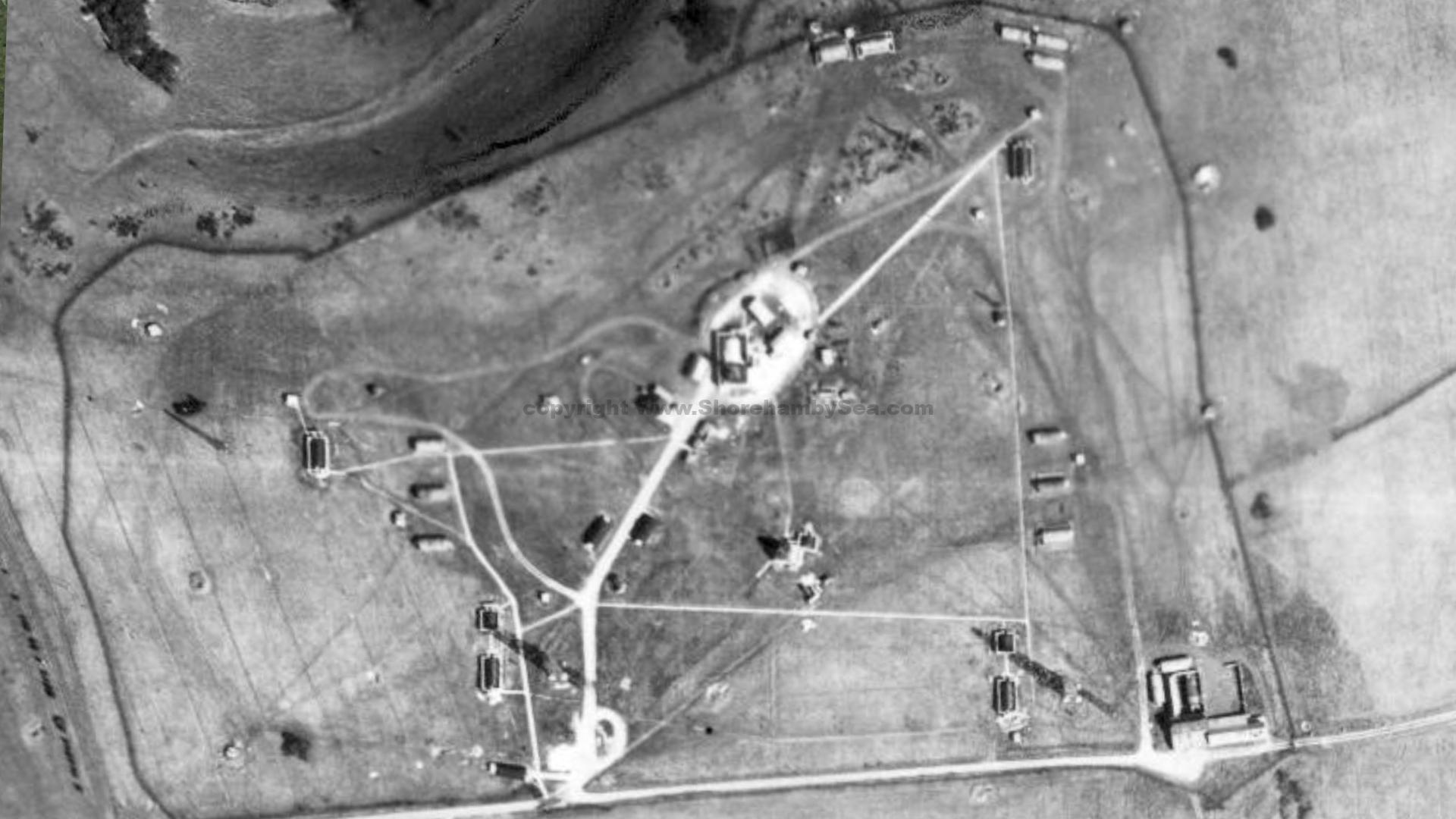
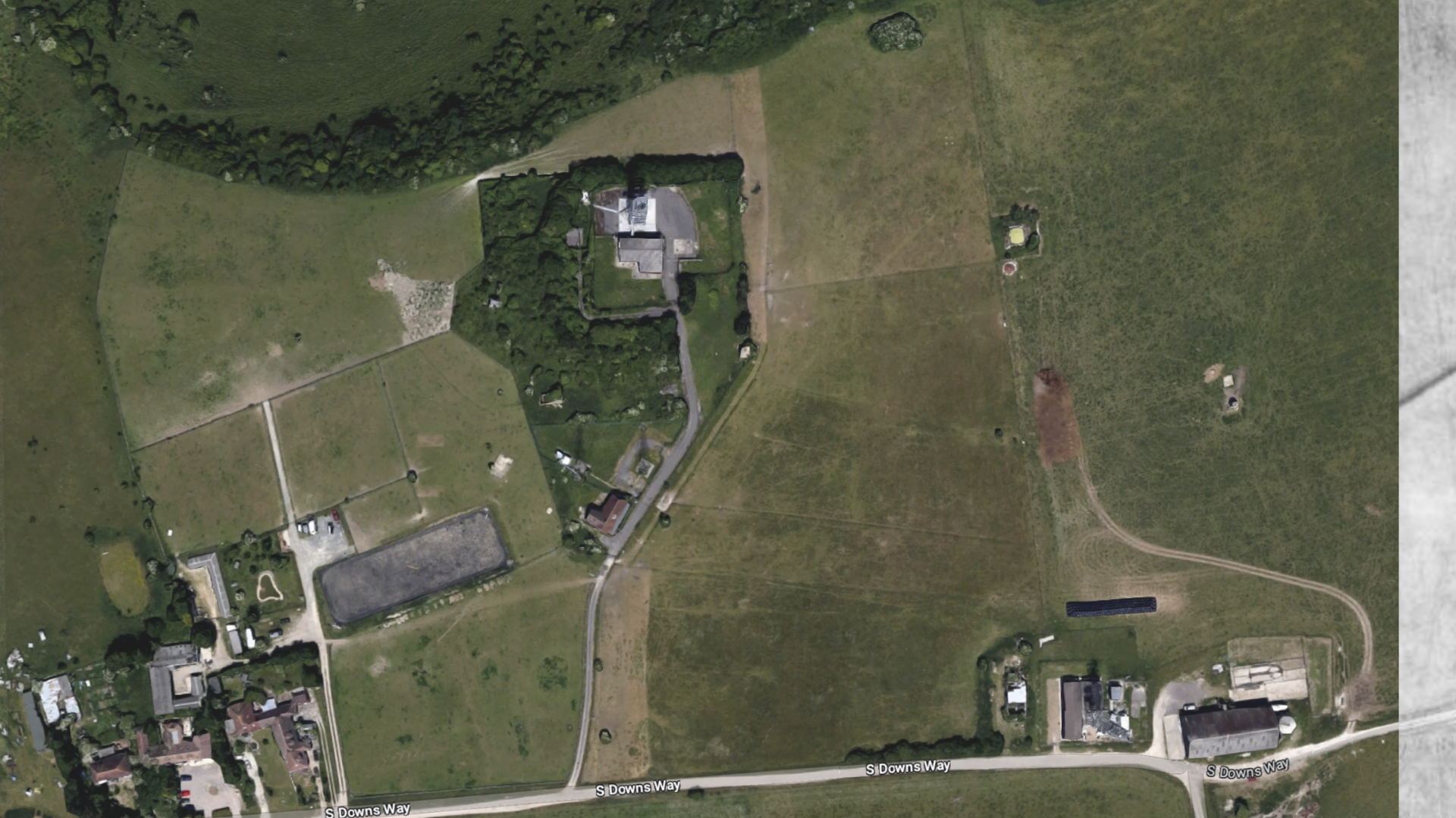
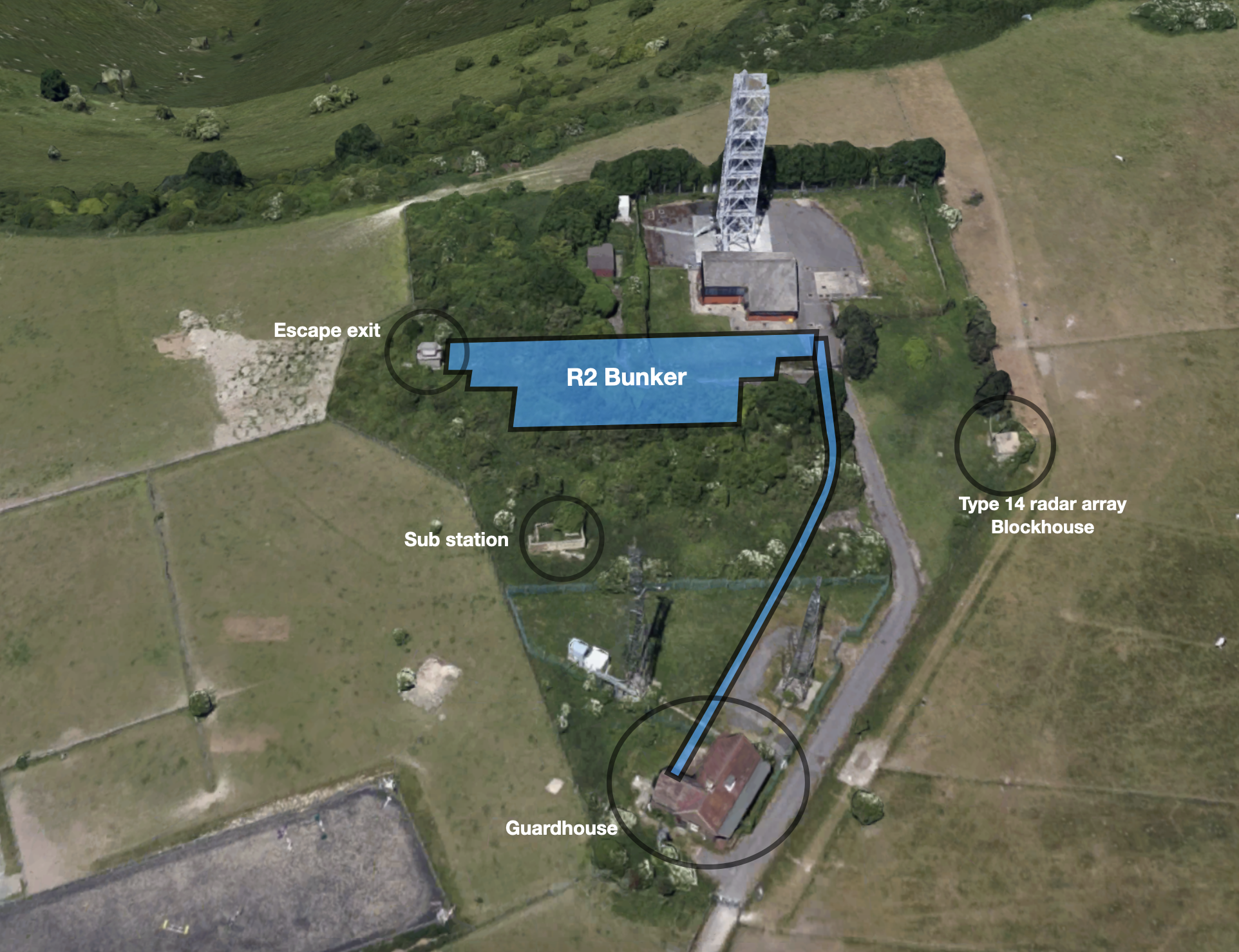
The RAF Truleigh Hill Radar base has seen an immense amount of change in the short time it has been hidden from public view. The World War 2 radar base was a sprawling overground site with scattered buildings and technical structures. Within a few years of the end of the war the threat and technology had moved on and Truleigh Hill was one of a number of sites chosen for the top secret expansion and upgrade of radar early warning capability. A huge civil engineering project of unparalled size was undertaken and in less than a year an underground, blast proof facility was dug, built and covered. The detail of the scale of similar cold war construction projects is told here. The detail of RAF Truleigh Hill’s history is recounted here.