Old Shoreham Parish & Buckingham Manor
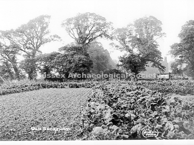
Bob Hill, a local historian, concentrated much of his research work and photo collections on his beloved Old Shoreham. Author of two outstanding booklets on Old Shoreham Bob used many of the following images to illustrate them and in doing so has preserved an important historical record of that small parish. The collection now lies with the Sussex Archaeological Society in their Marlipins Museum archives who have given their permission to display them on Shorehambysea.com.
Bob Hill Collection – Photo titles/text from Hill’s ‘Old Shoreham Village and Farms’
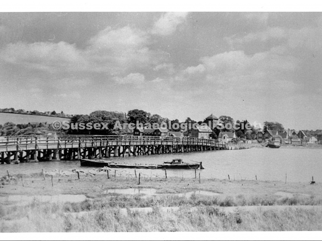
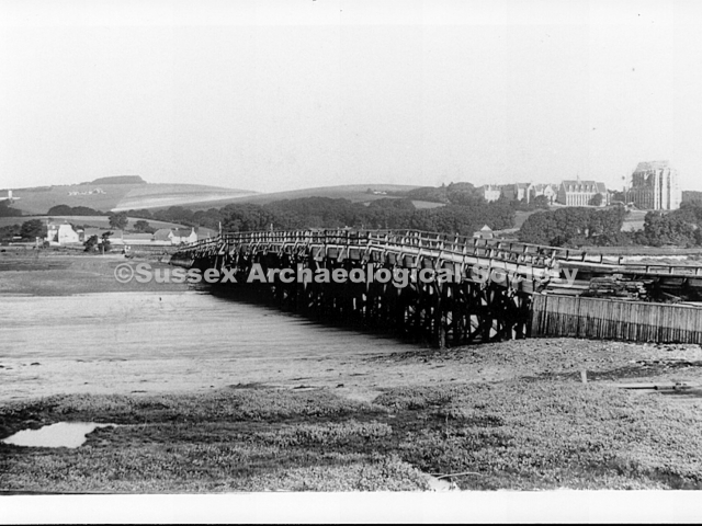
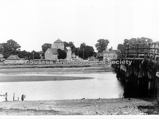
0001 – C.1920 looking north. To the right of the toll bridge is the village separated from the main town (New Shoreham). The upper line of trees are along The Street. (the start of the Army Camp huts can be seen top right RB)
0002 – The Toll Bridge at Old Shoreham with a barge moored in the foreground. The photo must be before c.1889 when the Mill Hill windmill (on theskyline) burned down – the roof of the miller’s cottage can just be seen alongside. RB
0003 – A later photo (than 0002) showing the new houses on Mill Hill but now with a larger barge.
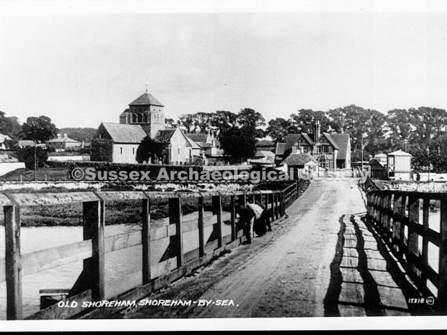
0004 – c.1900 with a single crossing gate across the road.
0005 – The Toll Bridge with Lancing College and the windmill (left of Lancing Clump) in the distance. RB
0006 – Looking south-east with Old and New Shorehams still separated by farmland. RB
0007 – Looking north-west along the causeway to the original Sussex Pad, windmill behind it and Lancing College to the right and the chapel still only half built. c.1900 RB
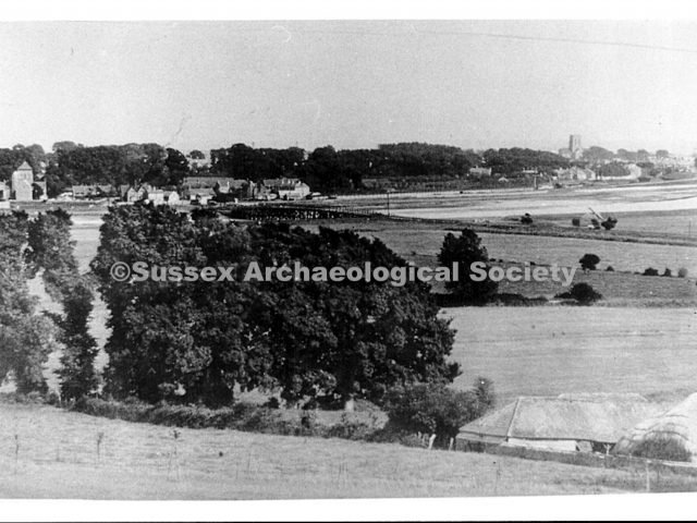
0008 – 1930 view of Old Shoreham and St. Nicolas church from Lancing Ring, showing the fields and a lot of trees. The roof of the Sussex Pad is right of centre with the old A27 and toll bridge beyond.
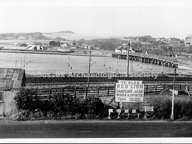
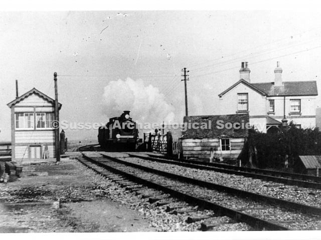
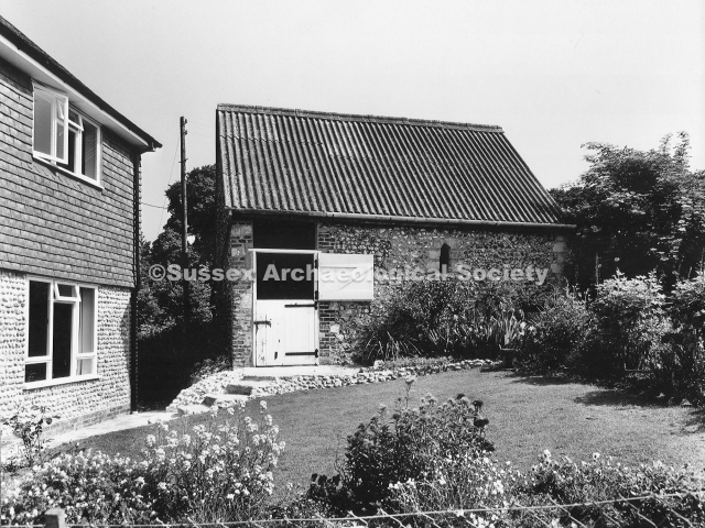
0009 (& 10) – Looking west across the railway from an attic window in 1946. Wartime mooring posts can be seen in the river. J. Boxall, shoeing and general smith, worked in the corrugated shed c.1900.
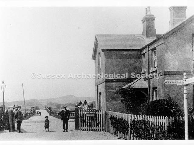
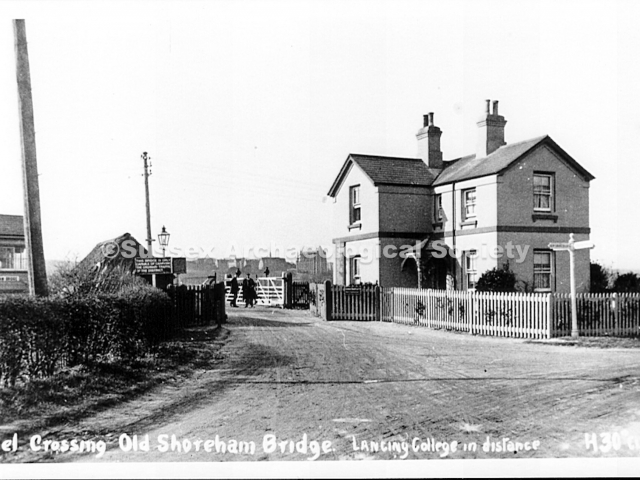
0011 – Tollkeeper’s house at the toll bridge – George Bartlett was the tollkeeper at the time of this photo. RB
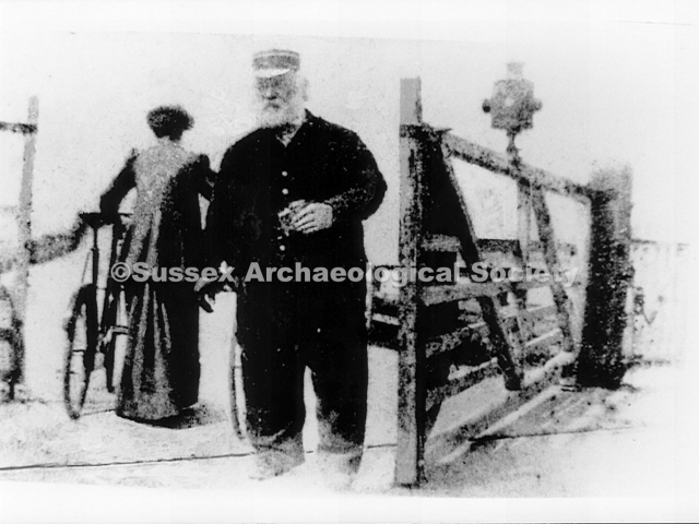
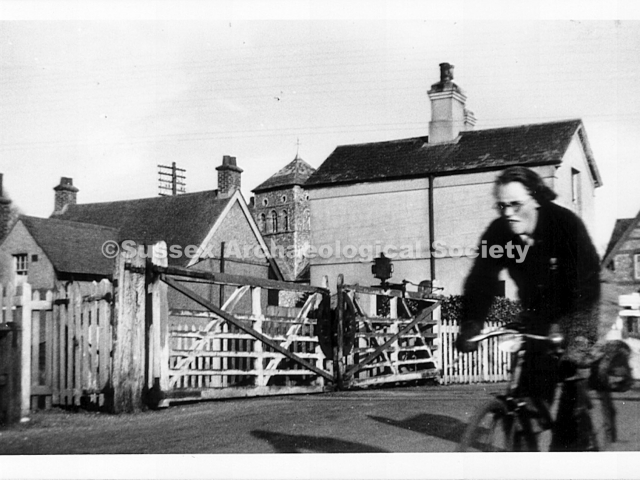
0012 – A toll keeper and cyclist.RB
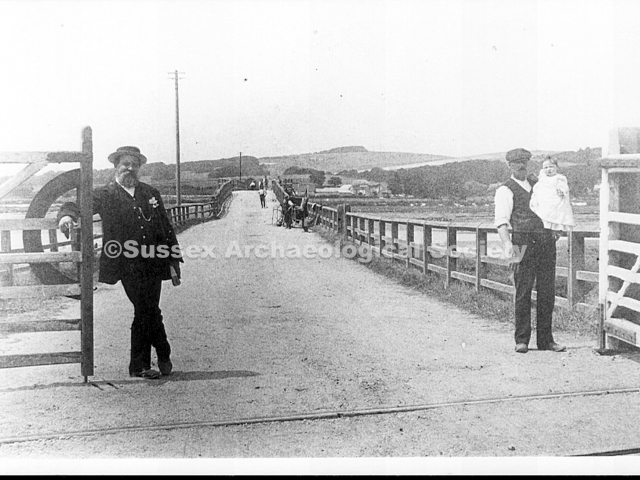
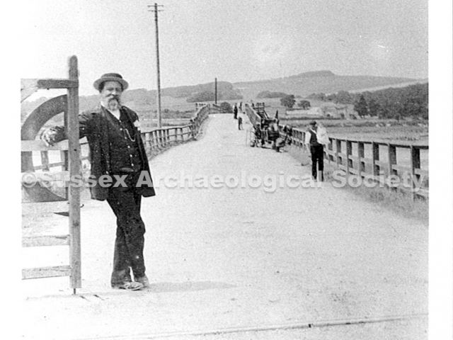
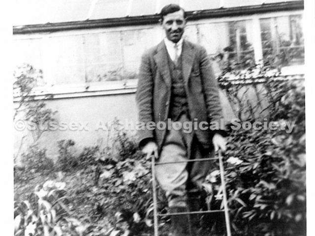
0013 – George Bartlett (right) signalman and toll collector.
0014 – George Bartlett in the near distance holding his son.RB
0015 – An unusual angle shot – the gates had obviously become rickety and had now been fitted with strengthening cross braces. RB
0016 – A popular view – in this photo the cottage on the Steyning Road (left) and the tollkeepers house have since been demolished. RB
0017 – A similar but later view to 0016 – note the two new houses. RB
0018 – The toll house at the time of George Bartlett’s occupation. RB
0019 – Toll House built by 1903. Line opened 1861 as a single track. Passenger trains ceased 1966
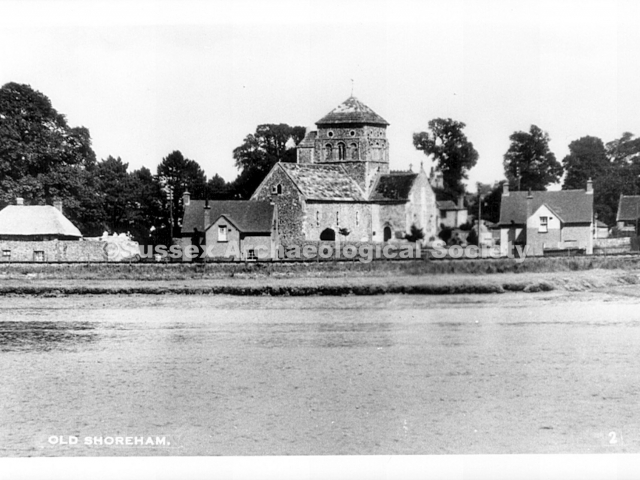
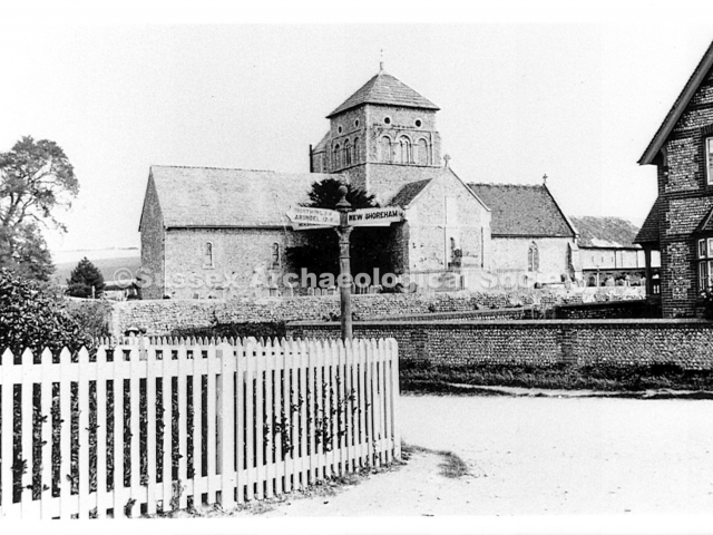
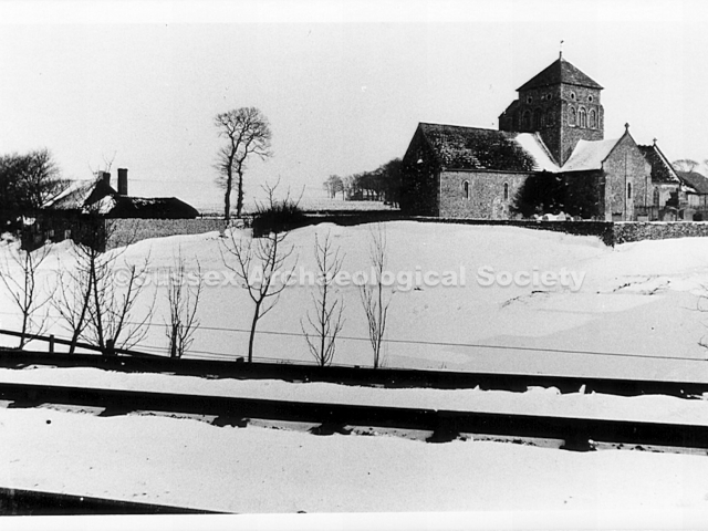
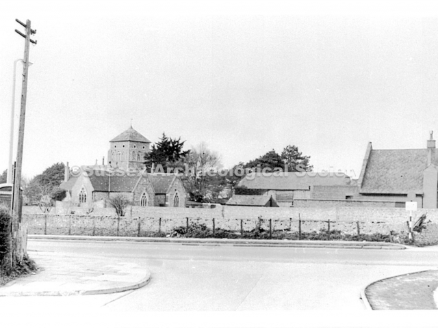
0020 – St. Nicolas church from just below the level crossing. RB
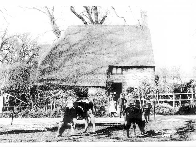
0021 – Cottage on Steyning Road by the church home of the Tuppen family from 1928 until cottage demolished 1954 looking north
0022 – The Tuppen family, a few years before they came to the village. Standing – Annie, Arthur, Marjorie, Fred, Ethel. Seated – Percy, parents Fred and Ellen with Winnie, Len. Sitting, Albert, Betty, Raymond.
0023 – looking across the railway line and Steyning Road to the church, probably after the 1881 snow storm.RB
0024 – Unknown
0025 – Unknown
0026 –The Steyning Road looking north.RB
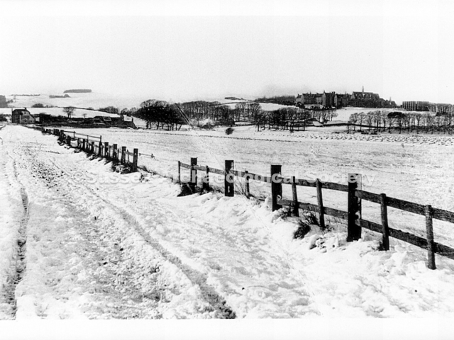
0027 – Perhaps the area just north of Old Shoreham, near the Steyning or waterworks roads.RB
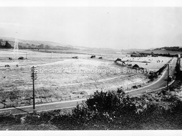
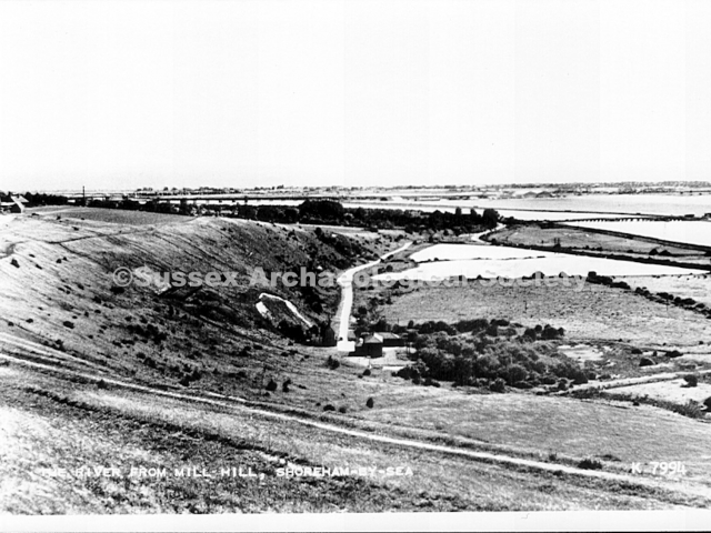
0028 – 1920’s view of the valley, waterworks road and toll bridge from Mill Hill. The church and barns are top left. The white patch, left of centre, is the chalk pit; now overgrown and just south of the A27 by-pass.
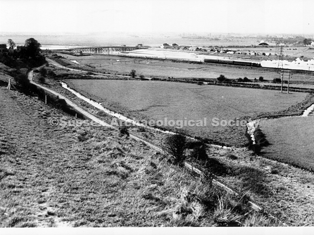
0029 – A similar view but looking more westwards with Ricardo’s by the Toll Bridge and, in the distance, an aircraft hangar and the Sussex Pad. The Horsham Flyer is passing through.RB
0030 – A similar viw to 0028 but from further north.
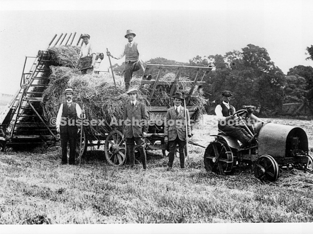
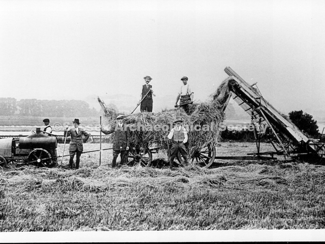
0031 – Loading hay in the Adur Valley c.1916. Percy Norman, farmer of Old Shoreham farm, is standing on the wagon with a pitchfork. Below from the left are H. W. Tingley, his son, Len Cobby, unknown.
0032 – The same event c.1916. The horse gin drives the elevator via a drive shaft. Percy Norman has his hands on his hips and H. W. Tingley is second left of him. The other men are mostly farm workers.
0033 – The same characters, the same machinery as 0031 but from a different angle. Photos 0031, 0032 and 0033 were seemingly taken within a few minutes of each other.RB
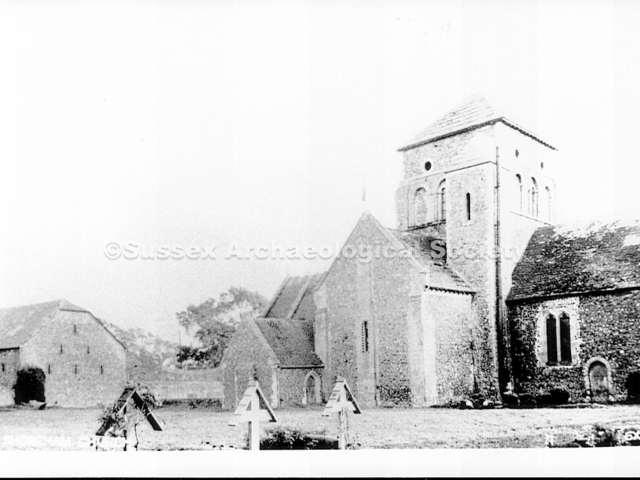
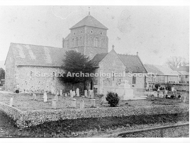
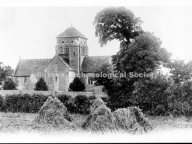
0034 – The church, graveyard and Great Barn looking southeast..
0035 – Looking northeast to the church and Great Barn behind it.
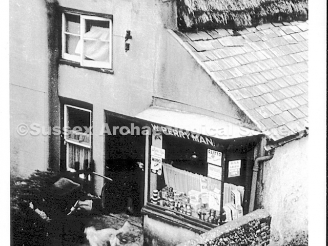
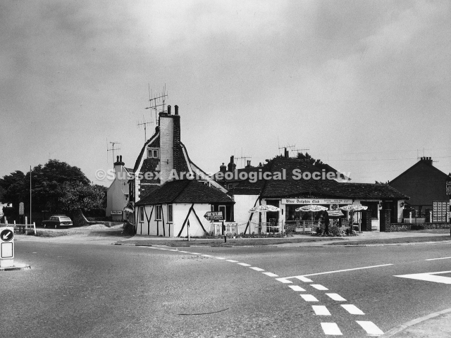
0036 – 1947 view looking S.E. over the Red Lion before Old Shoreham Stores was built. Note the narrow lane in front of Perryman’s shop and garden, now the access to the car park of the Amsterdam restaurant.
0037 Looking southeast to the church.
0038 – OSR after the 1881 snow storm looking north. Boards on the wall shield horses from the noise/shight of noisy, fast moving trains. To the right of the barn are church are Hoopers Cottages, the bakery and the church.
0039 Detail from 0041.RB
0040 – Detail from 0041. RB
0041 – Red Lion c.1890 with Hoopers Cottages on right behind the single building of three homesteads that later became the Amsterdam. The cycle is a Rudge Rotary cycle that was manufactured from 1878 onwards.
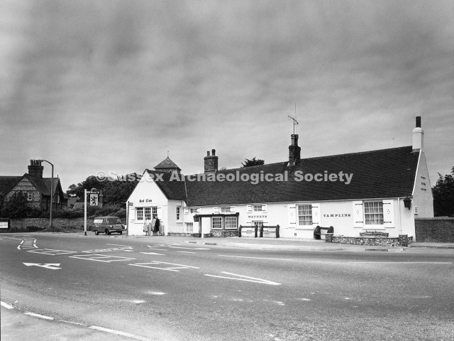
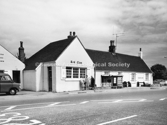
0042 – The Red Lion c.1910 with extended north end. The Lawrence family ran a riding school from the stable in the 1930’s.
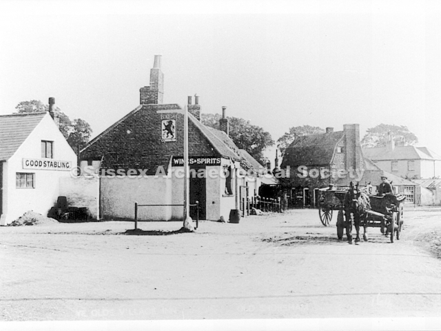
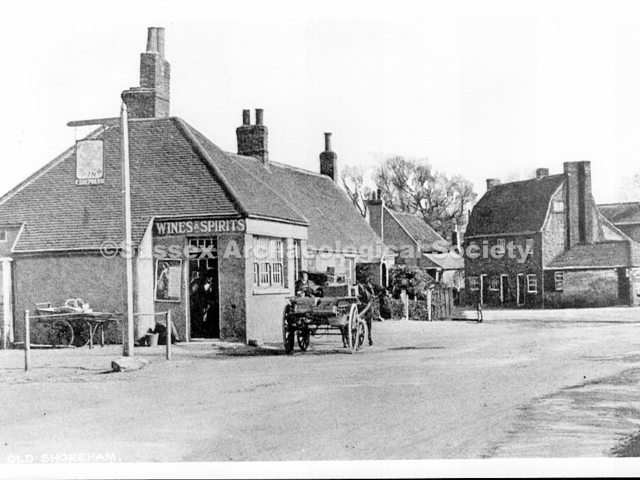
0043 – Another view of the Red Lion – the pub sign includes ‘F. Shepherd’ who is known to have been the landlord in 1917.RB
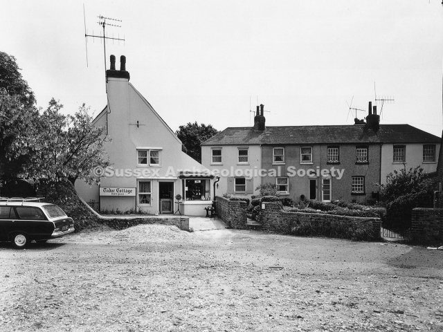
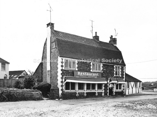
0044 – Now the Amsterdam restaurant this 1946 view shows the original three cottages and annex when threatened with demolition. Mr. Winter turned them into tearooms. To the left is Mrs. Perryman’s shop, formerly a bakery.
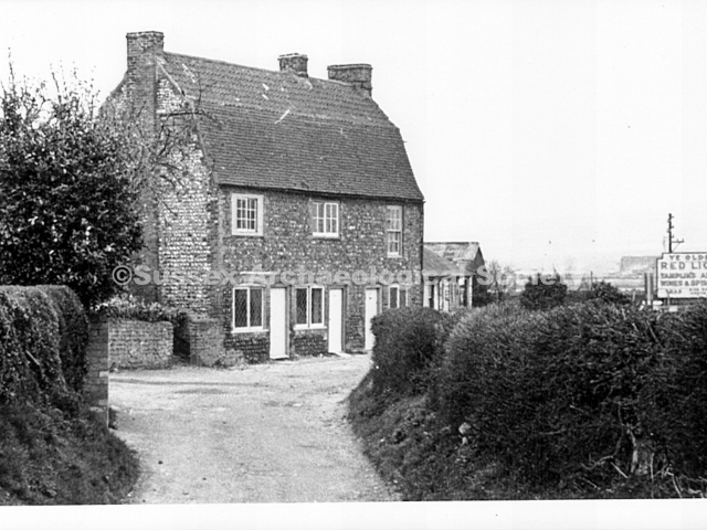
0045 – An unusual view of the three cottages looking west with a seemingly misplaced sign for the Red Lion that stood a few yards to the right.RB
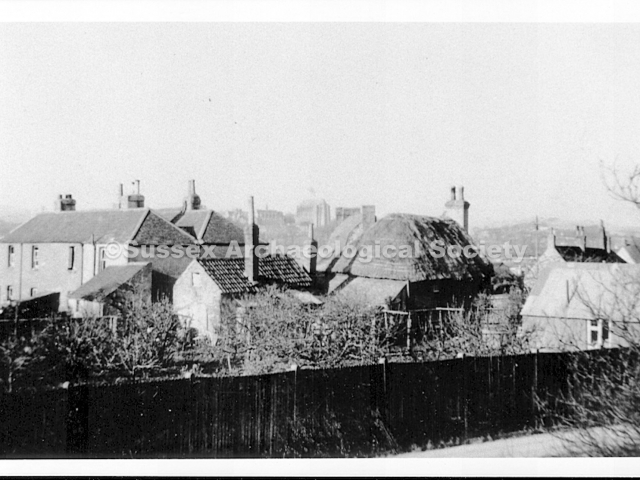
0046 – Another unusual view from Connaught Avenue looking across the rooftops of Mrs. Perryman’s shop and Hoopers Cottages to Lancing College.RB
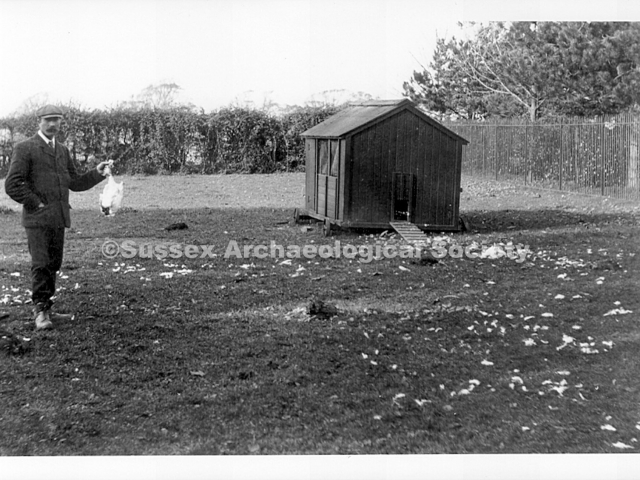
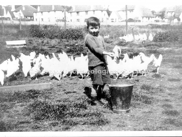
0047 – A devastating view of what was left of Old Shoreham farm’s chickens following an attack by, surprisingly, not a fox but a badger.RB
0048 – Thomas Turrell (b.1849) and his wife Christiana (nee Reeve) at their home, No.4 Hoopers Cottages, in 1931. The cottage is now the rear part of the Amsterdam restaurant. Thomas was born at Old Erringham.
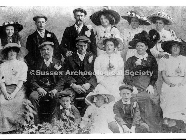
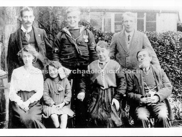
0049 – Most here are unknown except for Christiana and Thomas Turrell (front right). Could this include one (or more) of Thomas and Christiana’s offspring?RB
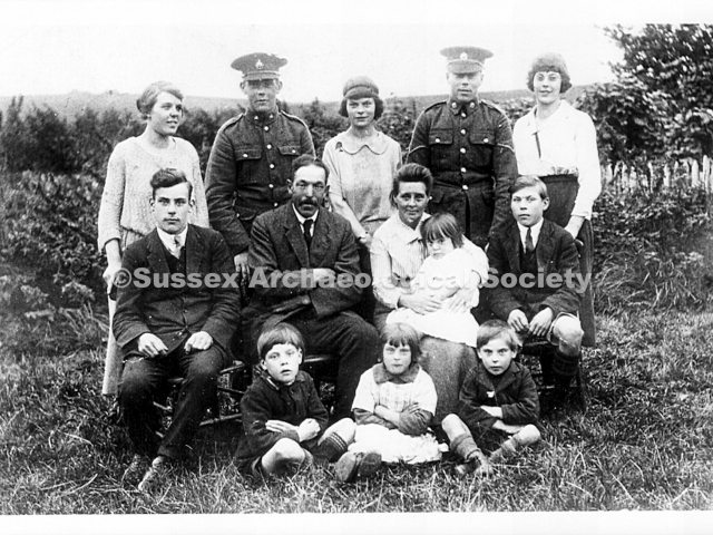
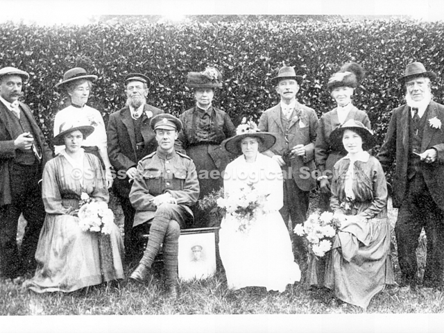
0050 – This would appear to be a post wedding photo of Charles Samuel Turrell, son of Thomas and Christiana Turrell of Hooper Cottages, Old Shoreham, who stand behind the soldier, a private with the Royal Fusiliers 2nd Battalion, 29 Division. Charles’ new wife was Lilian Parsons and the photo was likely taken at East Preston where the marriage took place in 1916. What with Charles’ service on the front the couple barely had much time together before, as so often was the sad case with wartime marriages, he was killed at Tyne Cot on the 9th October 1917 and is buried in the War Graves Cemetery there.RB
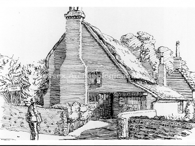
0051 – 1933 sketch by J. Oakman of Perryman’s grocery shop. It was a bakery for about 60 years prior to 1923. Part of the bakehouse is shown on the right. Note the sign advertising ‘garden teas’.
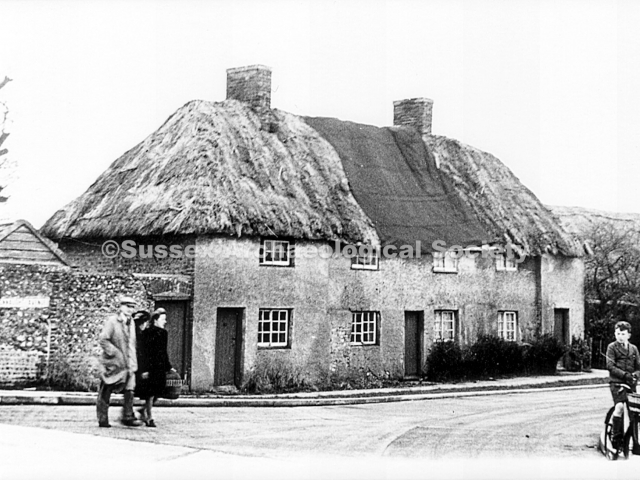
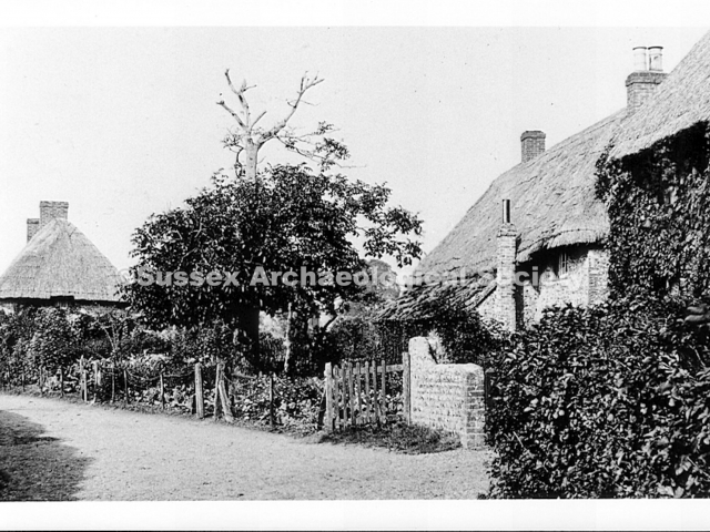
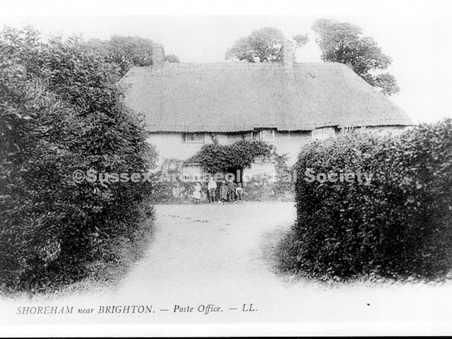
0052 – This cottage still stands at the top of Connaught Avenue. Looking east c.1900 from the lane in front of the bakery, the children are standing outside the post office run by Mrs. Munnery.
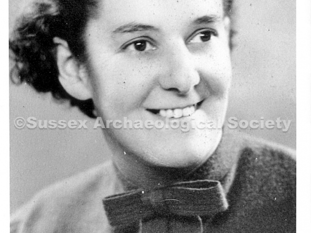
0053 – Winifred Perryman ran Perryman’s grocery shop until c.1960.
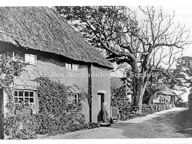
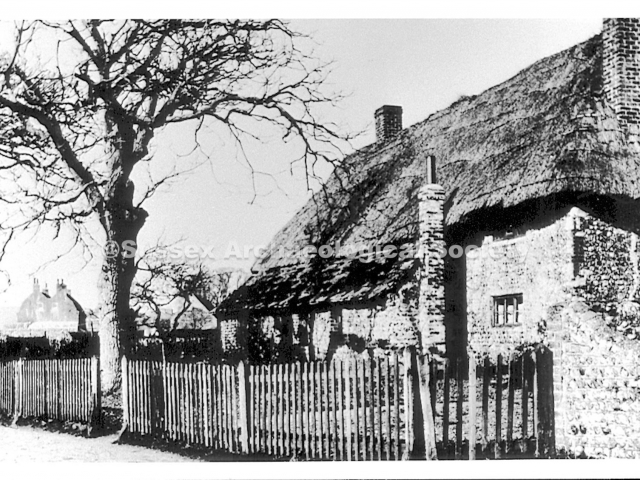
0054 The old post office at the top of Connaught Avenue shortly before rethatching.RB
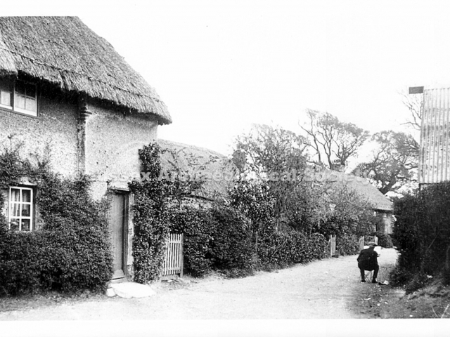
0055 – Looking south down Connaught Avenue from alongside the post office with an artist recording the view.RB
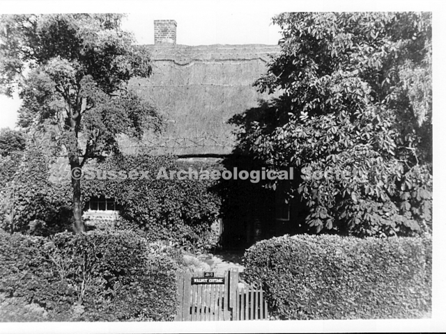
0056 – The view north when Connaught Avenue was still a track. Walnut Cottage on the right. RB
0057 – The Post Office with the other cottages in Connaught Avenue.
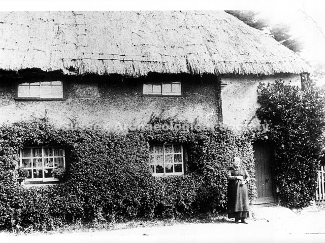
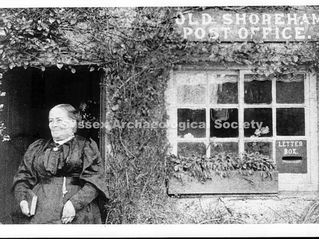
0058 – Mrs Munnery, postmistress outside her post office. RB
0059 – The centre part of the building (the post office was on the right of it) from the pathway opposite that is now part of the Amsterdam car park.RB
0060 – Old Shoreham Post Office c.1900. Mrs. Elisabeth Munnery (b.1846) ran the post office for more than 40 years from 1880. The Post Office moved to St.Nicolas Lane c.1930.
0061 – Walnut Cottage, Connaught Avenue with the Old Shoreham farmhouse in the distance. The post office was out of shot to the left.
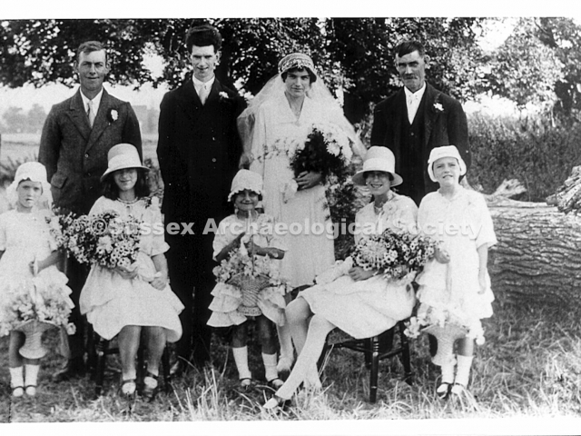
0062 – Wedding photo c.1930 of Irene Fuller, showing the fields behind the cottage. Father George Fuller is top right. Irene’s sisters are Ann (left), Rowena (right) and Ivy (next to Rowena).
0063 – Walnut Cottage, home of George Fuller and wife Ada for more than 40 years before this 1950 view. George was a thatcher and a shepherd. The bought up 11 children at the cottage.
0064 – Presumably George Fuller outside Walnut Cottage.RB
0065 – Three cottages which stood south of Walnut Cottage. The lane turned left past the tree, to Slater’s Cottage, and continued as a path to Swiss Gardens (looking south c.1900, demolished c.1930). (NB Quite a well known photo with two of the children in it anxiously looking into a doorway. You can imagine their mother standing there out of sight tinstructing them to stand still while the photographer takes his picture! RB)
0066 – The cottages south of Walnut Cottage (see 0065) during demolition c.1930.
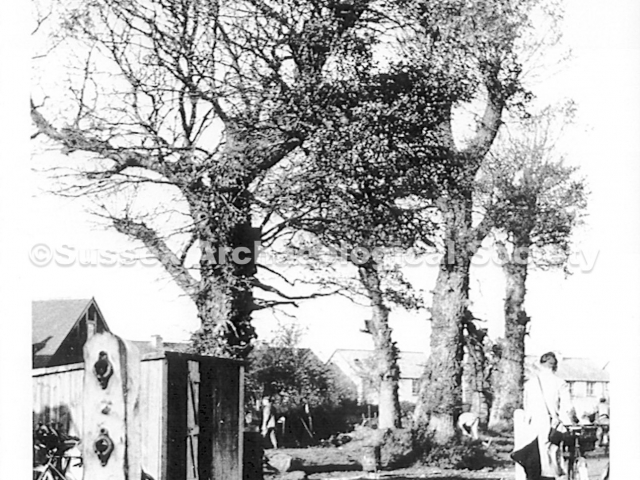
0067 – The same cottages with Walnut cottage beyond.
0068 – Elm trees on Connaught Avenue c.1939 just before they were felled to widen the road. The trees were up to 4 feet in diameter.
0069 – Slater’s Cottage stood where Colville Avenue now joins Connaught Avenue. The cows in the field opposite belonged to George Smart, a market gardener (looking N.E. c. 1900, demolished c.1930)
0070 – Probably the elm trees in Connaught Avenue from a field alongside it. The cottage on the right looks to be Slater’s Cottage (see 0069).RB
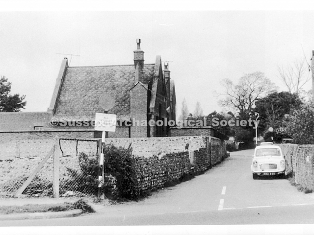
0071 – Looking north from the top of Connaught Avenue to the the school buildings and St. Nicolas church beyond. RB
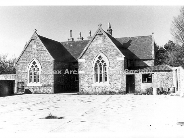
0072 – The school buildings on the east side of the playground at the foot of The Street. RB
0073 – The school buildings on the west side of the playground.
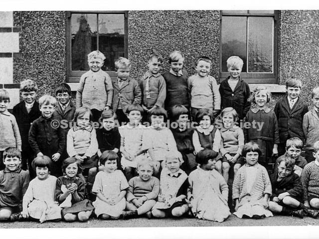
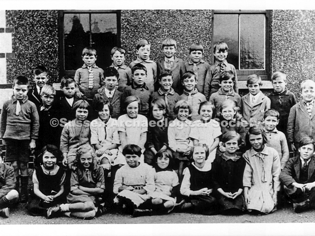
0074 – Old Shoreham school, October 1928, infant class (age 5 to 8)
Back row (6 boys standing on bench) left to right: John Wells; Desmond Hunt; Wm. Richard Paris; Fredk. William Adams; James Sinden; Peter Saunders.
Middle row (4 boys standing, 7 girls sitting on bench, 3 standing): Robert Minter; Cecil Johnstone; Donald Hamilton; Alfred Puttock; Dorothy Smith; Muriel Knight; Annie Fuller; Dorothy White; Doreen Woolmington; Evelyn Godley; Margaret Munnery; Heather Perham; Reginald Grinstead; Alfred Bowyer.
Front row (11 sitting on ground) left to right: George Sanders; Eileen Wells; Lily Gadd; Marjery Matthews; Albert Knight; Eileen Johnson; Mary Castle; Dorothy Wickham; John Sinden; Charles Dorey; Denis Still.
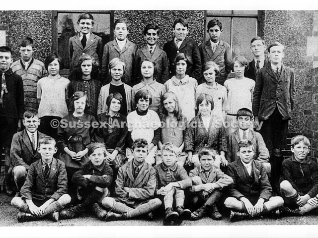
0075 – Old Shoreham school, October 1928, senior class (age 10 – 14)
Back row (5 boys standing on bench) left to right: Reg. Wm. Suter; Albert Tuppen; Anthony Priest; Alex Hancorn; Henry Johnson.
Upper middle row (standing, 2 boys 7 girls, 2 boys) left to right Hubert Sinden; Briton Still; Violet Peters; Nellie Snook; Doris Saunders; Marjorie Knight; Ivy Fuller; Celia Snook; Doreen Virgo; Walter Hancorn; Ron Fuller.
Lower middle row (boy, 5 girls on bench, boy) left to right: Ernest Cooper; Elizabeth Grinstead; Violet Denton; Betty Tuppen; Constance Tompsett; Nellie Peters; Leonard Jordan.
Front row (7 boys sitting on ground) left to right: Henry Perham; Ray Tuppen; Fred Langrish; Stanley Bishop; Harry Wellstead; Percy Glew; Chris Bowyer.
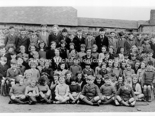
0076 – Old Shoreham school, October 1928, junior class (age 7 to 10)
Back row (6 boys standing on bench) left to right: Ivor and Roy Gawn (twins); Robert Virgo; Edward Pretty; Albert Leslie Woolmington; Arthur Barker.
Upper middle row (12 boys standing) left to right: John Minter; John Cooper; Victor Saunders; Henry Baker; Bernard Cox; Harry Fuller; Malcolm Langrish; Richard Everest; Ernest Denton; Harold Glew; Robert Bowyer; Gerald Prince.
Lower middle row (7 girls sitting on bench plus boy kneeling) left to right: Jessica Saunders; Gladys Barker; Nellie Dorey; Ivy Jordan; Dorothy Perham; Marjery White; Irene Munnery; Victor Heather.
Front row (boy, 7 girls, boy) left to right: Denis Hersey; Eileen Dye; Margaret Tompsett; Rowena Fuller; Winifred Tuppen; Doris Nellie Jordan; Elsie Snook; Jessie White; Reginald Woolmington.
0077 – St. Nicolas School c.1935, looking N.E. showing the whole school with the barns behind. In the centre of the group are the three teachers L to R Miss Young, Miss Archer (head) and Mrs Spragg.
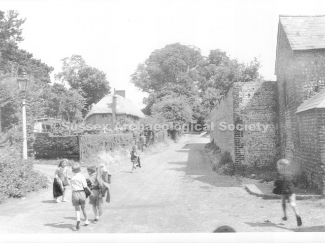
0078 – Looking up The Street after school is over c.1950’s (?) RB
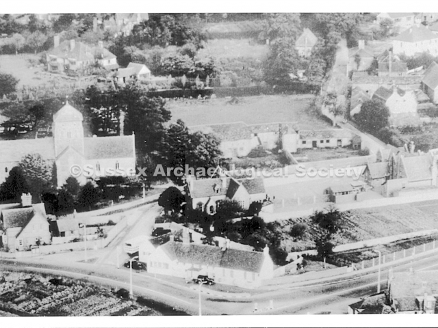
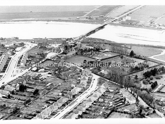
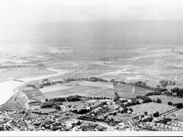
0079 – The village from the air looking northeast.
0080 – Aerial view 1958. Above the church is Greystones. To the right of the church are the barns and Lamb Field. On the right is the school, built 1914, with allotments below. All these have now gone.
0081 – St. Nicolas Lane looking west c.1900, showing the old school and the church gate, now a lych gate. The tree ewas hollow by 1930. A row of elm trees ran across the field to the left of this photo.
0082 – The former Post Office (1930’s) on St. Nicolas Lane, east end, north side, run by Miss Bates. During the war it was a troop canteen. Tommy Mason worked the forge at the rear.
0083 – Tommy Mason working at the forge in St. Nicolas Lane.
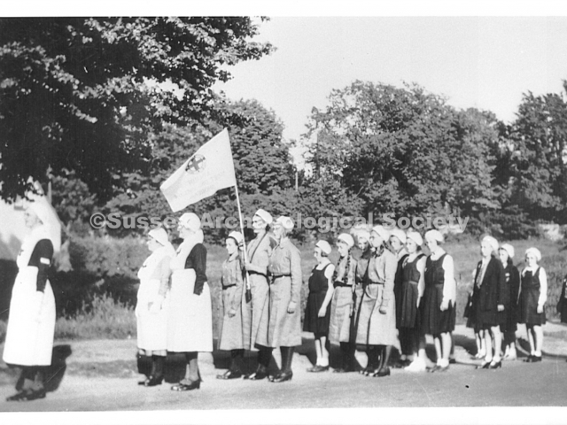
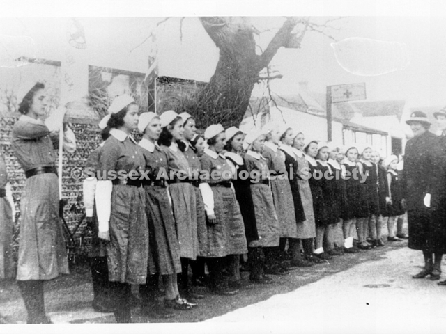
0084 Probably the Junior Red Cross on parade in 1939 RB
0085 – The junior Red Cross on parade in St. Nicolas Lane c.1939. It was organised by Miss Frith and Miss Jones. The Red Cross volunteers ran the troop canteen during the second world war.
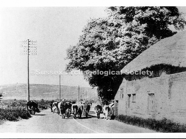
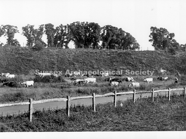
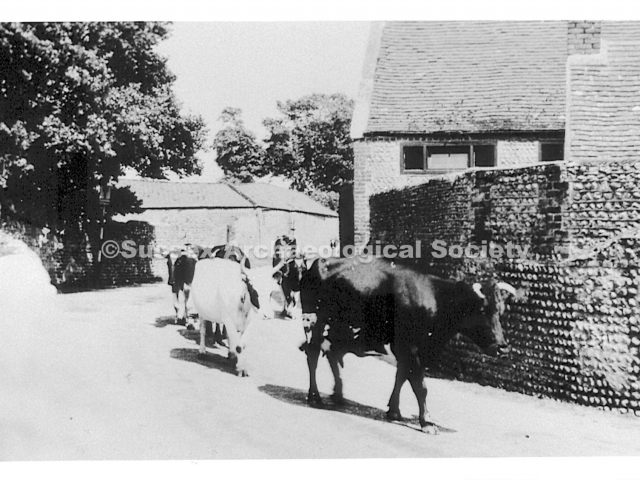
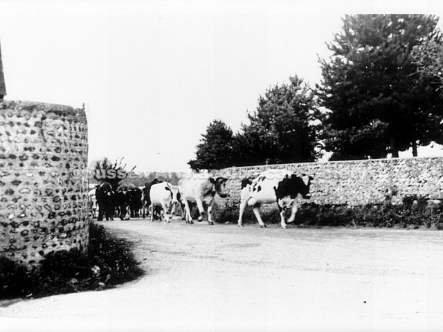
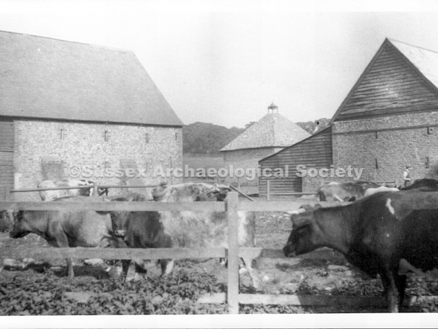
0086 – Cows from Old Shoreham Farm passing the School House on their way back to the fields along Steyning Road, after milking. Behind the cows is the cart store (looking east c.1950).
0087 – Cows passing the curchyard wall in St. Nicolas Lane on the way to milking. RB
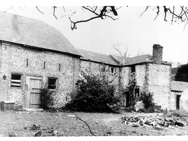
0088 – The Great Barn, tack room and stable on St. Nicolas Lane, east of the church, before demolition in January 1962. Two German prisoners of war lived in the part with the chimney (see photo 0113)
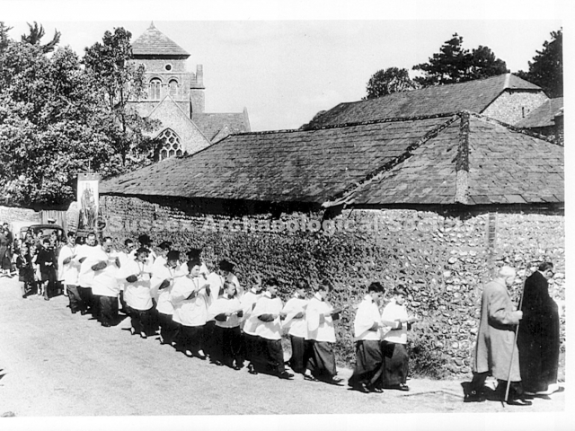
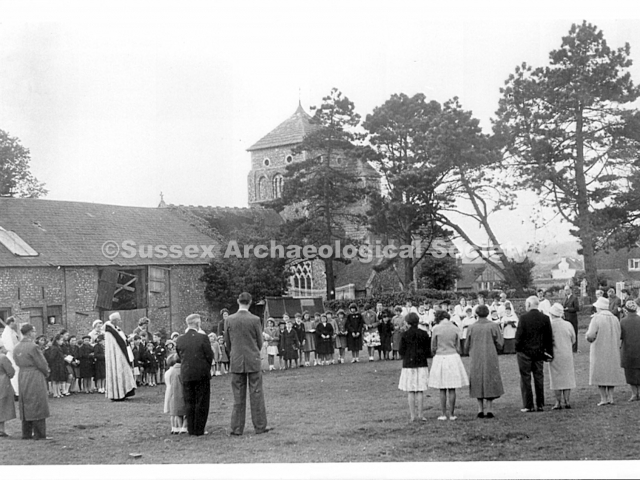
0089 On their way to a Rogation or other ceremony in the Lamb Field.
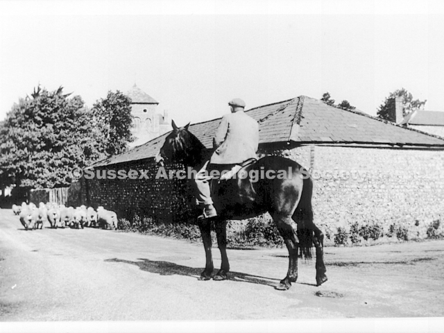
0090 – Farmer Frampton with his dog (left) driving sheep along St. Nicolas Lane. The size of the cart store can be appreciated from this c.1955 view. Note the entrance into the yard just beyond it.
0091 – A Rogation ceremony on the Lamb Field c.1960. This view shows more of the north side of the Great Barn. To the right, Valentine Close has now replaced the thatched cottage.
0092 – Mr. Frampton outside the dairy in the early 1930’s. The milk was colled in there. The dairy was N.E. of the farmhouse, near the south gable of the barn, seen left of centre with ventilation slots
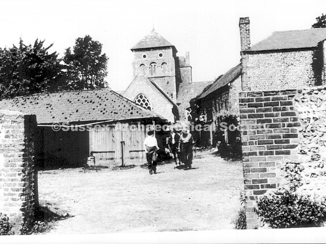
0093 – The entrance to the yard from The Street, looking west c.1955. Hazel Frampton and Tommy Mason are leading a pony out. The doors, centre, are to the garage at the end of the cart store.
0094 – Looking north up The Street with the Lamb Field on the left.
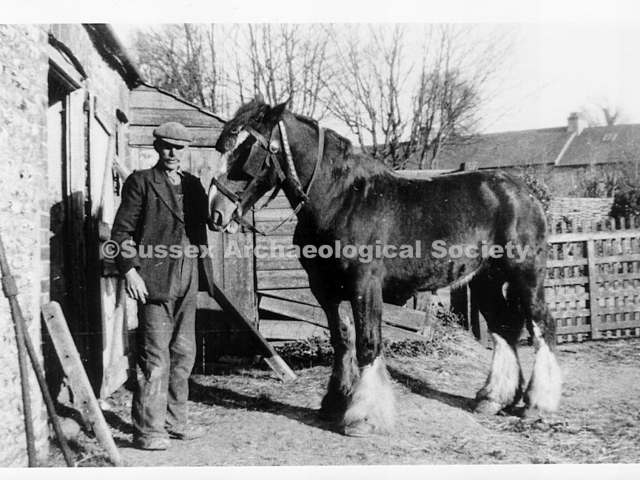
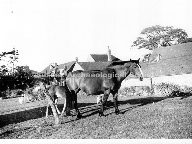
0095 – Albert Longley, a carter, with a cart horse called Punch outside the stable. Looking S.E. c.1945, the fence is across the entrance shown in 0093, the houses are on the Upper Shoreham Road.
0096 – Photo blurred
0097 – Unknown
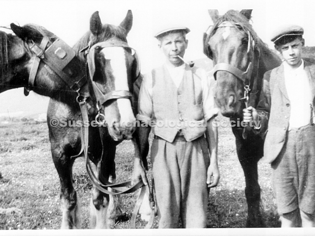
0098 – Jack Chaplin (centre), a carter, and his son Ernest with horses in the fields on Steyning Road. Jack came to Shoreham with Mr. Frampton in 1931 but died in December 1933. The family stayed.
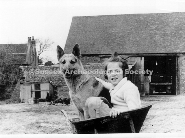
0099 – Heather Frampton c.1951 in the farmyard with the famr house behind, left.
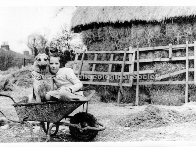
0100 – Heather Frampton c.1951 by a rick. The hay ricks and corn ricks were built N.E. of the forge. The corn ricks were left through the winter and threshed in spring.
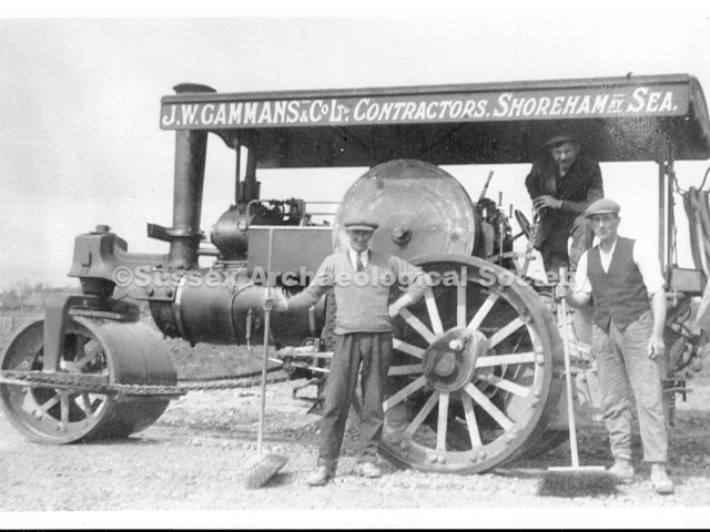
0105 – George Weller (centre of group) was a steam traction engine driver who lived at No.4 Steyning Road for 40 years or more. At threshing time he came to Old Shoreham Farm with machines like this.
0110 – left hand photo – Tommy Mason c.1950. He worked the forge on St. Nicolas Lane.
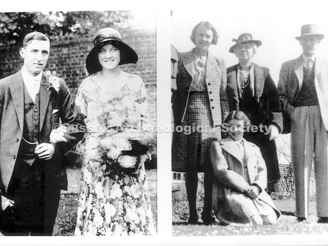
0111 – left side photo – Mr & Mrs Frampton married in Dorset in May 1931, the day before coming to take over Old Shoreham Farm.
– right side photo – Mrs. Frampton (left) & her mother Mrs. Hecks who came to run the house after being bombed out(with Hazel & Mrs. Frampton c.1942).
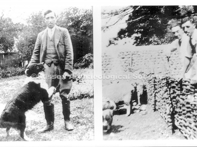
0112 – left side photo – Mr. Frampton in the garden with his sheep dog c.1932.
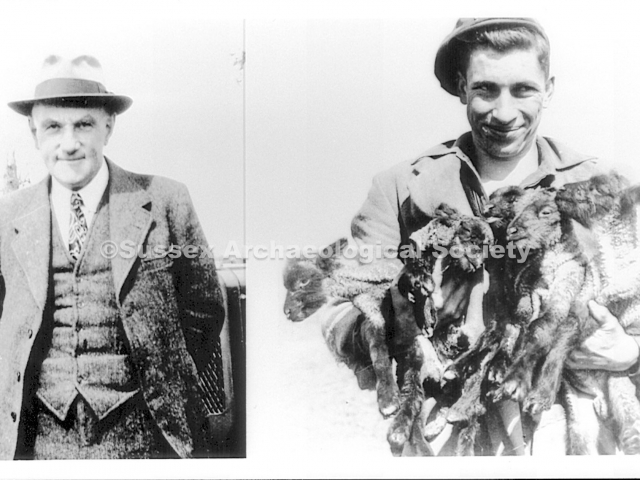
0113 – left hand photo – The two German prisoners of war who worked at Old Shoreham Farm. Note the diamond shaped warning patches by their right knee.
– right hand photo – an incredible shot (if not a composite photo) of a flying bomb. If not out of control “ Following the V1 bomb at the top of Eastern Avenue on 5th November 1944 John Lyne remembers an increasing number of doodlebugs overflying Shoreham, although to his knowledge no more crashed in Shoreham “ but it started to be a common sight as they seemed to fly so low, hardly clearing the south downs.” The V1 in this photo although very low looks to be in a stable, flying attitude (i.e., not crashing) but the roofs of the buildings can’t be positively identified as Shoreham houses.
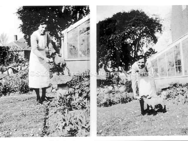
0114 – Mercy Thomas, maid, bottle feeding a lamb in the garden c.1955.
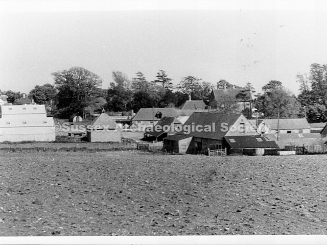
0117 – The barn and cow sheds north of the farmhouse, on the east side of The Street c.1960. The ricks were built behind the barn, which contained machinery. The buildings are now converted to dwellings.
0121 – Greystones, situated in a 2½ acre site north of Lamb Field , was occupied by the James family 1926-72. It burned down in 1938, was rebuilt in 1939 and was occupied by troops during the 19399-45 war.
0124 – Lesser Foxholes in 1939 looking west towards the entrance porch. Nigel Rowlands age four is sitting in a dog basket by the west pond which has the fountain operating. The house was built c.1932.
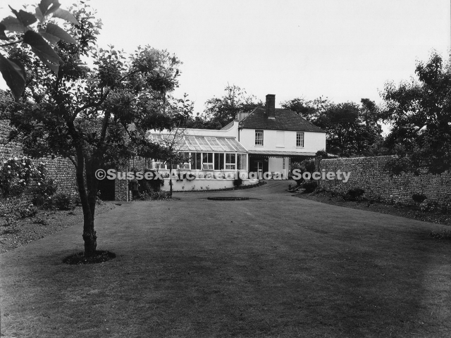
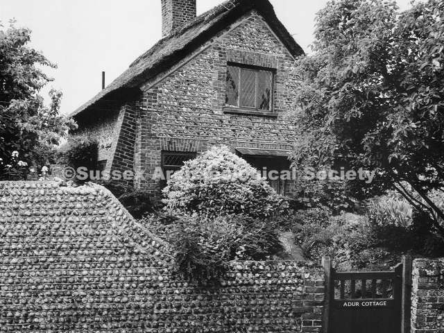
00125 – Looking east from a bedroom window of Lesser Foxholes in 1938 across the newly planted 2½ acre garden. Sister Wadey is sitting by the pond with baby Diana and Nigel. Adur Cottage is above centre.
0127 – Looking N.E. up The Street c.1933, just before Adur Avenue was built to the north of Prospect Place (extreme right). John Lawrence, riding the grey, ran the riding stable by the Red Lion.
0129 – The field on the west side of The Street c.1905, looking S.W. towards the church and No. 8 on the left. The three choir boys in Eton collars are Jack & Bill Wells (b.1896 & 7) who lived at No.11 and Harry Weller.
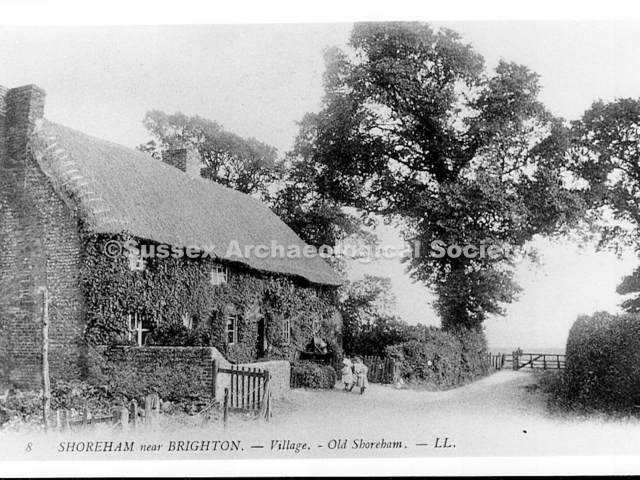
0132 – Looking N.E. up The Street c.1880, this pair of thatched cottages stood on the bank to the north of Adur Avenue. The cottages, Nos 6 & 7 were demolished c.1946.
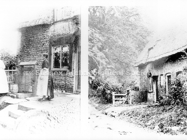
0135 – left hand photo – Mrs. Kent standing by the well outside No. 6 c.1890.
– right hand photo – Another view. The Bishops lived at No. 6 from c.1896 until it was demolished soon after the war.
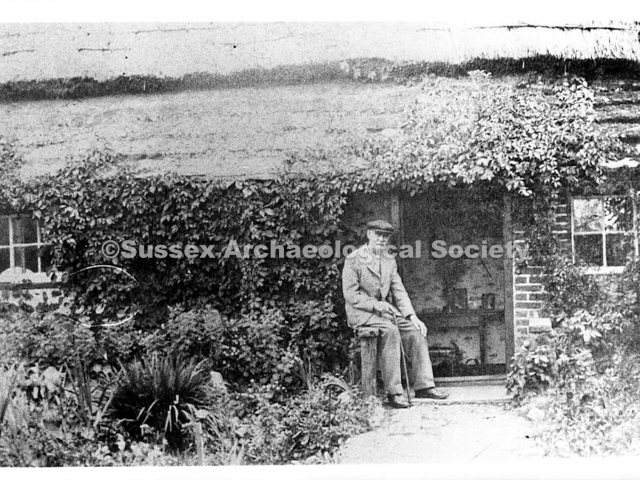
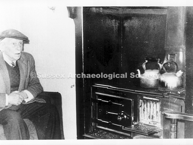
0140 – Henry Munnery (1885 – 1969) sitting by the range in No. 4 The Street. He and his family lived there from c.1915. The cottage had an old built-in ‘court’ cupboard, now in the Marlipins Museum.
0141 – Nos. 4 & 5 The Street looking S.W. c.1880. The boy in breeches is outside N0. 5, the former home of blind Fanny Winton (1810 – 1871) who was bed-ridden at the cottge for more than 30 years.
0147 – 1941 sketch of Adur Lodge by E. S. Stamp looking north from the lawn. This view shows the building with two pitched roofs. The west roof was replaced by a flat roof soon after the army left in 1945.
0148 – Adur Lodge built 1795 for Lt. Wm. Stephens R.N. on the site of Rook’s cottage. Col. G. Porter lived there c.1800. The Bridgers lived there from c.1890. The Ellman Brown family lived there after the war.
0150 – Looking north up Mill Hill from The Street after the 1881 snow storm. Note the water company marker. On the south east corner, right, was a pond known as Cockeroost pond. Cockeroost barn was further east.
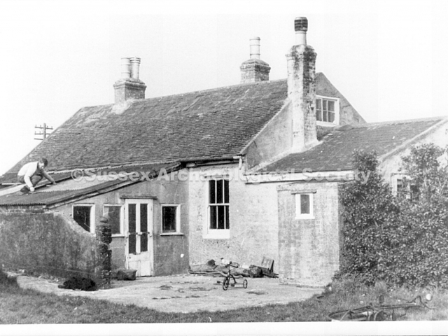
0151 – The Mill House, Mill Hill c.1960. This is a view from the rear looking north east. The living accommodation was on the ground floor and the upstairs was a miller’s loft. Graeme Eager is on the roof.
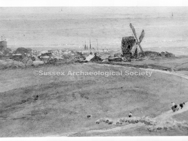
0152 – An artist’s view of Old Shoreham mill. The mill stood on the west side of Mill Hill, immediately north of the cutting for the modern A27 by-pass. It was built before 1780 and burned down c.1890.
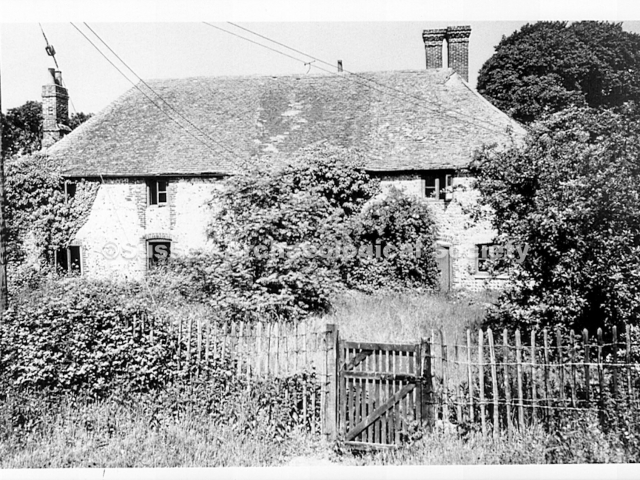
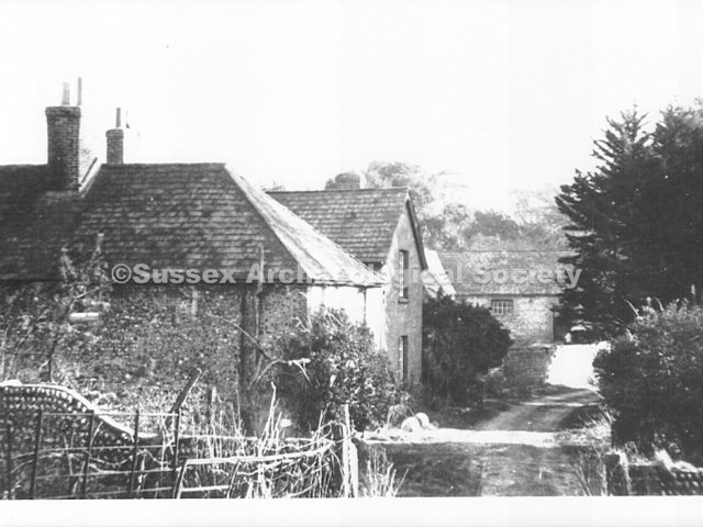
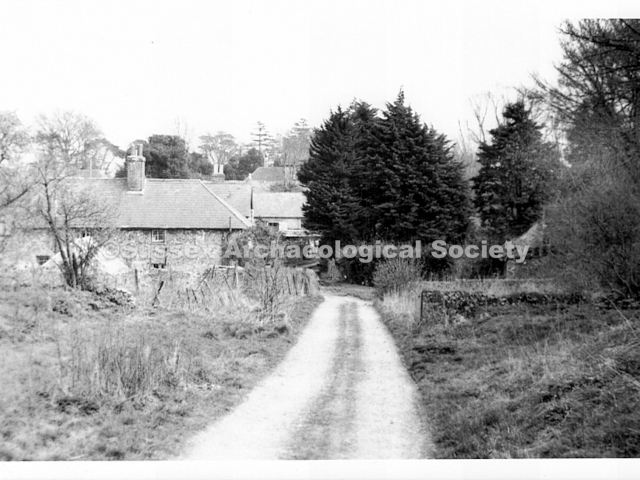
0154 – Old Erringham manor house in 1967 looking N.W. It was split into farm cottages by 1850 but became a single dwelling again c.1970. The gate was the access to the cottages from Mill Hill.
0155 – The paddock or Lamb Field, looking west towards Lancing Ring c.1950. The Great Barn (left) looks as though it is joined onto the church. Note Tuppen’s cottage on Steyning Road (right).
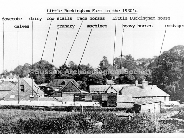
0160 – Little Buckingham Farm looking east in the 1930’s, situated on what is now the north side of The Avenue. The dovecote (left) is all that remains. The Fullers lived in the cottage on the right.
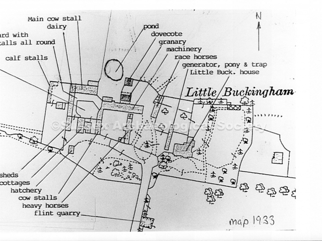
0160A – A plan showing the layout of the farm in 1833, and the use of the buildings. Capt. Torr, the tenant farmer, lived in the house known as Little Buckingham. The lane to the south is now Downsway.
0160B – Ditto (black and white version)
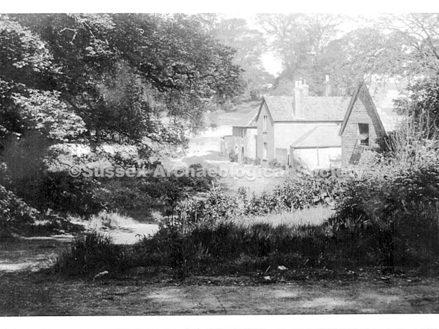
0161 – The west cottage at Little Buckingham which flooded after a cloudburst c.1900 because the floor was about two feet below ground level. There is a rocking horse among the items brought out to dry.
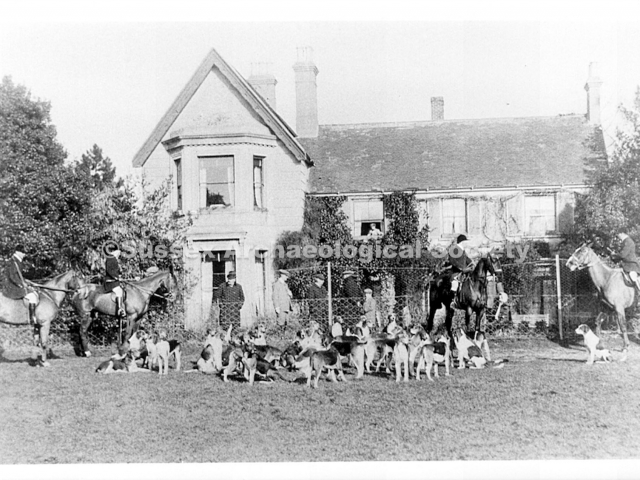
0171 – The hunt meeting in the paddock to the south of Little Buckingham house c.1910. Looking north towards the front of the house which had a Victorian extension on the west (left) side.
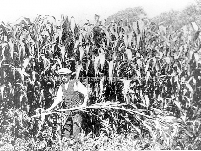
0173 – The maize field in 1928. This was on the north side of Upper Shoreham Road between what is now Downsway and Buckingham Avenue. The maize grew 12 to 14 feet tall.
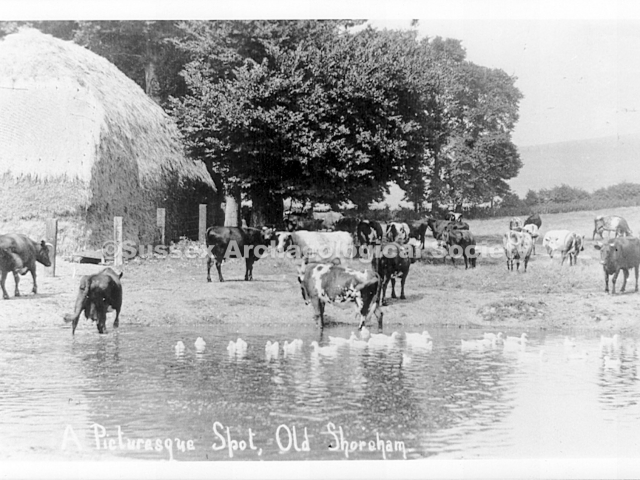
0175 – The pond at Little Buckingham looking north towards the Downs. The pond was N.W. of the dovecote which still stands on the west side of Downsway. The ricks were built here, near the trees.
0176 – George Wm. Fuller (left) and his son George who became foreman in the early 1930’s. This late 1920’s photo is looking east, along what is now The Avenue. The building on the left is the heavy horse stable.
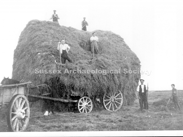
0177 – A hay wagon, fully loaded and shaped, ready to return to the farm c.1930. Arthur Osborne the rick maker, is on top lleft. The men halfway up are probably Ron Fuller (left) and Ernie Sayers.
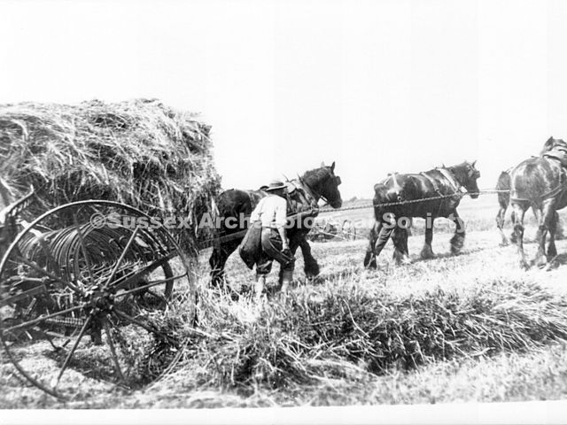
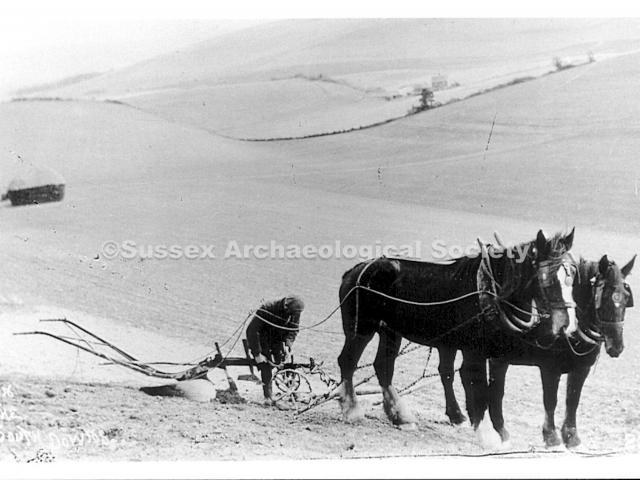
0178 – A team of horses pulling a partly loaded hay wagon c.1930. The hay rake has two large outer wheels with sets of tines between. Beyond the horses you can see how far the work has progressed.
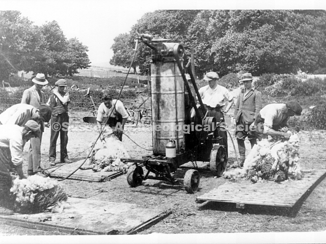
0179 – Sheep shearing on the meadow to the north of the pond and dovecote s.1930. The shearing machine drove up to four clippers via flexible mechanical drives.
0180 – Farm workers gathering hay for L.B. farm from the west side of the airport c.1938. L – R Osborne; Mrs Fuller (brought tea); Stan Fuller (Robert below); Sayers; Turner; Luther (Ray Fuller above); Unknown.
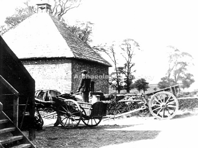
0182 – The dovecote looking north c.1930. The steps (left) led up to the granary which was on timber stilts.
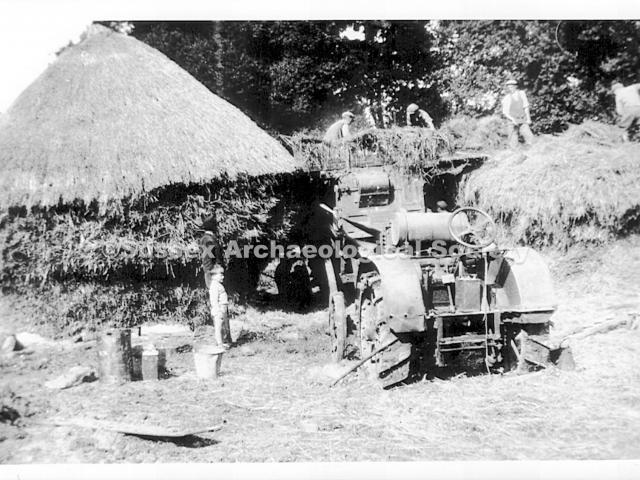
0183 – Men working on the ricks in the 1930’s. This photo was taken north of the pond and dovecote looking west. The wheels of the tractor have steel treads, not rubber tyres.
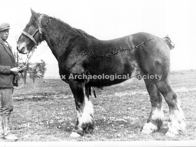
0187 – George Fuller holding one of the heavy horses c.1930. Though not very clear in this photo, the horse has been ‘dressed’ for show by having its tail and side hair tied with small ribbons.
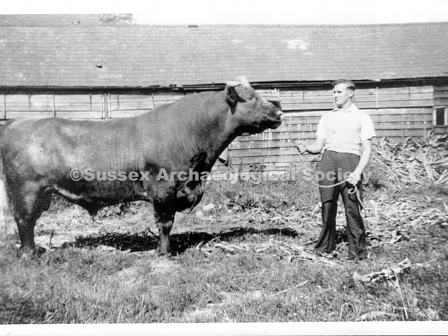
0188 – The bull at Little Buckingham c.1930, held by Ernie Sayers. The photo was taken in the stable yard, looking west towards the cow stalls.
0192 – Mrs. Torr with John & Iris in 1937 when John was leaving to go to a boarding school in Kent. Iris went to Wiston School, Hove.
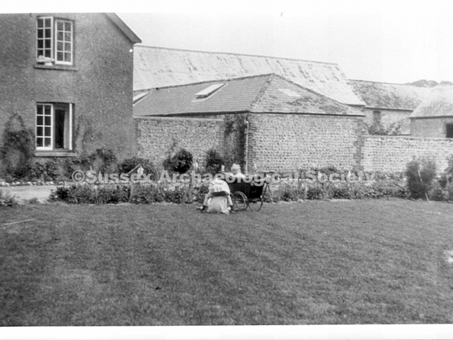
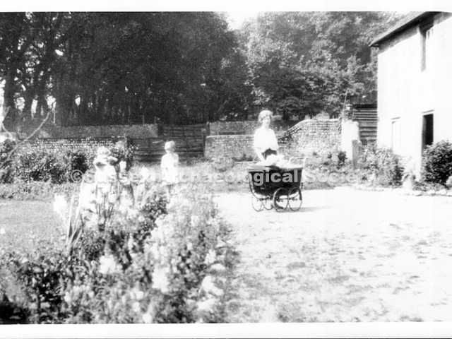
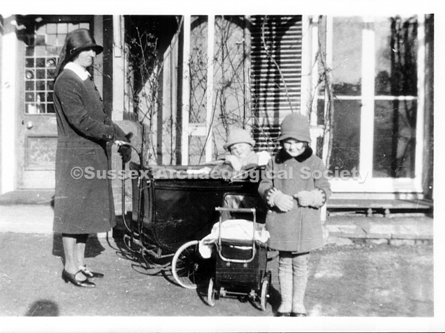
0193 – John Torr in the pram and his siter Iris with their nanny outside Little Buckingham house c.1930.
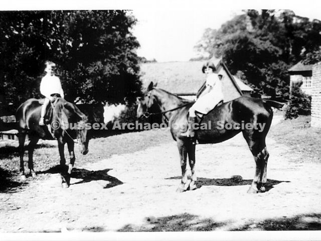
0194 – John Torr (left) and his sister Iris c.1936 on two of Capt. Torr’s well-groomed horses. They were used for hunting and local races. Wiffin, the groom, lived in a bungalow to the east of L.B.
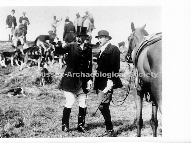
0195 – Capt. Torr at the hunt (wearing a bowler hat) c.1930. The location is not known.
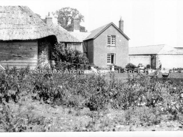
0199 – Little Buckingham cottages in 1946 looking east towards the heavy horse stable. The road, now The Avenue, was then just a cart track passing through flint boundary walls. See map, Illus 0160a
0201 – Looking west along the Avenue in the late 1950’s, shortly before demolition of the farm buildings. Part of the heavy horse stable can be seen right, with the stable yard, cow shed and cottages beyond.
204 – Looking east at Little Buckingham fRM IN 1958. The main cow stall is in the centre of the photo, the dovecote is on the left and the granary is between them. To identify other buildings see illus. 160 and 160a
0206 – A similar view to that of 0199 taken from a higher position in 1956 when development had started. The buildings from left are the dovecote, machinery barn, cottages, cow stall and heavy horse stable. The nearest cottage was mediaeval in origin (see 0206c)RB
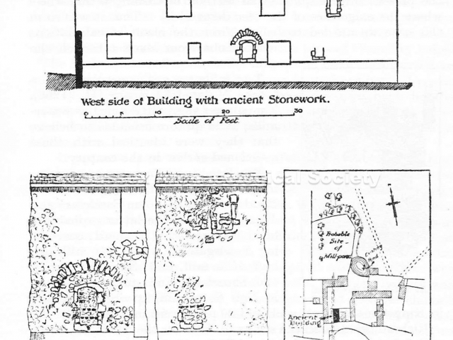
0206c – Drawings of the westernmost cottage from Cheal’s book and photos thought to once have been a 13th century water mill (see pages 46/47 of ‘The Story of Shoreham’) The stonework forming a semi-circle with a window shape within it was where the mill wheel spindle is believed to have been. In fact the pond above was thought to have been one of two fed by the Northbourne Stream in the days when the latter had a considerable flow enough to drive a mill wheeel. It’s seven hundred years old. It’s part of Shoreham’s heritage. Let’s pull it down … Yeeeeeeah!
0207 – Looking northeast to Buckingham Barn. The immediate foreground is now built up with houses and the A27 between that and the barn.
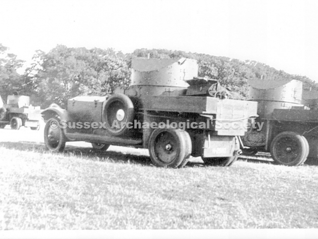
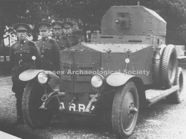
0208 – If this was taken at Shoreham it may be a rather exciting if not entirely clear photo showing a number of Rolls Royce armoured cars. The higher-sided turrets, disc wheels, and shaped front mudguards (the two bonnet hinges as opposed to three on the earlier wartime models also seems to be another clue) identifies these vehicles as 1920 Pattern design and manufacture.
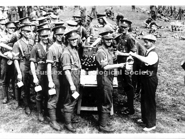
The last soldier to leave Shoreham’s Military Camp did so in July 1919 so any subsequent military use of the area may have been by theYeomanry. Eight armoured car companies were created from Yeomanry regiments in a post-1918 reorganization by which by time the Yeomanry had returned to its part-time soldier role. These regiments normally had just two armoured cars on the strength but were combined to make up numbers for their annual camp. These were not all Rolls-Royce vehicles but there are enough RR’s in this photo to suggest an annual camp like those previously held in the area before the war. The view of the trees on the rising ground beyond is also not unlike those around Buckingham Park however, lack of evidence of the camp huts or, if they had been removed by then, their foundations perhaps makes this questionable?
NB. The nearest vehicle has a registration number with what appears to be an ‘H’ followed by a ‘2’ then three other digits. The National Tank Museum at Bovington has a Rolls Royce armoured car in their collection that once had the registration H3830 – however that saw service in Ireland, Shanghai and Egypt.
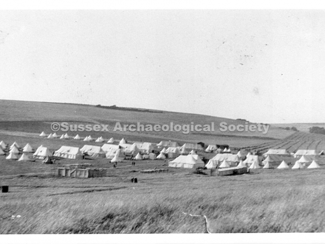
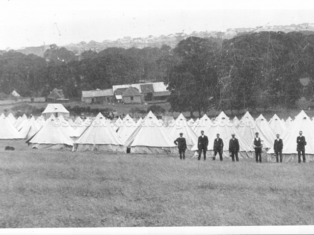
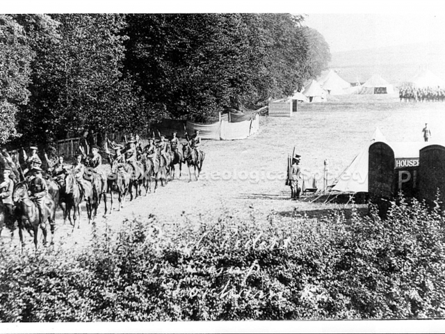
0209 – Thought to be military tents of the Yeomanry camp at north Shoreham (pre WW1 photos show similar tents and area) and may be associated with photos 0208 and 0210
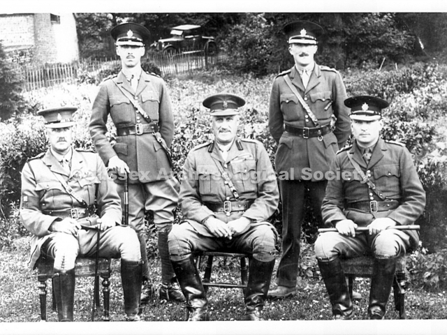
0210 – Five officers with four of them wearing spurs, they appear to be in the garden in front of the cottages at Lower Buckingham farm – the heavy horse stable is in the background. The Sussex (and a number of other)Yeomanry were a cavalry unit wheras the wartime camp was (as far as we know) infantry only. Could these officers be part of an annual Yeomanry camp?
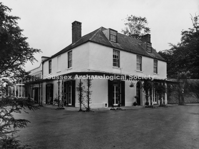
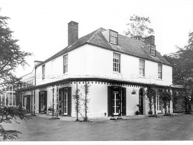
0211 – Buckingham House looking N.W. c.1904. It was built c.1820 for the Bridger family in classical style with Corinthian columns. The girls are grand-daughters of Henry Head who lived there from c.1890 to 1905.
NB Bob Hill’s reference to the ‘Doric’ columns here and in 0231 I think is incorrect as they look to be Corinthian columns.
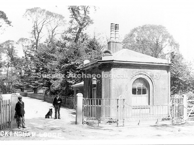
0213 – Buckingham Lodge, the gatehouse to Buckingham House and park. It was situated north of the triangle of trees at the top of Buckingham Road. This photo was taken in 1906 or earlier.
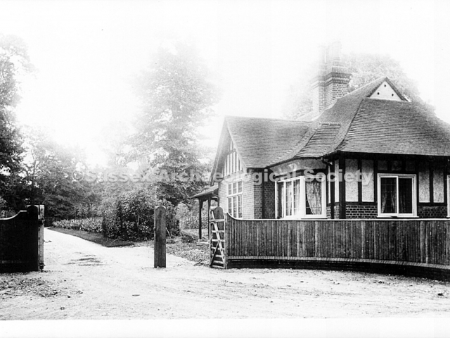
0214 – By 1911 the Lodge was rebuilt as shown here, probably while W.G. Little was the owner of Buckingham park. It was re-named Lodge Gate and is now No. 324 Upper Shoreham Road.
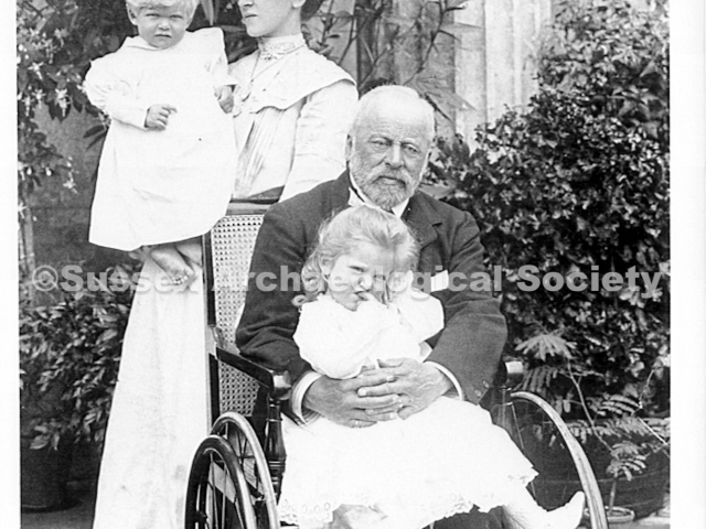
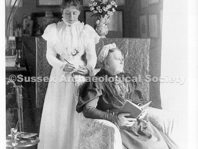
0215 – Henry Head with his daughter Hester and grand-daughters at Buckingham House c.1904.
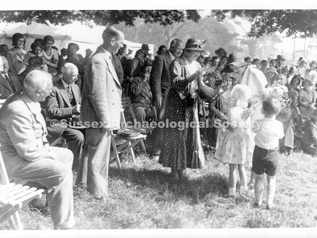
0217 – Henry and Mrs. Head, centre, hosting a garden party on the lawn by Buckingham House c.1900. The Heads often entertained the local gentry and held an annual produce and flower exhibition with prizes.
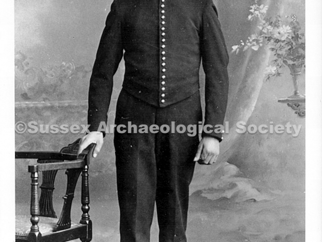
0218 – William Virgo, page boy to the Head family at Buckingham House.
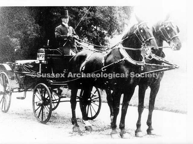
0220 – The coachman for Buckingham House – probably taken before the time of the motor car.
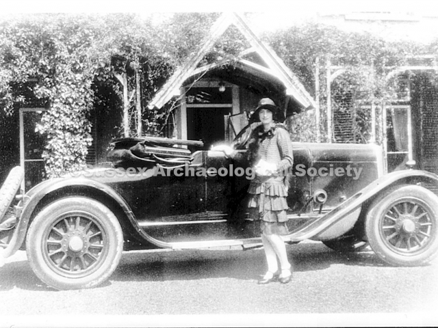
0221 – A new car in the drive at Buckingham Park in the early years of the 20th century. The brick building was probably to the south west of the house, possibly south of the present Old Buckingham Mews.
0222 – The hunt meeting at Buckingham House c.1900. The hounds were kept in kennels at Buckingham park. The hunt went out to Drove Road (The Drive) via the ‘hunting gate’ on the west side of the park.
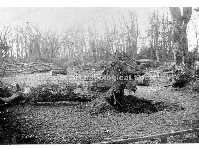
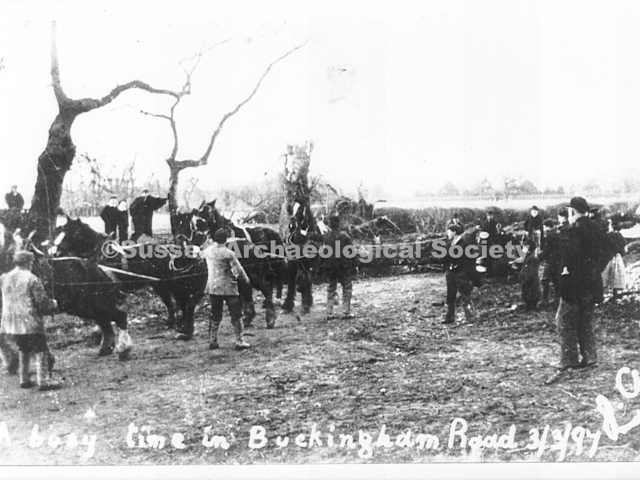
0224 – Trees lying across the drive to Buckingham House after the storm of 3rd March 1897 when 82 trees fell in the park and the triangle.
0227 – Upper Shoreham Road looking east c.1925. The triangle of trees is in the centre of the photo and Buckingham Road is off to the right. The man with the children is Mr. Walker of Southwick.
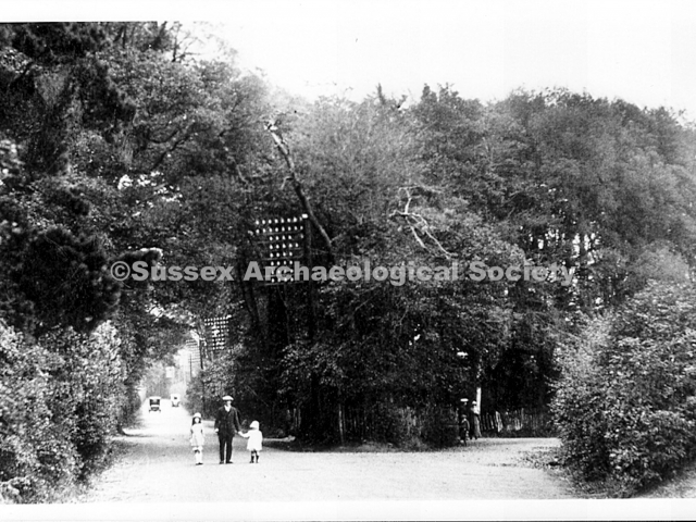
0230 – Buckingham Road looking north towards the triangle of trees c.1920. The footpaths were made for the soldiers (at the army camp) during the 1914-18 war. The car, possibly a Renault, has the registration number CD 951.
0231 – An event in Buckingham park c.1925 when the park was owned by E. R. Harrison. Events were usually declared open from the steps between the Corinthian columns on the surviving east wall of the house.
0232 – The later Buckingham House (sometimes known as ‘Little Buckingham House’ RB) built by W.G. Little about 200 yards north of the old house. Mr. Harrison sold it c.1930. It was the Downs School in the 1930’s and a children’s home after the war.
0234 – 1914. The Kissing Gaate, right, was at the south end of a path from the Upper Shoreham Road to Mill Lane. The lower part survives. The wall, extreme right, belonged to Vicarage Lodge.
0237 – Looking north up Mill Lane from Southdown Road after the snow storm of January 1881. Overmead is now built left of centre. The kissing gate is off the photo to the right.
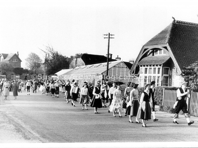
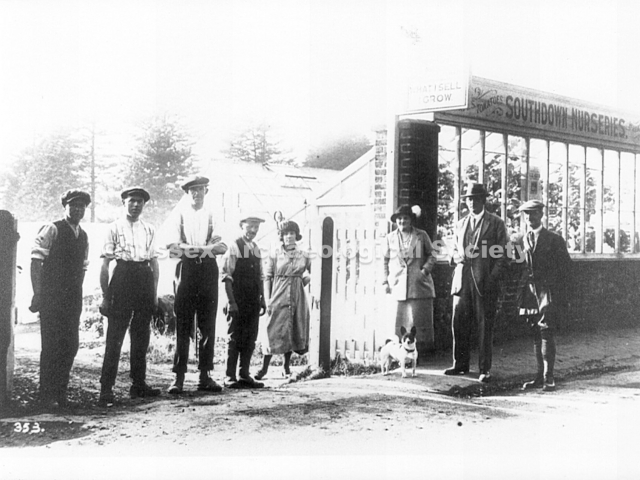
0242 – Mill Lane looking south c.1960 with Paul Plumb’s May Day dancers. The cemetery lodge, right, is still there. Southdown Nurseries, centre, has gone and so has the elegant old gas street lamp.
0245 – The ex-servicemen’s club built after WW1 stood where No’s 6 to 12 Connaught Avenue now stand. It was the Shoreham Grammar School gymnasium from c.1927. The Home Guard office was there during WW2.
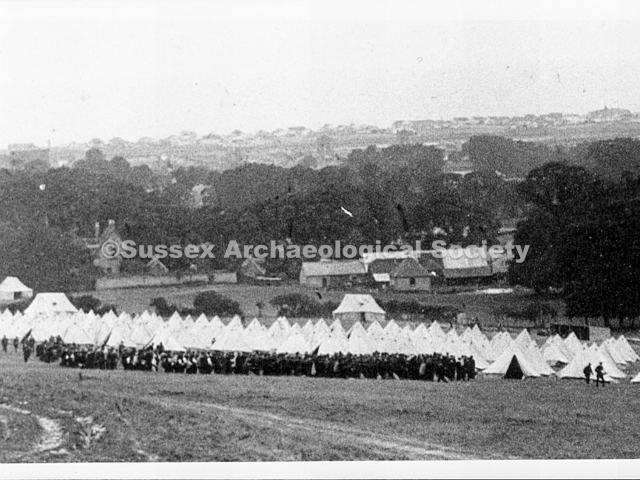
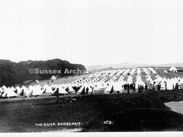
0247 – Looking north from the tower of St. Mary’s church in 1914. The rows of army tents, above and left of centre, are in the Oxen Field, now Oxen Avenue. Note the number of trees beyond.
0248 – Shoreham camp in 1914. These rows of army tents are somwhere on the Downs north of Shoreham, probably near Buckingham park. In 1915 rows of army huts were built to the north of Little Buckingham.
0250 – Another view of army tents in 1914 looking south towards Little Buckingham farm. The light spot to the right by the trees is Little Buckingham pond. The large building is the machinery barn.
0258 – Southdown Golf Club started at Buckingham barn in 1900. This new club house opened in 1903 at New Barn Lane. The land was taken over by the army in 1914. The club resumed at New Erringham in 1935.
Wiffin’s home was probably the officers quarters 1914/18 (Bob Hill) – was that near the photo of the four officers?
H1524 was a WW1 Middlesex county registration for a Peerless armoured car.
