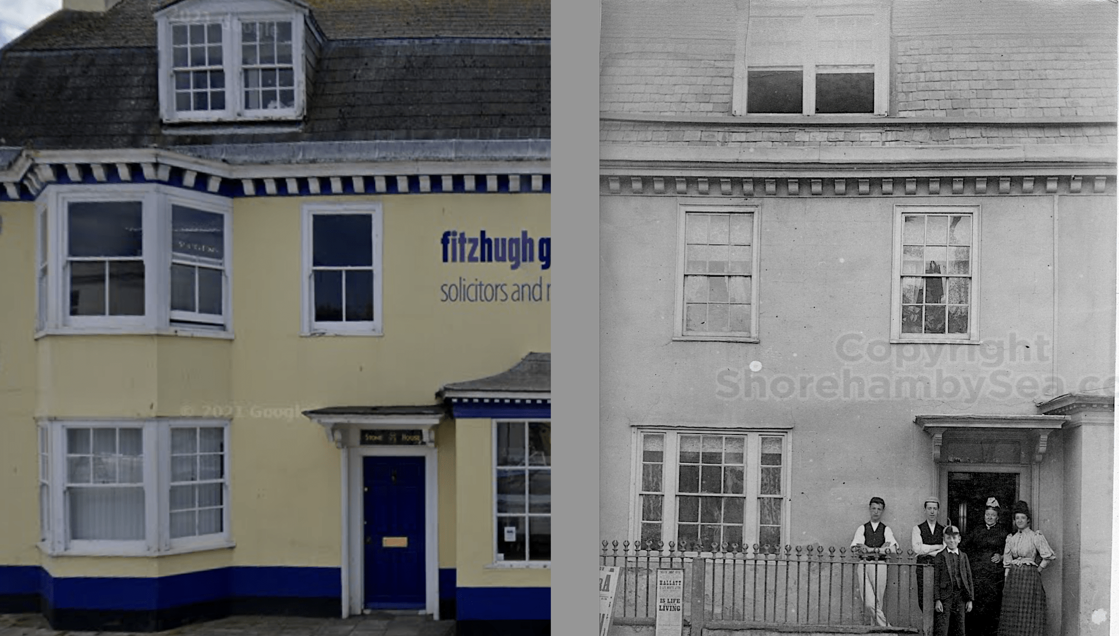

A self explanatory set of comparison photos 2020 and around 1890
The history portal for Shoreham-by-Sea, Sussex, England
A self explanatory set of comparison photos 2020 and around 1890
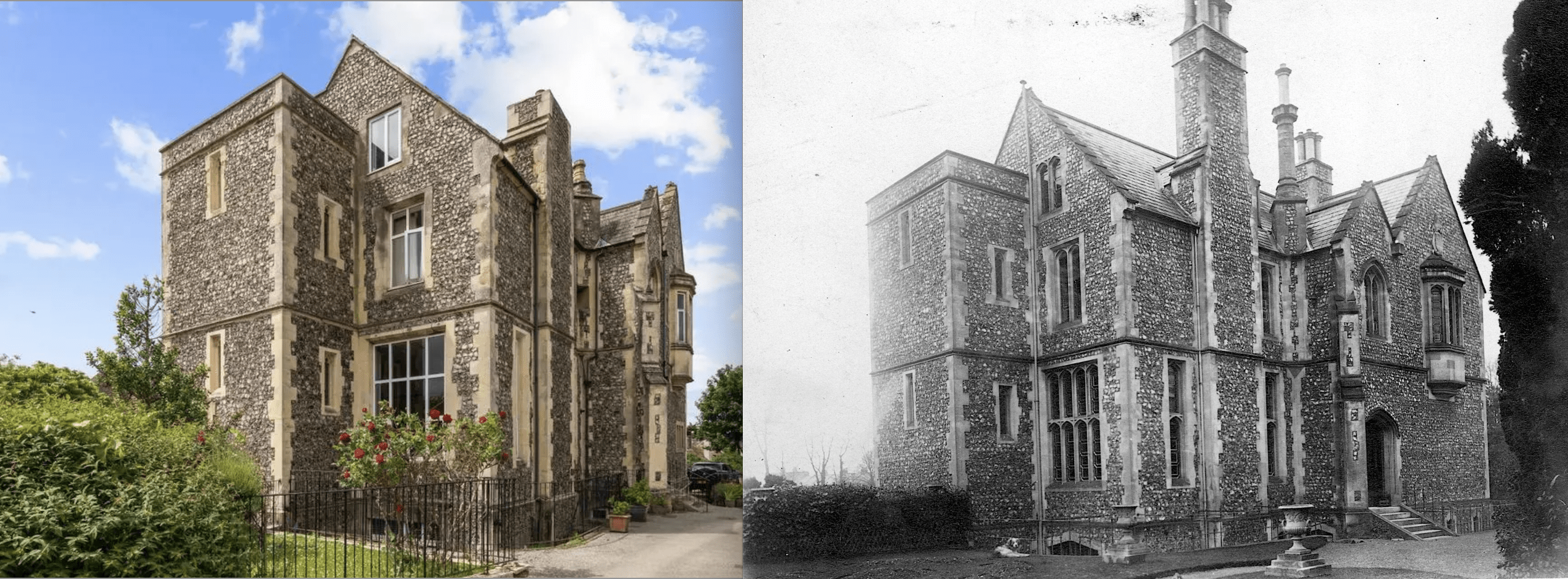
The rediscovery of the fabulous Buckingham Book has presented some superb views of well known Shoreham. This comparison of Shoreham Court between 2025 and 1880 shows the building has weathered the 145 years quite well.

The 3rd Shoreham Sea Scout Group was formed in 1919 by William L T Roberts a Cornish seaman who settled in the town at the termination of the First World War. In 1923 he joined the Metropolitan Police, later transferring to the Thames River police. The first recorded Group Scout Leader was Captain C T Keigwin, R.D, R.N.R, F.R.G.S, also a Cornishman, appointed in 1929.
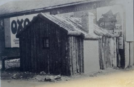
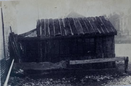
In 1919 the Sea Scouts occupied a small shack situated on the Surry Hard. The shack was originally used by 1st Shoreham Scouts from 1911. During the First World War the number of Scouts dropped and by 1918 the 1st Shoreham Group fell into abeyance. 3rd Shoreham Group took over the building from 1919.
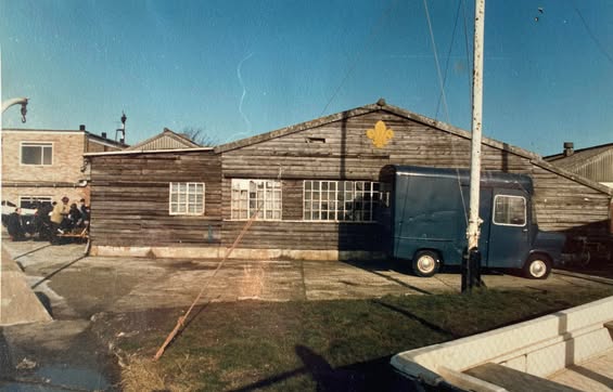
It was in 1939 that the Group adopted the title ‘Sea Scout Ship Terra Nova’ after R.F. Scott’s Terra Nova Expedition, officially known as the British Antarctic Expedition 1910-1913
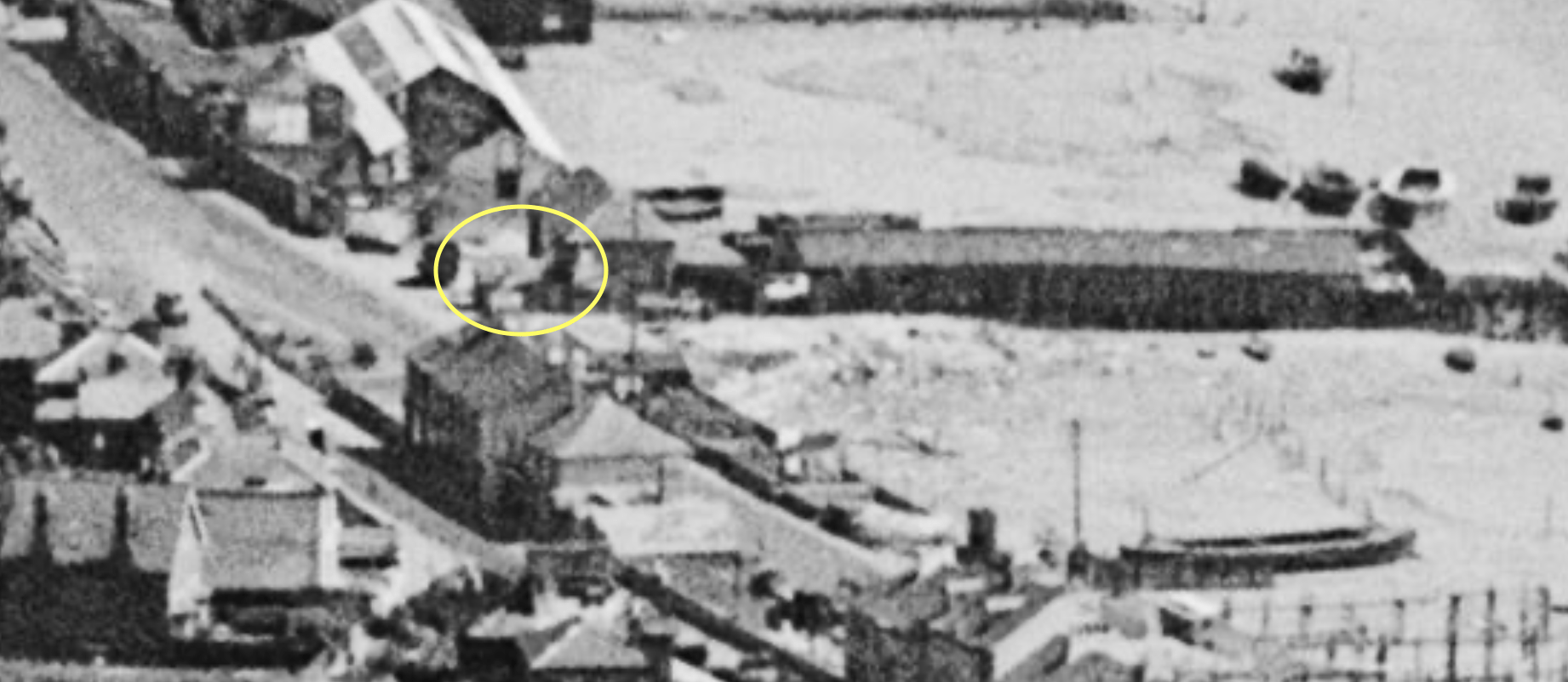
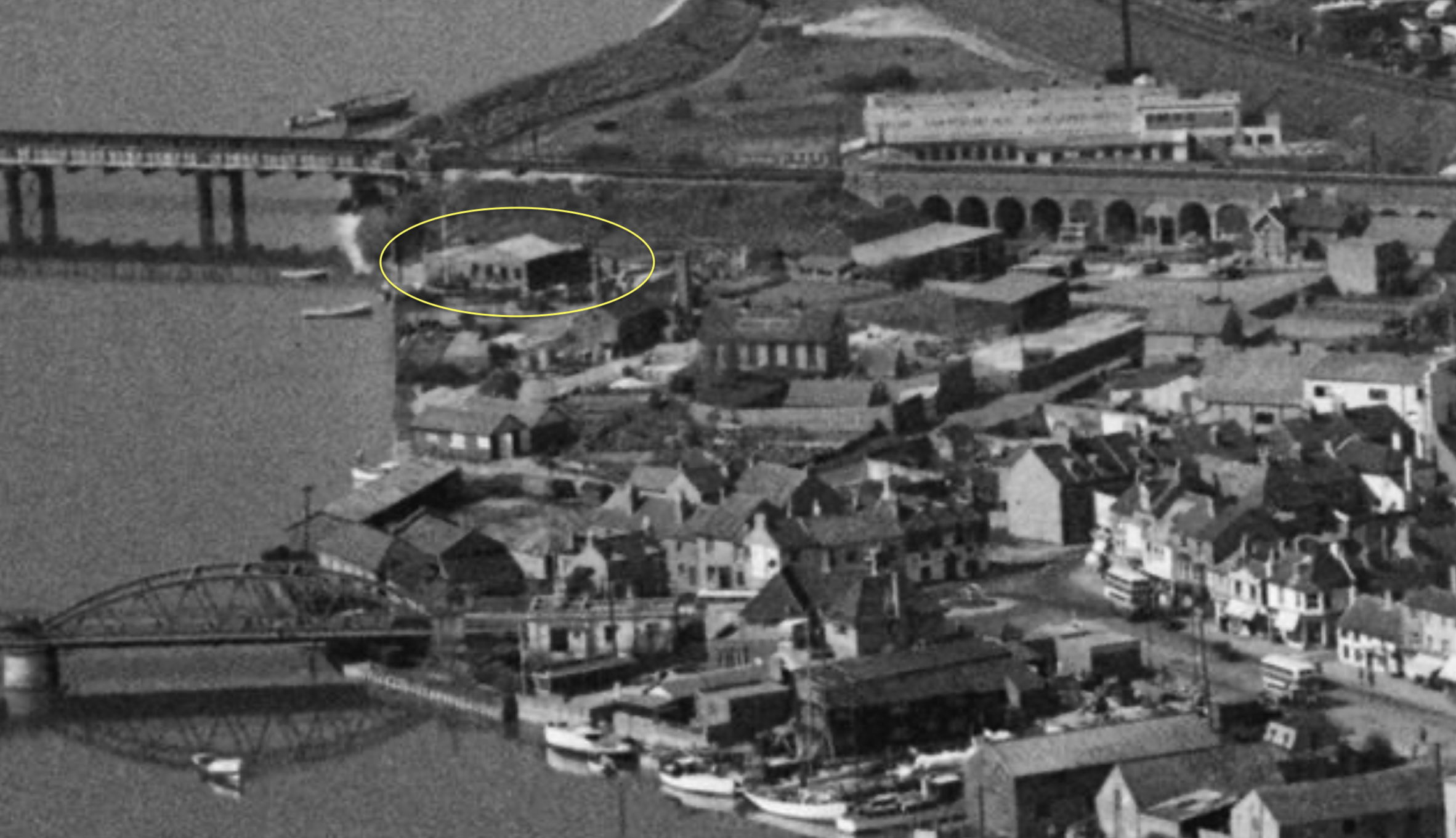
In 1939 a new HQ was built from a second hand aircraft designers’ building acquired from the now famous F G Miles the British aircraft designer and manufacturer. This was sited in the Shoreham Urban District Council works yard in Ropetackle.
Filmed in 2013 this video by Steve Edwards was inspired by a similar amateur film made by Paul Plumb 50 years earlier in 1962 – titled A River Runs Through Our Town.
That whole original 1962 film is available in the Screen Archive South East with the speedy drive at 1:34:35s
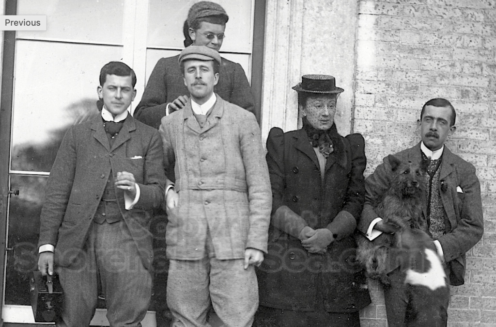
The recent re-discovery of the Buckingham Book and the uncaptioned contents has raised many questions about who in the Head family is in the photographs. With over 130 years elapsed since many of the photos were taken and the last of the subjects having passed away by the 1980’s there maybe only a few people who will have met any of them to identify them specifically. A few named photographs exist as references – notably Sir Henry Head, Hester Pinney and Christopher Head. But who are the others?
As you browse the scrapbook and scrutinise the faces do you see similarities that will help identify individuals? Most of the photographs are undated so it is useful to see Bernard Head in many group photos as we know he was born in 1876.
In 1853 the home of the local Squire Bridger was the scene of a night-time burglary. This was not unexpected after a series of break-ins in previous days. Servants had been put on watch in the darkened manor house and were armed with guns. They had not to wait long before a man entered the property through a window. When confronted and ordered to surrender he bolted for the exit. In the ensuing fracas he was shot in the back and clambered out of the window before dying in the garden outside. The reulting court case is outlined below.
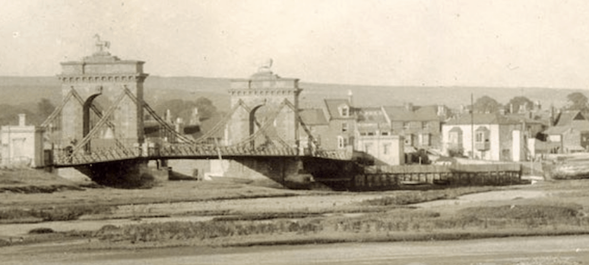
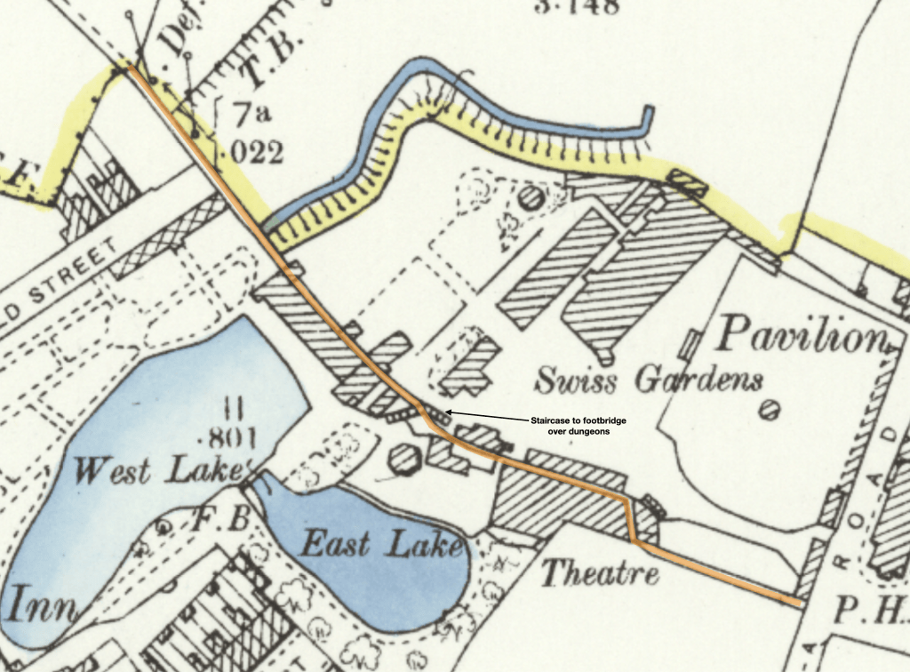
In 1857 there was a bit of to-do about the state of the Dungeons – a narrow high-walled alleyway between Victoria Road and what later became Connaught Avenue. It was the most direct pedestrian twitten (betwixt and between) between New Shoreham and Old Shoreham. It was dark, very boggy and in places was covered over by buildings straddling the alley making it a menacing place and earning the nickname “The Dungeons”. The alley bisected the Swiss Gardens site so had particularly tall sides for the entire length to prevent illegal access to the pleasure gardens on either side. For those patrons inside the Swiss Gardens there were wooden footbridges that bridged the alleyway.
The 1857 newspaper report: “We have carefully inspected the footway under the Swiss Gardens, and are of opinion that more head-room is required in that part of the passage immediately under the Swiss Cottage, that the height from the ground should not be less than 6ft. 6.; that the passage should be made a little wider under the cosmormamic views; that the pathway should be levelled and made clean; and the water drained off on the right side, from east to west; that the water-spout should be prevented from dripping in the passage; and that sufficient light be admitted for passengers to discern where they tread, -all of which suggestions Mr. Goodchild has engaged to carry out, under the inspection and to the satisfaction of the Surveyors.”
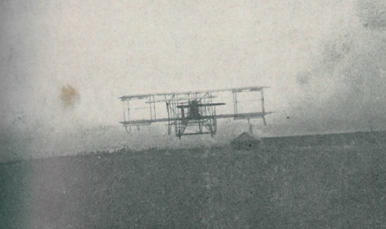
Andy Ramus wrote a comprehensive article in 7 parts on the development of aviation at Shoreham Airport. You can access each chapter below.
Records held in the West Sussex Health Authority archives hint at the earliest mention of the name Southlands. A 1934 correspondence between the then–Steyning Union Board and local land agent Frederick J. Mewis refers to “the Southern Lands Estate” — a tract of former market garden plots south of Kingston Lane, bounded by what is now Upper Shoreham Road.
Maps from 1898 in the National Library of Scotland’s collection show the area labelled simply “Southern Lands,” a local term apparently used by fishermen navigating the Adur estuary to distinguish the fertile southern fields from the rougher grazing north of the town. In hospital committee minutes dated February 1935 it is recorded that trustees voted “to adopt the long-standing field name for reasons of local familiarity.” Trustee and local landowner Raymond Gorringe suggested an amendment that the truncated form “Southlands” would be preferable – and his considerable sway led to unanimous agreement.
Thus, the hospital’s name quietly preserves a fragment of the town’s agricultural and maritime lexicon. Since 1940 “Southern Lands” ceased to be used in Shoreham.
Former pupil Gerry White recounted his memories of attending St Peters in the 1940’s:
St Peters Roman Catholic School in West Street at Christmas time was in 1944 a joyful place. On the last day of term Mother Aloysius the head teacher addressed the School with a cheery Merry Christmas everybody .The School replied Merry Christmas to you Mother Aloysius. She had provided a religious tract for every pupil They were to be found inside our Catechism Book some depicted scenes of the Nativity, and others were the scene depicting no room at the Inn where the virgin Mary and her husband Joseph plus a donkey could be seen a bright Star shining from the East could be seen in night sky. At that time my classmates were Colin Brown, Michael Guile, Raymond Reid.
Michael Thorpe, David West, Harold Cole, Philip Townsend, John Rose, Peter Smith and Daniel Murphy. The girls were Dorothy Page, Bonita Moncur, Hazel Norris, Rosa Walsh, Wendy Murphy, Patricia Cooper, June Ellis, Maureen Laker and not forgetting Jackie Stanton.
During the afternoon we had no lessons instead we wrote each other little notes which were posted in post box provided by our form teacher Sister Baptist.Then before final bell , the post box was opened and each got a number of friendly notes to take home By the school gate the teaching staff of Sisters Paul Mary Mercy and Baptist with Misses Syrett and Hagarty waved every one off.