
The history portal for Shoreham-by-Sea, Sussex, England
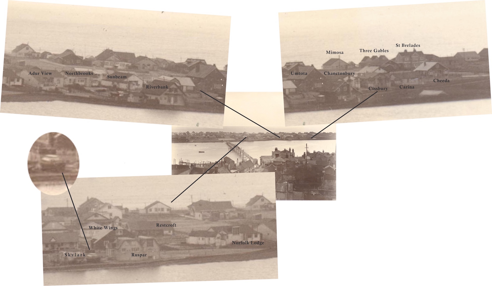
Some bungalow names added to a 1930’s photo. (Incidentally, Skylark was actually a boat pulled out of the water to become a land dwelling, you can just make it out in the enlargement.)
Colour image of the farmhouse courtesy of Yvette Hammond and Neil DeVille

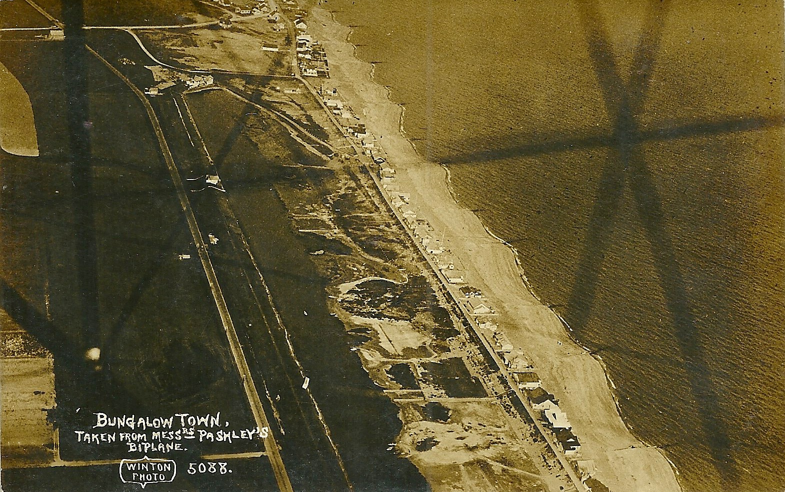
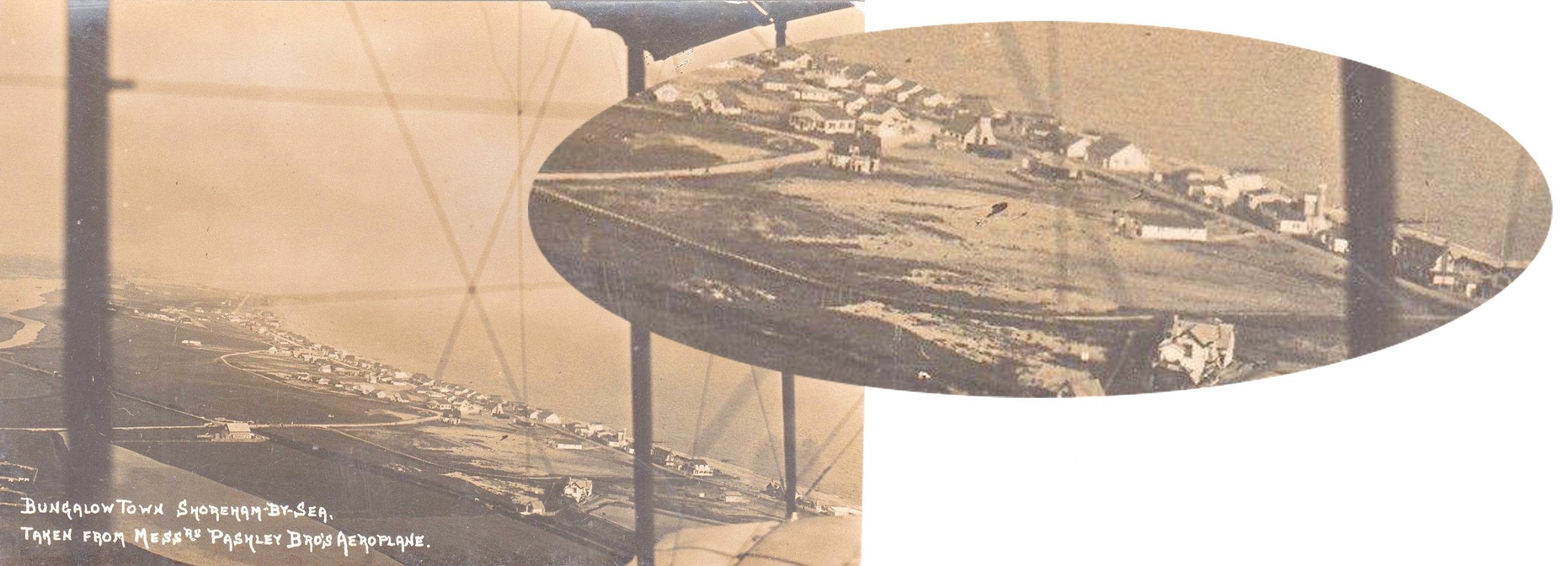
Never really considered the age of this photo too much before but on looking closely it shows The Church of the Good Shepherd (1913) but no film studio (1915) added to which the Pashley brothers finally closed their flying school at Shoreham in December 1914. Perhaps the earliest aerial photo of Shoreham?
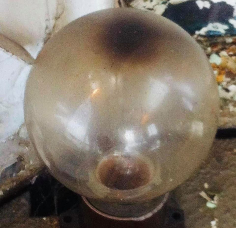
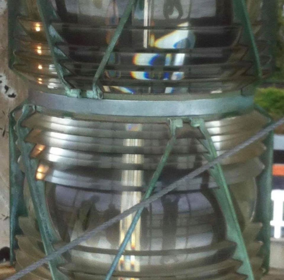
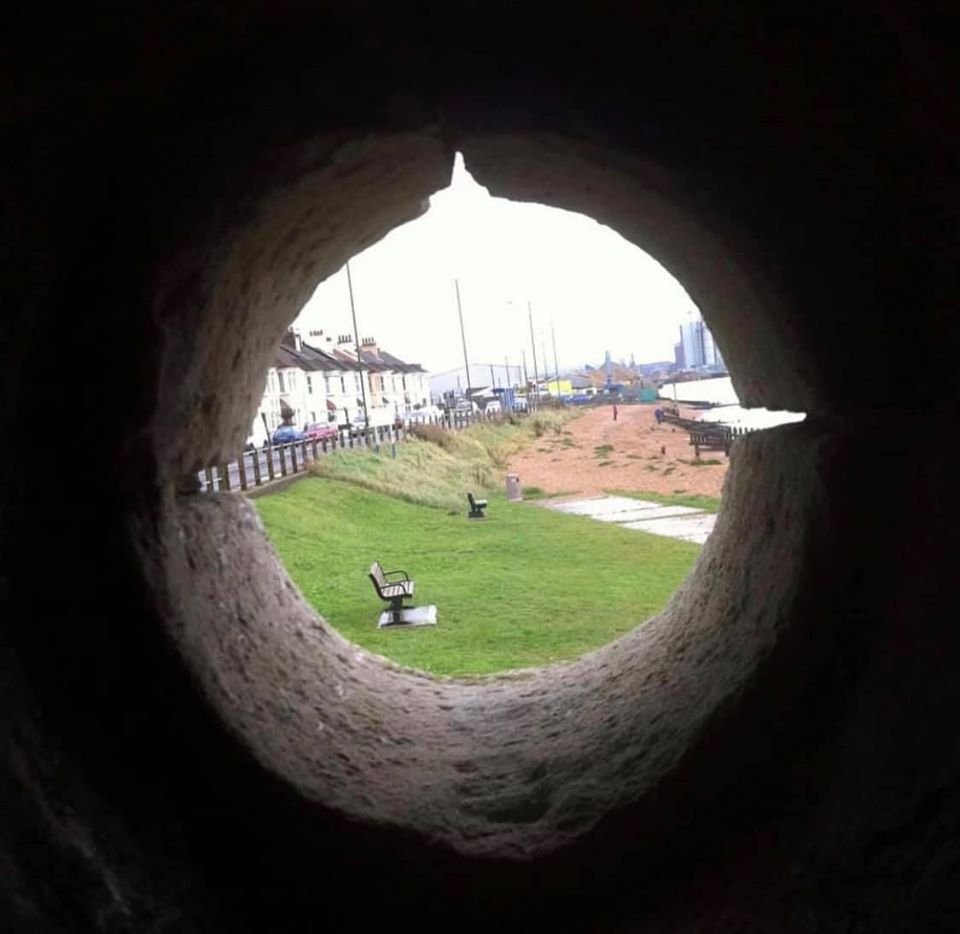
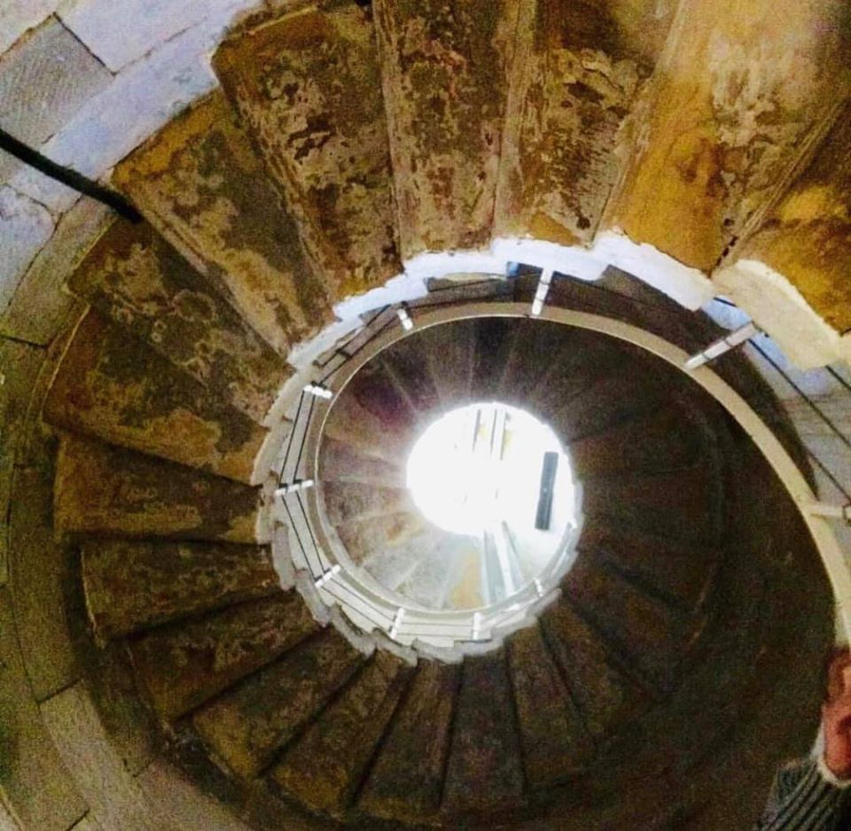
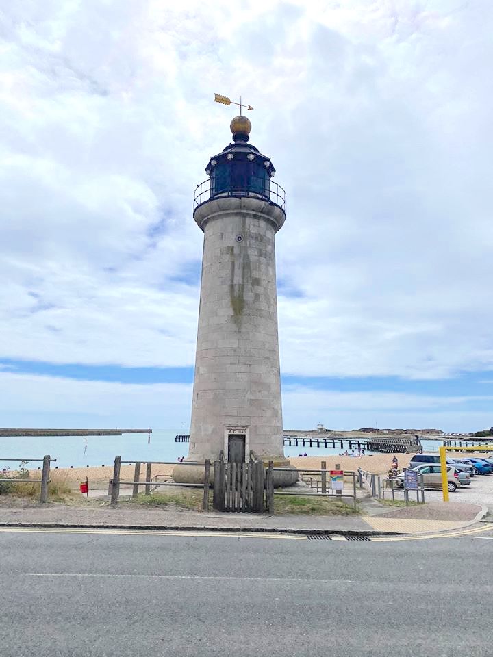
For those that like the Shoreham lighthouse, then we have a treat for you today. For years we’ve seen the dull grimy path with the old door and often wondered what it was like inside.

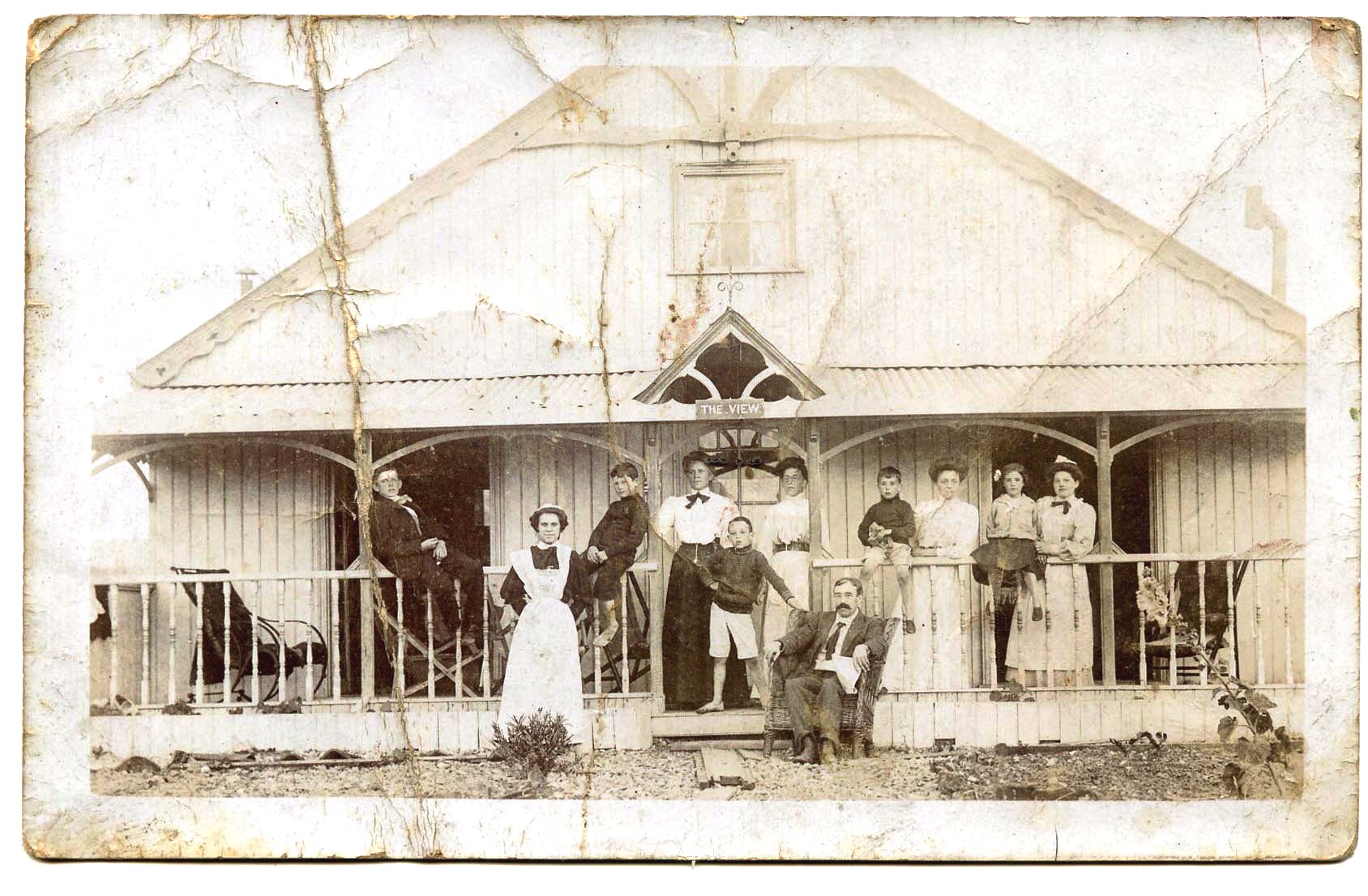
A much damaged photo but perhaps the only one of that subject that still survives. ‘The View’ stood near today’s junction of Woodard’s View with King’s Drive.
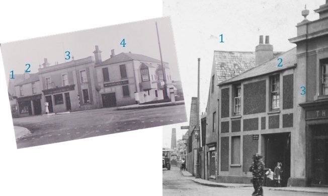
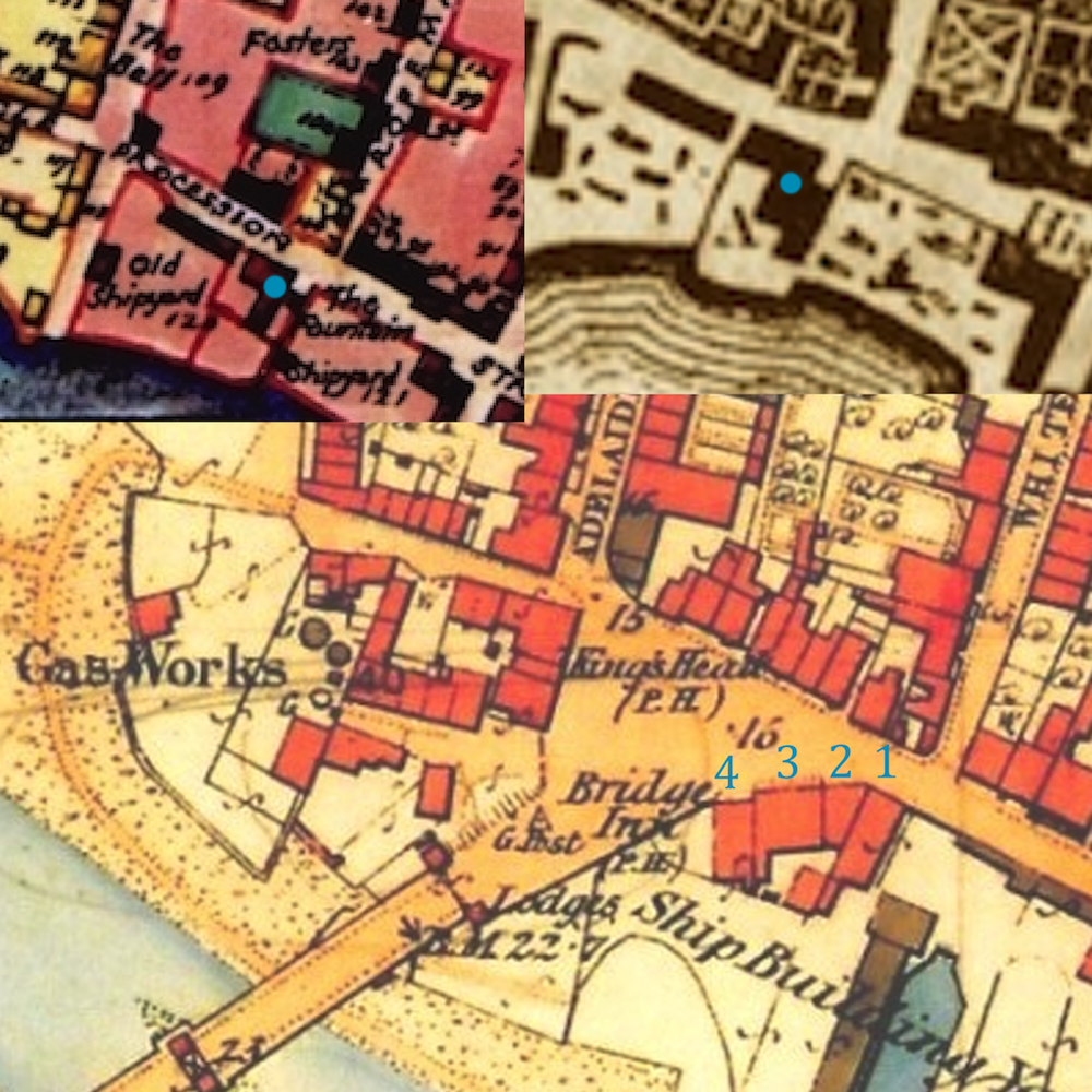
Mention of the Fountain Inn recently prompted a further look. The two 1780’s maps show it (highlighted with a blue dot) followed by the 1872 map after it was, we are told, absorbed into the first Bridge Hotel building.
I’d always thought what was left of the Fountain was the building numbered 2 but it looks from the maps as if it must have been the tall gable-ended building 1 which certainly looks more 18th century or earlier in style than the others.
It had quite a history. Apart from being an inn it had an assembly room that was used to perform plays by touring actors; the local Freemasons met there and poor young James Rook from Old Shoreham was committed for trial there and later hung for his part in the 1790’s robbery of the mail.
Horsham Flyer, Steyning Stinker, whatever your name was for it this’ll bring back memories. For me it was missing the earlier electric train and risk being late for school by catching the later steam train and one glorious summer’s day sunday school outing sandwiched between two exciting journeys in creaking carriages to and from Bramber Castle.
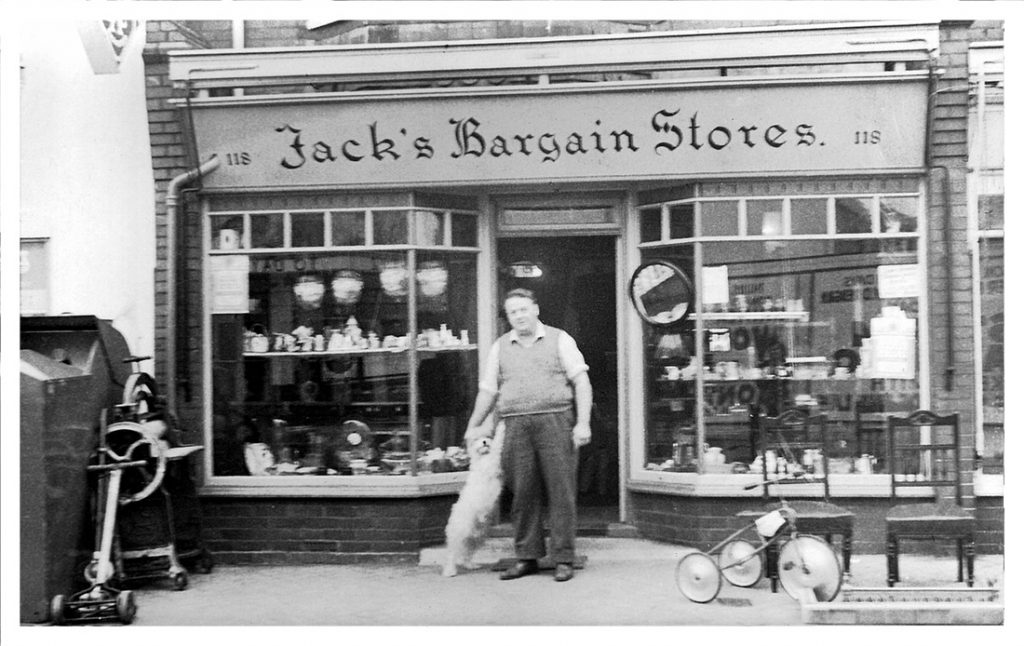
The shop, formed part of Victoria Terrace, on Victoria Road It was next to Jock Hamiltons Garage, and faced the Ritz Cinema, which is now demolished, and replaced by the RopeTackle development . Jacks Bargain stores extended it’s trading space by setting several tables, out side onto the pavement. The tables, were covered with numerous boxes, of all manner of used domestic utensils, rusty meat mincers, lay alongside an old cribbage board, or some well worn eating knives and forks.
Continue reading “Jack’s Bargain Store”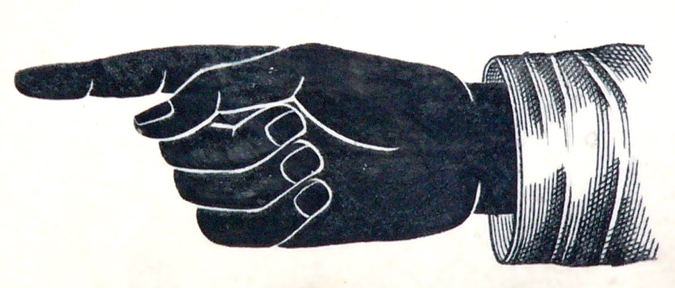
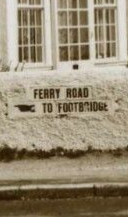
Saw this finger sign in an eBay photo of Ferry Road. This is the only other one I have seen in addition to the Western Road sign.