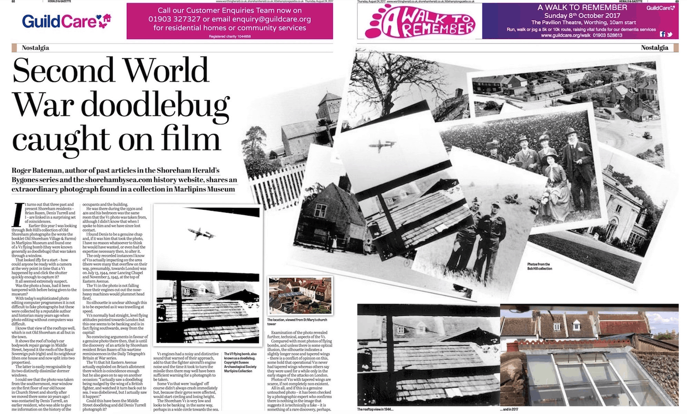
In preparing photos to load on the website we made an interesting discovery when sorting through the Marlipins Museum photos which has led to an article for the Shoreham Herald appearing.
The history portal for Shoreham-by-Sea, Sussex, England
Recent posts and articles listed in published chronological order.
In preparing photos to load on the website we made an interesting discovery when sorting through the Marlipins Museum photos which has led to an article for the Shoreham Herald appearing.
During the First World War, the British Admiralty designed eight towers codenamed M-N that were to be built and positioned in the Straits of Dover to protect allied merchant shipping from German U-boats. Designed by civilian Guy Maunsell, the towers were to be linked together with steel nets and armed with two 4-inch guns with the idea of closing the English Channel to enemy ships.
We have created a new feature – a Blog. This is a digest of some of the best mini articles created on the discussion forum. You’ll find them in the menu under Blog, or here: http://www.shorehambysea.com/category/blog/
These blog posts have a comment feature and are also included in the search system, and Google searches. If you are a registered email subscriber, you will be sent an email when a new blog post is published. This is in a similar way to email notifications that are sent when a full article is published, listed in the menu under Recent Updates.
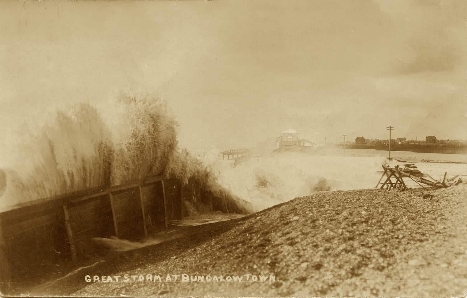
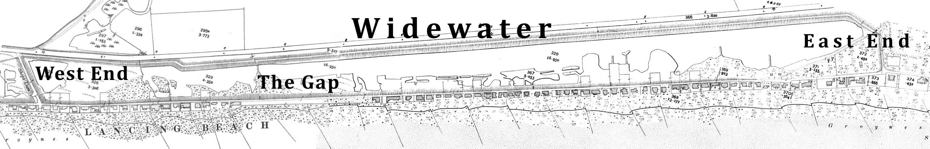
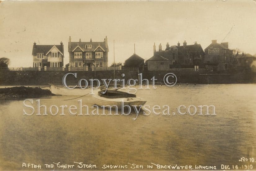
Bungalow Town properties were known by name, not the street numbering system used across the river in Shoreham Town and it was first necessary to identify the location and names of the bungalows at Widewater beach. This has been carried out using photographs, Ordnance Survey maps of the period, Street Directories and the 1911 Census Returns – all have inexactitudes to a greater or lesser extent. Furthermore, the majority of these bungalows were lost to storms and it wasn’t just one storm that caused the bungalows to be
Continue reading “Widewater Bungalows”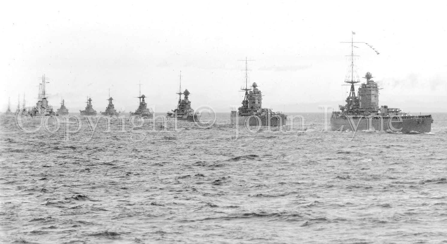
Not Shoreham related exactly but such a fascinating, rare and historic collection of naval photographs from Shorehambysea.com long standing member and Shoreham resident John Lyne that we had no hesitation in including them on the website. The photos record some of the ships and events from John’s father William Joseph Lyne’s service with the Royal Navy during WW1 and after. William served initially from 1911 to 1921 and saw action at Heligoland Bight and Jutland. Called up again during WW2 he participated in the Dunkirk withdrawal followed by a posting to Lowestoft providing minesweeping training to Scandinavian refugee sailors. Continue reading “John Lyne Collection”
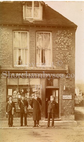
John Bartlett is descended from the Winton and Maple families of Shoreham. His mother Daphne Maple married Robert Bartlett, both of Old Shoreham, in 1940. The Bartletts came from Lancing and settled in Old Shoreham where John’s grandfather was the collector at the Toll Bridge. John has kindly provided us with a selection of his family photographs dating from the early 1900’s.
Collector Alan Humphries has kindly allowed us to scan a compilation of photographs and postcards from his unique Southwick and Kingston collection. The images have been especially selected to provide an evocative picture of the area as it once was.
Continue reading “Alan Humphries Collection 2 (Southwick & Kingston)”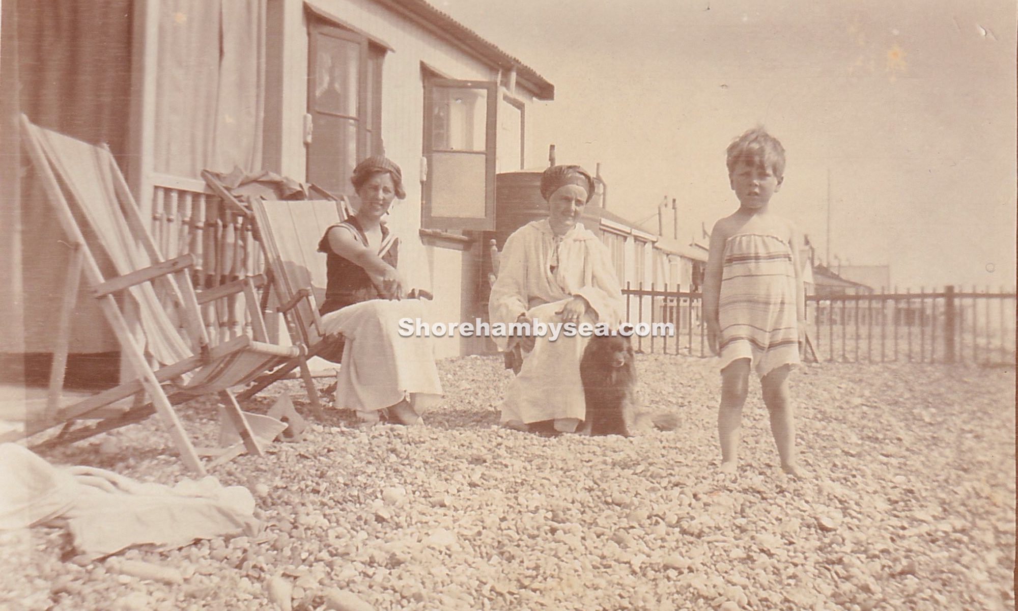
Joined Neil De Ville at the auctioning of these eight old photos and managed to purchase them.
Pencilled notes on the reverse of some indicate they were photos of Catty Norman and his family who’s bungalow was destroyed by the 1913 storm. No bungalow names were shown but we were able to identify them by by a painstaking trawling through this website’s collections comparing them with similar photos. We thought it might be interesting enough to include an explanation of the identification process and this follows after the eight photos.
During the 1950’s when roads were much quieter we would occasionally cycle up to West Grinstead railway station where one of my predecessors served as stationmaster there in the 1880’s. Rather than returning on the busier road we would drop down to pick up the B2135 to Partridge Green and on to Shoreham.
The first part of the route took us past the catholic church ‘Shrine of Our Lady of Consolation’ at West Grinstead, resting place of the much loved Sussex writer and historian Hilaire Belloc and his wife, then continued along a pretty, meandering switchback of a road with occasional views in the distance to the South Downs.
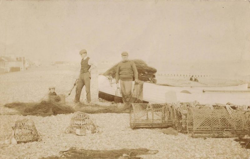
For centuries Shoreham folk have earned a living from the sea and one hundred years or so ago the fishing families of Ratcliffe, Page, Laker and Maple were prominent. Perhaps the best known of them were the Maples who sold their fish and oysters from their shop at the west end of the High Street in one of the ancient cottages that once stood alongside the King’s Head pub. Continue reading “A Fisherman’s Tale – the Maple Family”