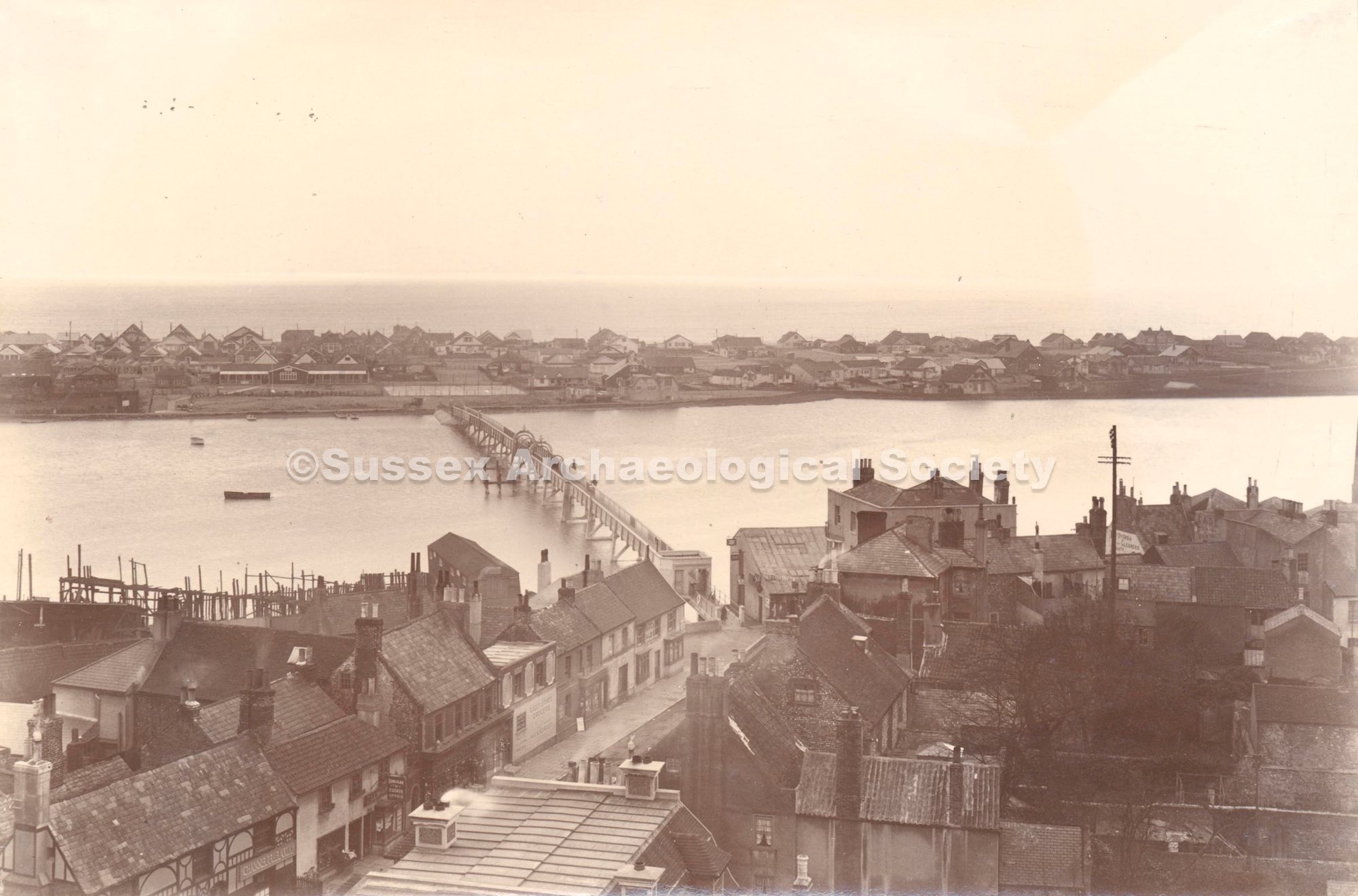
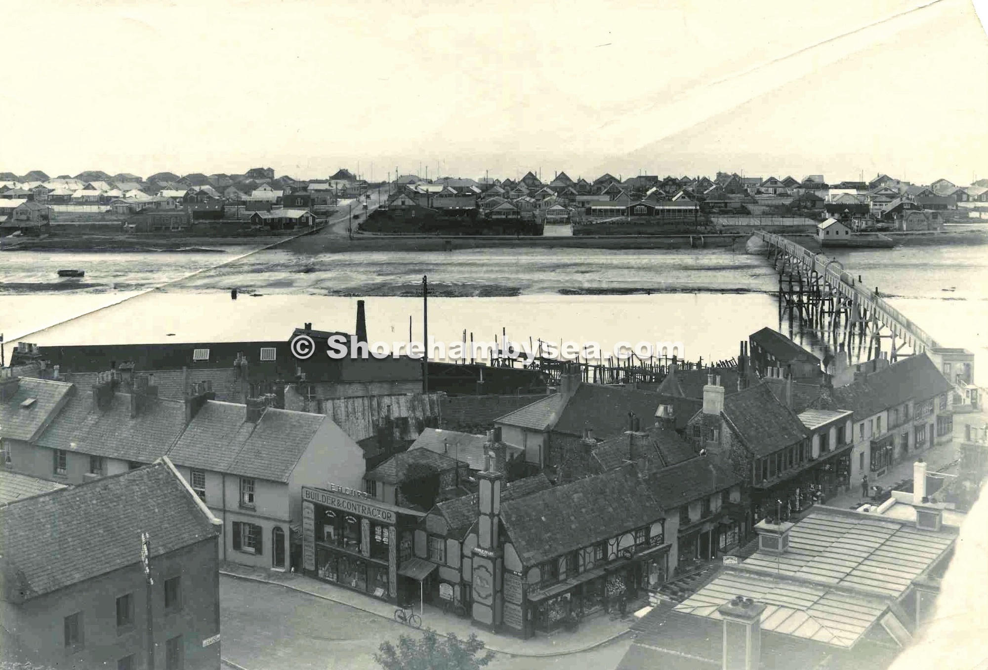
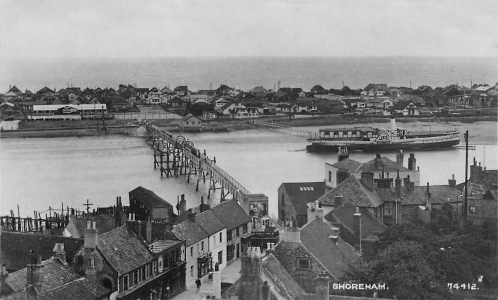
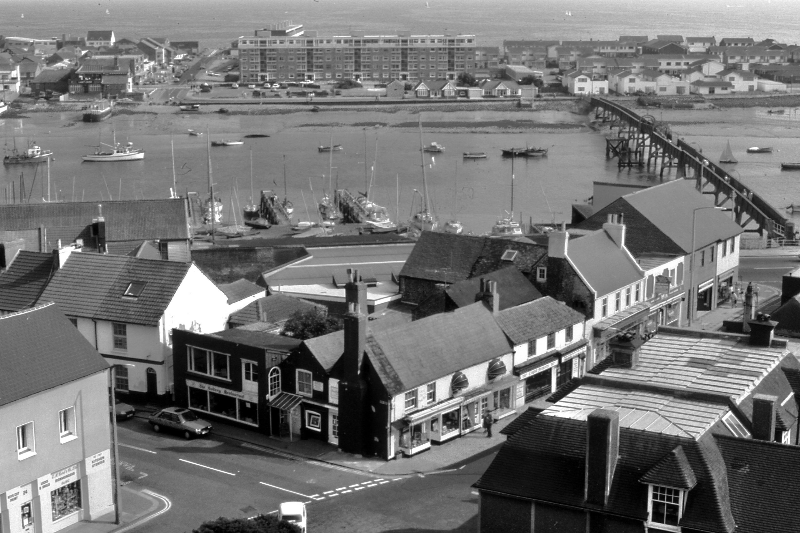
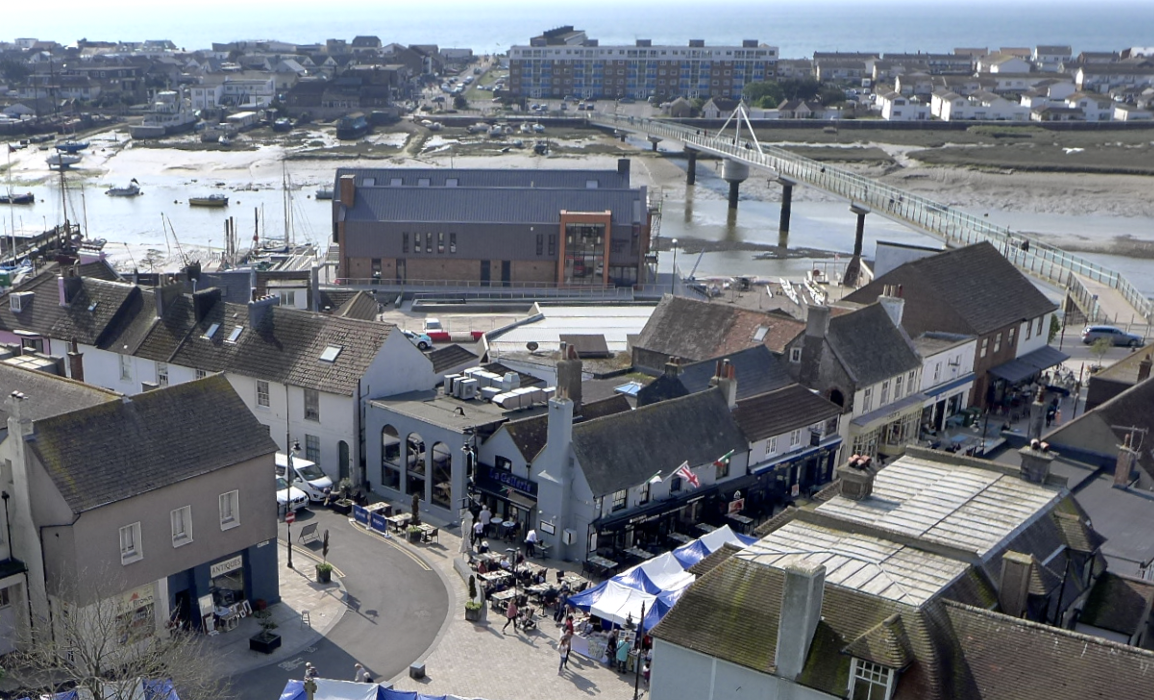
East Street, New Road and the footbridge have not changed too much over the last 100 years. However the encroachment of large buildings on the waterfront has restricted views of the river significantly. Note the position of the photographer on the tower roof was identical, except a little shorter. Maybe a tripod was used in 1924 or they sat down away from the low parapet?
To celebrate St George's Day 2022, ShorehambySea.com were allowed escorted access to film the hoisting of the flag of St. George on the recently refurbished flagpole on the tower of St. Mary de Haura. To view the four 360 images click with the mouse and scroll and zoom around the views of Shoreham town. Note: imagery was taken using a remote 360 camera & telescopic pole safely from within the tower parapet.
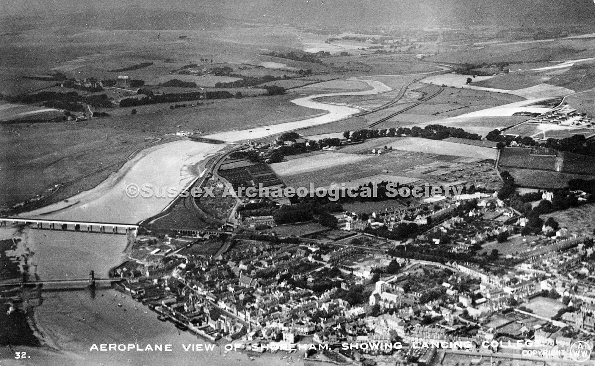
Shoreham has 5 bridges over the Adur. Before 1781 the only way to cross was by ferry boat or detour upriver to cross at Bramber bridge. The ‘old’ Toll Bridge changed this in 1781, followed 50 years later by the suspension Bridge and causeway to Lancing. Within 12 years the railway was extended westwards from the Shoreham terminus with the building of an impressive viaduct / wooden trestle rail bridge (1845). This was replaced 50 years later. By 1921 Shoreham had a new footbridge to the beach and 2 years later the original Norfolk Bridge was replaced. 46 years later a brand new ‘flyover’ road bridge was constructed as part of the new A27 trunk road, bringing the tally of river bridges to five.
3 Bridges. 1919 taken from an Avro aircraft by AW Wardell. Before the footbridge was built.
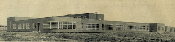
– the new school photographs and plans in 1936 with reminiscences of former pupils from the 1940’s to 1990’s
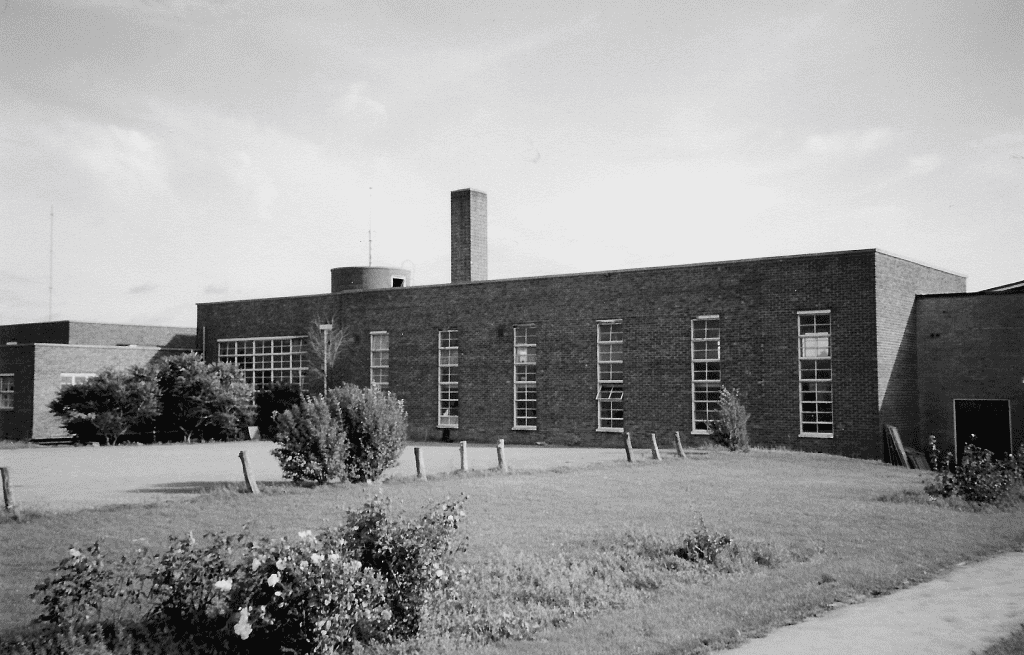
Built in 1936 on a five-acre site in Middle Road, Kingston, where the recreation ground is now but then in land that had largely been used as fruit orchards and nurseries by the Cook’s Jam Factory in Dolphin Road. Initially opened as a boys’ senior elementary school for 360 pupils it included a number of unusual features (for those days) in both design and construction. It was built of reinforced concrete and flat roofs to allow for future extensions to be placed on top of the ground floor building and enabled wider spans for rooms that, with the large Crittall windows also installed gave pupils and teachers a bright and spacious environment.
A study of the inhabitants of Mill Lane, Shoreham in 1939.
written by Jenny Elton
Following the onset of war in September in 1939 a Register was taken of the civilian population with the purpose of producing a National Identity card. Later it was to become multifunctional, first as an aid in the use of ration cards and later helping officials to record the movement of the civilian population over the following decades. From 1948 it formed the basis for the National Health Service Register. The data was collected on 29th September 1939.The following information was listed. Name, gender, date of birth, marital status, occupation, and whether a visitor, servant, patient, inmate or inferred family member and other members of the household.
Published in 1921 this is a copy of the definitive history of Shoreham-by-Sea written by local historian Henry Cheal, Hon. Curator and Librarian to the Sussex Archaeological Society. This PDF version is as provided by shoreham.adur.org.uk.
– a collection of images from the galleries and collections of shorehambysea.com illustrating the changes to the area since the 18th century.
What a wonderfully eccentric place it was! Besides a fascinating ropemaking and shipbuilding past there were, in Victorian times, ancient buildings still standing, quaint cottages, wharf houses, a gas works and, spookily, a mortuary alongside an incinerator! In the Little High Street there were peculiarly shaped houses and strange, shop-like windows.
It was never a fashionable area, being part industrial and part residential where the poorer, labouring families largely dwelt. In 1817 William Butler’s poor grammar described it as being “the lower ‘hend’ of town” and goes on to mention a ‘pour new’ shop where he had ‘connections’ with Sarah Fillaps. Something of a mystery and perhaps a pawn shop (a corruption of the French ‘for us’) or as William’s escapades suggest one of the numerous brothels in Shoreham port then?
During the early part of the 19th century Ropetackle included wharf houses, sheds, a brickyard, coal yard, a bonding pond, Thomas Clayton’s deal yard, his cement factory, stables, a mixture of 17th to 19th century houses and even a mill pond. By the Victorian era there was also a sewage plant and of course the gasworks, flint-built ware houses, incinerator and mortuary. It all added to a certain air of eeriness and mystery to the area.
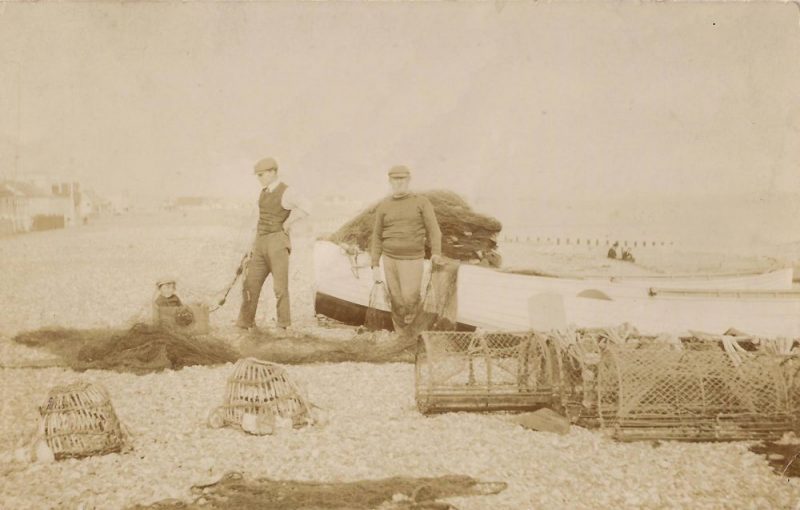
For centuries Shoreham folk have earned a living from the sea and one hundred years or so ago the fishing families of Ratcliffe, Page, Laker and Maple were prominent. Perhaps the best known of them were the Maples who sold their fish and oysters from their shop at the west end of the High Street in one of the ancient cottages that once stood alongside the King’s Head pub. Continue reading “A Fisherman’s Tale – the Maple Family”
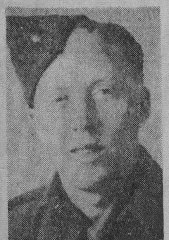
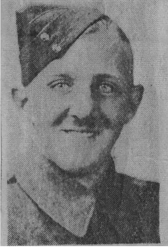
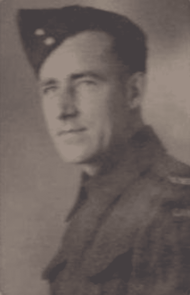
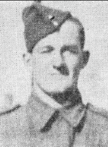
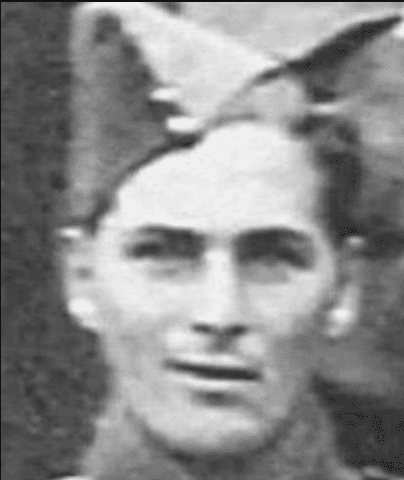
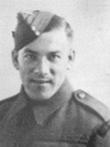
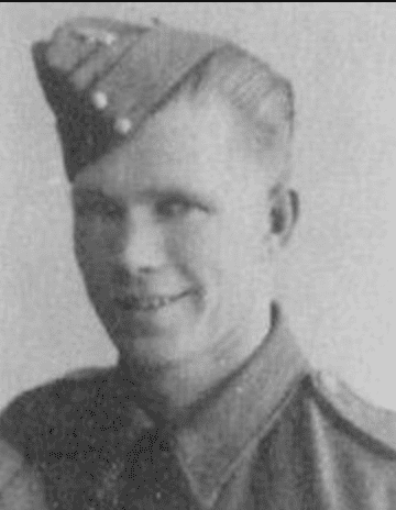
1942: 7 Canadian Soldiers die in accident on the river
The West Nova Scotia Regiment had been carrying out defensive and security duties at various places in the southeast of England before arriving at Worthing on the 22ndNovember 1941 from their previous posting at Newhaven. Here they took over responsibility for the area including Shoreham Airport from the Royal Welsh Fusiliers. The official strength of the Regiment at the time was 36 officers and 840 other ranks.
In the Shoreham area some billeting was arranged for the Canadians in local residents homes but others were also thought to have been housed at the Grammar School in Pond Road (the pupils had been evacuated) and more under canvas in the school’s playing fields, now the Greenacres housing estate, where a searchlight, anti aircraft gun and heavy machine gun emplacements were installed
Besides their day-to-day duties the men, like all soldiers from whatever regiment or country at the time, received ongoing training, route marches and exercises. The latter were necessarily made as realistic as possible to harden the men in readiness for what was anticipated to be an eventual return to the continent and renewed face-to-face conflict with the enemy.
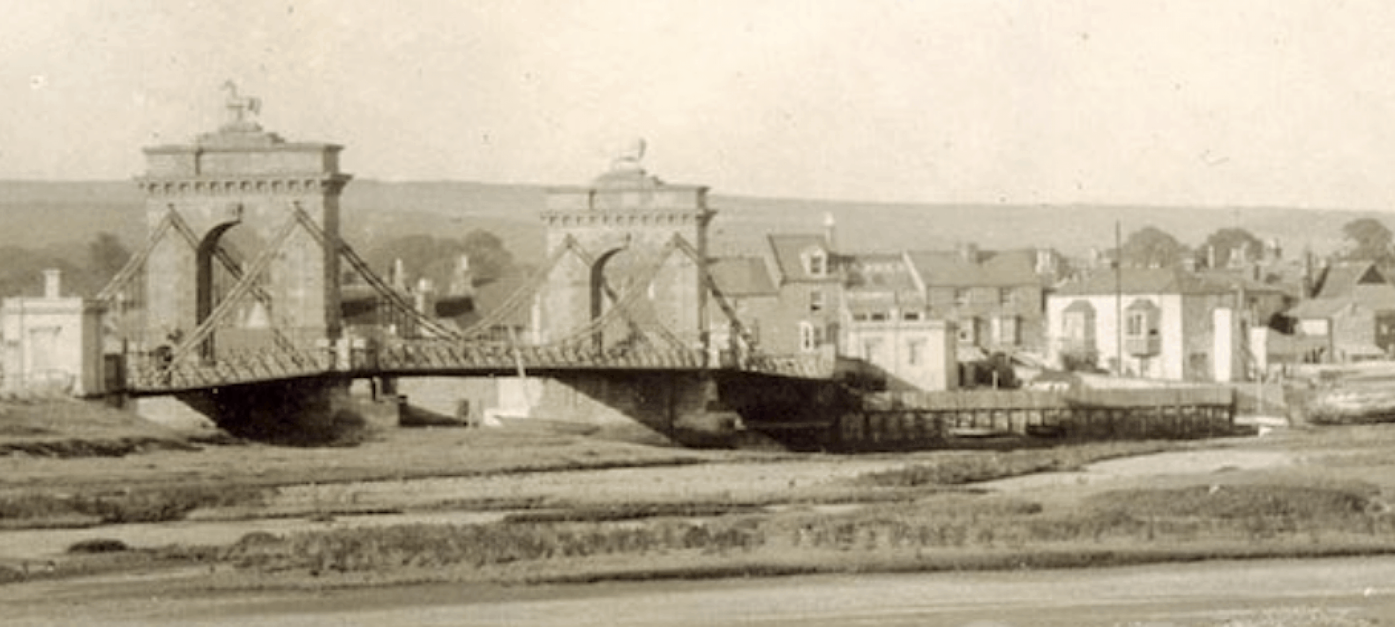
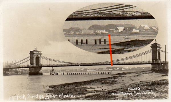
A chance swop of postcards between collectors Neil De Ville and Alan Humphries revealed previously unnoticed buildings on Shoreham Beach. The image is of the old Norfolk Suspension Bridge and across the river below the bridge span two large shed-like structures can be made out.
Photo by permission of Neil De Ville and Alan Humphries
The image has been postitively dated as 1921 by local historians at the time when the Bridge was being prepared for demolition so what were the mysterious buildings for? Their location looked to be near Ferry Road and at first sight 1927 aerial photographs seemed to confirm this by showing their likely footprints on the beach, not just of the structures but also a concrete raft or apron on their seaward side.