The Buckingham House Timeline
The first Buckingham House (c1655-1820)
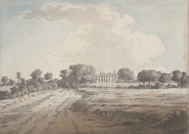
The first Buckingham House known as “Buckinghams” (or “Great Buckingham” to differentiate it from the Bridger’s farm at Little Buckingham) was built in the c1655 for the Bridger family. Note the main East-West road took a more direct route passing just South of the house and through Little Buckingham Farm. This would join the Avenue and The Street to emerge at St Nicolas Church and the Toll Bridge. Lidar imaging from the air reveals the exact route of the road across the park (shown yellow in the photograph below) and that also suggests the original approach to the front of the house was along the straight avenue of trees still evident in the park.
Continue reading “Buckingham House Timeline”The Buckingham House Timeline
The first Buckingham House (c1655-1820)
The first Buckingham House known as “Buckinghams” (or “Great Buckingham” to differentiate it from the Bridger’s farm at Little Buckingham) was built in the c1655 for the Bridger family. Note the main East-West road took a more direct route passing just South of the house and through Little Buckingham Farm. This would join the Avenue and The Street to emerge at St Nicolas Church and the Toll Bridge. Lidar imaging from the air reveals the exact route of the road across the park (shown yellow in the photograph below) and that also suggests the original approach to the front of the house was along the straight avenue of trees still evident in the park.
Continue reading “Buckingham House Timeline”