Two events recording one photograph

A photo that unusually records both the grounded SS Brussels and the last of the two mystery towers before it was demolished – July 1922

The lifeboat house and lifeboat had been  moved to the beach in 1892 after the build up of the bar had prevented the lifeboat from leaving the harbour. They were returned to Kingston after the bar had been cleared and after that photo was taken. Holloways of Shoreham were involved in harbour reclamation work in 1925 which seems likely to have included clearing the bar.

Properties for sale

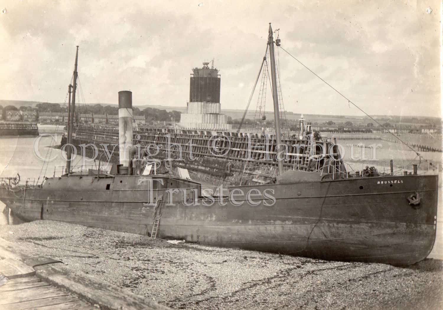
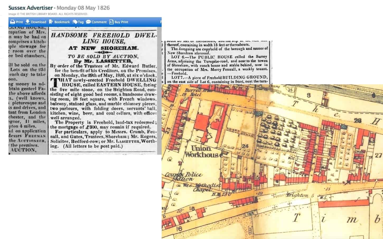
Houses and buildings were advertised for sale in the papers very much like they are today. One gives details of the numerous store-rooms, cellars and counting room of Daniel Roberts’ huge granary on Mill Green, Ropetackle (1826). Earlier, in 1813, it had been advertised for sale, suitable for possible conversion into a tide-mill. Another advertisement in 1831 revealed that the lean-to still to be seen on the side of the Crown & Anchor was then a hairdressers’ and the sale of the original windmill in Mill Lane (1832) disclosed that it was a wooden smock mill before it was rebuilt in brick and converted to steam power. The Dolphin Chambers buildings on what is now Coronation Green in 1812 included ‘High Cage’ a pivoted boom at the end of which was a lighted brazier to guide vessels to the quayside in poor visibility. Below ground level was an arched cellar 30 feet by 13 only exceeded in size by the vaults in Church Street and the later Custom House/Town Hall.
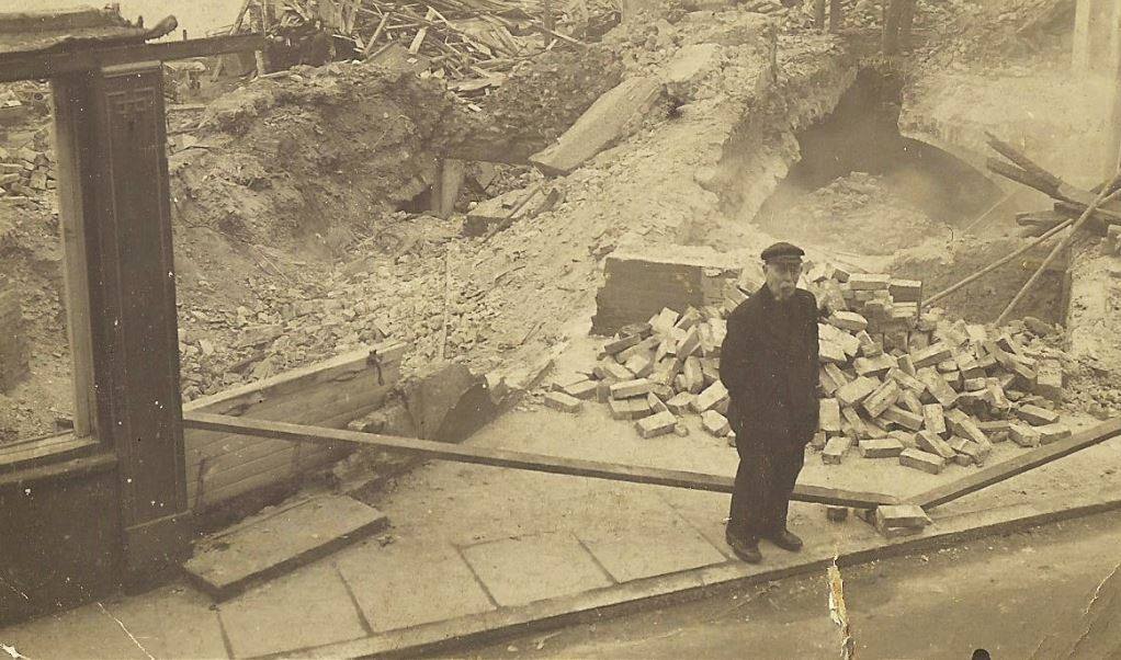
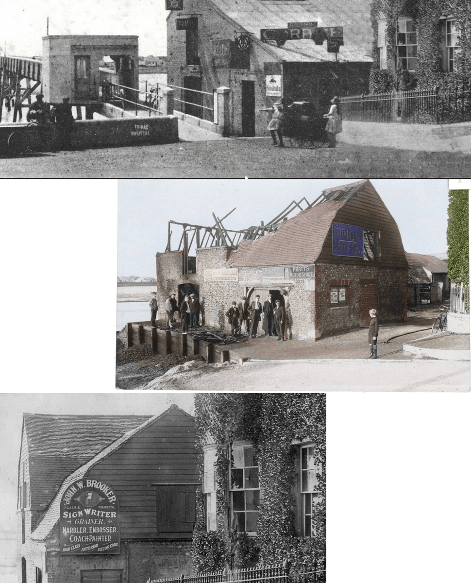
(Photo shows Dolphin Chambers being demolished in 1938 with the arched cellar just visible behind the man)

Criminal matters

A trawl through newspapers of old brings up some interesting facts. In Shoreham stocks were still being used for lesser offences well into the 19th century; the thief who stole gooseberries from Barruch Blaker’s garden was ordered to receive ‘a good whipping through Shoreham’ administered by the parish constable (1819); a number of months hard labour was the sentence for minor stealing and other misdemeanours; John Hindess received six months hard labour for keeping a brothel (1842) – he was aa Navy pensioner who had fought at Trafalgar but lost his pension because of the offence and in other words was punished twice; John Banks was found guilty of stealing a cow (1823) and after trying to escape across the river near the Pad was re-arrested and later executed; John Baldock of Shoreham also received the death penalty for burglary (1838); Charles Packett was convicted of stealing one of John Glazebrook’s sheep (1838) and sentenced to be transported to one of the harshly run penitentiaries in Australia for ten years – all this at the time when an increasing number of emigrants had been voluntarily sailing from Shoreham for a new life in that country and Canada (1832).

5 mile stone

Identifying the location of this building advertised in 1826 prompted a look at the old Ordnance Survey maps to find where the five mile stone was (five miles from Brighton) on the Brighton Road. Turns out to have been the Surrey Arms – originally known as Eastern House a later advertisement shows it to have had eight bedrooms!

Coronation Green Barn

Photos showing three phases in the life of the barn that once stood on what is now Coronation Green.
Below – as a workshop for John Wallace Brooker, signwriter – he also played in goal for Shoreham FC in the early 1900’s
Centre – Gutted by fire 1911
Top – Repaired and remodelled for use as a garage 1920’s

Gargoyles

Some of you may remember Shorehambysea.com member Chris Dowling who participated in a number of our photographic projects. I had always wanted close up photos of the gargoyles on St. Mary’s church tower and Chris’ previous work showed he and his zoom lens were just right for the job. Sady, as it turned out, nine hundred years of weather erosion meant that of the 14 gargoyles only six survive as being recognisable.

Old Marker Stones

I seem to remember that these stones have been discussed before, some years ago on our old web site. They are situated at the top of The Street in Old Shoreham. One stone is marked ‘BS’ (boundary stone?) and another ‘CL’ – the other two don’t appear to have any markings. The stones must have some historical signinfcance otherwise I would have thought they would have been removed long ago – does anyone know?

Bungalow locations from old deeds

Interesting extract on e-bay from the 1908 deeds of Sea View owned by the Maple family. They sold their fish and oysters from their shop at the west end of the High Street – more here http://www.shorehambysea.com/a-fishermans-tale-the-maple-family/
Detailed plans like this of Sea View and surrounding bungalows are invaluable for confirming location and names at a specific time, particularly as the names were often changed.  Inset is Louisa Maple, who signed the document, matriarch of the family at the time – husband Samuel had died just a few years earlier.

An old courtyard recreated

Found a photo I took of the courtyard at our previous house in Church Street that reminded me of the Winton family next door in the years when the courtyard was shared by both neighbours. Had a quick look through the Winton photos and realised that by putting their courtyard photos together the courtyard as it was in 1900 could virtually be recreated.
Left to right are Pansy Winton, Myrtle Winton, Reg Eley, Stan Winton, Billy Reading and Bobby Hall. The Wintons were a large, happy family of eleven and you can just imagine the laughter and occasional squabbles between brothers and sisters at the family gatherings that took place there (articles on the Winton family are at http://www.shorehambysea.com/william-edward-winton/ and http://www.shorehambysea.com/stanley-howard-winton-1881-1964/

Where in Shoreham is this?

I’m sure we discussed this painting some years ago on the old web site without coming to any real conclusion as to its exact location. Assuming the content is not artistic licence then the view almost fits the history we have of one part of the Shoreham river front area. The windmill could be the one that stood on Mill Green at Ropetackle and behind it rising ground in the distance that may be Mill Hill; the town to the right and the timber work in the foreground is perhaps where the flood arch is now.
There are two question marks of this though.
The Norfolk Suspension Bridge had been well and truly built by the time the artist painted it and (if it is this area) should have featured as the centre piece of the painting so why has he masked the bridge with the boats’ sails?
The Ropetackle mill (we know it was a post mill and the painting confirms this) and the land it was on was sold in 1790 to Daniel Roberts who built a large granary on it. This had burned down by the 1820’s but could it be that the windmill was at a distance from the granary and still standing at the time of the painting – it certainly looks dilapidated with only two sails?
(Fisherfolk on a Tidal Estuary, Shoreham by James Webb 1825 – 1895)