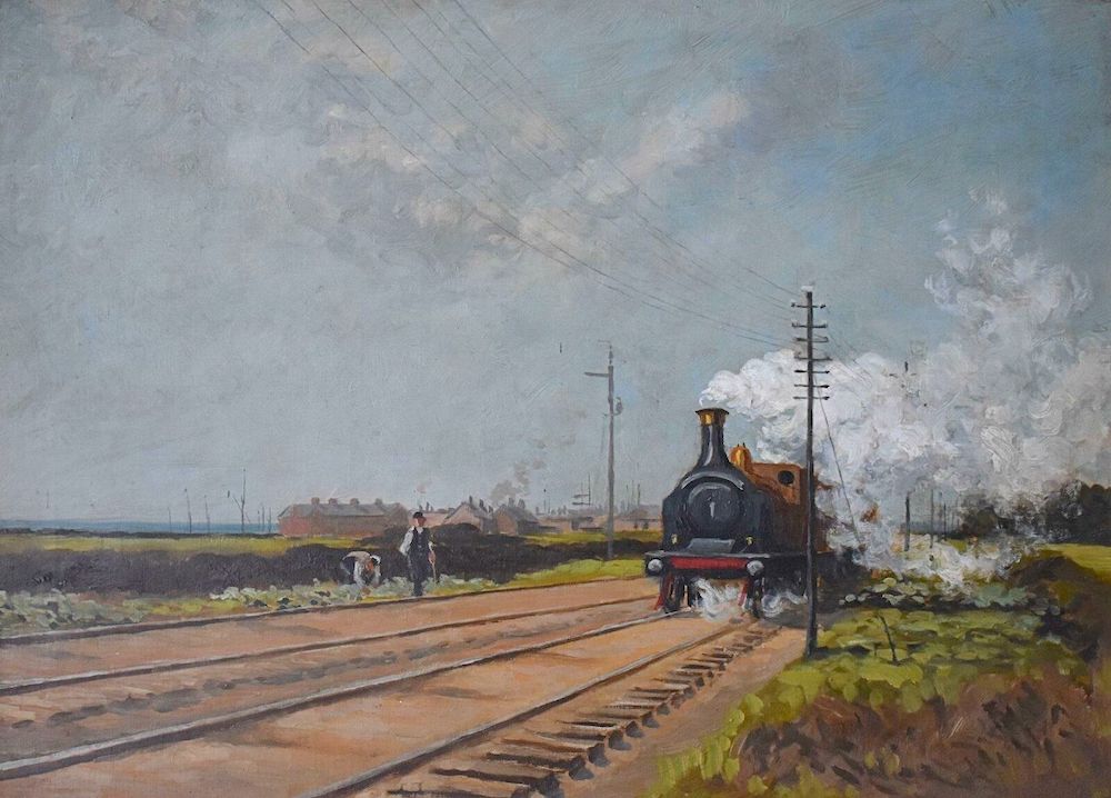
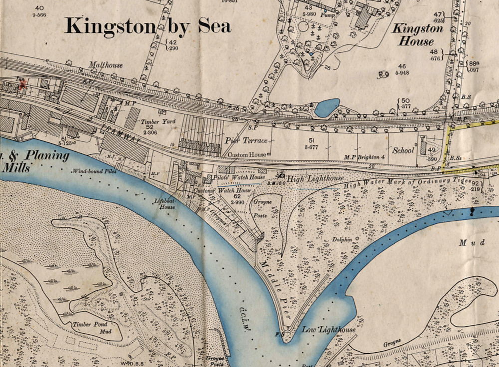
A painting for sale on e-bay. It’s being advertised as 1950’s Shoreham but the engine is clearly older and the year 1894 can just be made out on the reverse of the frame. Comparing the painting with the 1898 OS map the only area that seems to match is if the artist was sitting with the Kingston Lane bridge behind, the signal (SP on the map) south of the railway bank by the access tunnel from Gorringe’s Kingston House and the terrace on the left perhaps Pier Terrace. Any other thoughts?
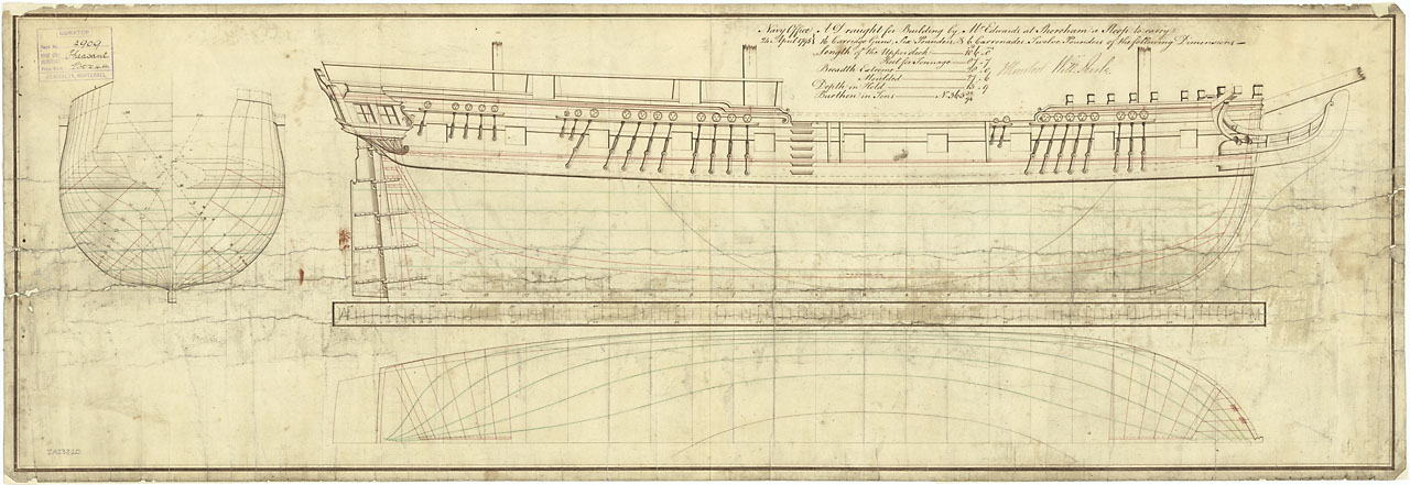
HMS Pheasant was built for the Royal Navy in 1798 by John Edwards at Shoreham. A sloop of 373 tons burthen, 106 ft gundeck, 16 six-pounder guns, 4 twelve pound carronades, two nine-pounders and a compliment of 121 crew. It was an amazing coincidence to discover that a predecessor captured by the French in the Caribbean but released in an exchange of prisoners was conveyed to HMS Spartiate some miles away in the Pheasant. Shortly after he was still with the Spartiate when that vessel took part in the Battle of Trafalgar.
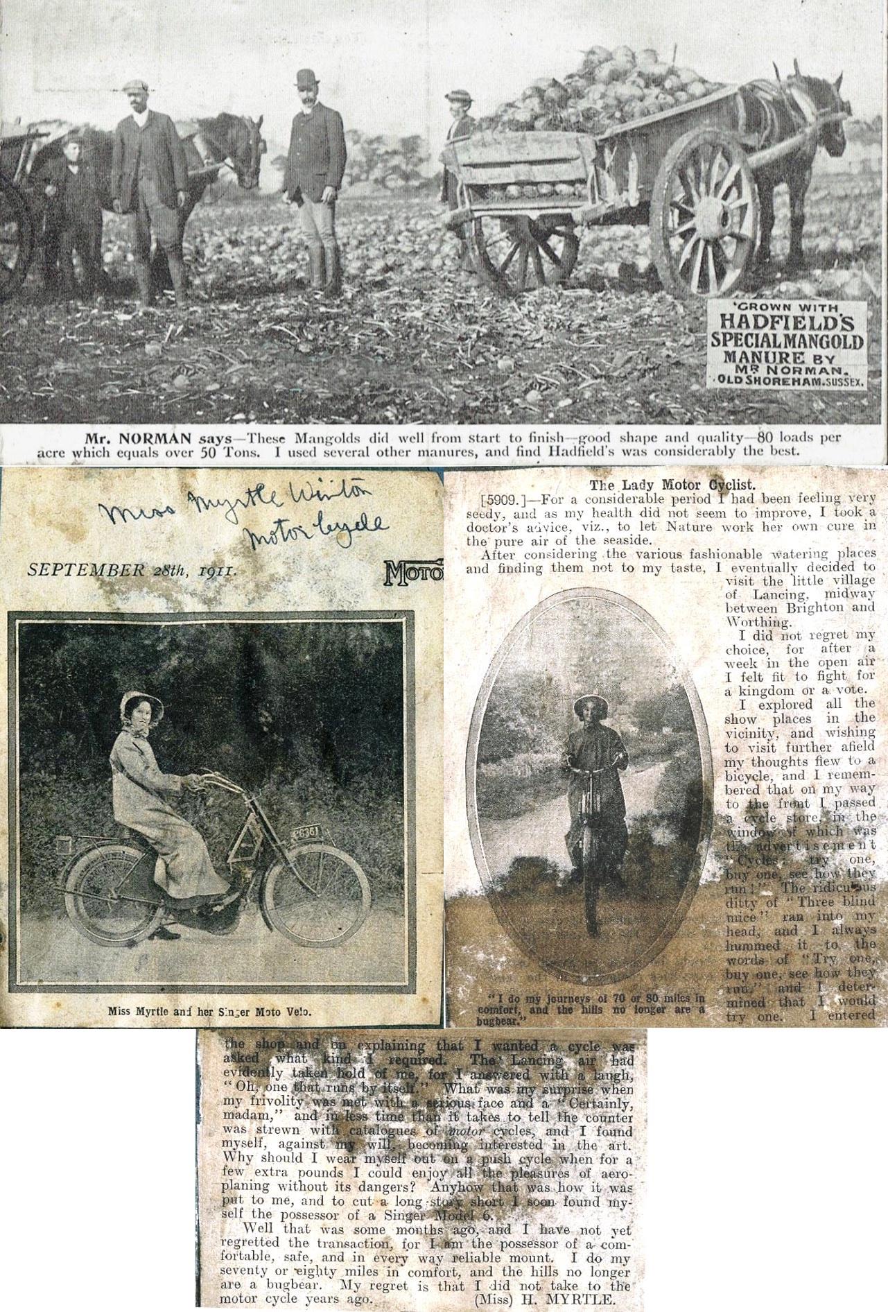
Hadfield’s advert featuring early 1900’s Old Shoreham farmer William Norman and his massive mangolds! In 1910 another Shoreham character that featured in an advert was Myrtle Winton who’s husband Reg Eley ran a motor cycle business in Shoreham. This over-pasted and grubby insertion from the ‘Motor Cycle’ magazine in the Winton family scrap book is nevertheless an interesting relic perhaps.
Mr. Clarke lived in Church Street during the 1930’s, he used to help pump the bellows at the Burtenshaw blacksmith family’s forge in Middle Street behind their houses. His father was Head Chef at Lancing College and number 22 across the road was the College Laundry where linen from the college was dropped off by a van each day.
During the last war when the beaches were closed Cuckoo’s Corner became a bathing lido. Something of a surprise perhaps bearing in mind the not inconsiderable number of drownings there during the early 1900’s through to fairly recent years.
One Shoreham doctor would tell mothers (that had children) suffering from muscular fever to strip the patient off and lay them in the river mud at low tide to let the iodine from rotting seaweed effect a cure.
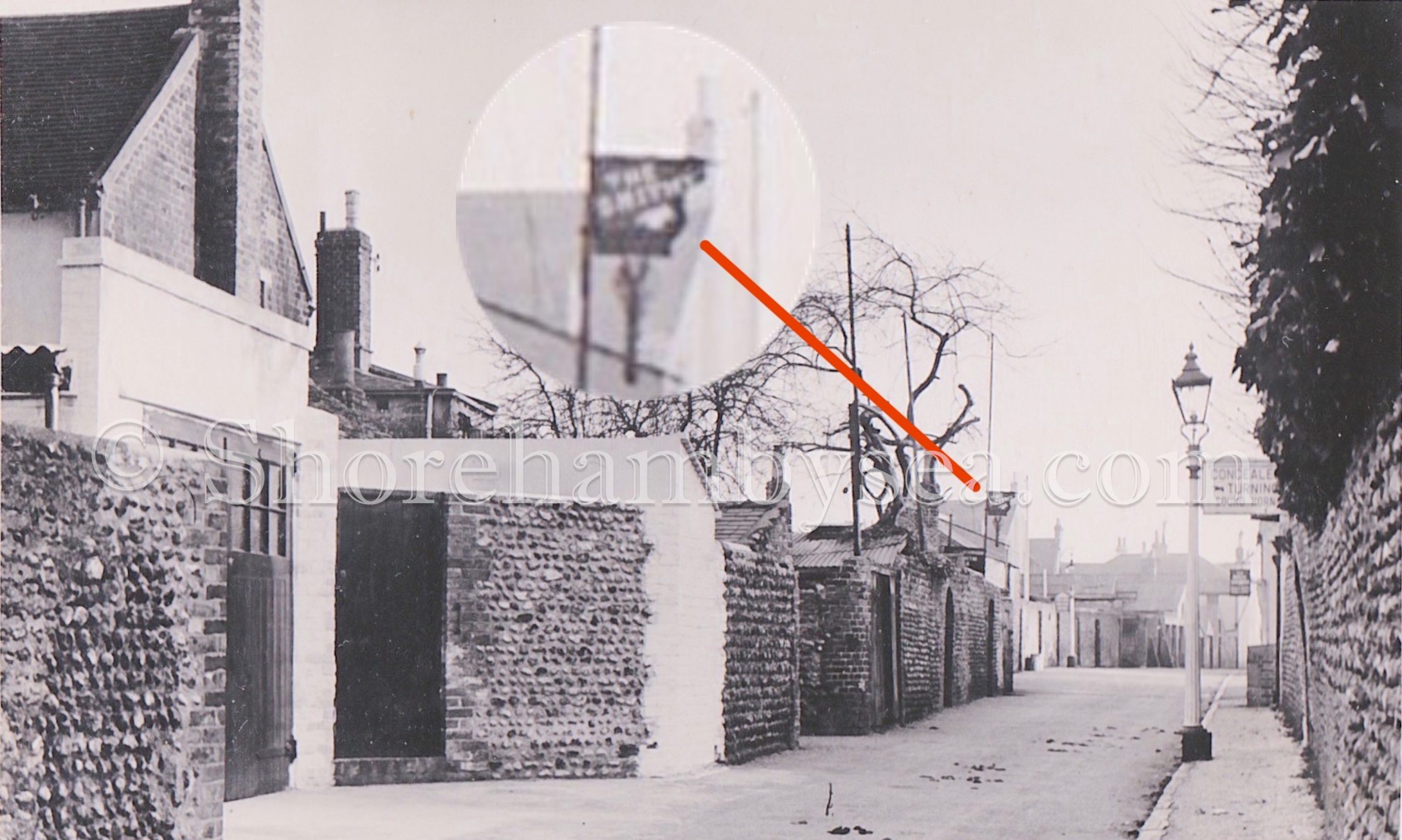
Middle Street with most of the Church Street garden walls still intact and horse droppings indicating the last few years of use even then (c. 1952) of horse drawn carts. A sign advertises Burtenshaw’s smithy and anoth
There was a doctor’s surgery on the churchyard (possibly the surgery in East Street) where a Dr. Hall carried out ‘boyhood operations’ on the kitchen table, set broken limbs and made up his own medicines.
Snellings butcher shop is mentioned at the south side of the gap (before it was all demolished) – at Christmas time he would always display a very large whole pig with a lemon in its mouth on a trestle table.
The annual regatta was held on both sides of the footbridge and included in the ‘games’ was the greasy pole, suspended beneath the footbridge which Bill Peters usually won; builder’s races where participants rowed with shovels and fights between the millers and the sweeps using bags of flour and soot as ammunition. At half-tide football was played on the mud and the two fishing families Lakers and Pages would race against each other running and rowing across the river and back.
Even in those days there was still work on boats being carried out (Suters Yard for example) and on a quiet day the sounds of the adze and caulking mallet could be heard as far away as Slonk Hill.
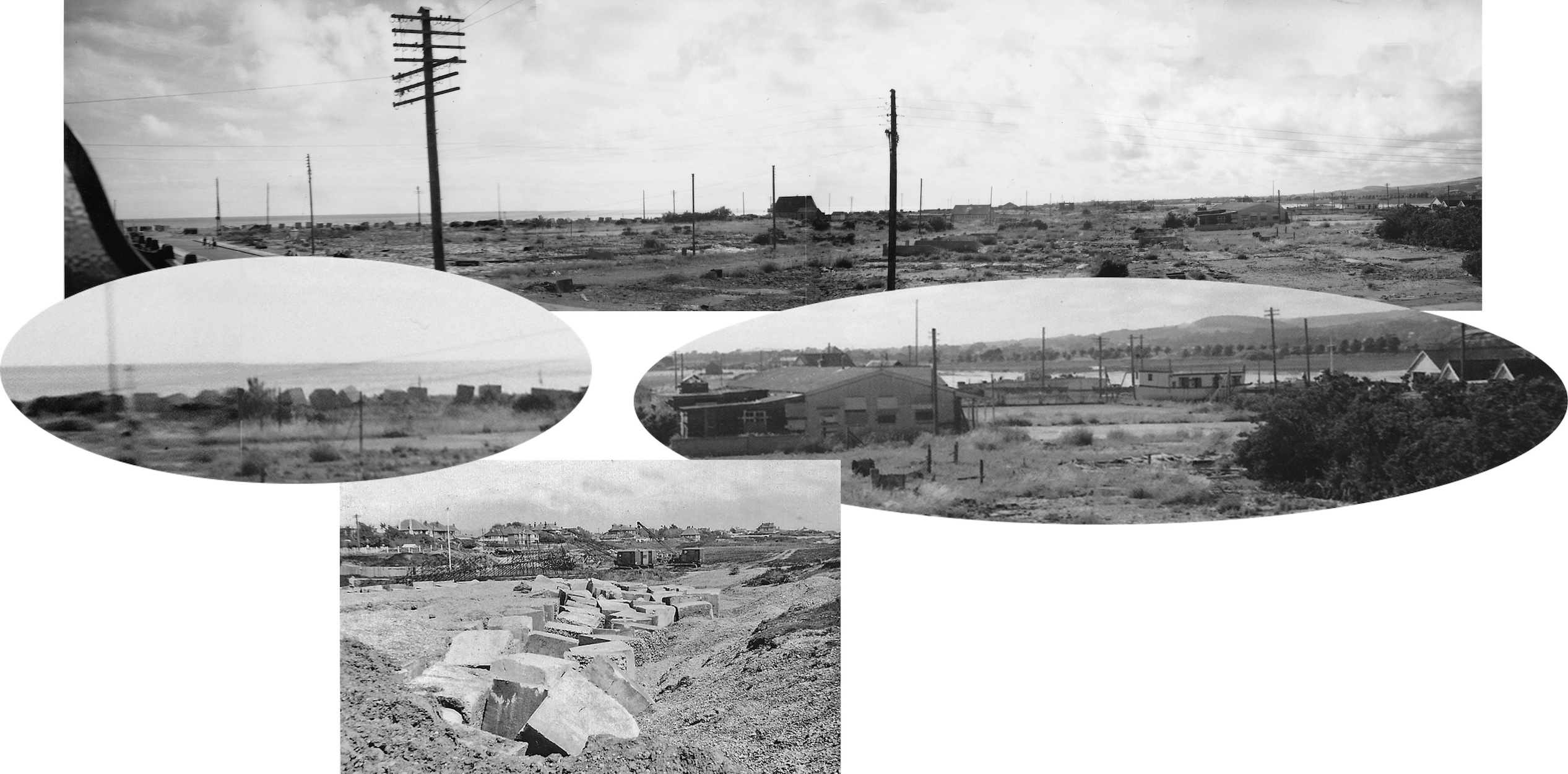
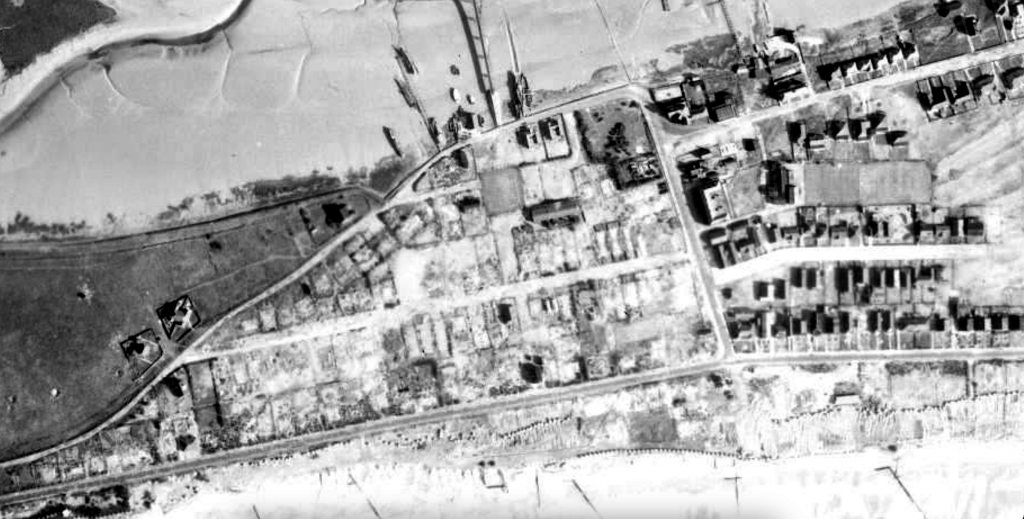
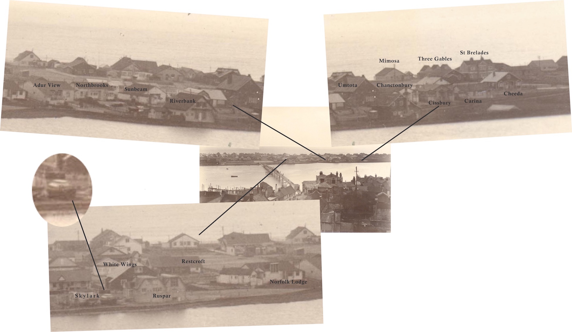
An interesting panorama of four photos sent to us by Chris Mead. Taken by his father in 1946 from one of the flats above the shops in Ferry Road it looks out westwards across a barren landscape following the wartime clearance of most of the bungalows. Amongst those that survived were West and East House(s) on the extreme right. Just beyond the old sports club are two house boats, the one on the right is Skylark and to the left of it is what looks like an MTB that to me is very similar to one that survived until recent years – perhaps someone remembers it’s name?
Why were the two bungalows in the centre of the view left untouched I wonder? The smaller one was named ‘Barge’ but the larger doesn’t appear to have been named and is just noted as No. 81 on the BT Properties list.
Lastly, along the shore can be seen the anti-tank blocks that were removed a few years later – the lower photo of blocks at Lancing gives an idea of them closer up.
Ferry Road 1946: Sussex University Geography Dept.Old Fort Road 1946: Sussex University Geography Dept.
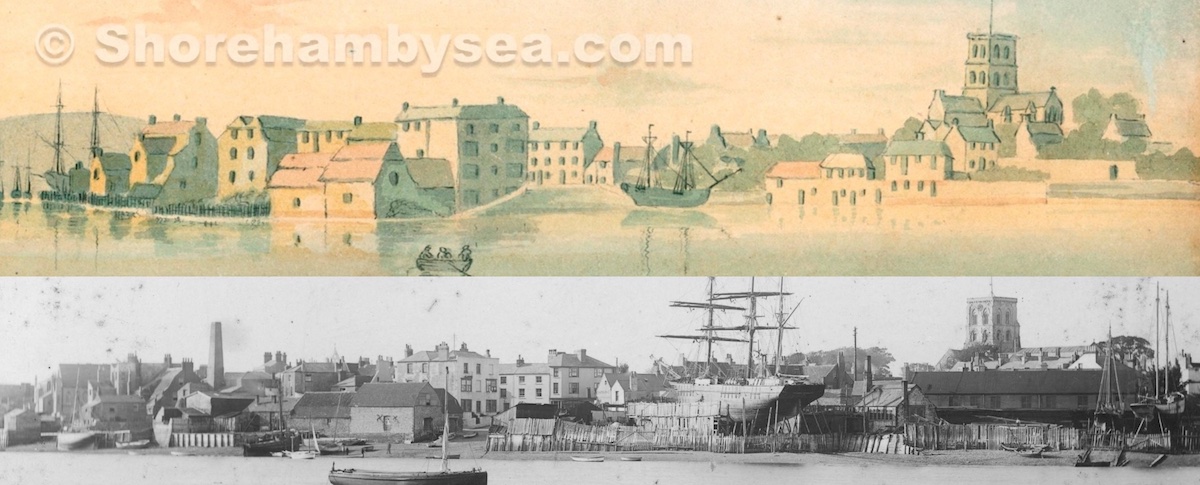
A circa 1810 painting attributed to John Smith seems at first sight to be a somewhat naïve illustration perhaps owing something to artistic licence – until it is compared to a photograph of the same spot one hundred years later.
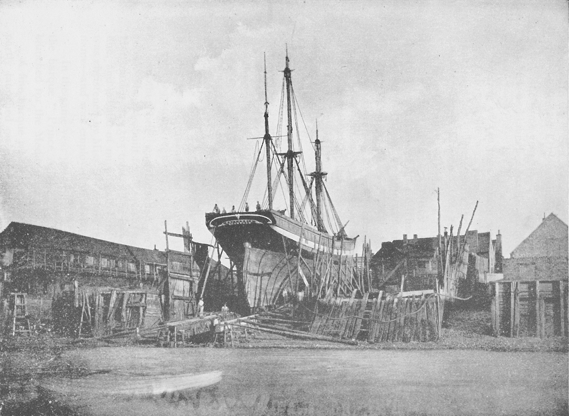
I’ve been told it, with it’s mechanical winch, was only used for pulling up ships for repairs and maintenance. Even the last ships built in Shoreham (Britannia and Osman Pacha) were built in the old shipyard near the suspension bridge. I didn’t readily accept this to begin with but have since seen photos that show it. Incidentally, how is it possible these old ships were launched without falling over? Looking at this photo it doesn’t seem possible to avoid it but, with the Adur’s very deep tidal drop, I guess it may have been submerged enough at high tide – particularly the stern? Perhaps others will know?
Some bungalow names added to a 1930’s photo. (Incidentally, Skylark was actually a boat pulled out of the water to become a land dwelling, you can just make it out in the enlargement.)