Shoreham’s cliff

We’re told that the inundations of the sea eroded the south east part of the town leaving a small cliff in the New Road area. It’s still there but now totally built over. The front part of the houses on the south side of the road are only two stories high but the backs of them have three.

Swiss Mystery

This 1914 aircraft crash by the Shoreham/Horsham railway line bank shows buildings in the background that are difficult to identify. If the crash site is about point 1 then what is the long building at 2 to the left of the terrace of houses at Buckingham Street? The Swiss Cottage pub roof level may be too low to show above the bank and isn’t as long as that anyway. Was it a still standing building in the Gardens or the newly built, yet to be opened Victoria Road school?
The most likely surviving building is the one at 3 – it looks like two towers on a longish building but to the left of the trees that stood in the grounds of the school, but what was it?

Continue reading “Swiss Mystery”

Ham Road

Not much left – even the council offices have gone since the colour photo was taken.
(using black & white photos from Marlipins  and Lofty’s Michael Norman collections)

Crier’s Bell pub

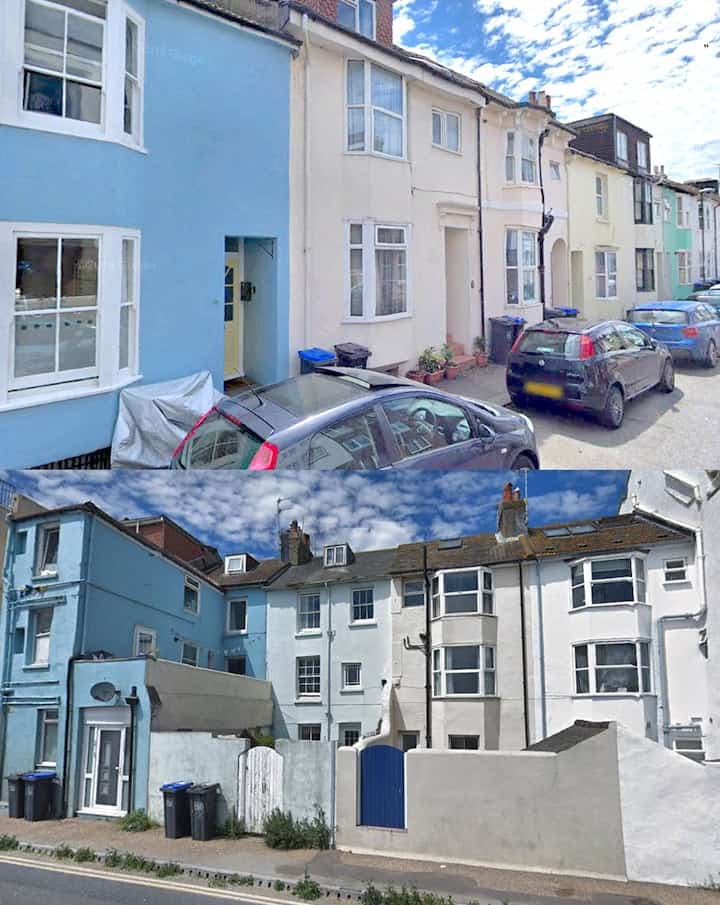
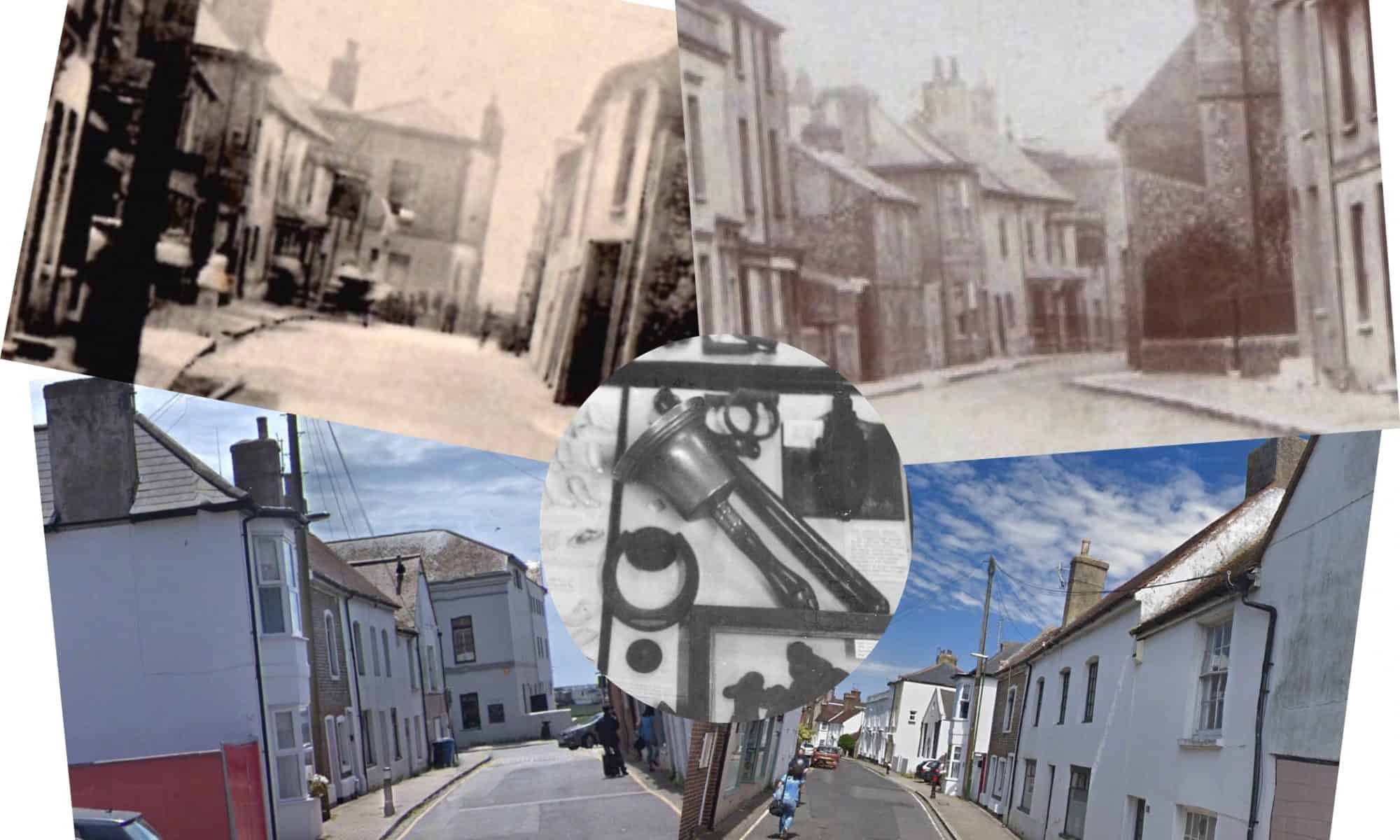
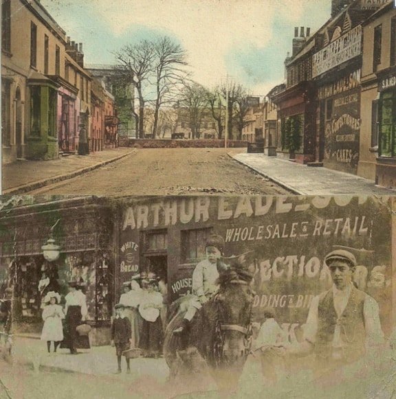
One of Shoreham’s lesser known pubs was The Crier’s Bell in John Street. A substantial, double-fronted building it was given its name by James Chapman, the last official town crier and  landlord of the pub in the 1850’s and who’s handbell still survives in the safekeeping of Marlipins Museum. 

I’ve never seen a detailed photo of it but have managed to dig up two early 1900’s images from our website. They only show it in the distance but enlarged copies do give more of an idea that surprisingly show two bay windows encroaching on to the pavement and something of an overly large pub sign.

The building still exists albeit without its bay windows.

Shoreham’s Tidemills

Back in the 1780’s today’s river bank at Ropetackle was thrown up to reclaim land and reduce flooding. In 1813 though the enterprising owner of the land between the bank and the Old Shoreham Road filled it up again by breaking through the bank at the southern end to allow tidal ingress and egress then offered it for sale as a tidemill. The mill pond is recorded in Clegram’s map of 1815 but after the railway came through only the lower half  seems to have survived as a tidal pond into the 1870’s but there is no record of an actual tidemill to utilise the flow ever being constructed.
This photo-shopped aerial photo with the railway viaduct removed gives a good idea of the original size of the pond which together with the photo of the height of the bank/depth of the water gives an indication of the considerable volume of water it would have held.

Kingston Eqypt

These three buildings look to have been of the right age to have existed at the time of the naming of the area ‘Egypt’ (after the Battle of the Nile 1798). It was awful to see them demolished but whenever we drove through it the huge warehouses there made it feel like passing through a deep and gloomy chasm. The Inn had it’s view to the south completely blocked and seemed always in shadow – I always wondered how on earth they managed to survive financially. 

East Street c1900

A somewhat different East Street circa 1900 with Eade’s Store where Toast by the Coast is now and next door George Hedgecock’s shoe shop (nowTeddy’s).
Lower photo from the Hedgecock Collection on this website

Swan Inn, Church Cottage in the twitten

How many of Shoreham’s old houses used to look – it’s previous use as an inn is alluded to in the 1782 Survey where it is noted as the ‘sign of the swan.’ At some time in its life it also seems to have been named ‘Church Cottage.’ The first time that name appears at the twitten addresses is in 1890 when both the house and the small westerly extension were shown as ‘Church Cottages’ but not in the singular until 1917.
Congratulations to the owners for revealing this lovely old sign!

Continue reading “Swan Inn, Church Cottage in the twitten”